
Subscribe and receive email notifications of new blog posts.
 RSS Feed
- 2026 | 96 Posts
- 2025 | 102 Posts
- 2024 | 110 Posts
- 2023 | 72 Posts
- 2022 | 52 Posts
- 2021 | 70 Posts
- 2020 | 84 Posts
- 2019 | 38 Posts
- 2018 | 48 Posts
- 2017 | 39 Posts
- 2016 | 31 Posts
- 2015 | 10 Posts
20
Maiden Peak: A Challenging Climb to One of Central Oregon's Best Views
Maiden Peak: A Challenging Climb to One of Central Oregon's Best Views
There are hikes where the difficulty is obvious almost from the beginning, and there are others that save nearly everything for the end. Our August 1, 2026 hike to the summit of Maiden Peak definitely fell into the second category.
Starting from the Maiden Peak Trailhead off Gold Lake Road near Willamette Pass, our GPS recorded 11.41 miles round trip with 2,828 feet of elevation gain. Those numbers are consistent with published descriptions of this western route, which generally put the hike at roughly 11 to 12 miles round trip with about 2,800 to 2,900 feet of climbing. What those numbers don't convey particularly well, however, is how the hike actually feels. Much of the early trail is surprisingly moderate. Then, during roughly the final mile to mile and a half approaching the summit, Maiden Peak gets serious.

Hiking Maiden Peak from Gold Lake Road
Maiden Peak rises to approximately 7,818 feet along the Cascade crest between Mount Bachelor and Diamond Peak. There are several ways to reach the summit, including approaches from the east and from the Pacific Crest Trail near Willamette Pass, so mileage figures for a "Maiden Peak hike" vary considerably depending upon where someone begins.
Our route followed Maiden Peak Trail #3681 from Gold Lake Road, the traditional western approach. From the trailhead the path begins through a beautiful forest of tall conifers, and the first several miles provide little indication of what is waiting farther up the mountain.

This is pleasant hiking. The trail climbs, but for much of the route the elevation gain is gradual enough that we found ourselves wondering when the nearly 2,800 feet of climbing recorded for the hike was actually going to arrive. We eventually crossed a small creek that was still carrying water despite Central Oregon's dry summer.

Then we found the elevation gain.
A Trail That Felt Very Different From Our Wilderness Hikes
The final climb toward Maiden Peak was considerably more difficult than we expected. During roughly the last mile to mile and a half, the grade becomes substantially steeper, and much of the elevation that had seemed absent earlier in the hike suddenly arrives.
We hike regularly in the Three Sisters, Mount Jefferson and other designated Wilderness areas, and this trail felt different. There is a reason. Maiden Peak Trail #3681 is on National Forest land but is not within designated Wilderness, and mountain bikes are permitted on the trail. That distinction changes the character of a trail.
A National Forest and a Wilderness are not mutually exclusive designations. In fact, many of the Wilderness areas where we regularly hike are located within National Forests. Wilderness, however, receives additional federal protection under the Wilderness Act, and bicycles and other forms of mechanized transportation are prohibited. On Maiden Peak Trail, bicycles are part of the permitted recreational use. As hikers accustomed to Wilderness trails, we noticed the difference.
The upper portion of the trail seemed much better suited to descending on a mountain bike than climbing on foot. Rather than the switchbacks we are accustomed to seeing on very steep Wilderness hiking trails, sections head aggressively uphill. For a hiker, that means gaining elevation quickly and working considerably harder than the overall statistics for the hike might suggest. It also helped explain something else: published descriptions of Maiden Peak sometimes identify it as both a hiking and mountain-biking trail. This isn't simply a hiking trail where an occasional mountain biker happens to appear. Mountain biking is an established use of Maiden Peak Trail. That doesn't make the trail bad. It simply makes it different, and hikers should know what they are getting into.
Maiden Peak Is a Shield Volcano
The mountain itself is also more interesting geologically than its heavily forested lower slopes might suggest. Maiden Peak is a steep-sided shield volcano, part of the volcanic landscape that defines Oregon's Cascade Range. Shield volcanoes are built primarily by repeated flows of relatively fluid lava that spread outward, gradually constructing a broad volcanic mountain. Maiden Peak's summit is somewhat different, however, because a steeper cinder cone sits on top of the underlying shield volcano. Glaciers subsequently reshaped the mountain, particularly on its northeastern side, where glacial erosion carved into the volcano and exposed some of its underlying volcanic structure.
You don't really appreciate the scale of Maiden Peak while climbing through the forest. The trees hide both the summit and the surrounding landscape for much of the hike. Then you reach the top. And suddenly you understand why people climb it.
The Summit Views Make the Climb Worthwhile
The summit of Maiden Peak provides an extraordinary perspective across this part of the Oregon Cascades. After spending most of the hike enclosed by forest, the transition is dramatic. To the north, the Cascade skyline stretches toward Mount Bachelor, Broken Top and the Three Sisters, with miles of forest spreading across the foreground.
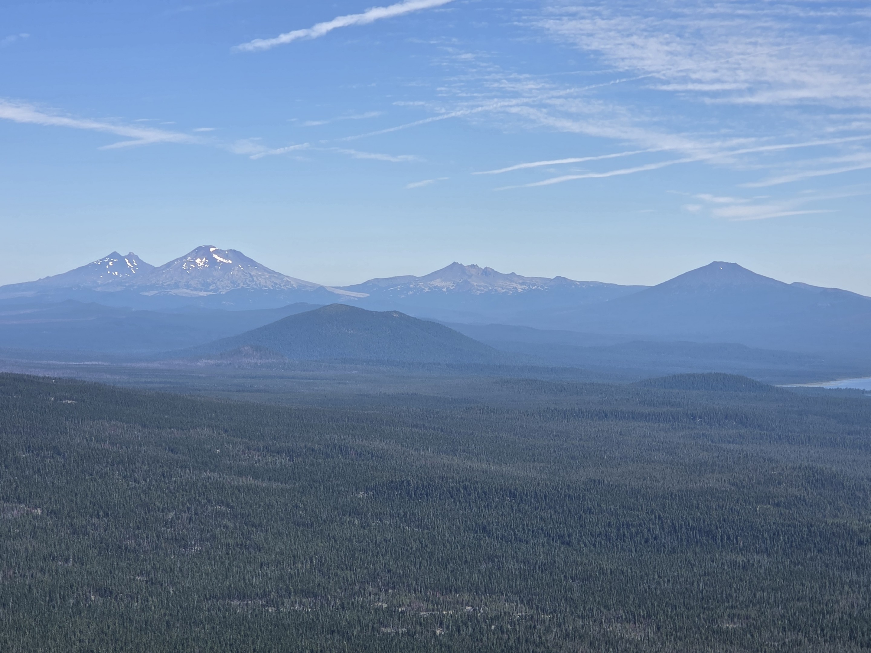
Nearby lakes appear surprisingly small from nearly 7,800 feet.
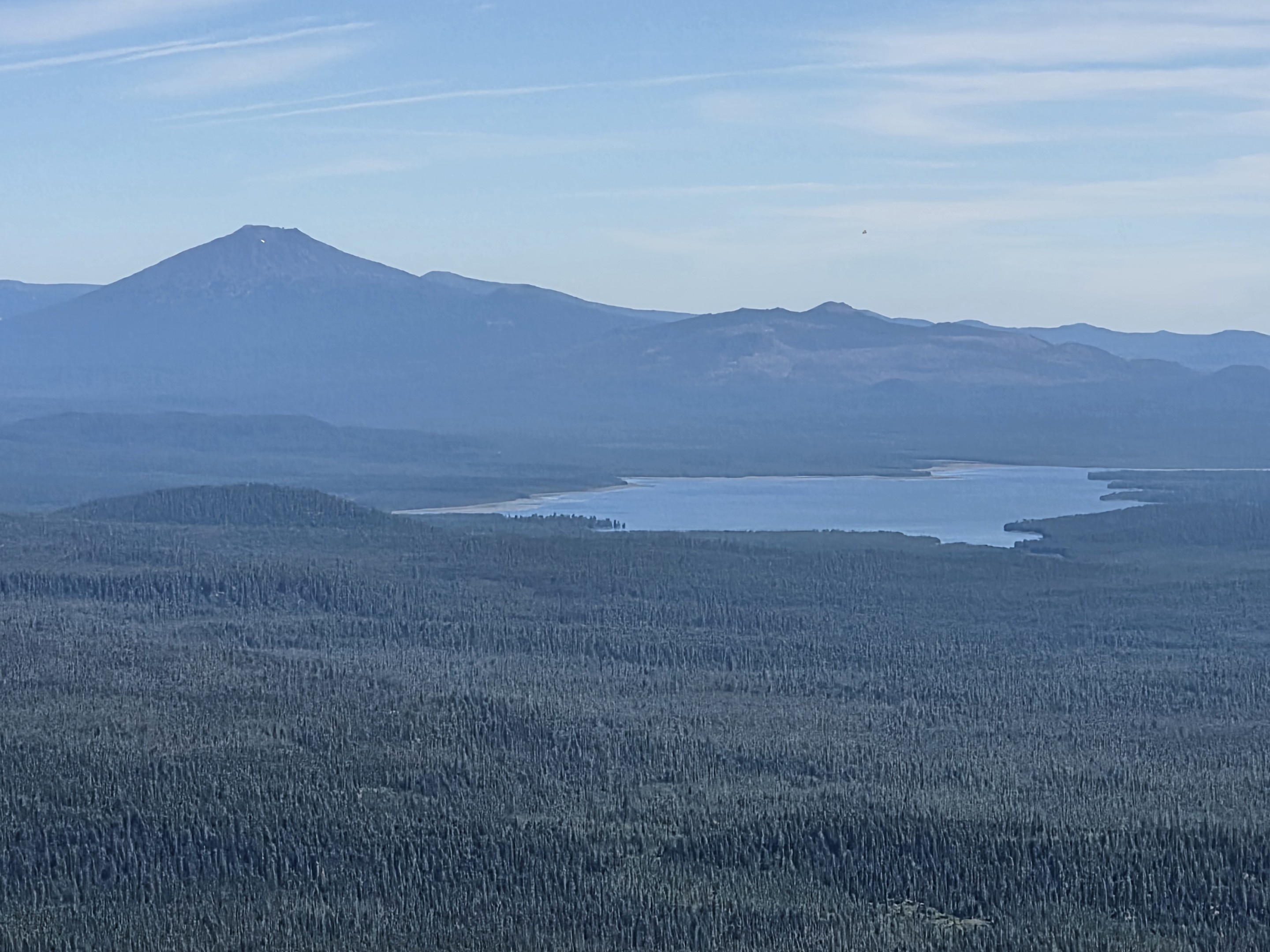
Looking toward Willamette Pass, the ski runs are clearly visible across the heavily forested landscape, along with nearby lakes tucked into the Cascades.
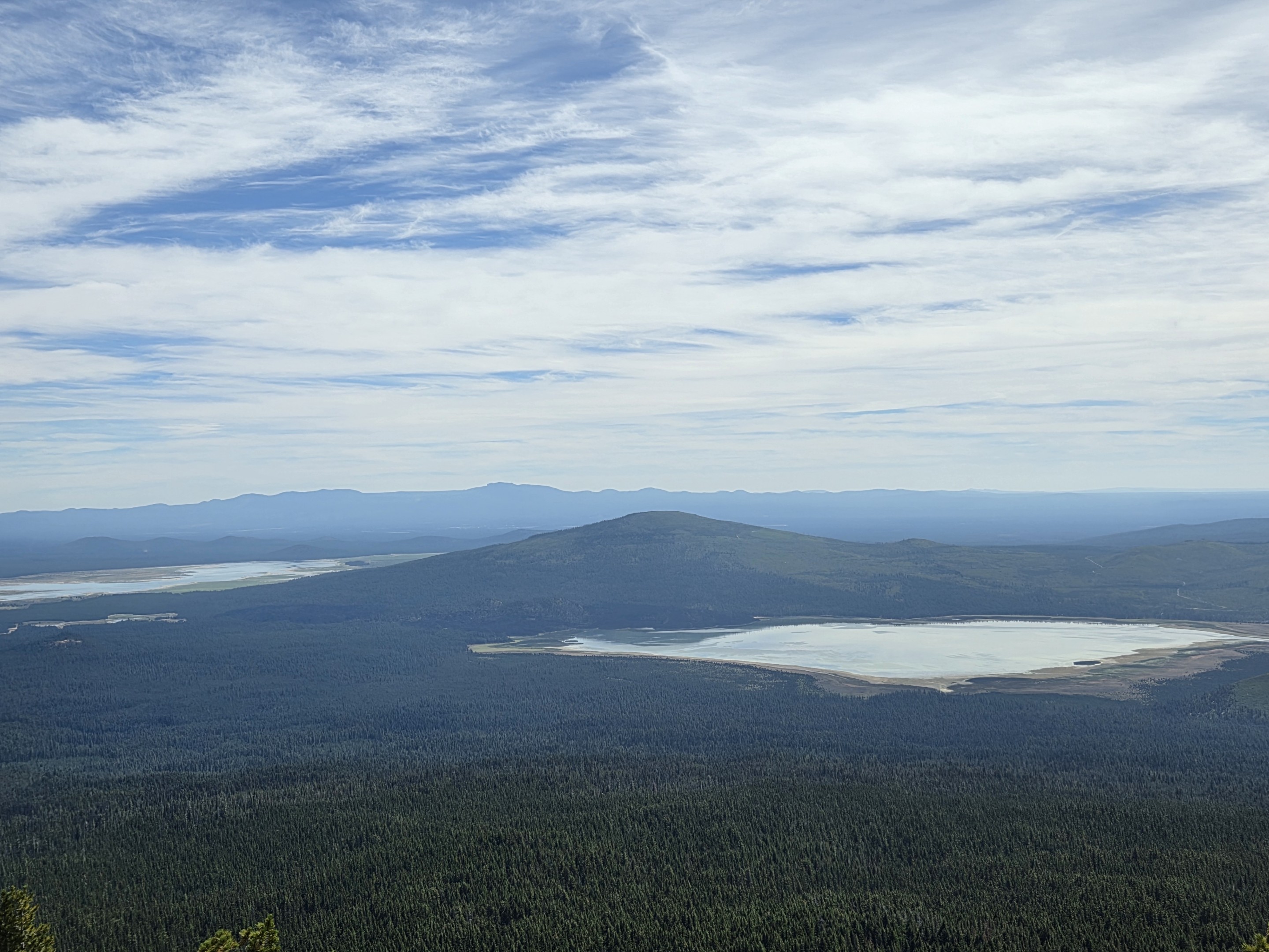
In another direction, the landscape opens toward large mountain lakes and the broad volcanic country surrounding Willamette Pass.
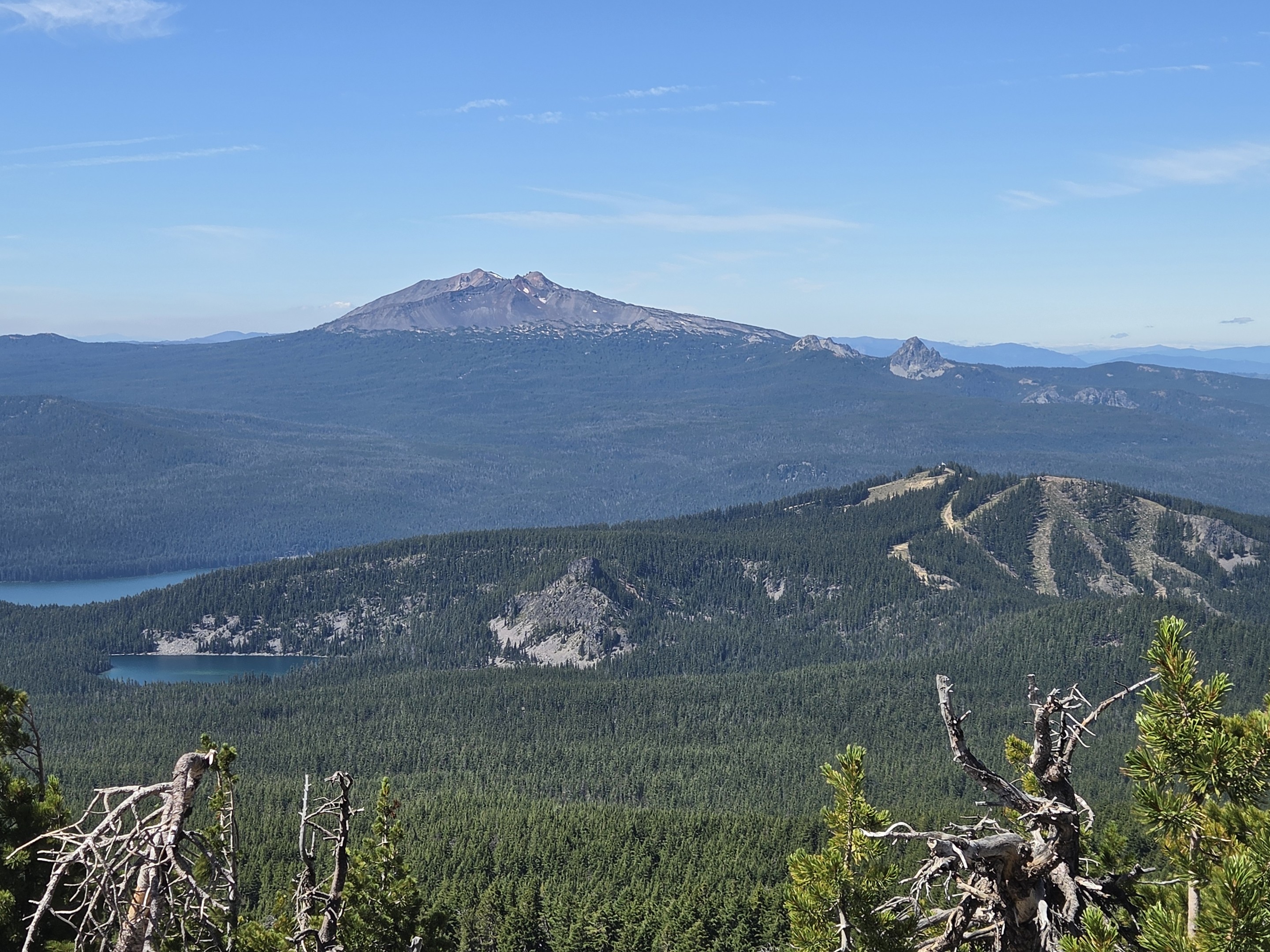
But perhaps our favorite view was south toward Diamond Peak. Its rugged summit dominates the horizon and provides a reminder of just how many volcanic peaks define this part of Oregon.
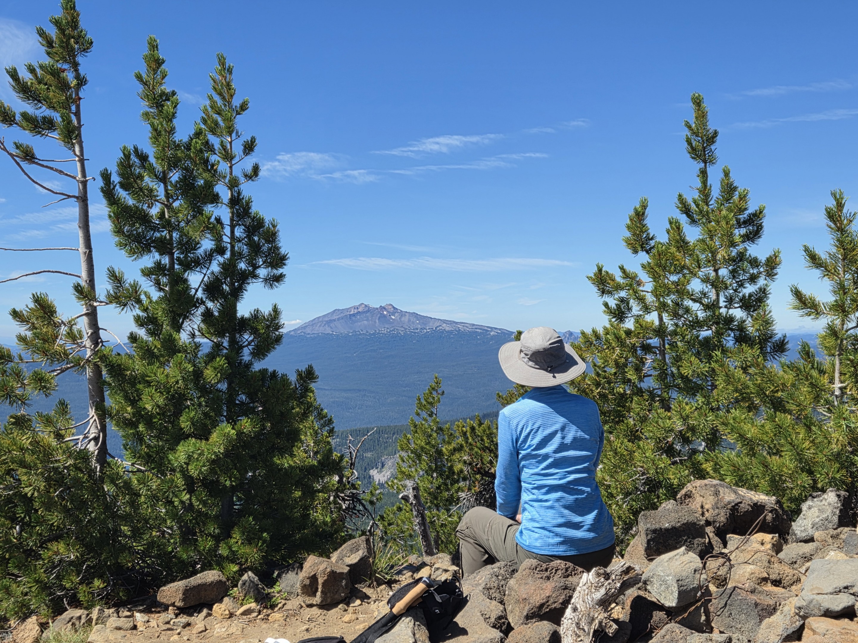
After the strenuous final climb, sitting among the rocks and simply taking in that view was an easy decision.
Is Maiden Peak Worth the Climb?
Absolutely—but we would classify the Gold Lake Road route as a difficult hike, despite the relatively moderate terrain encountered during its first several miles.
Our hike totaled:
- Distance: 11.41 miles round trip
- Elevation gain: 2,828 feet
- Summit elevation: approximately 7,818 feet
- Route: Maiden Peak Trail #3681 from Gold Lake Road
- Difficulty: Difficult
- Primary challenge: Very steep climbing during the final portion of the ascent
The unusual distribution of the elevation gain is important. Someone looking only at 2,828 feet spread across more than 11 miles might expect a long but fairly steady climb. That isn't what we experienced. The easier opening miles leave a substantial amount of climbing for the final push toward the summit.
Maiden Peak also gave us an interesting reminder of how differently trails can be managed within Oregon's public lands. We spend much of our summer hiking in designated Wilderness, where trails are traveled only by people and horses and where trail construction generally reflects those uses. Maiden Peak Trail shares the forest with mountain bikers, and its character reflects that broader recreational purpose.
Would we hike it again? For the views from the top, probably. But next time we would know exactly what is waiting during that last mile. And sometimes knowing what is coming makes all the difference.