Posts from April 2021
Subscribe and receive email notifications of new blog posts.
 RSS Feed
- 2026 | 71 Posts
- 2025 | 103 Posts
- 2024 | 110 Posts
- 2023 | 72 Posts
- 2022 | 52 Posts
- 2021 | 70 Posts
- 2020 | 84 Posts
- 2019 | 38 Posts
- 2018 | 48 Posts
- 2017 | 39 Posts
- 2016 | 31 Posts
- 2015 | 10 Posts
27
The "Secret" Hike to Alder Springs
The "Unofficial" Hiking Route on Lower Whychus Creek
.jpg)
We hiked to Alder Springs last year for the first time. This lovely canyon oasis, located on Whychus Creek near the confluence of the Deschutes River, has beautiful geological formations and stunning sights at every turn. The "official" and "unofficial" trails are closed December 1 through March 31, but during our recent hike April 24th, 2021, we saw fewer than 20 people the entire time and no one at all on our "unofficial" trail. The unofficial trail starts at Whychus Creek Crossing, located inside the Crooked River National Grassland. The road to the crossing is rough, passable by standard car, but we would recommend a 4 wheel vehicle. There are several picnic tables at the crossing and no trailhead. But if you walk past the last picnic table, keeping Whychus Creek on your right, you will eventually find a trek that takes you down the creek 3.5 miles until you reach Alder Springs. The hike takes you up and down a bit on the escarpment bordering Whychus Canyon and in places is a bit sketchy near steep drop offs into the canyon. But the trail, although faint, is very passable and once you get close to Alder Springs, the trail will drop into the canyon bottom next to the ford over the creek.
.jpg) |
.jpg) |
Past the spring, hikers can walk another 1.5 miles to the confluence of Whychus Creek with the Deschutes River. This little additional trek was absolutely wonderful and is an experience not to miss. The rivers were full, but the foliage just starting to leaf out, so the views of the river from the trail were fairly visible and creek access doable. We believe later in the year, once the foliage is full and growing, river access may be harder to obtain. One of these side treks from the hike provided a beautiful view of a "weeping wall" - water flowing from the canyon wall into Whychus Creek which reminded us of Hawaii.
The confluence of Whychus Creek with the Deschutes was absolutely stunning with both waterways full from snowmelt. The rock outcropping at the end of the trail was a great place to have lunch, take pictures, and enjoy the beauty of Central Oregon.
.jpg) |
.jpg) |
After lunch, our hike back to Whychus Crossing was fairly uneventful, with the exception of the snake stretched out on our trail (we walked around it). During the summer the area will get very warm with the only shade near the creek. But early spring and late fall, the 10 mile round trip hike is a great way to spend a day enjoying Central Oregon's high desert.
.jpg) |
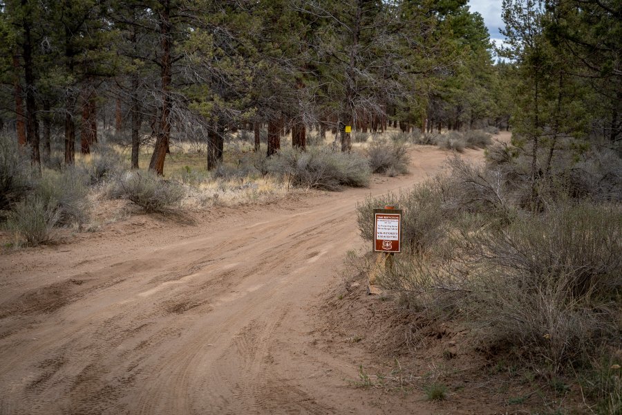 |
To find Whychus Creek crossing and our "secret" hike to Alder Springs, take Locust Street (Camp Polk Road) in Sisters 3.1 miles north from East Cascade Avenue. Take this to Wilt Road, staying on Wilt when the pavement ends 4 miles. Past Rimrock Ranch, the road is less maintained. Travel another 2.5 miles until you see a sharp unmarked turnoff to the right on the rough road we mentioned earlier. This turnoff has a brown sign noting the area being closed December 1 through March 31. Travel on this until you reach the crossing.
21
Our Tried and True Brunch Destination - Victorian Cafe
Tried and true, this great brunch spot in town continues to deliver excellent customer service and great dishes with seasonal vegetables.
 Every time we venture to The Victorian Café we comb through the menu - should we get the breakfast burrito? Any of the benedicts? Maybe some pancakes? Not this time! The specials' menu, which is swapped out regularly, caught our fancy.
We decided on the Veggie Hall Hash because- why not? Loaded with seasonal veggies, added mushrooms, and topped with fried okra our taste buds were satisfied but it was the drizzle of chimichurri sauce that knocked our taste buds to next week! We'd highly recommend this dish to anyone headed to "The Vic" but make sure you get there soon...or this special may already be off the menu!
We also had to...
19
Steins Pillar Hike Still a Great Central Oregon Option Early Spring
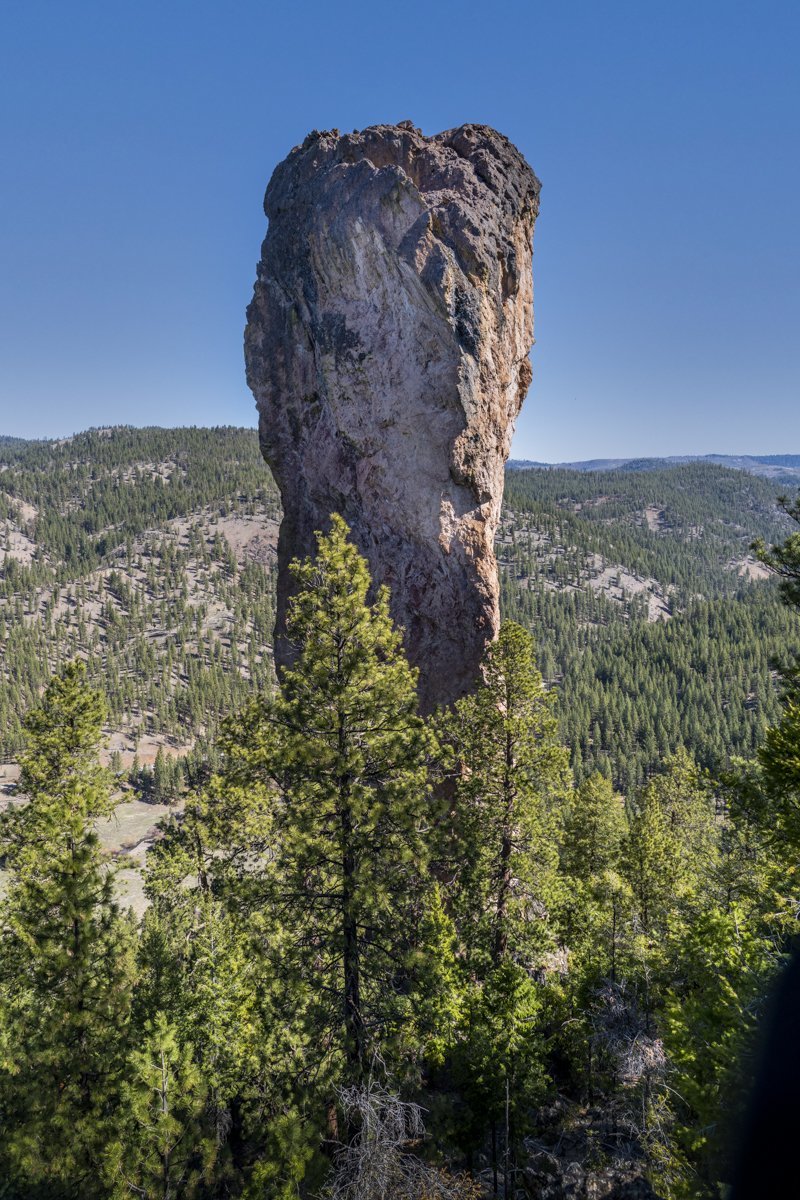
It seems that a year into the Covid-19 pandemic, we are finding ourselves repeating the hikes we took a year ago. Steins Pillar in the Ochocos is a fairly short, fairly easy hike with an impressive end at the 350 foot pillar, a volcanic remnant over 38 million years old. Probably the most concerting issue getting to the trail head is the two mile mostly single lane dirt road (within potholes) which can be somewhat sketchy going around corners, hoping no one else is coming the other way. But if you make it to the actual trail head without incident, the four-mile in and out moderate hike to the pillar has an easy to follow trail with several view points along the way. On our hike, April 17, 2021, there were just a couple of icy patches on the trail in sheltered, northern facing sl...
12
Bend Premier Real Estate | April 2021 Newsletter
What's in the April 2021 Newsletter?
- Lack of Inventory Triggers Escalating Home Sales Prices
- Ready for a Great Spring Hike?
- Are Bend Residents Being Priced Out of the Market?
- Buyer Competition is Good News for Sellers
- Bend's Newest Best Burger?
11
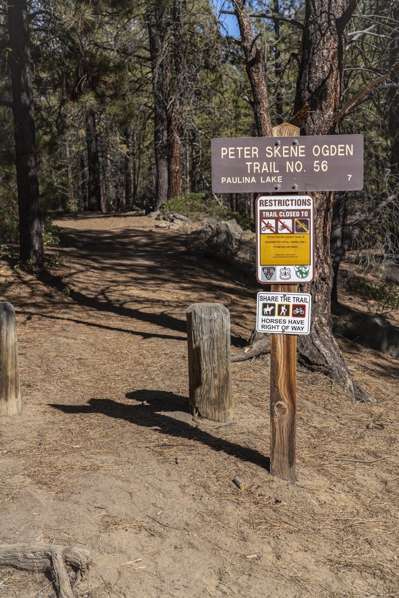
Ready for a Great Spring Hike?
Peter Skene Ogden Trail is Ready Now!
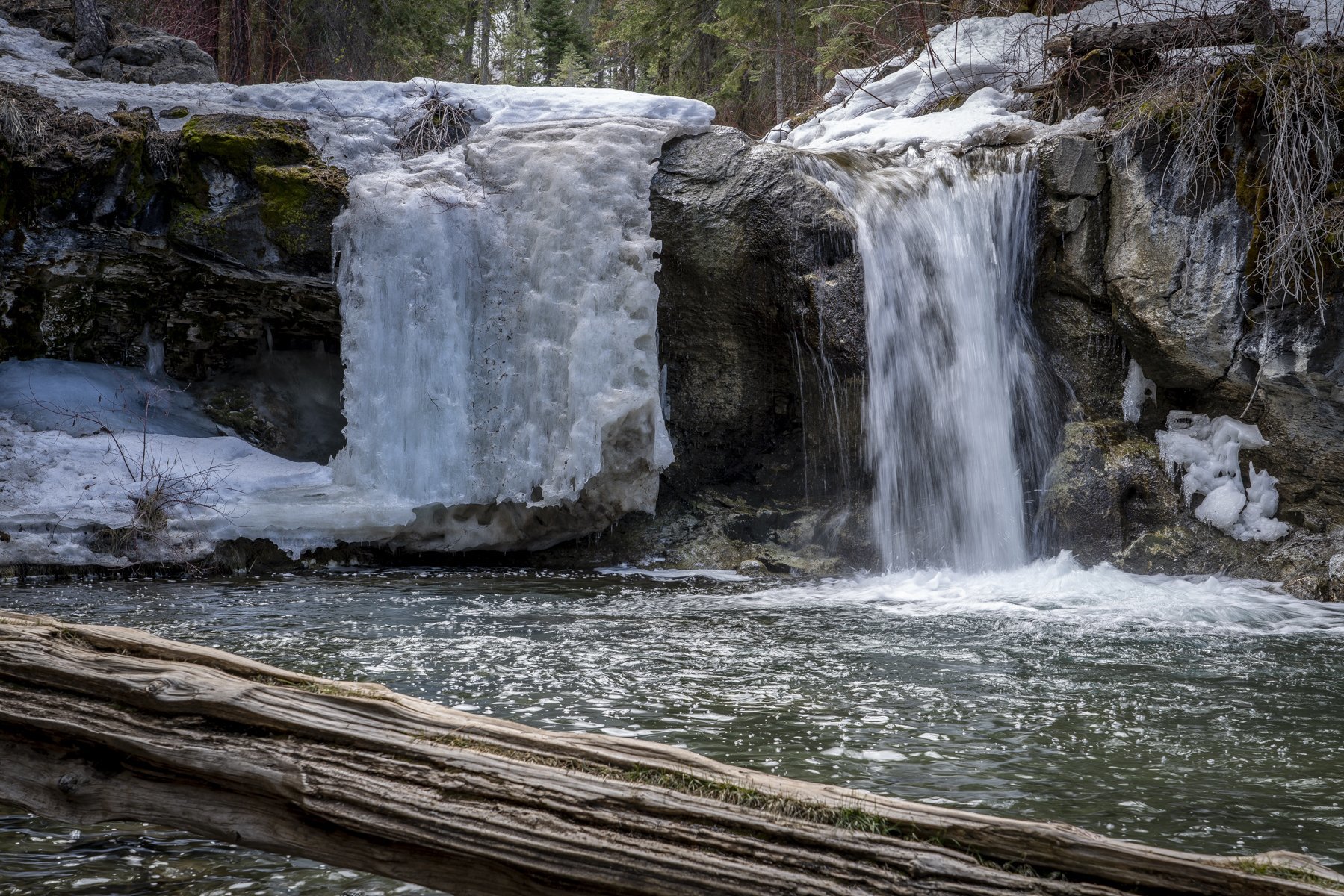
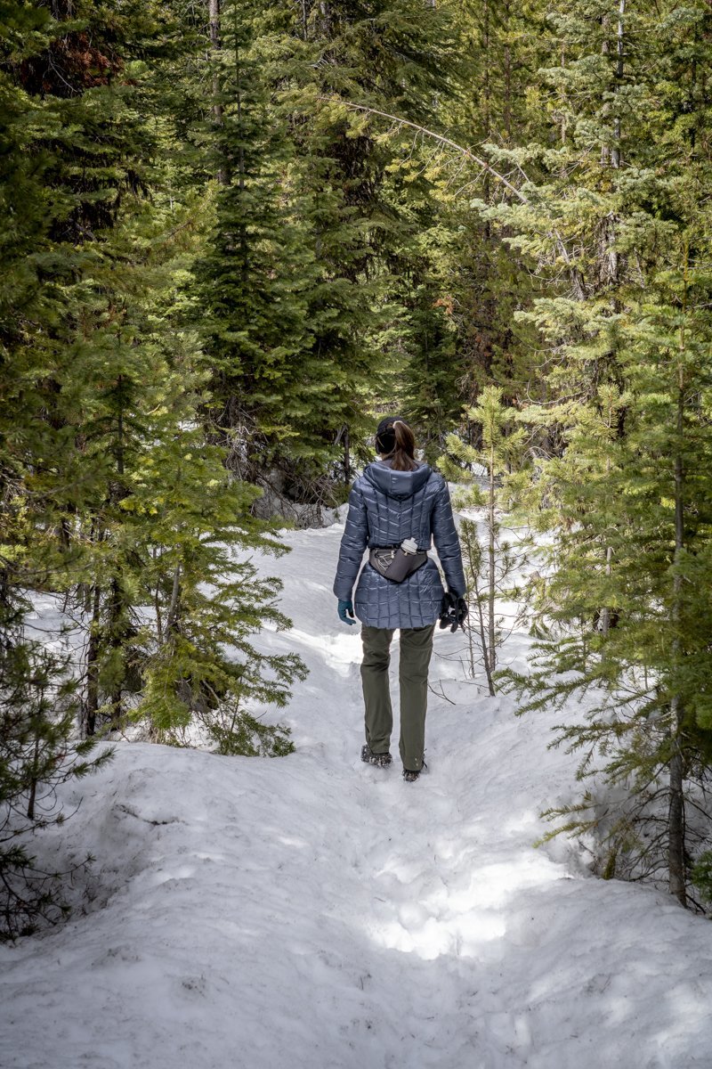
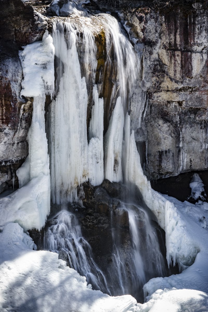
It has been just over a year since we last hiked Peter Skene Ogden Trail, located just outside Newberry National Volcanic Monument off the road to the park entrance. Last Saturday, April 10th 2021, the weather was predicted to be cool and windy and this hike, mostly sheltered from the wind in the canyon where Paulina Creek flows, seemed a good choice. When we parked our car by the trailhead at the closed McKay Crossing Campground, there was only one other car and the temperature was under 40 degrees. We thought we would hike the 3.5 miles to our favorite waterfalls along the hike - the place we call "Twin Falls." We dressed warm and quickly covered the distance to the falls. After a short stop with photos of the falls, we decided to see how much further we could make it on the hike, knowing the trail ends at Paulina Lake. We were surprised to see the trail was relatively snow free until past 4.5 miles, and then very passable with microspikes on our shoes. We made it all 7 miles to Paulina Falls where we enjoyed a quick lunch prior to starting back. Although trekking through the snow was much slower than on the bare ground, the experience was very enjoyable and yes, pretty sheltered from the wind. All in all, we saw only 6 other people and 2 dogs the entire day.
 |
 |
 |