Posts from August 2023
Subscribe and receive email notifications of new blog posts.
 RSS Feed
- 2026 | 71 Posts
- 2025 | 103 Posts
- 2024 | 110 Posts
- 2023 | 72 Posts
- 2022 | 52 Posts
- 2021 | 70 Posts
- 2020 | 84 Posts
- 2019 | 38 Posts
- 2018 | 48 Posts
- 2017 | 39 Posts
- 2016 | 31 Posts
- 2015 | 10 Posts
29
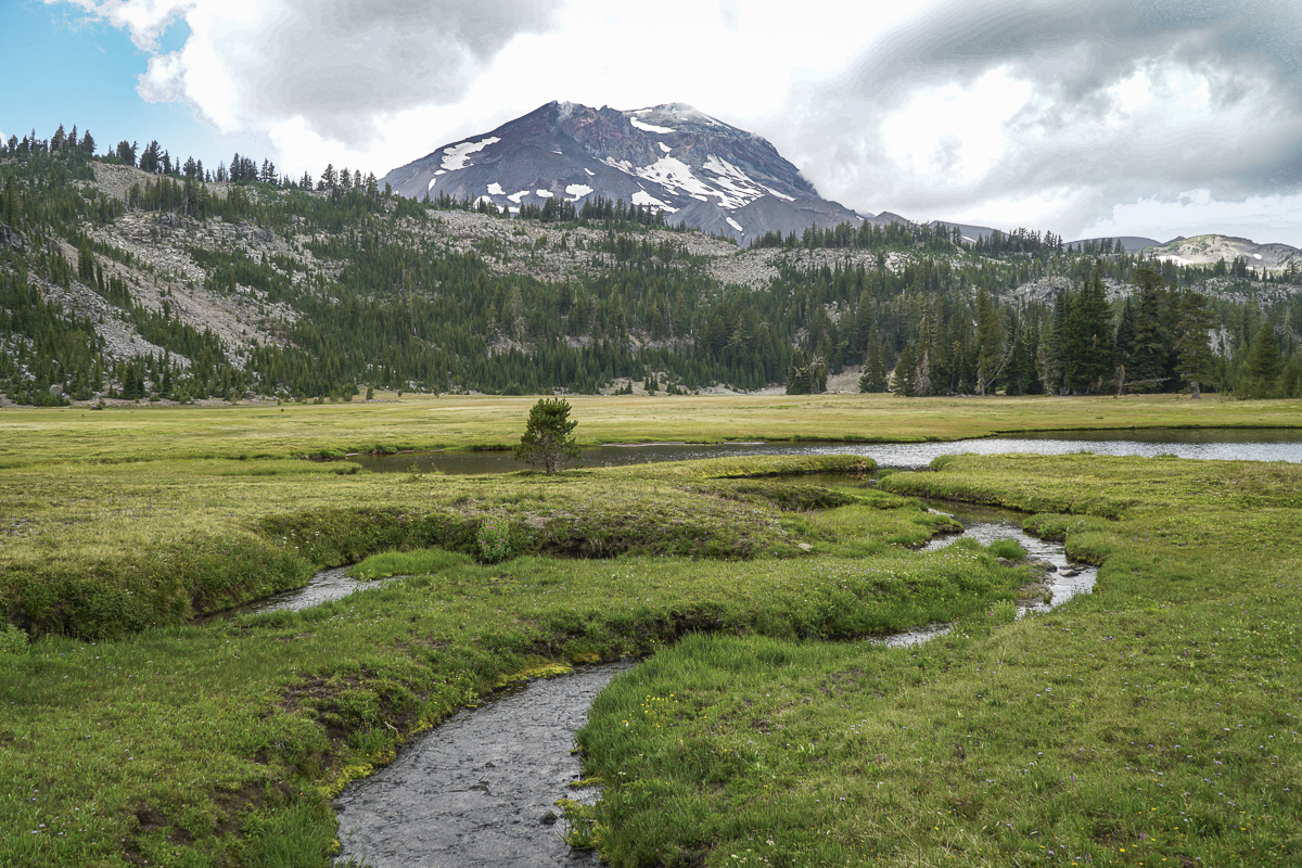
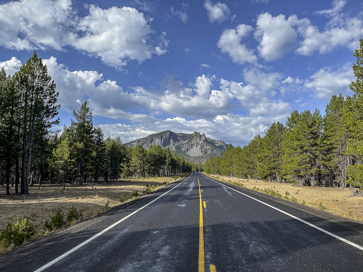
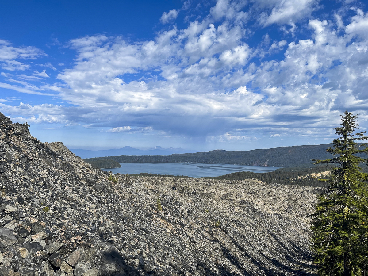
Crater Rim Trail at Newberry National Volcanic Monument Worth the Trip
Crater Rim Trail Lightly Traveled
Newberry Crater, including Paulina Peak and Paulina Falls, are often our go-to hikes when the weather doesn't cooperate in exploring the Cascades. At a lower elevation, we can often hike this area well into early winter when snow stops our adventures in the higher mountain regions. And its location, between Bend and La Pine, is an easy drive from home.
Last Saturday, we ventured into Newberry Crater to avoid the choking smoke much of Central Oregon has been experiencing from the Bedrock fire and now Lookout and Petes Lake fires as well. We were fortunate that the air stayed relatively clear during our day there and we could enjoy a great hike.
 We found a hike we had never done before last Saturday. All Trails named it "Lost Lake to Crater Rim Trail" and it was a loop. The suggestion was to park at the Obsidian Flow parking lot, but we drove further down the road to an access point off the main road about a mile past.
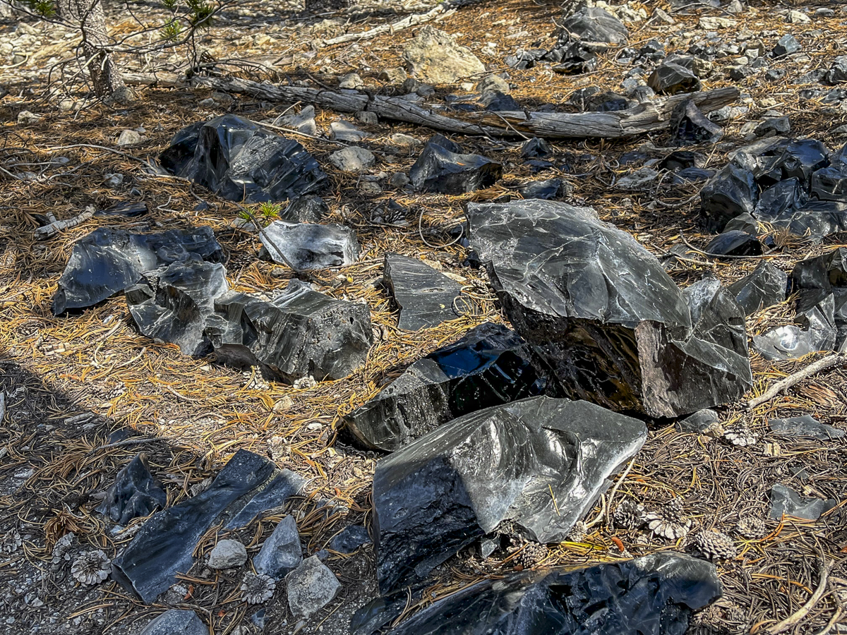
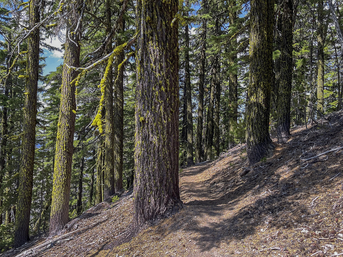
Our initial hike was through a lodgepole pine forest, but as we got further away from the road, we began to gain elevation and the trail got closer to the obsidian flow. We saw larger obsidian stones on each side of the trail as the hike got gradually steeper.
Eventually we reached the Crater Rim Trail. This trail circles Newberry Crater fully and is over 20 miles in length. We didn't want to take this hike today, but rather followed the route we downloaded. This involved a section of Crater Rim, and then a loop which dropped into a canyon that came up by Pumice Flat and rejoined our original trail. This seemed a bit short for us, so we went back up the loop and then hiked toward Paulina Peak, not fully reaching it but found a terrific lunch spot to enjoy the views of Paulina Lake. We then returned back the way we came. The entire hike was just over 13 miles with 2350 feet of elevation gain. We only saw 4 people during the entire hike - all of them riding mountain bikes.
 |
 |
 |
 |
18
Central Oregon Real Estate Market Trends for Sisters, Prineville, Madras and La Pine | July 2023
What's Up with Real Estate Trends in Sisters, La Pine, Madras and Prineville?
We track on a monthly basis the real estate single family home sales trends for Bend, and on a quarterly basis those of Redmond. However, there are four other cities in Central Oregon which are important markets to our home buyers and sellers. The small city of Sisters typically has had higher prices than the other Central Oregon municipalities, but the access to the Cascades and other recreational opportunities has been a draw for those who like its quaint, western theme. For many for whom Bend is too expensive, wonderful options are available in La Pine, Madras and Prineville.
For the past three years, all three towns have followed the same market trends for their single family home sales as we have seen in both Bend and Redmond. Lack of inventory with high demand drove home prices up through 2021 into mid 2022, at which time the sharp increase in mortgage interest rates led to a...
18
Bend Premier Real Estate & Tiffany Clark both Runner Ups in The Source Best of Central Oregon 2023
The survey conducted by The Source Weekly for the Best of Central Oregon in 2023 resulted in two winners for Bend Premier Real Estate. Tiffany Clark was named the runner up for Best Realtor and Bend Premier Real Estate was named the runner up for Best Real Estate Company. Thank you to everyone who voted for us. We appreciate the support!
16
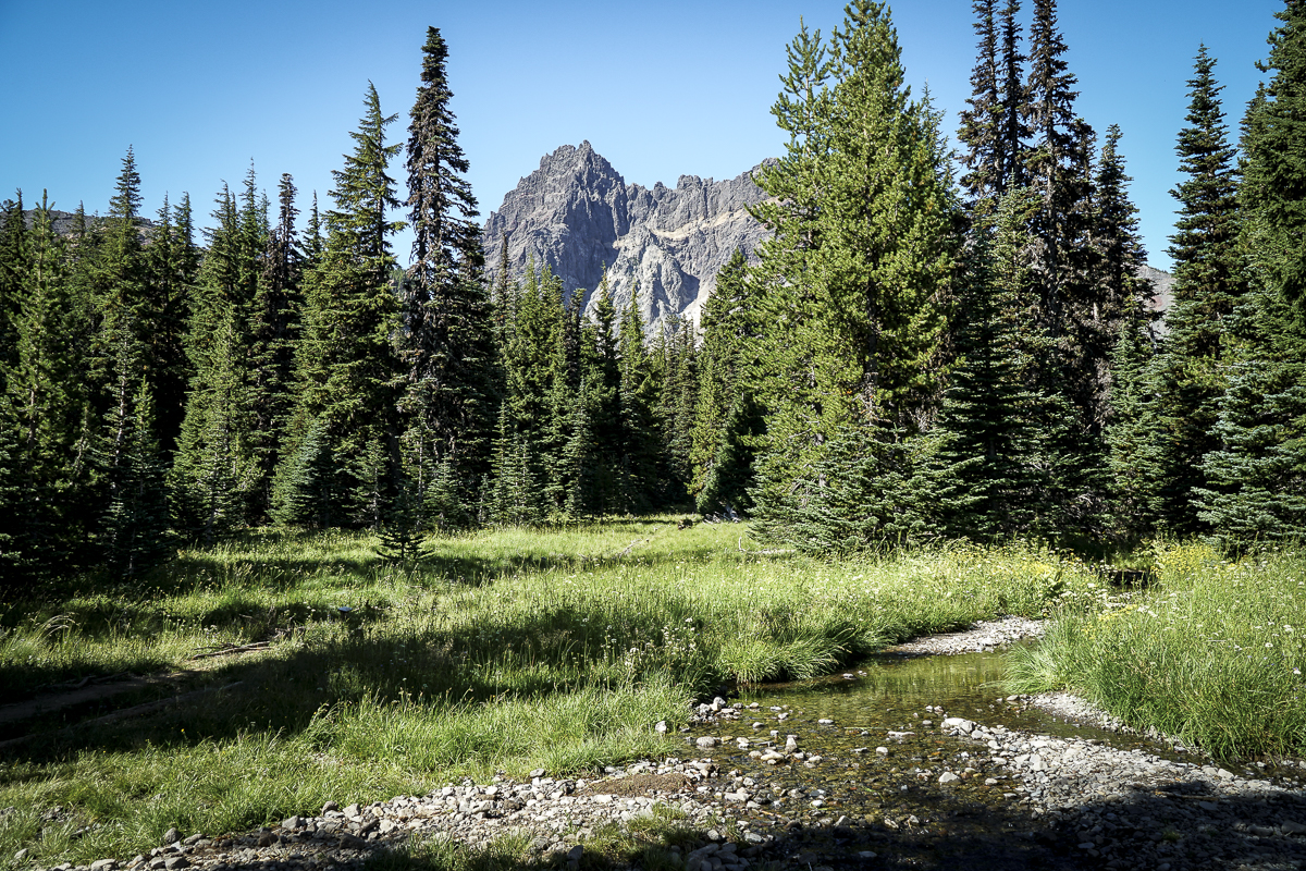
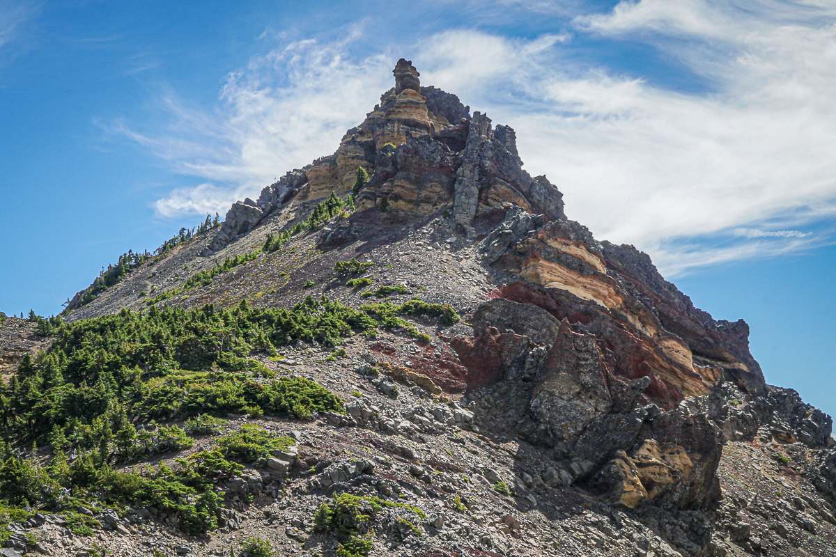
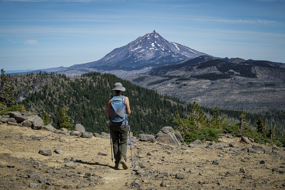
Three Fingered Jack Hike From Jack Lake Trailhead a Great Mid Summer Trek
We hike Three Fingered Jack yearly and always enjoy our experience. Our 2023 hike was no exception and the air was clear, a challenge this summer with the smoke from the Bedrock fire near Eugene coming and going for weeks.
The Canyon Meadow/Three Fingered Jack hike is one of our less strenuous summer hikes, the entire route taking less than 8 miles with roughly 1700 feet of elevation gain. Traveling through the forest recovering from the 2003 B&B fire, it is nice to see the growth of new vegetation and young trees, and it was easy to sample huckleberries growing along the path. Once you enter unburned forest, it isn't far until hikers reach Canyon Meadow with its green grass, wildflowers, and views of Three Fingered Jack. The "unmaintained" spur path to the mountain had a number of fallen trees to traverse, but past that it was easy to reach the base of the moraine which holds the blue glacial lake.
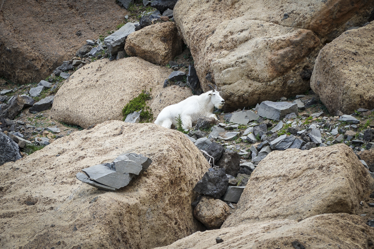
It is harder to scramble up the loose rock of the moraine (going down you have to be careful), but we always do this and reach the saddle between Three Fingered Jack and a nearby peak which we have nicknamed "Dragon Mountain". From there, stunning views of the Three Sisters, Broken Top and Mt Bachelor can be seen. Looking the other way, views of Mt Jefferson can't be missed. During this trip, we also saw a nearby mountain goat; these goats were reintroduced to the Mt. Jefferson Wilderness around Three Fingered Jack in 2010 and have grown in number.
 |
 |
 |
 |

10
Little Know Secret Found Near Golden Lake in the Three Sisters Wilderness
Tarn Lakes at the Base of Broken Top are Hidden Treasures
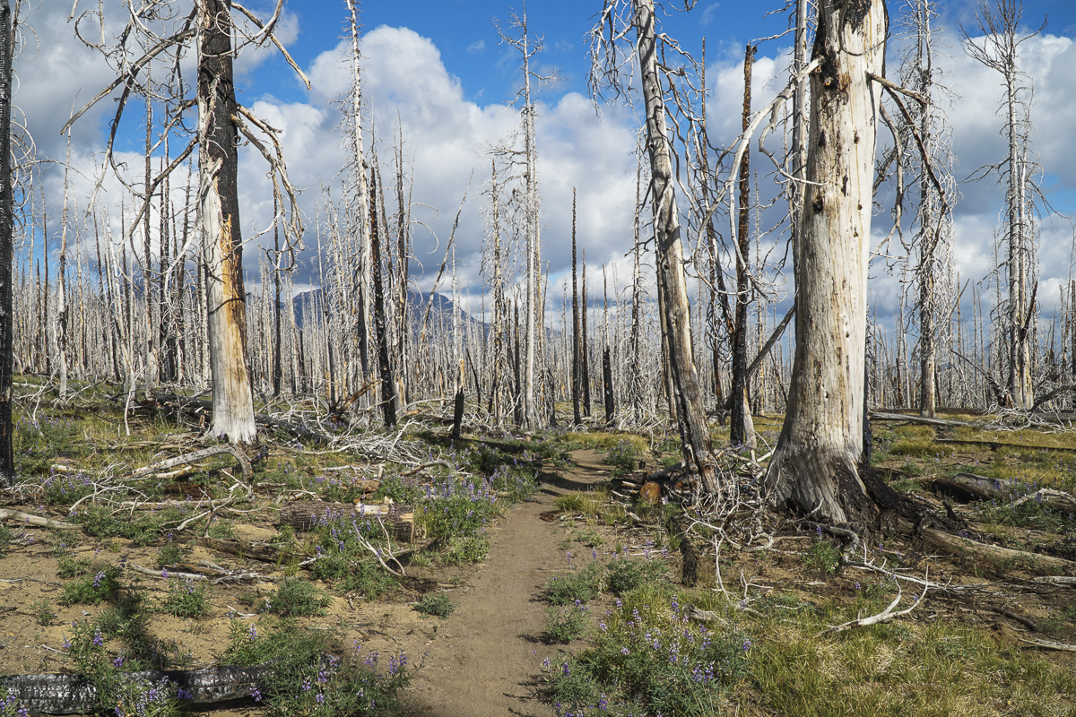
We have hiked to Golden Lake several times in the last few years, and have always enjoyed the experience despite the length of the trek. We have accessed Golden Lake via the Green Lakes trail, hiking past the last lake deeper into the Three Sisters Wilderness before turning off the main trail into the little used Golden Lake Trail and enjoying the gem of this beautiful, isolated mountain lake. However, we noticed several years earlier that the lovely series of waterfalls which feed the lake have a faint path next to the creek traveling higher up the lower slopes of Broken Top. We had never taken this path before due to the length of our day hike via Green Lakes already exceeded 16 miles.
The first weekend in August, 2023, we hiked to these remote lakes through Park Meadow, a hike we had never done before. The trailhead for Park Meadow is located near Three Creeks Lake, a few miles from Sisters, and the first four miles of trail were through the dry, dusty dead forest which was the result of the 2013 Pole Creek Fire. Volunteers had cleared the first 2.5 miles of blow down, but the next 2 miles were slow having to hike over and around fallen trees. Despite the dead snags, there are signs of life with young trees, wildflowers, grasses and mountain shrubs growing in the burnt forest, especially near water sources such as the several creeks which flow through the area.
 |
 |
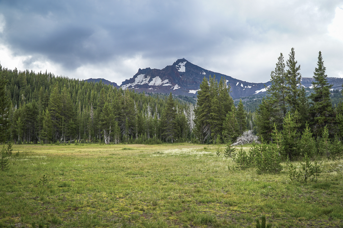
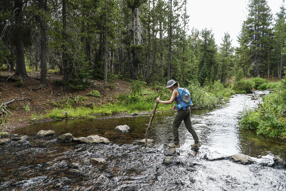
Once we reached unburned forest, it was a short mile or so to reach Park Meadow, a beautiful meadow with wildflowers, green grass and views of Broken Top. Crossing the East Fork of Park Creek was a little challenging for those of us wishing to keep our feet dry.
 |
 |
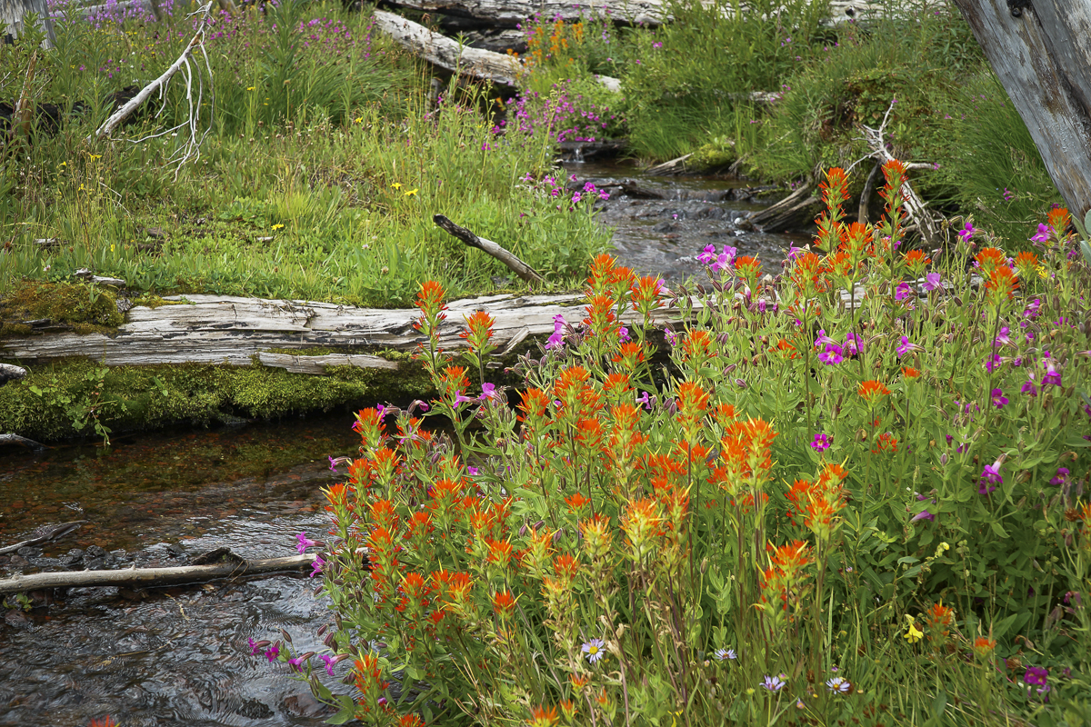
Past Park Meadow the trail gained elevation at a greater rate until we reached Golden Lake. We walked around the lake to the lovely waterfall at the far end and traveled up the faint path another mile or so, following the unnamed creek which had many small waterfalls and wildflowers all the way to the spring from which it began at the base of a glacial moraine. Hiking up the moraine to the top we reached the first tarn lake, which had a beautiful ice blue color we have seen at other glacial lakes. Up the second moraine we reached the last tarn lake where we ate our lunch and enjoyed the views of Broken Top, including the ridge which overlooks NoName Lake. We spotted several people walking along the ridge, but from the distance we were at, the figures were too small to identify.
With the extra mile up and back to the tarn lakes, our total trip was just shy of 16 miles and roughly 2000 feet of elevation gain. Outside of the volunteers clearing the blow down 2.5 miles in, we saw no other people until we returned to Golden Lake. It was a wonderful day exploring Central Oregon's beautiful hikes.