119 articles found with the search of "sisters"
Subscribe and receive email notifications of new blog posts.
 RSS Feed
- 2026 | 48 Posts
- 2025 | 103 Posts
- 2024 | 110 Posts
- 2023 | 72 Posts
- 2022 | 52 Posts
- 2021 | 70 Posts
- 2020 | 84 Posts
- 2019 | 38 Posts
- 2018 | 48 Posts
- 2017 | 39 Posts
- 2016 | 31 Posts
- 2015 | 10 Posts
20
Tumalo Mountain is Always a Great Central Oregon Hike
Tumalo Mountain is One of the Best Places to View Mt. Bachelor
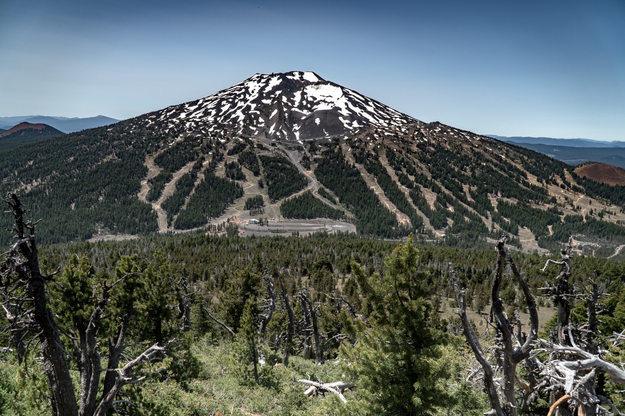
We have hiked Tumalo Mountain several times, but each has experience been enjoyable. The 4 mile round trip has 1400 foot elevation change, so it is fairly steep going up. However, once you reach the top, the views of Mt. Bachelor, South Sister, Broken Top, and east toward the Ochocos are fabulous. During July, the evidence that Mt. Bachelor is a renowned ski area is obvious with the ski runs and maintenance roads visible, but the beauty of the mountain is also easy to see. Tumalo Mountain is a popular hike and plan on seeing people during your trip up and back. Bring plenty of water and enjoy the experience.
 |
 |
17
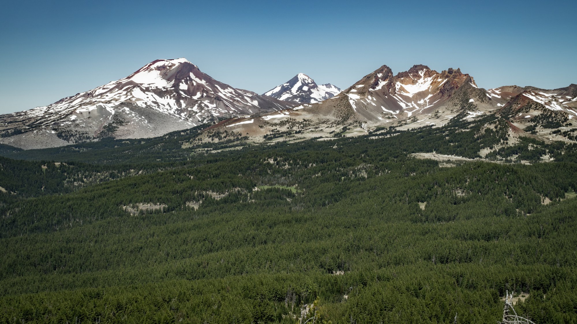
Black Crater Hike Offers Eight Cascade Peaks Views

We had never hiked Black Crater on McKenzie Summit until this month and it turned out to be a wonderful experience. Despite the burned area at the beginning of the hike, the result of the 2017 24,000 acre Millie Fire, the 7 miles up and back was easy enough, although steep in sections, and signs of new life in the burned forest was interesting to see. However, the reason people hike Black Crater is for the views at the top. On our day, July 13, 2020, eight Cascade Mountains were visible. We had to get through about 1/2 mile of snow to reach the top, but once the trail opened up, the stunning vistas of Broken Top, the Three Sisters, Mt. Washington, 3 Fingered Jack, Jefferson and Mt. Hood were all there and we enjoyed seeing them from this wonderful vantage point. Trail books note the hike as "difficult" or "hard," but we found it more moderate than super challenging. The elevation change is there, but if you take your time, the views are very much worth the effort.
 |
 |
 |
 |
7
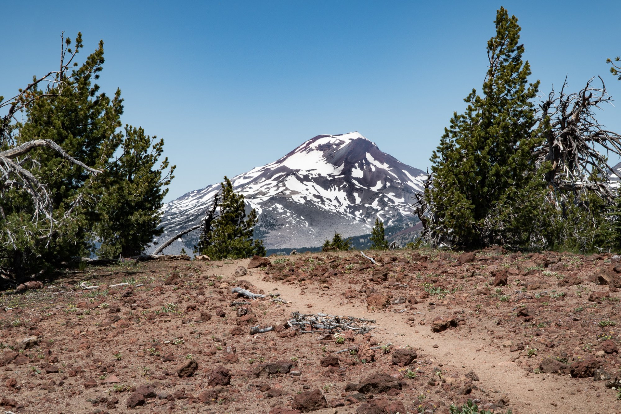
Beyond Green Lakes is Golden Lake in the Three Sisters Wilderness
Golden Lake is a Rarely Visited Site in the Three Sisters Wilderness

We have hiked to Green Lakes many times over the years. The 4.5 miles to the lake posted on the forest service sign by the trail head we believe is to the first lake the trail reaches and not to the far lake which usually takes another 1/2 hour to 45 minutes of hiking. We have gone to the far lake often, but have never gone past that last lake until this year. The trail further into the Three Sisters Wilderness continues past the last Green Lakes, over the creek and up a hill. We decided to travel a short distance on this trail to see what we could find, having checked out a map noting a meadow and Golden Lake.
Most people traveling into the Three Sisters Wilderness will backpack in and camp, but with our early start, we just hiked in and out. Our initial short distance idea expanded a bit, but the hike to Golden Lake was well worth it. The trail led over snow patches, but once we reached the lake, the beauty of the yellow wildflowers, the stunning views of Broken Top, South Sister, Middle Sister and North Sister and the absolute privacy with no one else around was an experience we shall remember for years to come.
 |
 |
 |
 |
 |
 |
3
Alder Springs - A Central Oregon Hidden Treasure
.JPG)
In all the years we have lived in Central Oregon, we have never hiked to Alder Springs. In fact, we didn't even know it existed until recently. Flowing into lower Whychus Creek which starts at Broken Top and merges into the Deschutes River, Alder Springs is an oasis in the midst of the High Desert.
There are two trail heads you can drive to in order to begin your hike to Alder Springs. Both trail heads have sketchy 4 wheel drive dirt roads which is probably why few take these hikes. We took the least rough road located out of Sisters to our trail head which resulted in a longer 3.8 mile hike one direction bordering Whychus Creek much of the way. We saw no one on this hike until we reached Alder Springs and at times the trail was hard to find. During the summer this hike would be very warm as there is little shade and we would recommend hikers bring a lot of water. But the hike along the canyon rim can be beautiful with views down to the creek and birds of prey circling in the sky.
Once we reached Alder Springs, we saw other hikers for the first time. They had come the shorter 1.5 miles from the other trail head and had hiked the additional 1.5 miles to an overlook of the junction of Whychus Creek and the Deschutes River. This second way to reach Alder Springs involves wading across Whychus Creek - which was knee high the end of May 2020. After resting a bit, we returned to our car the way we had come and made it there 10 minutes before a violent thunderstorm hit. It was a great day.
.JPG) |
.JPG) |
.JPG) |
.JPG) |
26
Metolius River - Another Great Central Oregon Easy Hike
Fast Flowing River, Springs and Easy Walk
.JPG)
We have lived in Central Oregon since 1985. During this time we have never hiked the Metolius River until this weekend. The day was overcast and light rain came and went. When we started the hike, we only saw one person for the first 2 miles - a fisherman casting his line in a quiet place on the river.
We started our hike at the Canyon Creek Campgound at the West Metolius Trailhead and followed the river downstream over 2.5 miles until we reached the Wizard Falls fish hatchery. The hatchery was closed due to Covid-19 and the bridge over the river was blocked. However, since we were on the hatchery side of the river, we walked on the bridge to view the beautiful blue water of Wizard Falls before returning the same way we came upstream back to the campground. We stopped to enjoy the early blooms of wildflowers scattered along the trail and the stunning spring flowing into the river 1/3 mile from the campground.
All in all, the hike was easy with little elevation change and a little over 5 miles total. To access the hike, travel west of Sisters on Hwy 20 until you reach the road to Camp Sherman. Travel on road 1419 4.8 miles until you reach road 1420. Travel straight on this 3.3 miles until you reach the sign for Canyon Creek Campground. Travel 1 mile on this dirt road until reaching the trail head.
.JPG) |
.JPG) |
.JPG) |