119 articles found with the search of "sisters"
Subscribe and receive email notifications of new blog posts.
 RSS Feed
- 2026 | 48 Posts
- 2025 | 103 Posts
- 2024 | 110 Posts
- 2023 | 72 Posts
- 2022 | 52 Posts
- 2021 | 70 Posts
- 2020 | 84 Posts
- 2019 | 38 Posts
- 2018 | 48 Posts
- 2017 | 39 Posts
- 2016 | 31 Posts
- 2015 | 10 Posts
1
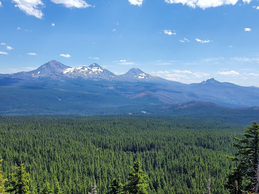
Sisters Mirror Lake to Wickiup Plains Hike Offers Lakes and Mountains
Last Saturday, August 29th, we decided to take an easier hike to Sisters Mirror Lake. Located just south of Devil's Lake off South Century Drive, the Sisters Mirror Lake trail head has limited parking space, but we easily found a spot on the highway. The 3 plus mile hike into Sisters Mirror Lake was a fairly easy walk in old growth forest with an elevation gain of between 600 and 700 feet. The lake itself is one of a series of small high elevation lakes, each with its own charm and privacy. We saw just a few people on this trip - many with packs to spend the night.
After enjoying visiting the various lakes, including Lancelot, Camelot, Needle and several unnamed lakes and snacking on wild blueberries that were at their peak of ripeness, we traveled on the Pacific Crest Trail, which skirts Sisters Mirror Lake, to Wickiup Plains having heard that the Plains provide wonderful South Sister views. That statement was proven true when we stepped out of the old growth forest and saw South Sister. The south side of South Sister rises dramatically up from the Wickiup Plains and dominates the skyline. The view is truly magnificent and with each step closer to the Wickiup Point, the view grew larger.
We took the Wickiup loop back, connecting with the Devil's Lake trail before taking the Elk Lake trail back to connect with the Sisters Mirror Lake trail roughly 1/2 a mile before the parking lot. Wonderful views of Broken Top were visible on this part of our hike before we entered the old growth forest again. All in all, our relatively easy hike ended up being in excess of 12 miles - but it was well worth it for the wonderful surprises we saw. We have lived in Bend since 1985 but have never heard of Wickiup Plains before. What a surprise!
 |
 |
17
Scott Mountain in the Mt. Washington Wilderness is a Great Hike

McKenzie Pass (Hwy 242), connecting Central Oregon with the Willamette Valley, is opened for such a limited time each year that many of the available hikes and places of beauty are not as visited as those located off Cascade Lakes Highway in the 3 Sisters Wilderness. But the hikes off McKenzie Pass offer views of the Cascades that cannot be seen from other locations in Central Oregon - including vistas of the west side of the 3 Sisters (and Little Brother) plus Mt. Washington, Mt. Jefferson and Broken Top.
Our hike up Scott Mountain started at Scott Lake and then passed through old growth forest to Benson Lake and then further to Tenas Lakes before climbing more steeply around the back of Scott Mountain to the summit (a total of 1300 feet elevation change in around 4.1 miles). Wild huckleberries were abundant as were thousands of orange California Tortoiseshell butterflies. The view from the top of Scott Mountain was fabulous - both toward the Cascade peaks but also west toward the Willamette Valley. The foundation of the old lookout tower was still in place, but we saw hardly anyone on this hike to the peak and absolutely no one at all as we came down the long way around by Hand Lake (where we saw a few families playing in the shallow water) back to Scott Lake (the huckleberries on this stretch of trail were hardly touched - and we wished we had thought to bring a bucket to gather some for home). The walk along the lava flow before we reached Hand Lake was interesting and full of the butterflies. All in all, the total hike was a bit more than 9.7 miles with our side trip to Hand Lake's shore.
 |
 |
 |
 |
13
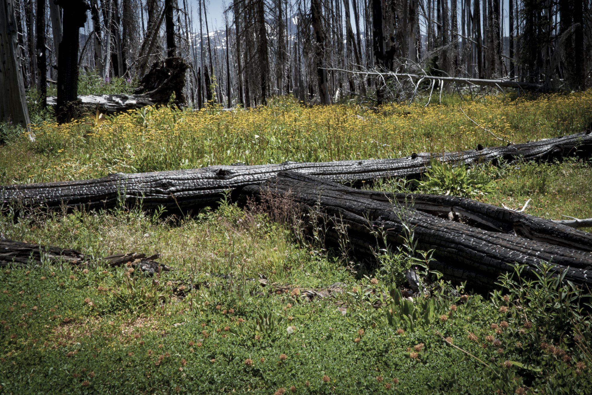
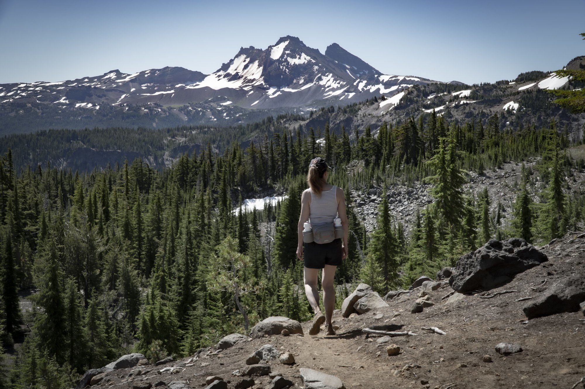
Hike to Three Fingered Jack in the Mt. Jefferson Wilderness

For those who have never hiked in the Mt Jefferson Wilderness, the feeling of the forest is different than that of the 3 Sisters Wilderness. And the hike to the east side of 3 Fingered Jack through Canyon Creek Meadow is a lot of fun. The Canyon Creek Meadow hike, which can be done on its own, is a 4.5 mile fairly easy loop taking hikers through the recovering 2003 B&B Complex burn through the beautiful, wildflower filled meadow, complete with the creek and stunning views of 3 Fingered Jack. A 3 mile round trip spur hike off the Canyon Creek loop will lead to a viewpoint on a flank of 3 Fingered Jack. This point provides fairly steep elevation change, loose stones and pumice on the trail and views toward the 3 Sisters, Mt. Washington, Mt. Jefferson, the meadow just hiked and the turquoise Cirque Lake created by glacial runoff. If you look carefully enough, you may be able to spot the mountain goats perched on unbelievable ledges on the rock face of 3 Fingered Jack.
Our trip back to the trail head involved another .7 mile spur off to Wasco Lake which was also mostly burned in the B&B Complex fire. Although not heavily traveled, the hike off to Wasco Lake also can provide access to Pacific Crest Trail and further lakes and vistas within the Mt. Jefferson Wilderness.
 |
 |
 |
 |
6
Hike Something Different - Tam McArthur Rim to Broken Top Via Broken Hand

We have hiked to Tam McArthur Rim in the past and we have hiked to Broken Top in the past, but we had never hiked to Broken Top from Tam McArthur Rim until last week. The hike starts at Three Creeks Lake located off Forest Road 16 (Elm Street in Sisters turns into this as you drive out of the city) and is heavily trafficked, rising over 1200 feet over 2.5 miles to the Rim viewpoint. Beautiful views of Three Creeks Lake and many of the Cascades are visible from the rim. Near the end of the initial trail is a sign near another trail heading off toward Broken Top which states "Trail Not Maintained." We decided to take this 2.2 hike to Broken Hand, a rock formation between the Rim and Broken Top. While this hike, much of it in the sun, was initially not that tough, once we approached Broken Hand, the trail got decidedly sketchy with scrambles over and around boulders and loose stones required. To get past Broken Hand, the trail traversed through a snow field. But once past this, a faint trail continued on toward Broken Top and we ended up on the moraine overlooking No Name Lake. This additional distance made for a very full day (and of course we had to travel back to our car at Three Creeks Lake), but the experience and views (10 full Cascade peaks) were fabulous. This hike is not easy and not recommended for all.
 |
 |
|
|

28
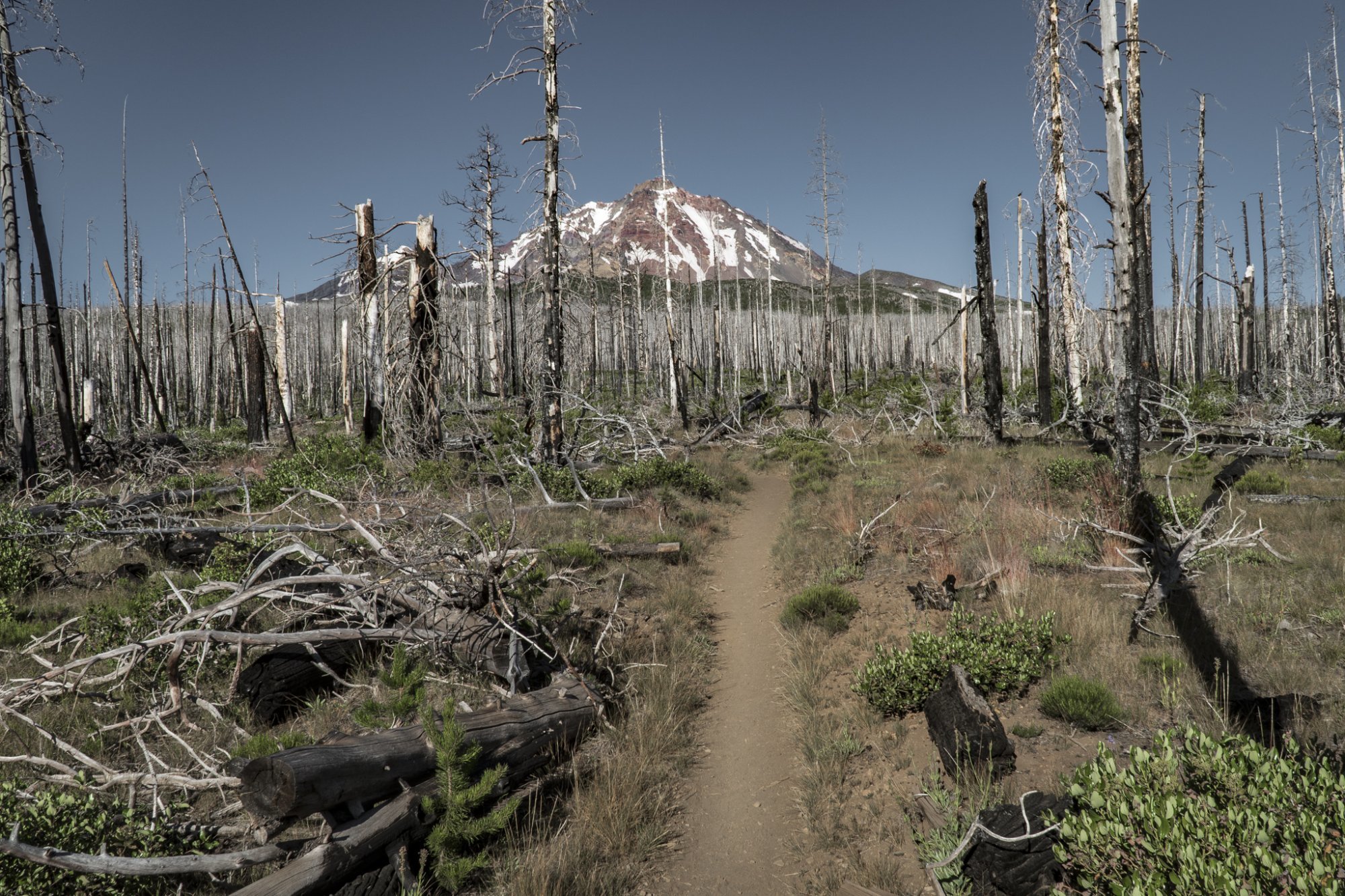
The Hike to Camp Lake in the Three Sisters Wilderness is Full of Surprises
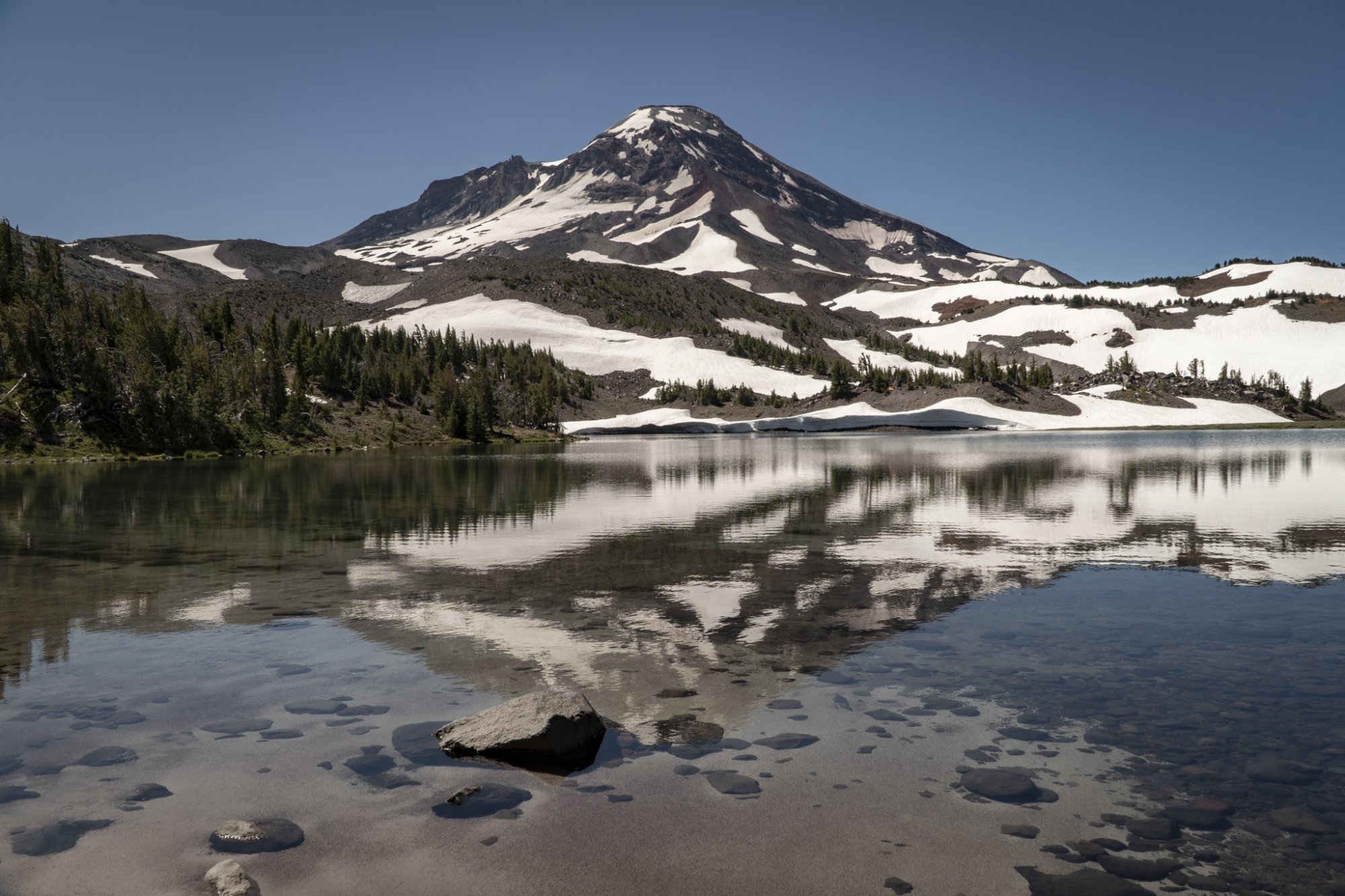
We have lived in Central Oregon since 1985, but during this entire time we have never hiked to Camp Lake. The start of this hike is located just outside Sisters off McKenzie Hwy on Forest Road 15 at the Pole Creek Trailhead. The hike into Camp Lake covers 7.1 miles (14.2 miles round trip), the first 4 through a burned forest, the result of 2017's Milli Fire. However, it is interesting to see how new plant growth is returning in the burned area. And the open areas provide for wonderful views of both Middle and North Sister.
Once we left the burned forest and entered the higher elevations, we had the opportunity to cross the North Fork of Whychus Creek and hike even closer to Middle Sister. Several trails off the main trail lead to the summit of Middle Sister, a hike only for very experienced hikers with recommendations for climbing gear. Our hike left Middle Sister at this point and traveled further southwest to end at Camp Lake, part of the Chambers Lake series of high elevation lakes in the area, at the base of South Sister. Many campers stay in this area - hiking in and enjoying the area before leaving the next day. The elevation change over the 7.1 miles is just shy of 1700 ft (5300 ft at the trailhead to 6980 at Camp Lake), but it is gradual enough that many take this hike, including children. The books call this a difficult hike, but we would call it more moderate - just longer than many other hikes in the area.
 |
 |
 |