119 articles found with the search of "sisters"
Subscribe and receive email notifications of new blog posts.
 RSS Feed
- 2026 | 48 Posts
- 2025 | 103 Posts
- 2024 | 110 Posts
- 2023 | 72 Posts
- 2022 | 52 Posts
- 2021 | 70 Posts
- 2020 | 84 Posts
- 2019 | 38 Posts
- 2018 | 48 Posts
- 2017 | 39 Posts
- 2016 | 31 Posts
- 2015 | 10 Posts
19
Our First Experience With Hiking Permits 2021 - Green Lakes to Golden Lake
Green Lakes is a Stunning Destination
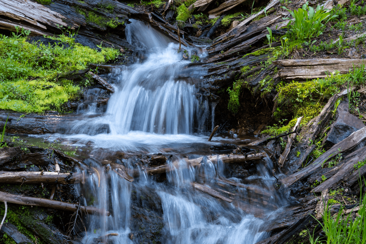
The Green Lakes trail, off Century Drive in the Central Oregon Cascades, has historically been one of the most popular hikes in Oregon. It has been used by families, trail runners, day hikers and backpackers for years as a beautiful and fairly easy hike to accomplish with the 4.5 miles and 1500 feet of gradual elevation change pretty doable for most. Over the years, we have hiked to Green Lakes many times, usually traveling on the east shore to the northern most lake, but enjoying the views and wildflowers and waterfalls of Fall Creek along the way. We have seen a huge increase of hikers traveling to Green Lakes over the years, but 2021 is the first year access to Green Lakes Trail is subject to the Central Oregon Wilderness Permit system. According to published articles, the Green Lakes/Soda Creek trails allow 120 day use permits during the 2021 hiking season.
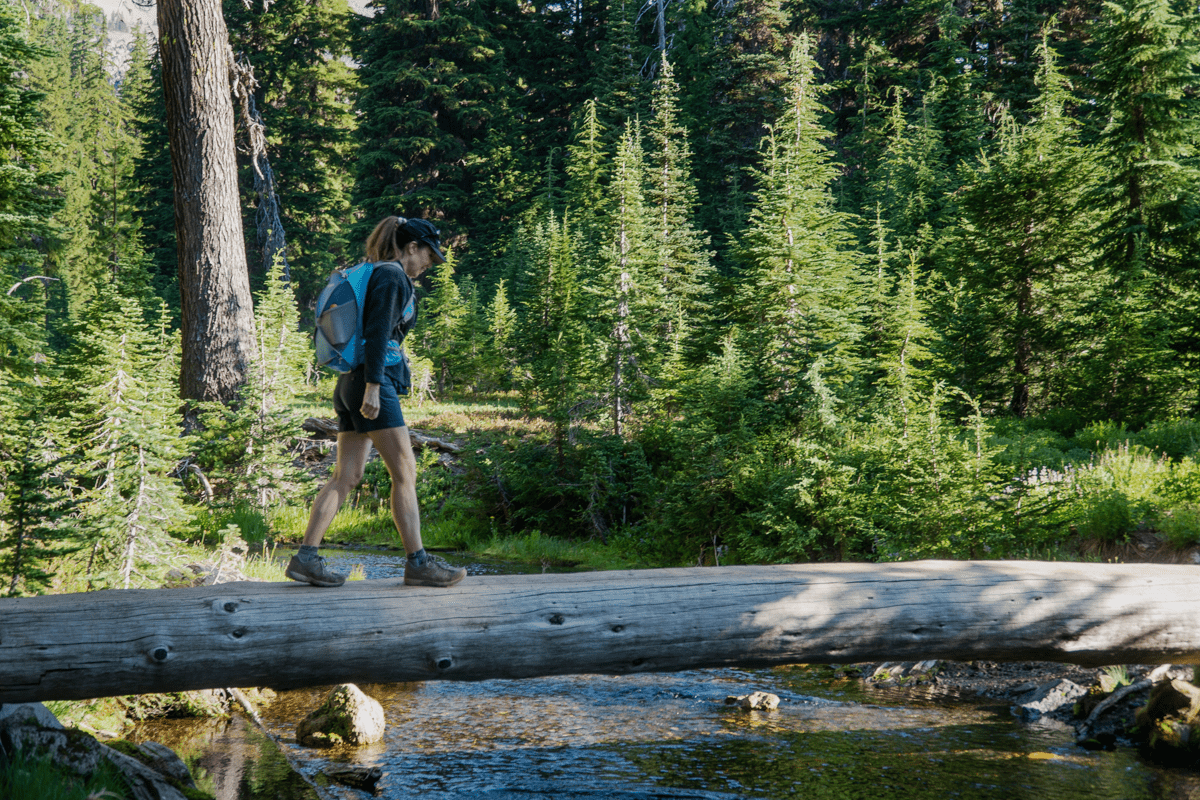
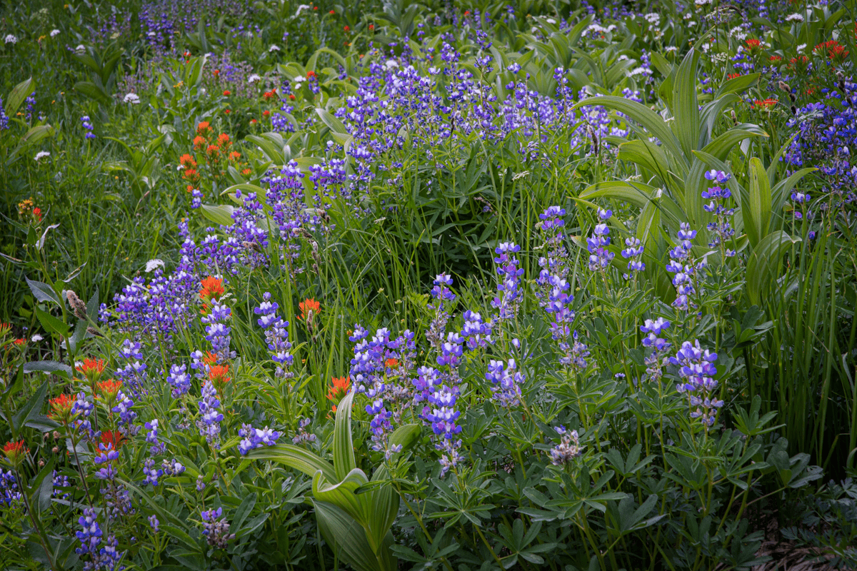
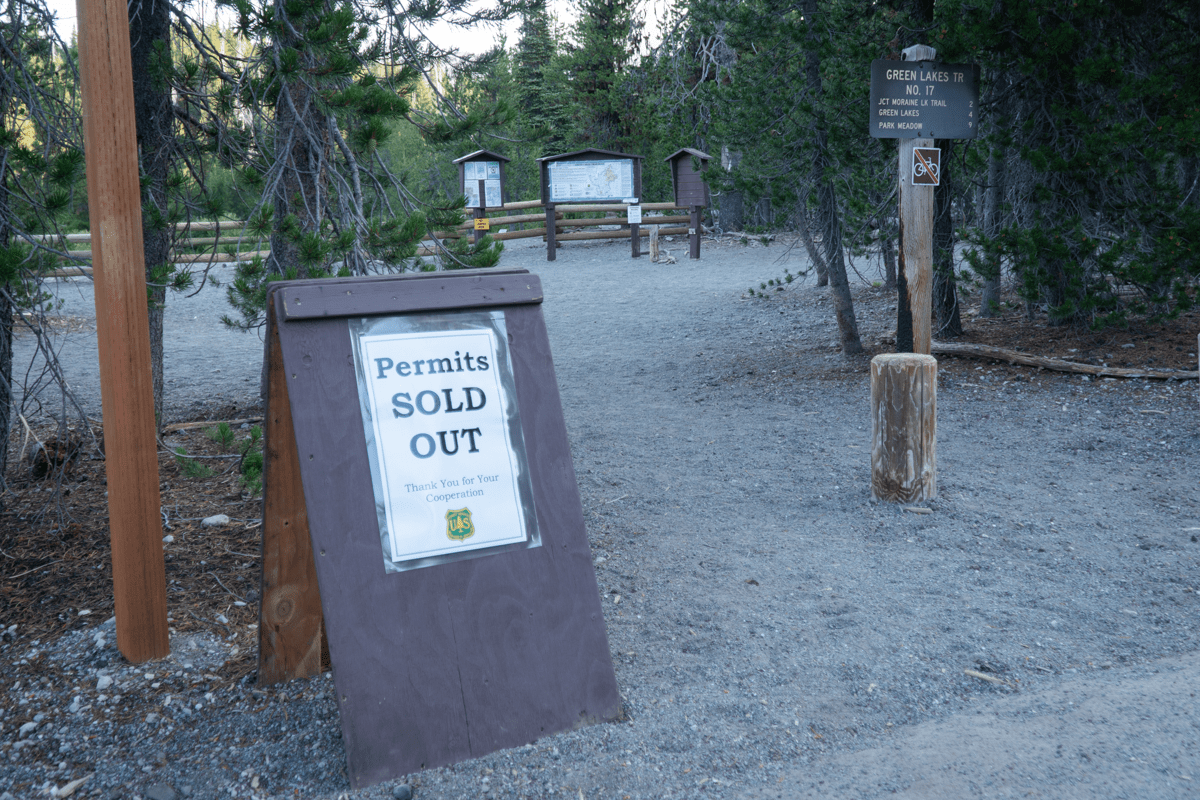 When we arrived at the trailhead at 7 am, we saw that all permits had been sold out. During the initial part of the hike, we saw just a small handful of people, mostly runners who were coming down from the lakes. The wildflowers were out and the waterfalls on Fall Creek were full and beautiful. Despite the mosquitoes, the experience was wonderful and our hike up to the lakes went very quick.
Once we arrived at Green Lakes, we looked around for the normal campers we were used to seeing at the 22 campsites around the lake. We only spotted 2, although there may have been others located on the west side of the main lake which we didn't see as we followed the trail north to the smallest lake.
 |
 |
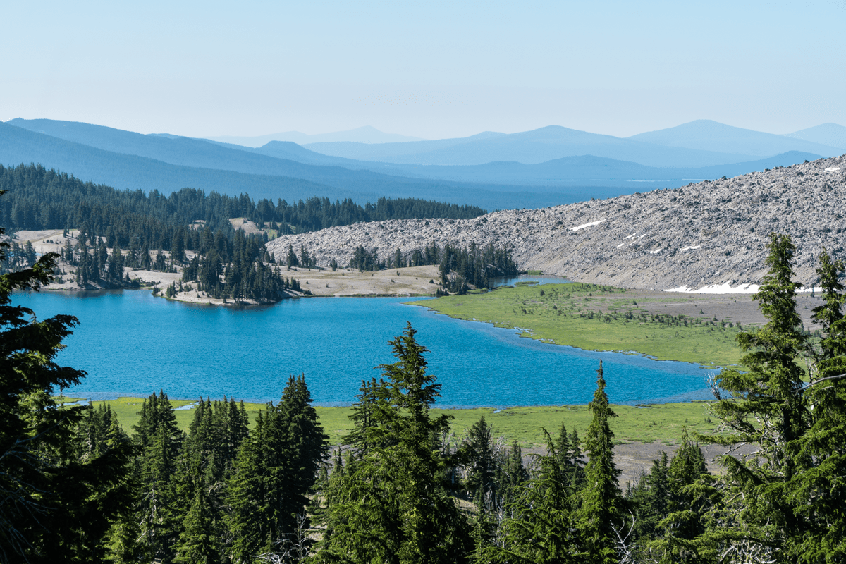
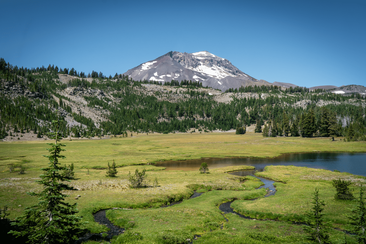
Last year was the first time we had hiked deeper into the Three Sisters Wilderness, following the trail past the northern most Green Lake up to the pass between South Sister and Broken Top, gaining 500 more feet of elevation. The views back toward Green Lakes were beautiful, as were the closer views of South Sister.
 |
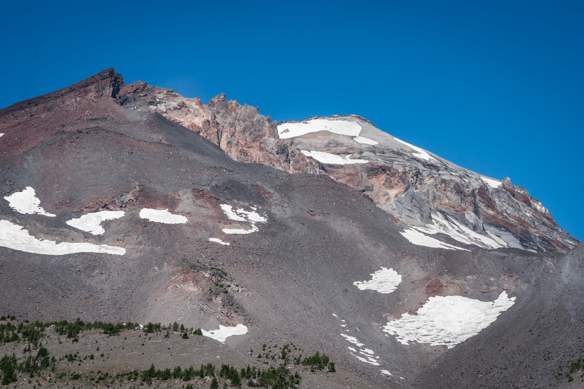 |
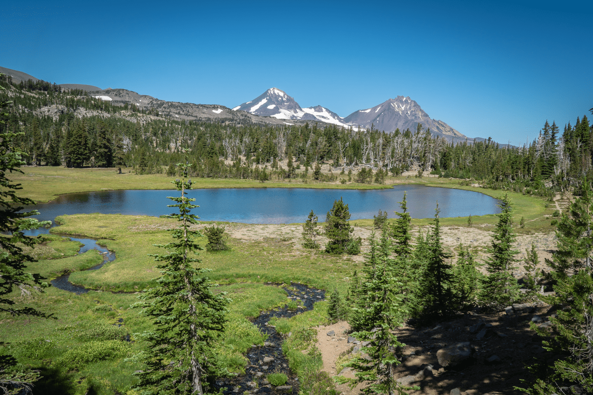
The trail in this part of the Three Sisters Wilderness is much less traveled. The few people we passed were all backpackers who were traveling multiple days with overnight stops at various campsites in the area. But the views of North and Middle Sister plus Broken Top from a different perspective make for a unique setting few people see . The trail towards Golden Lake is not marked, but if you are looking for it, it is obviously well traveled. It is about a half a mile from the main trail before the lake is seen. Golden Lake is called what it is due to the wildflowers which were past their prime when we arrived, but the basin was beautifully green and the waterfall across the lake its own special oasis.
 |
 |
All in all we hiked over 16 miles, a very full day, but enjoyed many beautiful views and new experiences. There is a reason why we believe the Central Oregon Cascades are among the most special places in the world and we look forward every year to seeing new sights in our local area.
7
Three Finger Jack From Santiam Pass Offers Options for Hikers
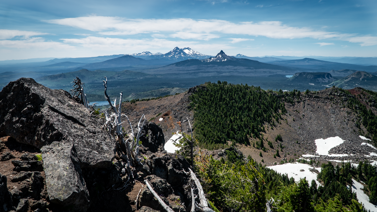
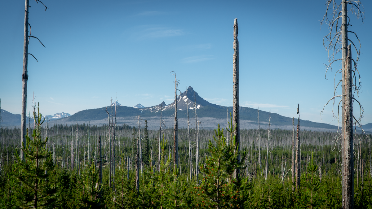
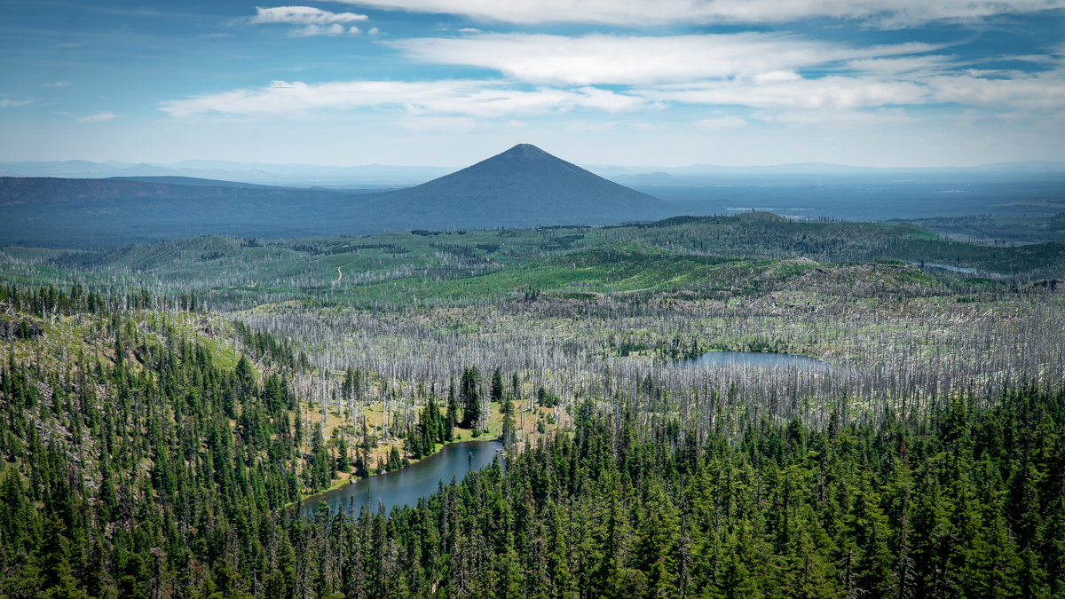
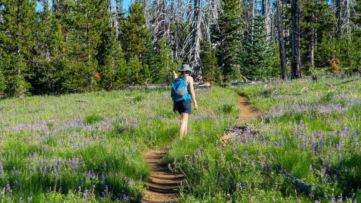
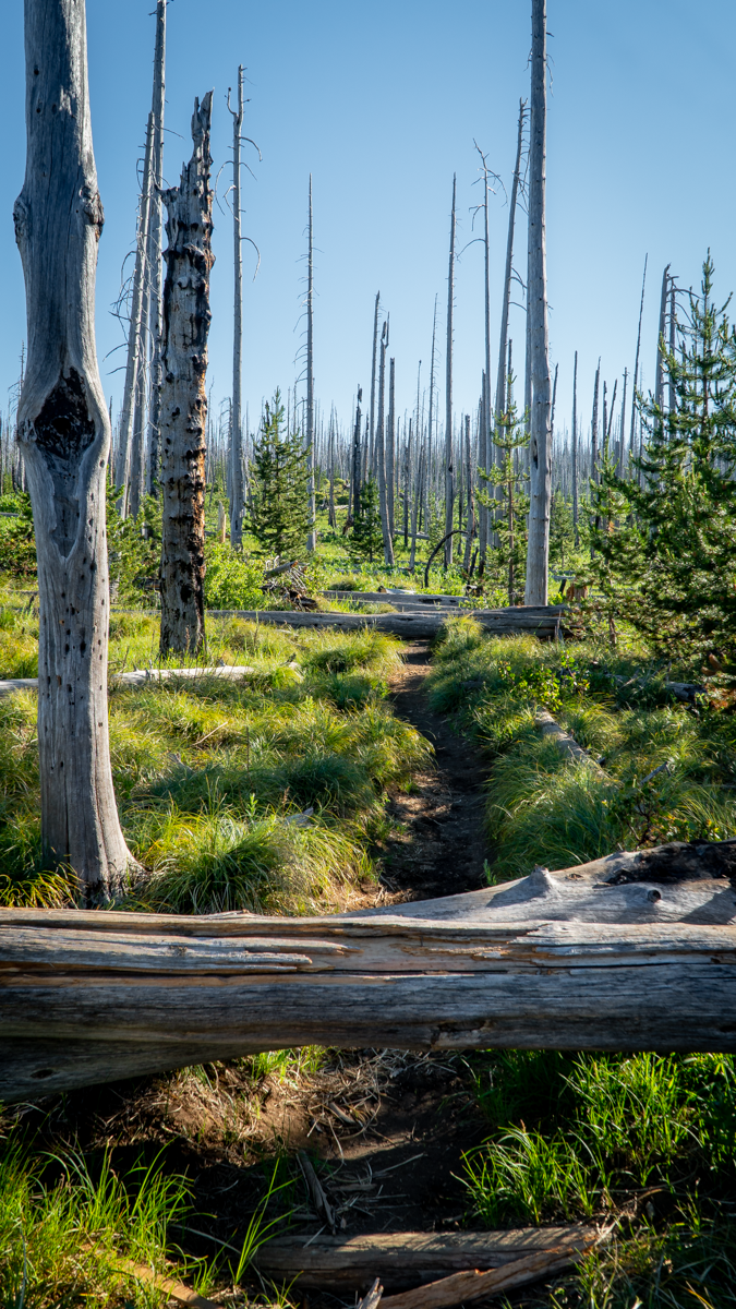
We have hiked to Three Finger Jack's base several times through the NE access to it from Jack Lake via Canyon Meadow in the Mount Jefferson Wilderness. Last Saturday, July 3, 2021, we decided to hike to Three Finger Jack from the South from Santiam Pass along the Pacific Crest Trail (PCT). The route from Santiam Pass takes hikers through part of the 90,000 acres which burned in the 2003 B&B complex fire. 18 years later, the area still has many burned trees, but new growth is abundant with wildflowers, young trees and mosquitos. And the views toward Mt. Washington and the Three Sisters are evident through the burned trees, many of which have fallen across the trail and need to be either walked around or stepped over.
 |
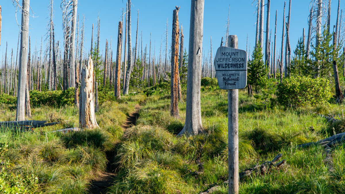 |
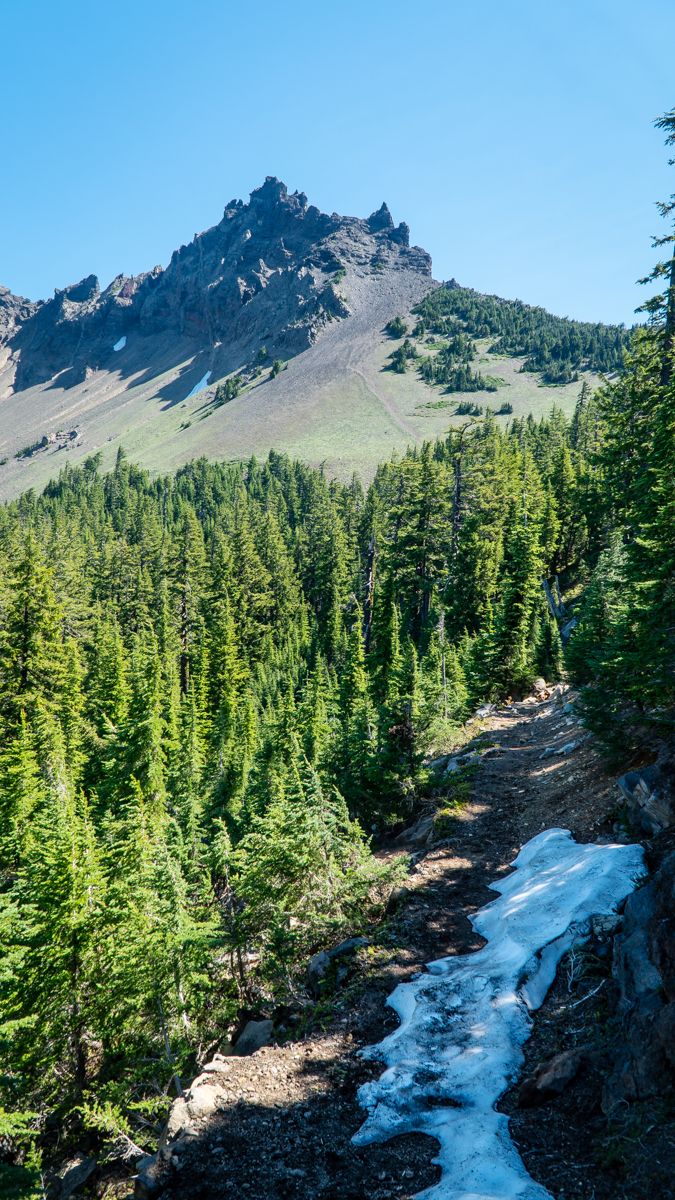
We had planned on hiking 5 miles in to what was described as a "viewpoint" in one of our hiking books. This hike would be roughly 10 miles round trip with 1500 feet elevation gain. However, as we proceeded along the hike and left the burn scars and entered areas of old growth forest, it became obvious that the trail app we were following was different than that which we read about in our local hiking book. The app led us to a "viewpoint" which was located just below the South Pillar of Three Finger Jack. As we climbed toward this extremely difficult location, we were half way before we recognized we had taken a wrong turn, but since we were half way, we became determined to complete the trek. The rewarding views were worth the difficulty, mosquito bites, and sore muscles. Plus we accomplished a "bucket list" item which we never had in the bucket to begin with. According to our app, we actually covered over 2300 feet of elevation gain and 12 miles round trip. We would not recommend this mistake to many, having determined that this unofficial trail is what is used by those few who rock climb the mountain, most of whom are much younger than us.
 |
 |
 |
 |
11
Black Butte is a Wonderful Central Oregon Hike
For a Great Aerobic Workout and Great Views, Hike Black Butte
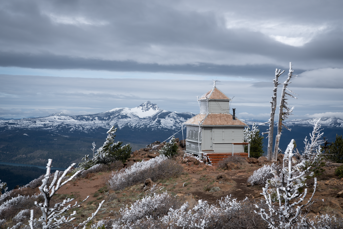
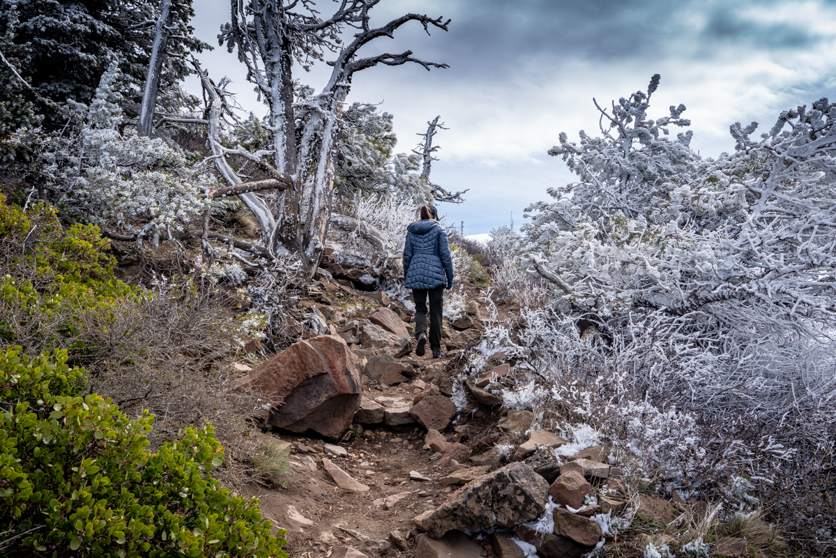
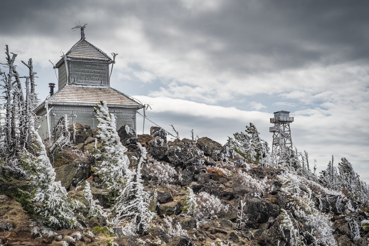
Black Butte is an iconic landmark just outside Sisters Oregon and over the years has also been a fire lookout. Today it is a terrific hike climbing 1600 feet in just under 2 miles. When hiked Black Butte on May 8, 2021, the weather was cloudy and cool, but the trail was free from snow until just before the top of the butte. To access the trail head, travel west on Highway 22 five miles past Sisters until you reach the Indian Ford Campground exit (milepost 95). Travel on paved Forest Road 11 until you reach unpaved Forest Road 1110. Travel on 1110 just under six miles to the trailhead (the last mile is quite narrow and rough). The trail head requires a forest pass and the parking area can fill up early.
The path to the top of the Butte is well maintained and popular. We saw people running the path to the top and others hiking with children. On May 8th, the wind was blowing at the top of the Butte and it was chilly; those dressed in running shorts didn't stay long. We were dressed for cool weather and were able to enjoy the time at the top seeing the lookouts and the brand new observation deck still under construction.
During our hike down, we were amazed at the numbers of people we passed climbing up. During that two mile trek down, we estimate we passed 70 people hiking up. Obviously others enjoy climbing Central Oregon mountains as much as we do!
 |
 |
27
The "Secret" Hike to Alder Springs
The "Unofficial" Hiking Route on Lower Whychus Creek
.jpg)
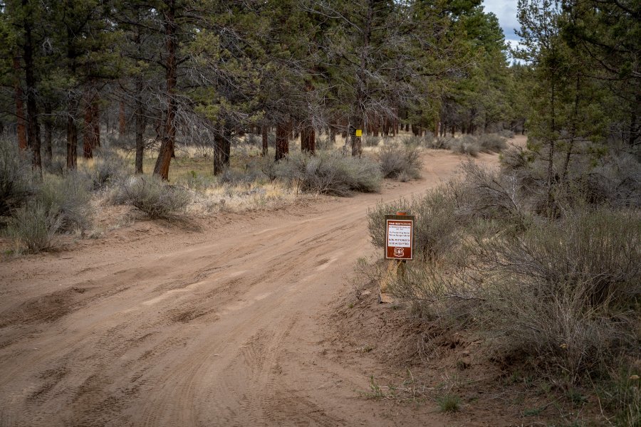
We hiked to Alder Springs last year for the first time. This lovely canyon oasis, located on Whychus Creek near the confluence of the Deschutes River, has beautiful geological formations and stunning sights at every turn. The "official" and "unofficial" trails are closed December 1 through March 31, but during our recent hike April 24th, 2021, we saw fewer than 20 people the entire time and no one at all on our "unofficial" trail. The unofficial trail starts at Whychus Creek Crossing, located inside the Crooked River National Grassland. The road to the crossing is rough, passable by standard car, but we would recommend a 4 wheel vehicle. There are several picnic tables at the crossing and no trailhead. But if you walk past the last picnic table, keeping Whychus Creek on your right, you will eventually find a trek that takes you down the creek 3.5 miles until you reach Alder Springs. The hike takes you up and down a bit on the escarpment bordering Whychus Canyon and in places is a bit sketchy near steep drop offs into the canyon. But the trail, although faint, is very passable and once you get close to Alder Springs, the trail will drop into the canyon bottom next to the ford over the creek.
.jpg) |
.jpg) |
Past the spring, hikers can walk another 1.5 miles to the confluence of Whychus Creek with the Deschutes River. This little additional trek was absolutely wonderful and is an experience not to miss. The rivers were full, but the foliage just starting to leaf out, so the views of the river from the trail were fairly visible and creek access doable. We believe later in the year, once the foliage is full and growing, river access may be harder to obtain. One of these side treks from the hike provided a beautiful view of a "weeping wall" - water flowing from the canyon wall into Whychus Creek which reminded us of Hawaii.
The confluence of Whychus Creek with the Deschutes was absolutely stunning with both waterways full from snowmelt. The rock outcropping at the end of the trail was a great place to have lunch, take pictures, and enjoy the beauty of Central Oregon.
.jpg) |
.jpg) |
After lunch, our hike back to Whychus Crossing was fairly uneventful, with the exception of the snake stretched out on our trail (we walked around it). During the summer the area will get very warm with the only shade near the creek. But early spring and late fall, the 10 mile round trip hike is a great way to spend a day enjoying Central Oregon's high desert.
.jpg) |
 |
To find Whychus Creek crossing and our "secret" hike to Alder Springs, take Locust Street (Camp Polk Road) in Sisters 3.1 miles north from East Cascade Avenue. Take this to Wilt Road, staying on Wilt when the pavement ends 4 miles. Past Rimrock Ranch, the road is less maintained. Travel another 2.5 miles until you see a sharp unmarked turnoff to the right on the rough road we mentioned earlier. This turnoff has a brown sign noting the area being closed December 1 through March 31. Travel on this until you reach the crossing.
9
An Amazing Combination of Taste and Texture - Bend's New Best Burger?
Today our culinary adventures took us off the beaten path to an area where food trucks are not the norm. Residing next to a live edge furniture store is Bend's newest food truck, and we think it is now one of the best. The Wagyu Wagon features the amazing quality Wagyu beef from 2Sisters Ranch which focuses on caring and sustainable ranching to produce the best quality beef possible. We can honestly say, this care that has gone into the ranching was absolutely reflected on the taste of our Wagyu Burger.
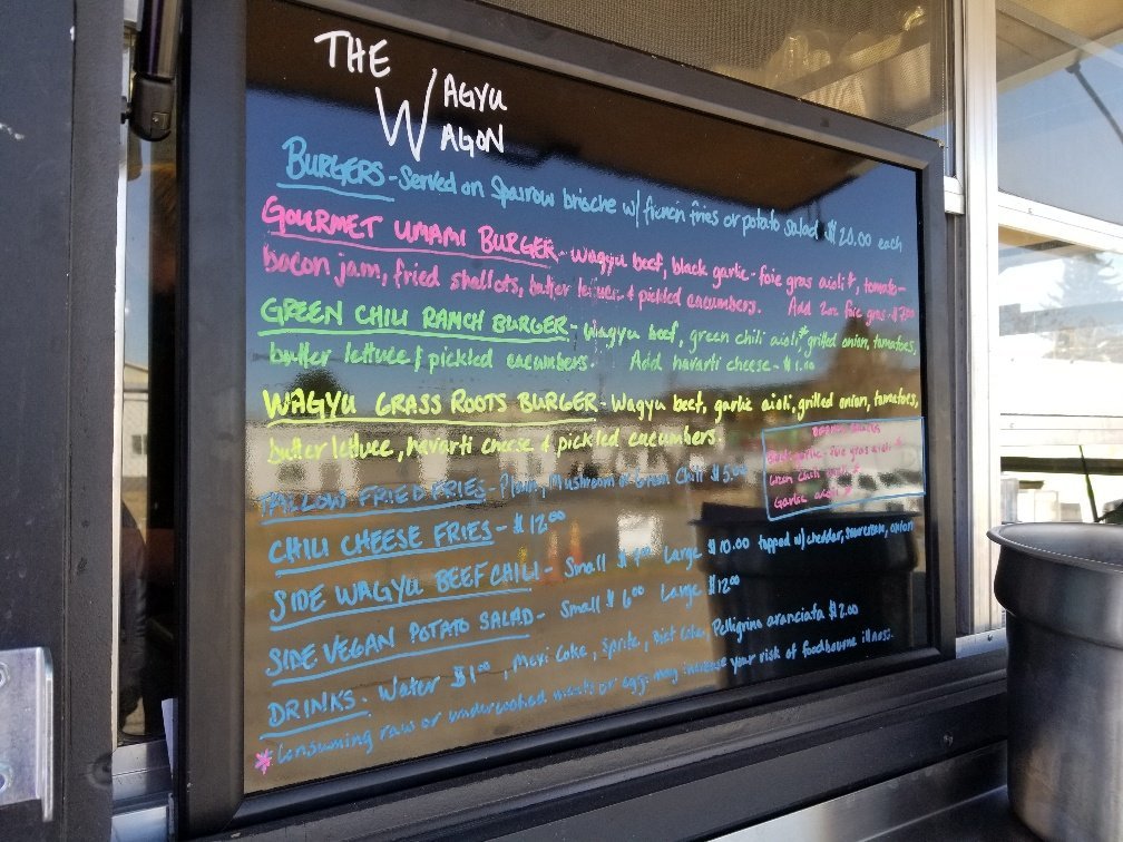 The first thing we noticed when approaching this truck was its simple, limited menu. This allowed us to really narrow down what we wanted quickly and also showed us the care and thought that went into each piece. For our first burger experience, we had to tr...