Posts with tag 'Central Oregon Hikes'
Subscribe and receive email notifications of new blog posts.
 RSS Feed
- 2026 | 72 Posts
- 2025 | 103 Posts
- 2024 | 110 Posts
- 2023 | 72 Posts
- 2022 | 52 Posts
- 2021 | 70 Posts
- 2020 | 84 Posts
- 2019 | 38 Posts
- 2018 | 48 Posts
- 2017 | 39 Posts
- 2016 | 31 Posts
- 2015 | 10 Posts
4
Santiam Summit to Square Lake and Round Lake Hike
Great Central Oregon Hike in the Cascades
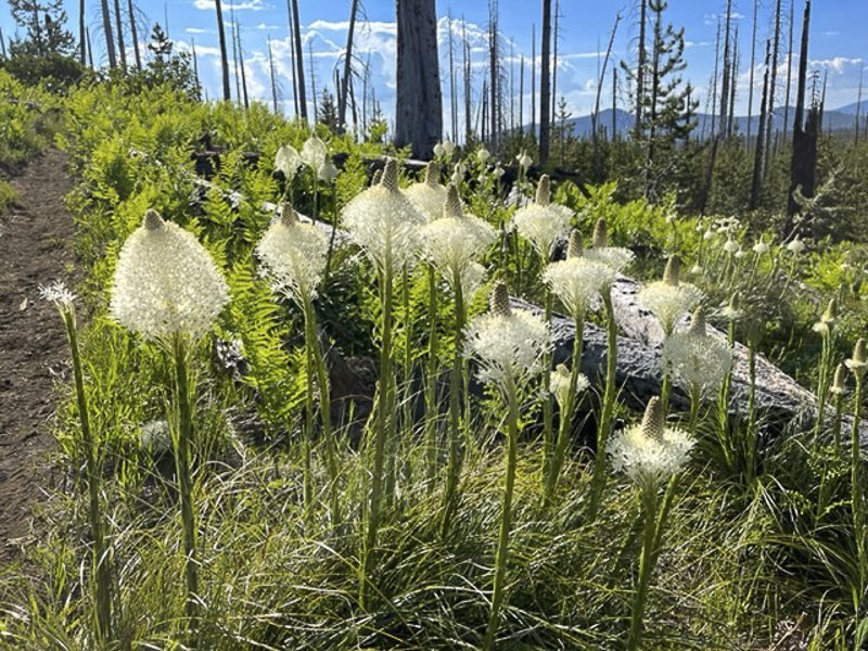
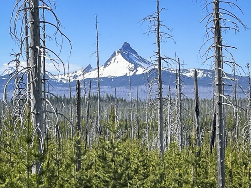
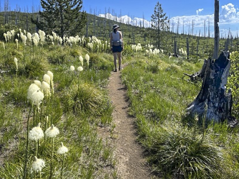
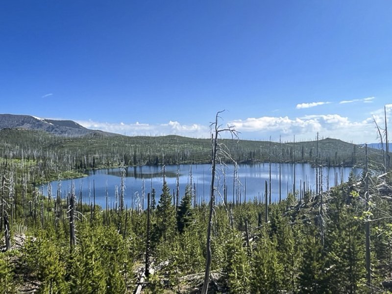
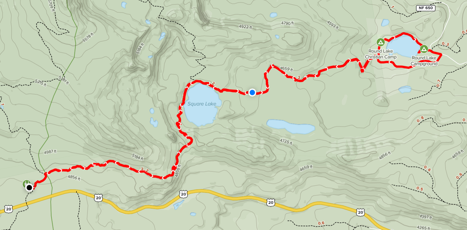
The late spring snow experienced in Central Oregon in 2022 resulted in a delayed opening of the trails in the higher elevations of the national forests and wilderness areas. But in early July, warmer temperatures have melted some of the snow and enabled hikers to access some of the lower trails. Last Saturday we hiked from Santiam Summit to Square and Round Lakes, a hike we had never done before in the Mt. Jefferson Wilderness. During this moderate 10.51 mile in and out hike we experienced 1056 feet of elevation gain - mostly easy downs to the lakes and ups out of the lake basins. The beargrass was blooming and among the most beautiful we have ever seen. The results of the 2003 90,000 acre B & B Complex fire were evident, but the blooming manzanita, lupines, and young trees were growing and reclaiming the burned land. The views of Three Fingered Jack, Mt. Washington and the Three Sisters were stunning.
When we reached Round Lake, we saw people enjoying the lake, either camping on the far shore or staying in the buildings connected with Wilderness Lakes Retreat (there is a dirt road that accesses Round Lake via Jack Lake Road). We even met and spoke with a wedding party who were planning on celebrating their event that evening. People were fly fishing, kayaking, rowing, or just floating on the calm lake. We enjoyed our lunch on the far side of the lake while we watched a bald eagle attempting to catch a fish before returning the way we came, getting back to our car before the thunderstorms began at 2 pm.
If you plan on hiking this trail, be sure to take a lot of water and wear a hat as the hike is exposed. We saw just a few people - a handful camping at Square Lake and more enjoying Round Lake, either camping or staying at the Wilderness Lakes Retreat.
 |
 |
 |
 |
For more information on Central Oregon hikes, check out our blog.
17
Bend Premier Real Estate | June 2022 Newsletter
What's in the June, 2022 Newsletter?
- Bend Oregon Real Estate - May 2022 Trends
- A Quick Lunch Bite in Downtown Bend
- A Checklist for Selling Your House
- Safety Tips for Doggy Doors
- Move Up This Summer
20
Bend Premier Real Estate | May 2022 Newsletter
What's in the May 2022 Newsletter?
- Bend Oregon Real Estate - April 2022 Sales
- Belknap Crater - a Unique Hiking Experience in the Mt. Washington Wilderness
- Myths About Today's Housing Market
- A Tantalizing Wine Experience in Bend
- Give Your Curb Appeal a Boost Before You Sell
12
Bend Premier Real Estate | January 2022 Newsletter
What's in the January 2022 Newsletter?
- Bend Real Estate Sales - 2021 Trends & 2022 Predictions
- Covid Cases Spiking in Deschutes County
- 2022 Paint Colors of the Year
- Top Hikes of 2021
- 2022 Housing Market Forecast
14
Tam McArthur Rim Trail in Snow Late Fall
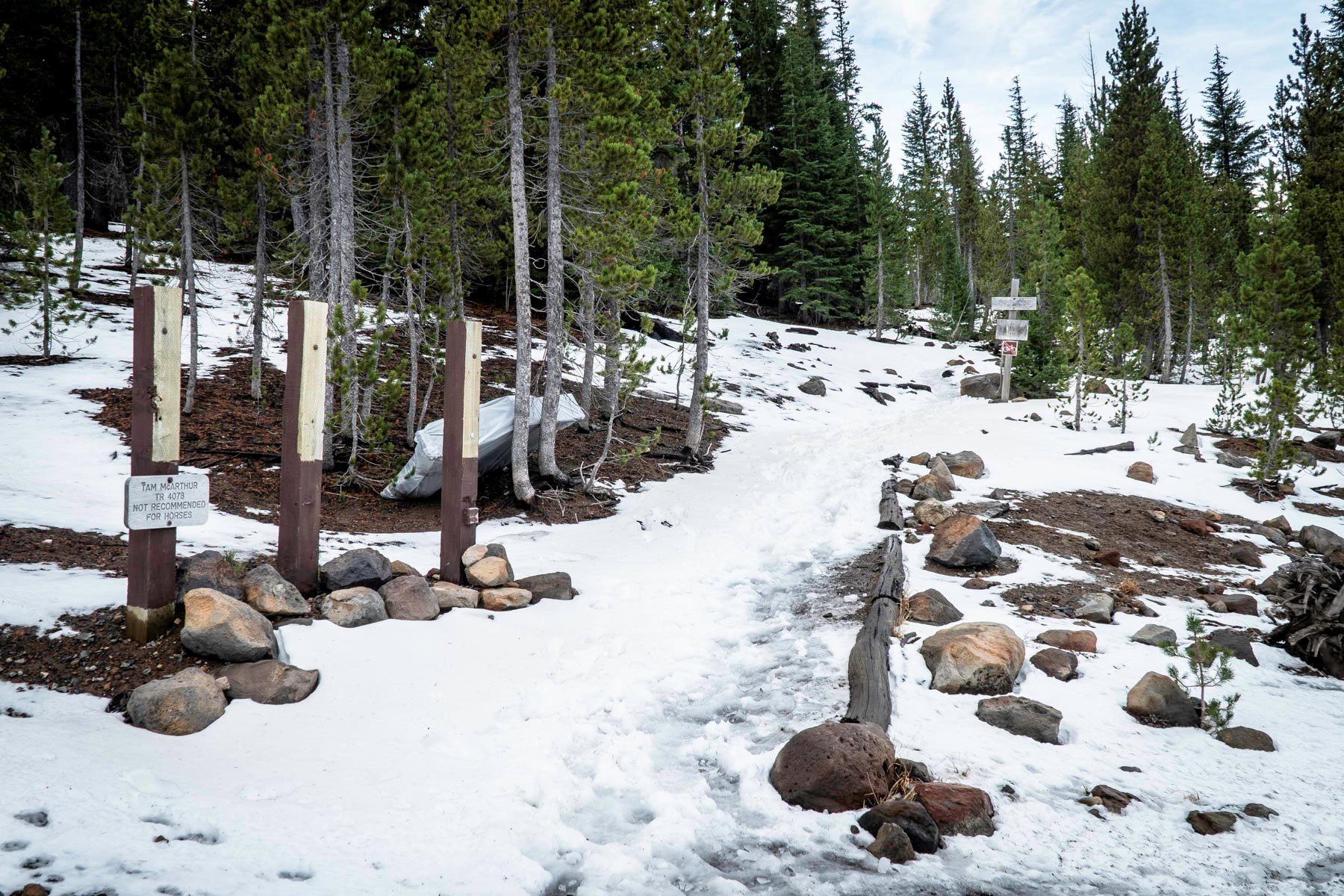
One of Central Oregon's more popular summer hikes in the Three Sisters Wilderness, we decided to hike Tam McArthur Rim 11-27-21 a few days after the first snow of autumn had fallen. Three Creeks Lake had icy sections and only one other couple started the hike just a few minutes before us.
We began our hike utilizing microspikes as the trail was icy and the added gripping security microspikes offer enabled us to quickly climb the initial miles of the hike. The snow deepened as we climbed and the trail became less obvious. However, we were able to follow the tracks of the couple who started the hike just before us, trusting that they knew where they were going.
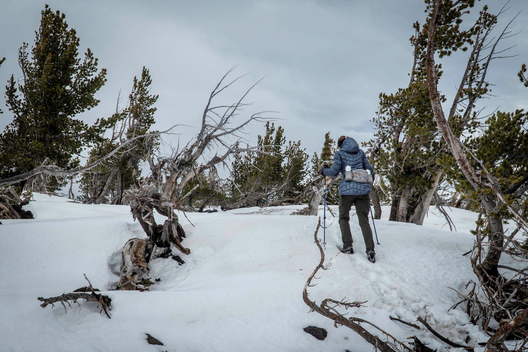
The hike to Tam McArthur Rim levels out near the summit into an open meadow. On this hike the end of November, we found the wind really picked up here. The final push to the summit was through shin deep snow and while accomplishing the destination of the hike, the cloud cover dropped and our views of the Three Sisters and Broken Top were obscured. We had hoped to take the "unofficial" trail from the Rim to Broken Hand to add additional distance and views to our hike, but with the cloud cover so low and fearful that it would start snowing again, and with no tracks to follow, we returned the way we came. On the way down we passed a few hiking parties coming up.
All in all, it was a fairly quick hike with a total of 5.3 miles in and back and 1246 feet of elevation gain. We hope to take more of these types of hikes, weather permitting, as we enter winter.
 |
 |