Posts with tag 'Central Oregon Hikes'
Subscribe and receive email notifications of new blog posts.
 RSS Feed
- 2026 | 72 Posts
- 2025 | 103 Posts
- 2024 | 110 Posts
- 2023 | 72 Posts
- 2022 | 52 Posts
- 2021 | 70 Posts
- 2020 | 84 Posts
- 2019 | 38 Posts
- 2018 | 48 Posts
- 2017 | 39 Posts
- 2016 | 31 Posts
- 2015 | 10 Posts
15
Jack Lake to Three Fingered Jack - Great Central Oregon Hike
Canyon Meadow Loop and Three Fingered Jack is a Beautiful Summer Hike
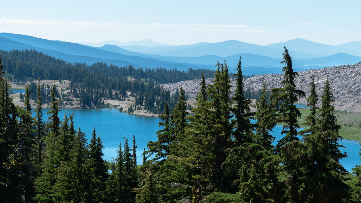
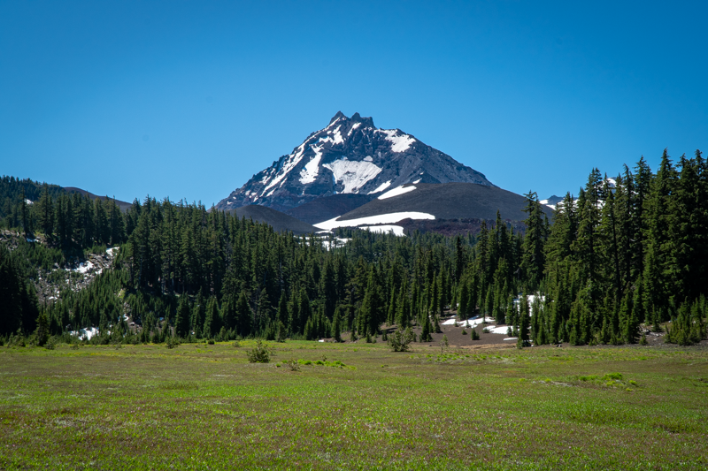
Hiking to Three Fingered Jack via Jack Lake and Canyon Meadow Loop is an annual event for us. Located in the Mt. Jefferson Wilderness, access to the trailhead is outside of Camp Sherman off Hwy 20 via several paved and dirt roads. But once hikers arrive at the trailhead, the path is obvious.
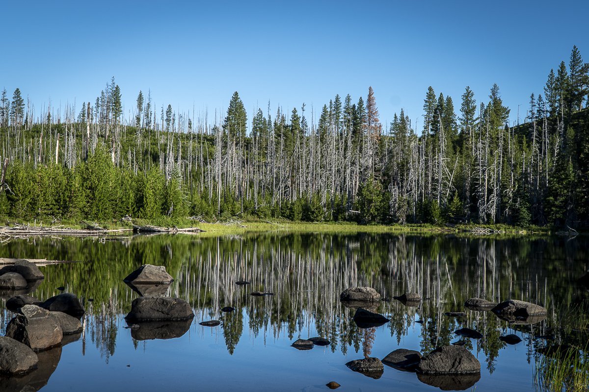 |
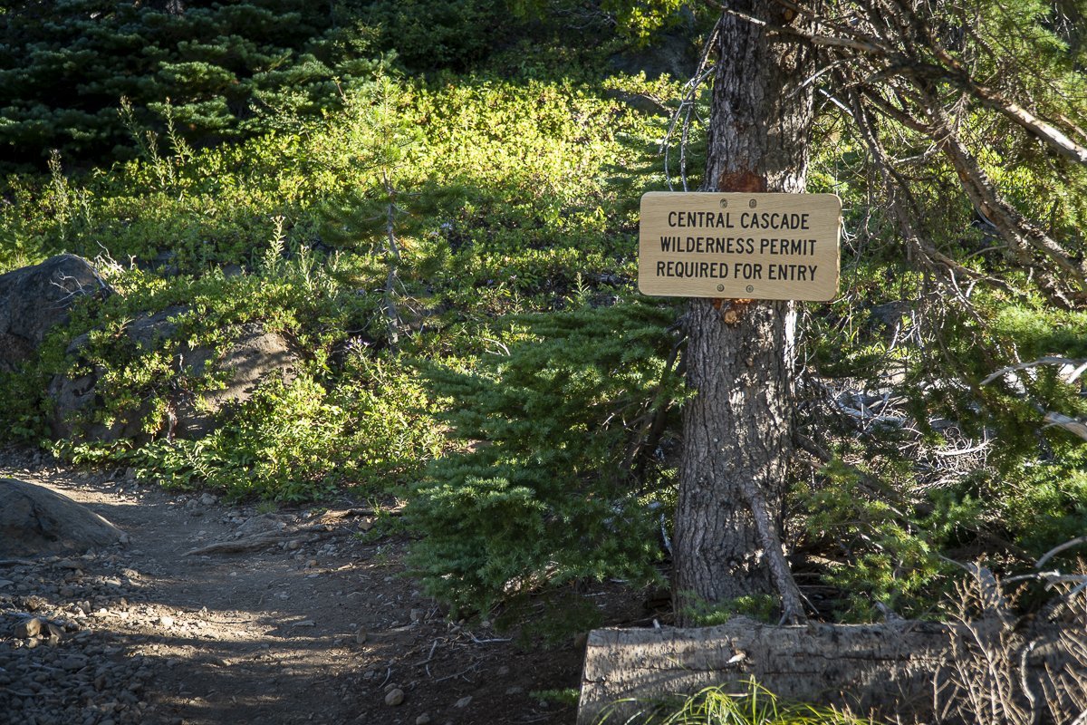 |
The trail starts next to Jack Lake, which reflects the burned trees of the 2003 B&B Complex Fire, but also the new growth that has come back since. It is evident that the new Wilderness Permits are required to take this hike.
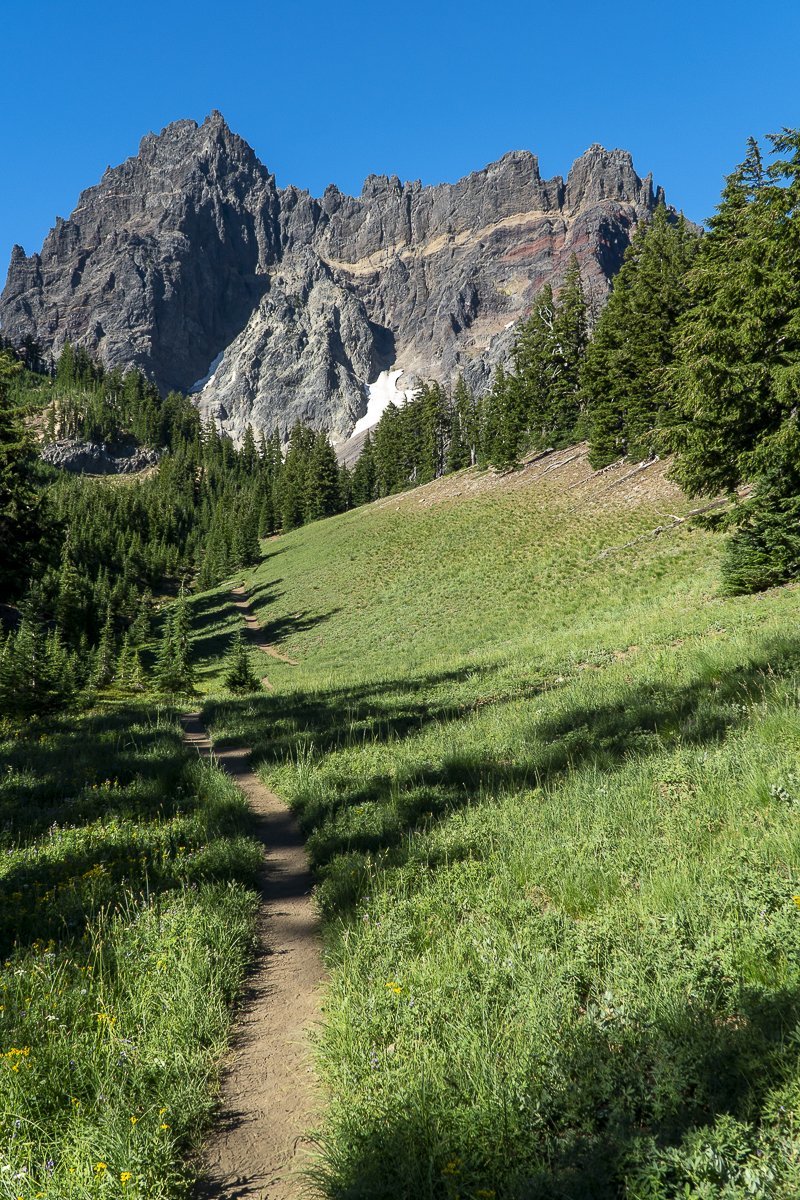
The trail opens at Canyon Meadow, which survived the 2003 fire unscathed. Canyon Creek runs through the meadow and during the summer, the blooming wildflowers, the sound of the creek and the beauty of towering Three Fingered Jack create an unparalleled Wilderness experience.
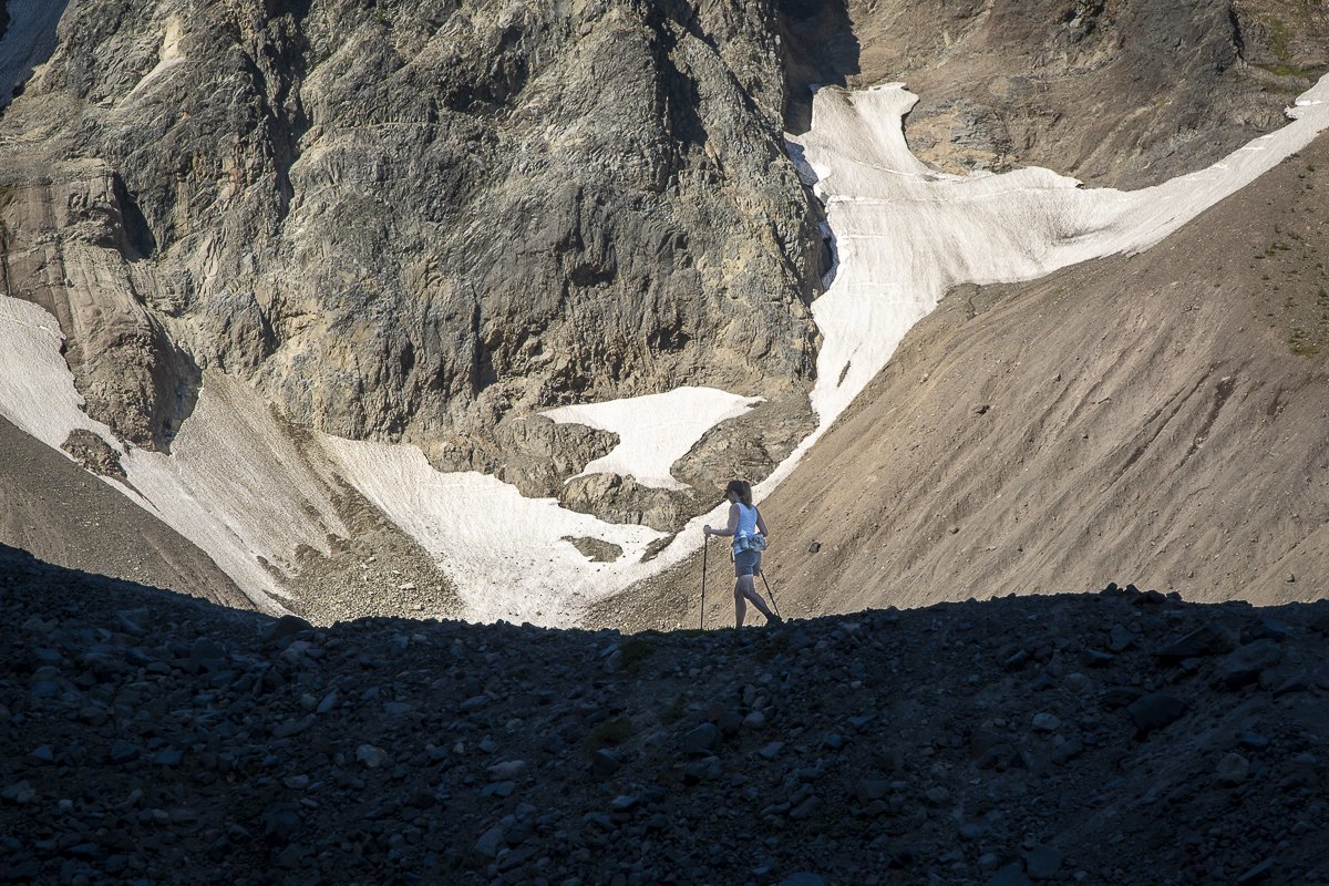
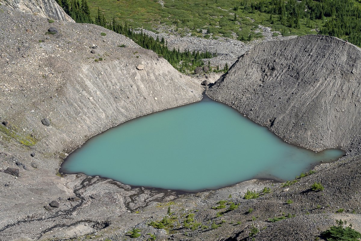
Once hikers reach the base of the mountain, there is a moraine which can be climbed (a scramble up loose rocks) which provides a perspective of the glacial lake and, if you are lucky, a view of the mountain goats which are known to live in the area.
 |
 |
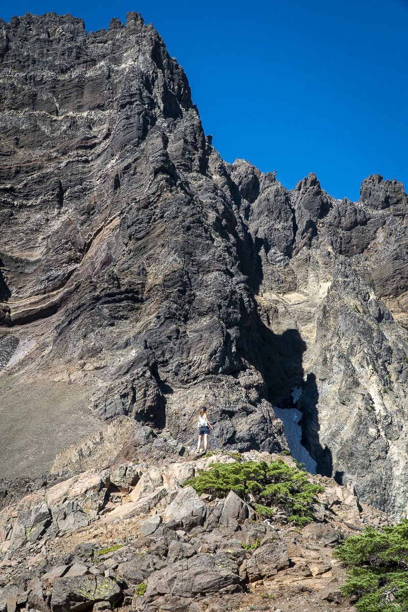
For hikers who make it up to the saddle above the lake, the views of the Three Sisters and Mount Jefferson are amazing as are the close up views of the jagged rocks of Three Fingered Jack (the eroded core of an extinct 100,000 year old volcano). Hikers should be careful coming down from the saddle as the rock is loose and the grade exceeds 30 degrees in some areas. Overall, the hike gains 1600 feet in a little over 3 miles and the entire loop is under 8 miles.
9
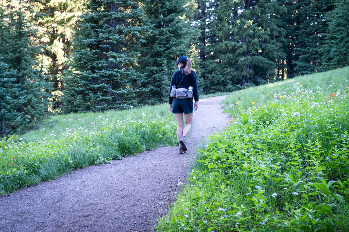
Green Lakes Hike is the Toughest Ticket in Town
The hardest tickets to get in Bend are not to the great acts at the Hayden Homes Amphitheater, but rather the trail pass required to hike the Green Lakes trail. These tickets literally sell out in 60 seconds once posted on the Forest Service website.
 |
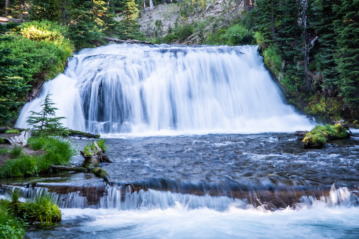 |
The trail largely runs alongside Fall Creek, which you will cross three times.
 |
 |
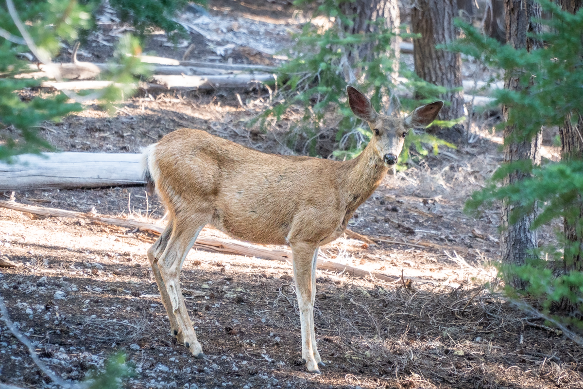
And there is simply no shortage of beautiful waterfalls, wildlife, wildflowers, and amazing views along the way.
 |
 |
This trail is considered moderate due to it's length of 9.1 miles round trip and 1200 feet elevation gain, but it is pretty gradual almost the entire way and a very enjoyable adventure. For the adventurous, taking the path past the last lake deeper into the Three Sisters Wilderness will result in views few experience, including the Northeastern flank of South Sister and Northwest sections of Broken Top, and vistas including Mt. Hood, Mt. Jefferson, North and Middle Sister and Black Butte. A look back toward Green Lakes, if you can avoid looking the towering figures of South Sister, Mt. Bachelor and Broken Top, may make you think you are seeing the Great Smoky or Blue Ridge Mountains. If you opt to take this additional path, you will add a minimum of 500 feet of elevation gain plus 4 miles in and back. If you want to go even further in you can reach Golden Lake, which is an experience in itself.
25
Four in One Cone is a Great Central Oregon Summer Hike
Fabulous Cascade Views Await Those Who Climb the Cones
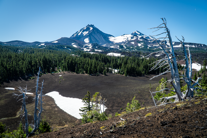
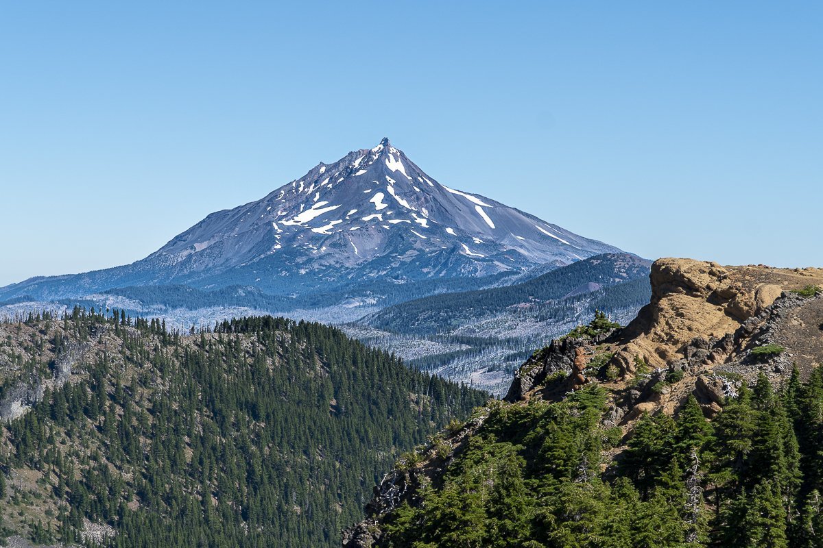
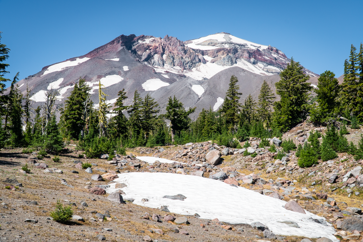
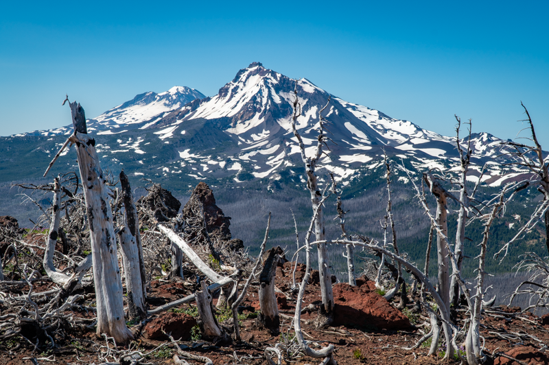
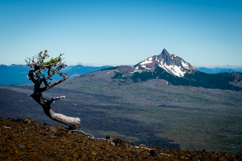
We climbed Four in One Cone for the first time in the middle of October, 2021. A moderate in and out hike with just over 1400 feet of elevation gain in 9 miles from the Scott Trailhead in the Three Sisters Wilderness, we looked forward to revisiting the area during the summer. The early spring snow we had in 2022 delayed access to the higher reaches of the Cascades with patches of snow evident above 6200 feet. But the trip up to the cones was fairly straight forward with little snow along the trail. Mosquitos were the worst thing we had to deal with - along with over 30 fallen trees to get around or over. But once we reached the lava flows, the mosquitos mostly disappeared and our hike to the top of the cones was great. The views of North and Middle Sister, along with Mt. Washington, Three Fingered Jack, Mt. Jefferson, Black Crater and Belknap Crater are outstanding from the top of the cones.
 |
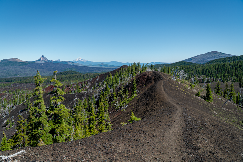 |
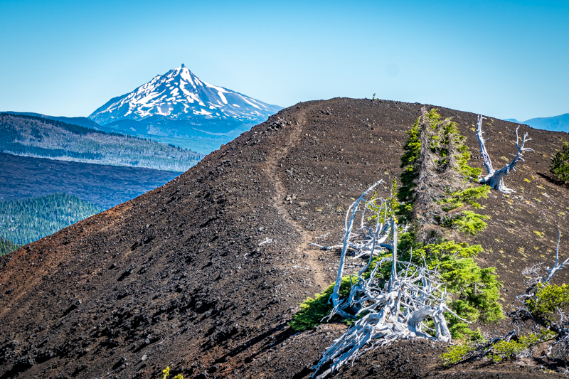
Four in One Cone has this name due to the fact there are four distinct cinder cones adjacent to each other which all erupted at different times, but which create the unique geological feature it is. The path at the top of the first cone traverses all the cones at the ridge line; it is roughly .4 miles to reach the end of the fourth cone and the drop off on each side of the path varies in steepness. When we first hiked to the top of the cones in October, the wind made us a little uncertain and we did not reach the far cone. This summer hike had much less wind and we made it to the furthest point.
After enjoying the views, we climbed back down the cones and decided to continue the hike to the junction of the Pacific Crest Trail, which was another mile past the cones. There is a large meadow at this junction and we were hoping to see wildflowers along with the view of North Sister. The wildflowers were sparse, but the view of North Sister was spectacular.
Our return trip was much easier than the hike up due to the volunteer efforts of six amazing people who were clearing all the fallen trees from the path. These six plus one more hiking party of three, and one person we saw hiking the PCT were the only people we saw during the entire hike. Amazing solitude and a wonderful day.
18
Black Crater Hike is Open in Central Oregon's Three Sisters Wilderness
Black Crater is a Challenging Hike
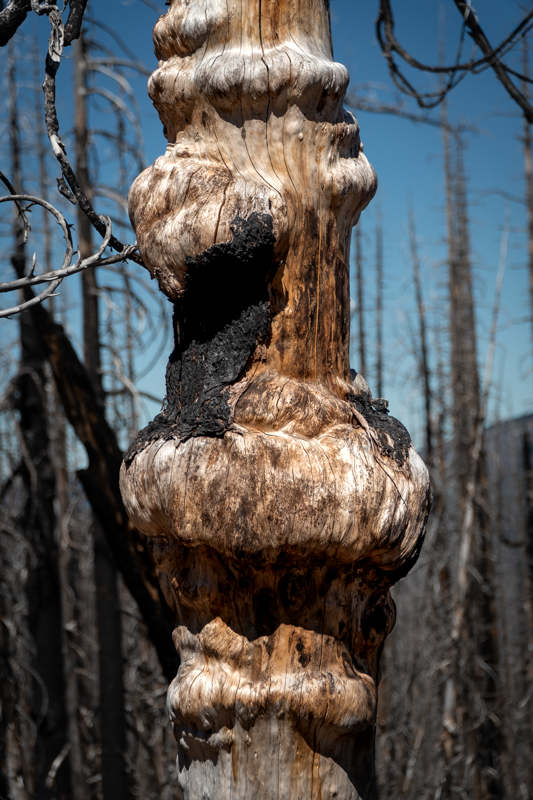
We have hiked Black Crater yearly since 2020 and although not the longest hike, it is challenging. The full hike is 7.5 miles up and back, but each hiker gains 2322 feet in the 3.75 miles up. And hiking through the burned forest from the 2017 Millie Fire can be hot and dusty during summer months. On July 15, 2022 sufficient snow had melted from the higher elevations to allow hikers to avoid slippery snow patches and reach the summit. When we arrived, we were alone at the top until we began our trip down.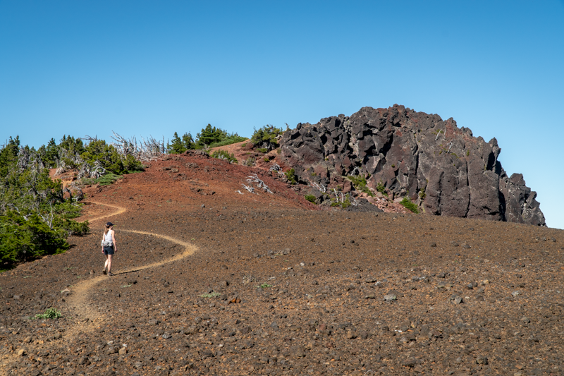 The Cascade views from the summit of Black Crater were fabulous from Broken Top to Mt. Hood. And the cold wind we have felt in earlier visits was not blowing, keeping us comfortable and able to fully enjoy the views.
It is interesting to see how certain plants have begun to reclaim the burned forest, with manzanita, fescue grass, and various wildflowers becoming more abundant each year. Young trees are beginning to grow, although it will take many decades for them to reach the heights of the trees that were killed in the fire. Ferns have regrown in some more sheltered and wetter areas of the hike; there is a certain beauty in the burned, dead trees, especially as we begin to see green undergrowth reclaiming the land.
We recommend that people planning on hiking Black Crater start early in the day before it gets warm and before crowds arrive. Allow 4.5 hours on your trip, which will provide time at the top to enjoy a snack and the views prior to returning to your car. Use your national forest parking pass and don't forget to complete and file the the free wilderness pass available at the trailhead.
 |
 |
 |
 |
12
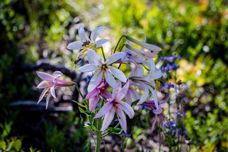
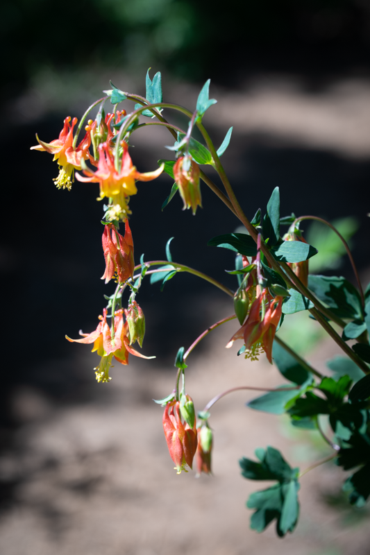
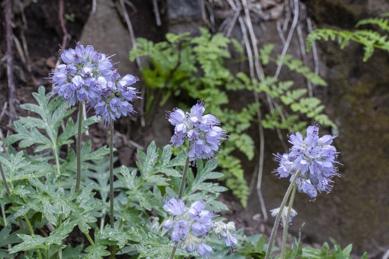
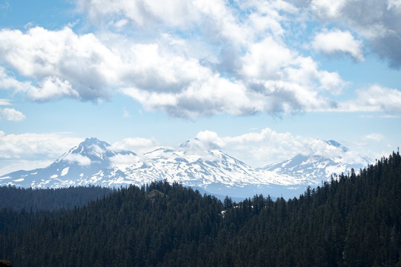
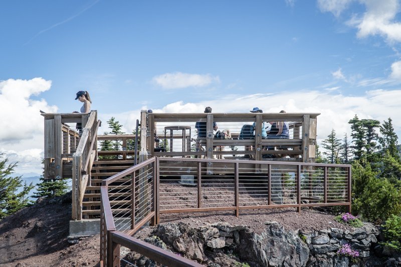
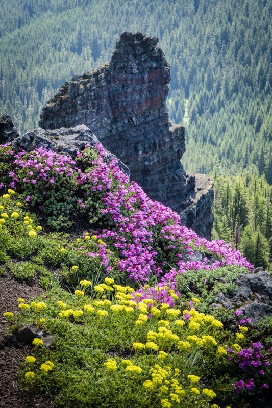
Wildflowers, Views and a Great Hike - Cone Peak Loop and Iron Mountain
Iron Mountain is a Yearly Favorite for Wildflowers

We try to hike the Cone Mountain Loop including Iron Mountain on a yearly basis, timing our hike to summer when the wildflowers are blooming. Located in the Willamette National Forest 20 miles east of Sweet Home on Hwy 20, this hike can be done multiple ways, but we opt for the longest route, parking at the Tombstone Summit parking lot (be sure to bring your National Forest Pass) and walking through the nearby nature trail and across the highway to the Cone Peak Trail. This trail switchbacks up the hillside in beautiful forest over several miles before it opens at the meadow at the base of Cone Peak which is filled with wildflowers (experts say there are over 300 varieties of blooming plants in the area). Continuing along the trail, hikers eventually leave the meadow and hike down the shoulder of the hill to the shoulder of Iron Mountain, where the trail continues up to the junction of the spur to take hikers to the top of Iron Mountain. This trail is somewhat steep with over 650 feet of elevation gain in less than a mile, but the views are fabulous and the wildflowers on the mountain stunning. At the top of the mountain is a nice, railed deck complete with mountain markers and benches for people to rest and enjoy a snack or lunch before returning down to rejoin the Cone Peak Trail to complete the loop back down across the highway and back to the Tombstone Parking lot via the Old Santiam Wagon Road. All in all, the hike is between 6.5 and 7 miles with just under 1900 feet elevation gain.
 |
 |
 |
 |
 |
 |