Bend Premier Real Estate Blog
Subscribe and receive email notifications of new blog posts.
 RSS Feed
- 2026 | 67 Posts
- 2025 | 103 Posts
- 2024 | 110 Posts
- 2023 | 72 Posts
- 2022 | 52 Posts
- 2021 | 70 Posts
- 2020 | 84 Posts
- 2019 | 38 Posts
- 2018 | 48 Posts
- 2017 | 39 Posts
- 2016 | 31 Posts
- 2015 | 10 Posts
19
Steins Pillar Hike Still a Great Central Oregon Option Early Spring
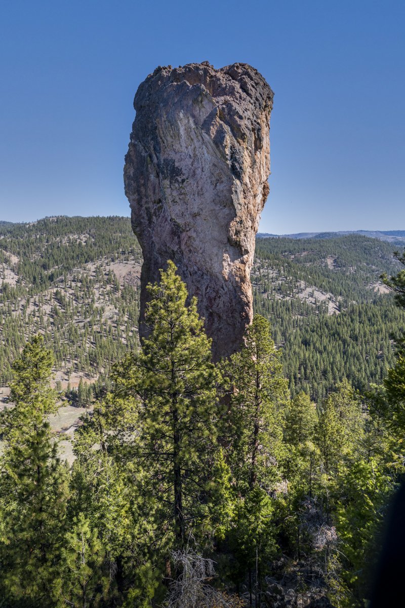
It seems that a year into the Covid-19 pandemic, we are finding ourselves repeating the hikes we took a year ago. Steins Pillar in the Ochocos is a fairly short, fairly easy hike with an impressive end at the 350 foot pillar, a volcanic remnant over 38 million years old. Probably the most concerting issue getting to the trail head is the two mile mostly single lane dirt road (within potholes) which can be somewhat sketchy going around corners, hoping no one else is coming the other way. But if you make it to the actual trail head without incident, the four-mile in and out moderate hike to the pillar has an easy to follow trail with several view points along the way. On our hike, April 17, 2021, there were just a couple of icy patches on the trail in sheltered, northern facing sl...
12
Bend Premier Real Estate | April 2021 Newsletter
What's in the April 2021 Newsletter?
- Lack of Inventory Triggers Escalating Home Sales Prices
- Ready for a Great Spring Hike?
- Are Bend Residents Being Priced Out of the Market?
- Buyer Competition is Good News for Sellers
- Bend's Newest Best Burger?
11
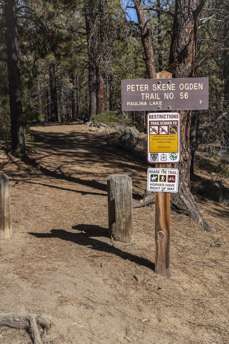
Ready for a Great Spring Hike?
Peter Skene Ogden Trail is Ready Now!
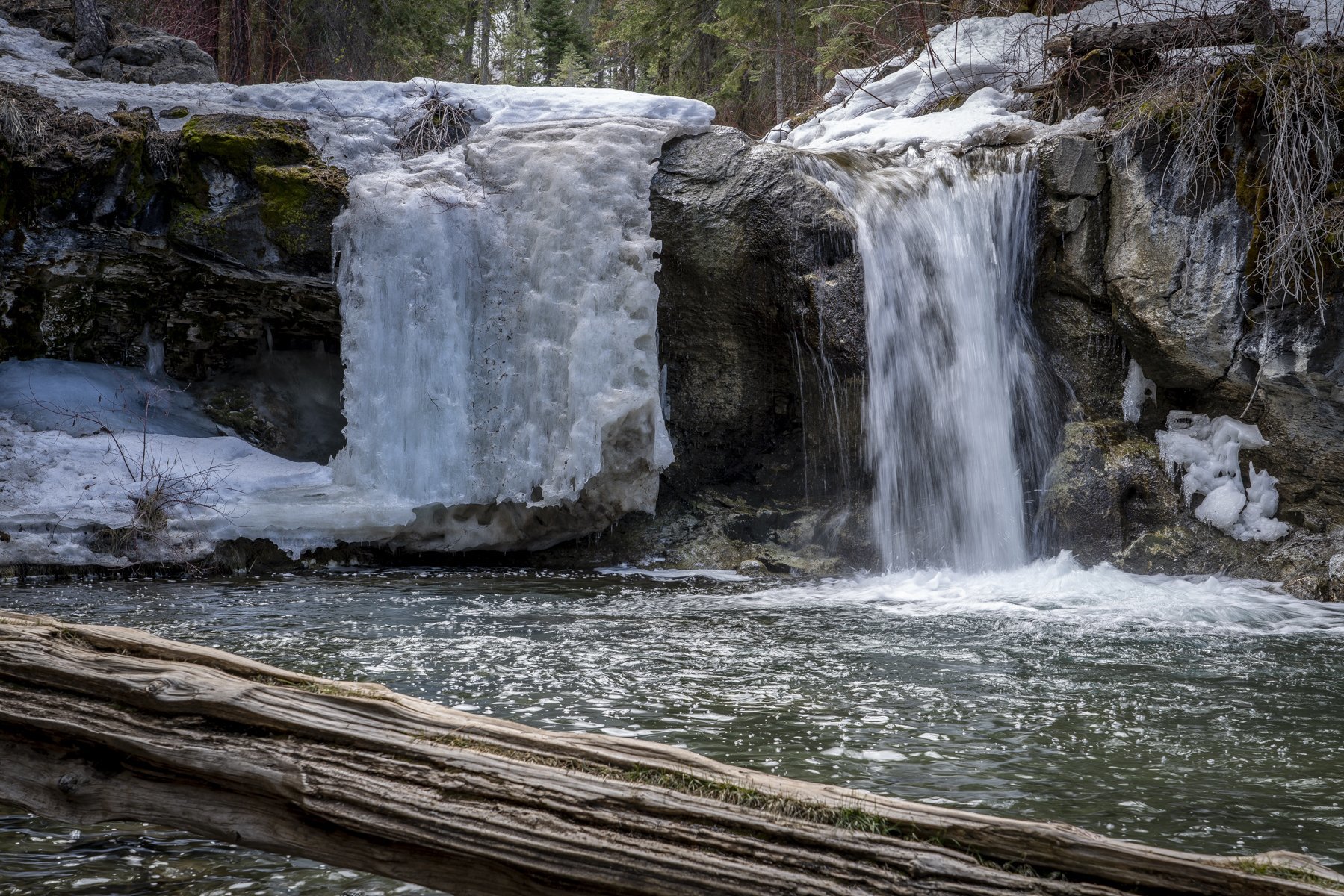
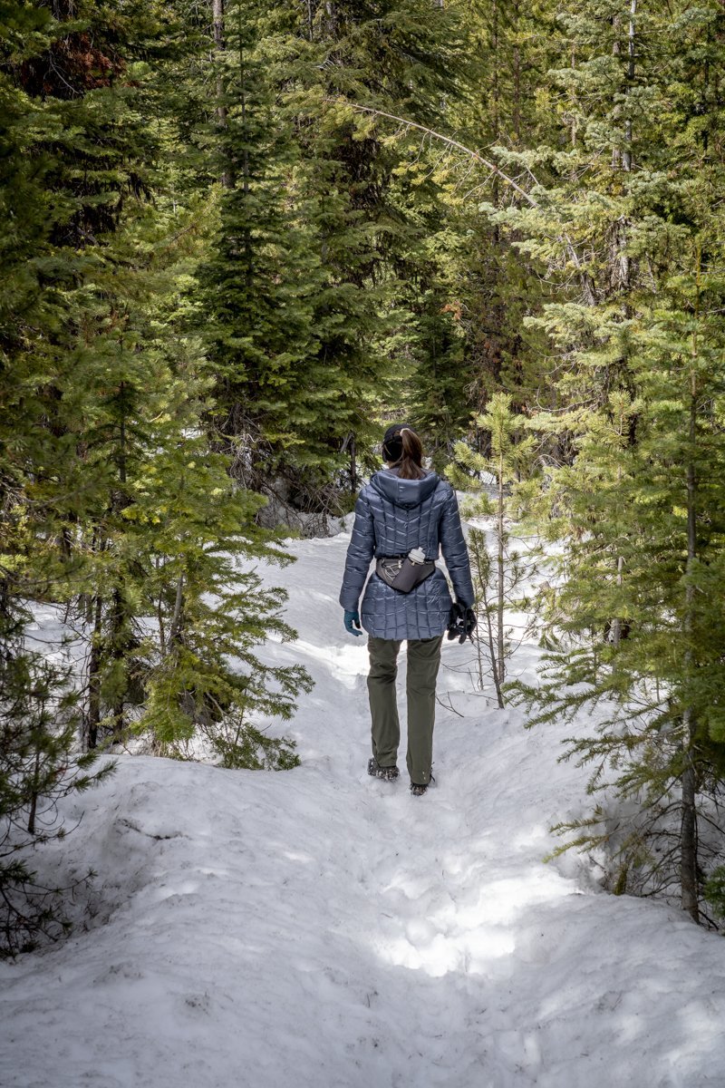
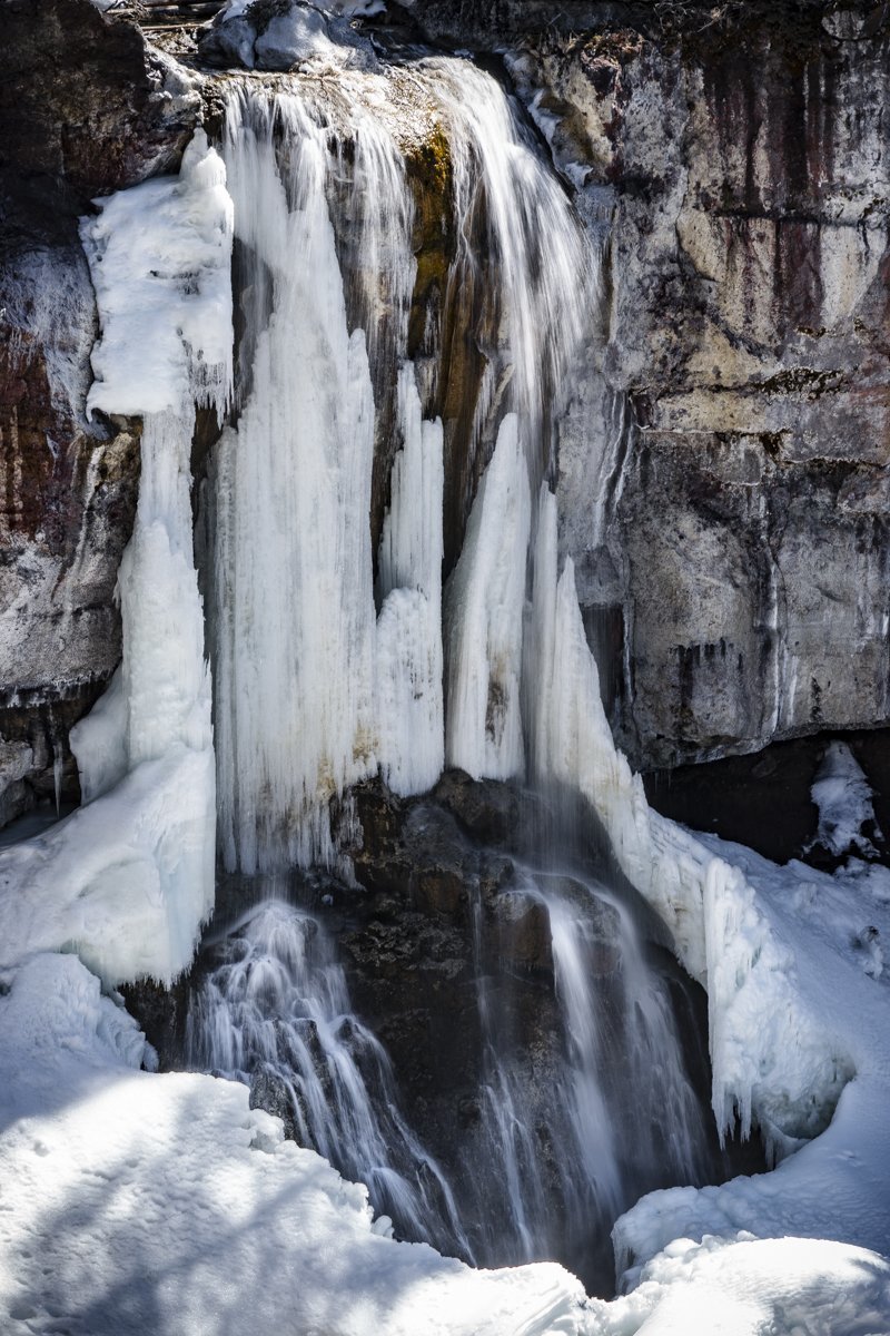
It has been just over a year since we last hiked Peter Skene Ogden Trail, located just outside Newberry National Volcanic Monument off the road to the park entrance. Last Saturday, April 10th 2021, the weather was predicted to be cool and windy and this hike, mostly sheltered from the wind in the canyon where Paulina Creek flows, seemed a good choice. When we parked our car by the trailhead at the closed McKay Crossing Campground, there was only one other car and the temperature was under 40 degrees. We thought we would hike the 3.5 miles to our favorite waterfalls along the hike - the place we call "Twin Falls." We dressed warm and quickly covered the distance to the falls. After a short stop with photos of the falls, we decided to see how much further we could make it on the hike, knowing the trail ends at Paulina Lake. We were surprised to see the trail was relatively snow free until past 4.5 miles, and then very passable with microspikes on our shoes. We made it all 7 miles to Paulina Falls where we enjoyed a quick lunch prior to starting back. Although trekking through the snow was much slower than on the bare ground, the experience was very enjoyable and yes, pretty sheltered from the wind. All in all, we saw only 6 other people and 2 dogs the entire day.
 |
 |
 |
9
An Amazing Combination of Taste and Texture - Bend's New Best Burger?
Today our culinary adventures took us off the beaten path to an area where food trucks are not the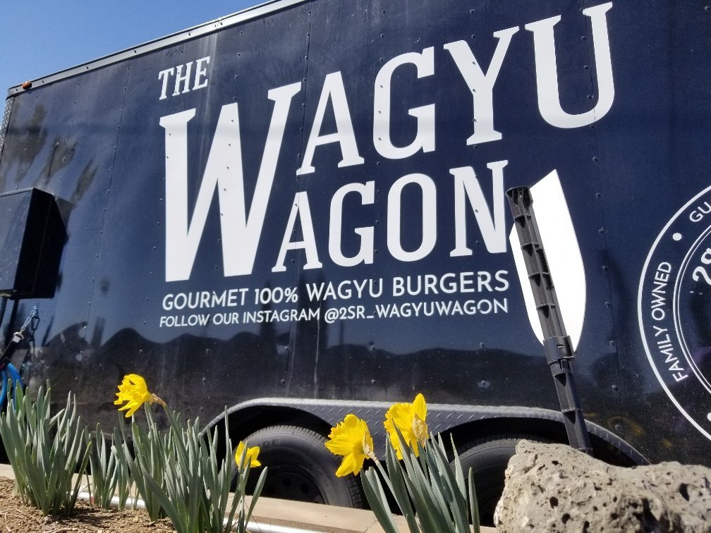 norm. Residing next to a live edge furniture store is Bend's newest food truck, and we think it is now one of the best. The Wagyu Wagon features the amazing quality Wagyu beef from 2Sisters Ranch which focuses on caring and sustainable ranching to produce the best quality beef possible. We can honestly say, this care that has gone into the ranching was absolutely reflected on the taste of our Wagyu Burger.
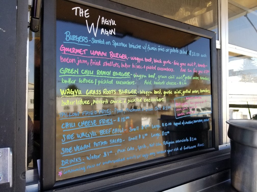 The first thing we noticed when approaching this truck was its simple, limited menu. This allowed us to really narrow down what we wanted quickly and also showed us the care and thought that went into each piece. For our first burger experience, we had to tr...
8
Bend Oregon Real Estate - March 2021 Trends
Lack of Inventory Triggering Escalating Sales Prices for Bend Homes
The figures are in for Bend single family home sales in March 2021. It has been a full year since Covid-19's impact on Bend home sales initially was felt and the resulting demand for Central Oregon homes began impacting our local housing market. We have had a year of tremendous buyer demand and Bend real estate sales which have broken records. Multiple offers and bidding wars have pushed Bend home prices to never before seen levels with cash offers typically beating out any offer involving financing. Entry level buyers have found Bend unaffordable and have determined Redmond, Prineville, LaPine and Madras may work better for their finances. The housing boom in Central Oregon is very real and it remains to be seen how long it will continue with buyer demand far exceeding supply.
When March 2021 is compared with March 2020, the following data can be noted for Bend single family home sales on less than an acre:
- Average sales price is up 40.7% to $776,573*
- Median sales price is up 32.2% to $597,500
- Number of new listings down 8.2% to 225
- Homes for sale down 84.9% to 99
- Pending sales up 103.7% to 385
- Sold homes down 6.3% to 177
- Median days on market down 76.5% to 4
- Months of inventory down 87.9% to 12 days
- Average price per square foot up 40.9% to $365
- Median price per square foot up 36.2% to $331
- Average percentage of listing to sales price up 5% to 104.2%
- Dollar volume of sales up 31.7% to $137,453,417
It should be emphasized that the number of sold homes are down 6.3% compared with 2020, yet the dollar volume of sales is up 31.7%. Bend home prices are on such an upward trend that appraisers are having a hard time justifying some of the prices and we are seeing homes not appraising, despite the huge demand and multiple offers. It is challenging to be a buyer in this market, especially a buyer that needs to finance their home purchase.
Will Bend Real Estate Sales Continue With Early 2021 Trends?
We do not see any end to what we have experienced year to date with Bend home sales. Our low inventory of less than 1/2 a month supply remains a key indicator of Bend real estate sales. If/when this figure starts to increase, we will know that we are starting to move towards a more balanced market.
 |
*Data from Central Oregon MLS