Bend Premier Real Estate Blog
Subscribe and receive email notifications of new blog posts.
 RSS Feed
- 2026 | 44 Posts
- 2025 | 103 Posts
- 2024 | 110 Posts
- 2023 | 72 Posts
- 2022 | 52 Posts
- 2021 | 70 Posts
- 2020 | 84 Posts
- 2019 | 38 Posts
- 2018 | 48 Posts
- 2017 | 39 Posts
- 2016 | 31 Posts
- 2015 | 10 Posts
6
Hike Something Different - Tam McArthur Rim to Broken Top Via Broken Hand

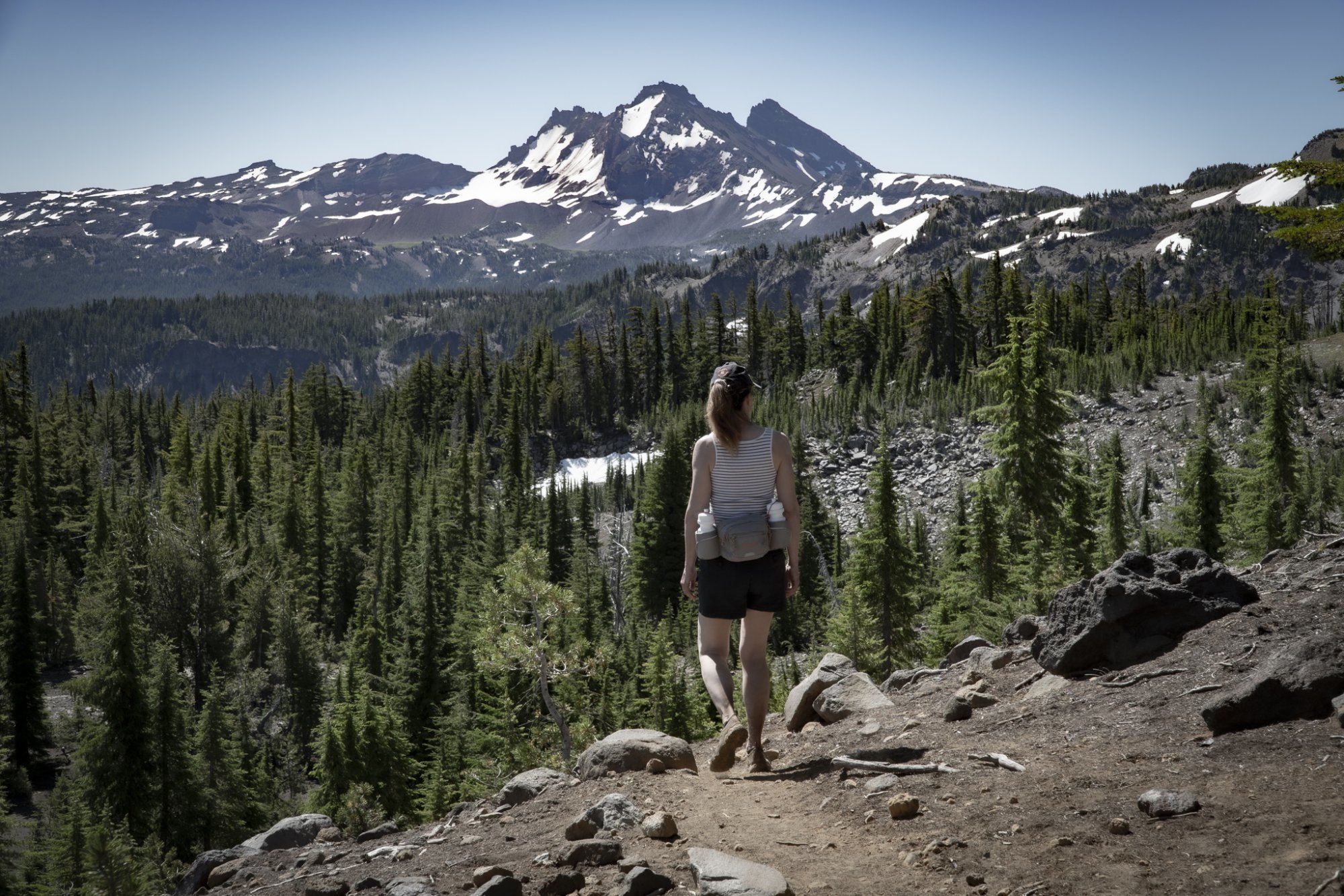
We have hiked to Tam McArthur Rim in the past and we have hiked to Broken Top in the past, but we had never hiked to Broken Top from Tam McArthur Rim until last week. The hike starts at Three Creeks Lake located off Forest Road 16 (Elm Street in Sisters turns into this as you drive out of the city) and is heavily trafficked, rising over 1200 feet over 2.5 miles to the Rim viewpoint. Beautiful views of Three Creeks Lake and many of the Cascades are visible from the rim. Near the end of the initial trail is a sign near another trail heading off toward Broken Top which states "Trail Not Maintained." We decided to take this 2.2 hike to Broken Hand, a rock formation between the Rim and Broken Top. While this hike, much of it in the sun, was initially not that tough, once we approached Broken Hand, the trail got decidedly sketchy with scrambles over and around boulders and loose stones required. To get past Broken Hand, the trail traversed through a snow field. But once past this, a faint trail continued on toward Broken Top and we ended up on the moraine overlooking No Name Lake. This additional distance made for a very full day (and of course we had to travel back to our car at Three Creeks Lake), but the experience and views (10 full Cascade peaks) were fabulous. This hike is not easy and not recommended for all.
 |
 |
|
|

5
A Taste Of Aloha In Bend
After reading the Source's Restaurant Guide 2020, we had to try Aina Kauai Style Grill. Named as Rookie Food Cart of the Year, we have to say their products did not disappoint. Located in the food cart lot associated with Bevel Brewing off Armour Road, this little tucked away gem is a Must this summer.
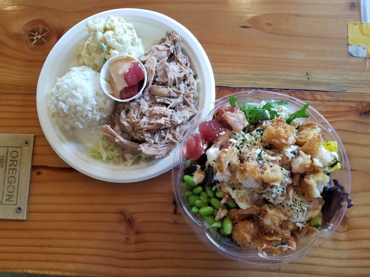 We tried the Crunchy Poke bowl and the Kalua Pork. Here is the breakdown:
The Crunchy Poke bowl was incredible. The fish was fresh, the sauce used had a slight kick, the fried shrimp created a great crunch, and the kimchi and fermented veggies added a little authentic Japanese twist! For $16 we had a little piece of Hawaiian paradise right here in Central Oregon.
As for the kalua pork? Wow. Everything you'd expect and more. With a side of rice, macaroni, and a little treat of some tuna poke- this dish was fabulous.
We'd highly re...
29
Bend Oregon Real Estate - How to Win the Multiple Offer
Bend Home Buyers Need A Great Real Estate Agent to Work With
Ask any Bend real estate agent right now how the market is, and the answer will be "crazy." In this time of the Covid-19 pandemic, home buyers are flocking to Central Oregon and buying Bend homes faster than they can be listed. This is resulting in a severe shortage of available homes for sale and in turn, a huge increase in the number of multiple offers on these properties.
Often referred to as a "bidding war," multiple offers can drive the price of a home up beyond the listing price and often the winner is the buyer willing to offer more money with better terms than the other buyers. Having an experienced real estate agent to work with is essential to help a buyer win the home.
Can't I Just Offer Low and Expect the Seller to Counter Higher? 
28
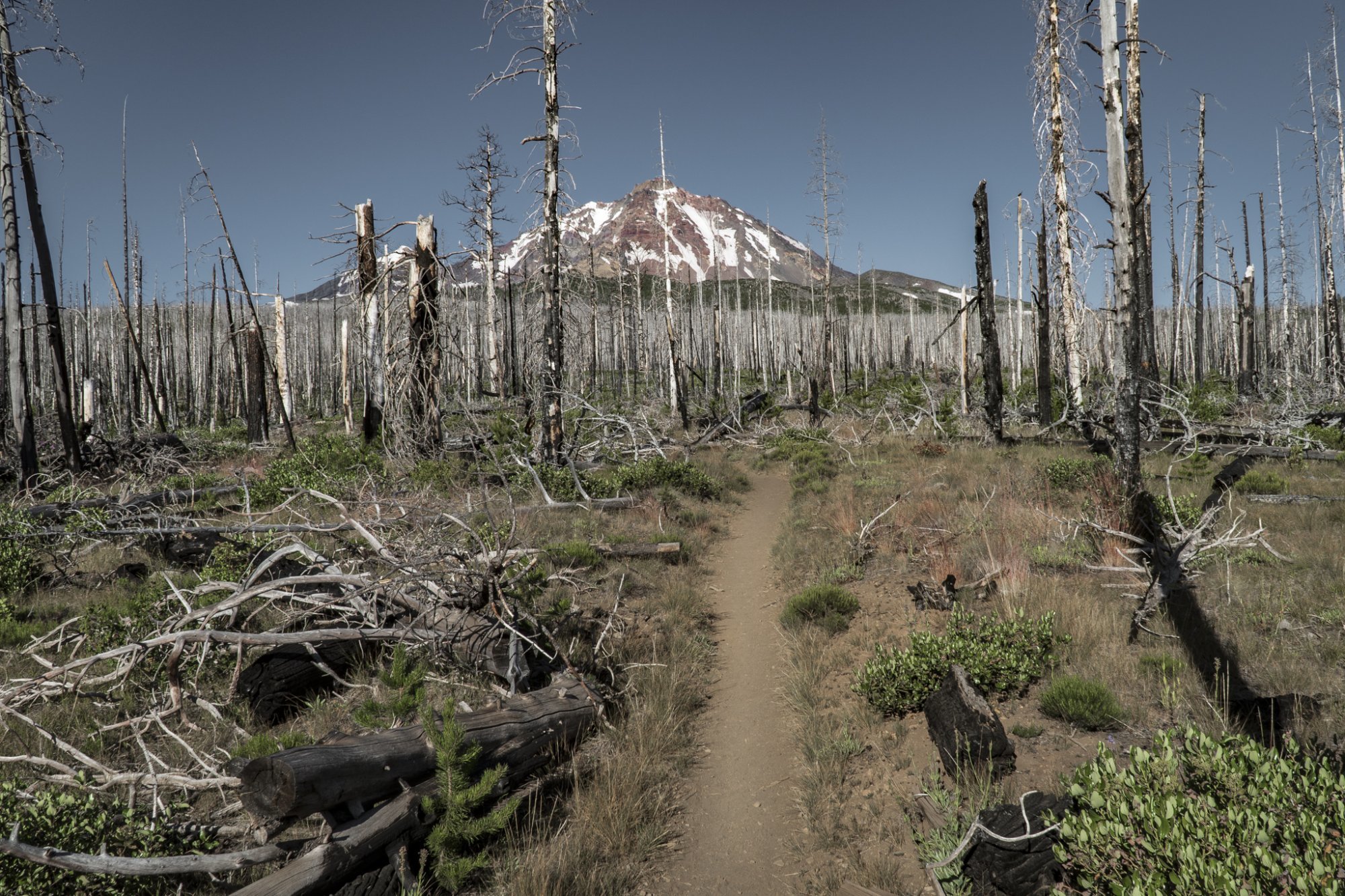
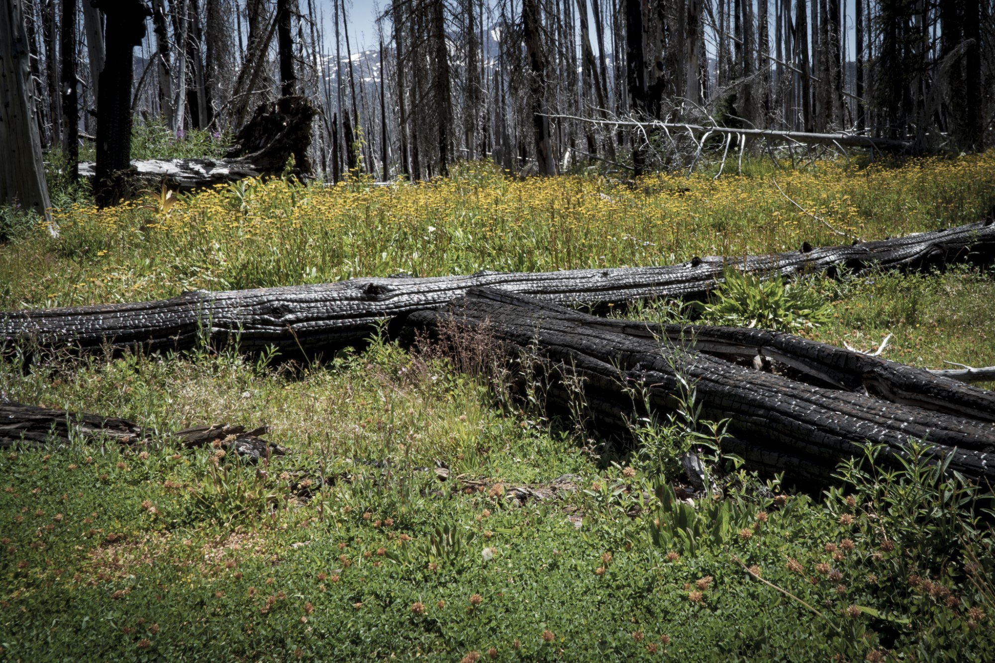
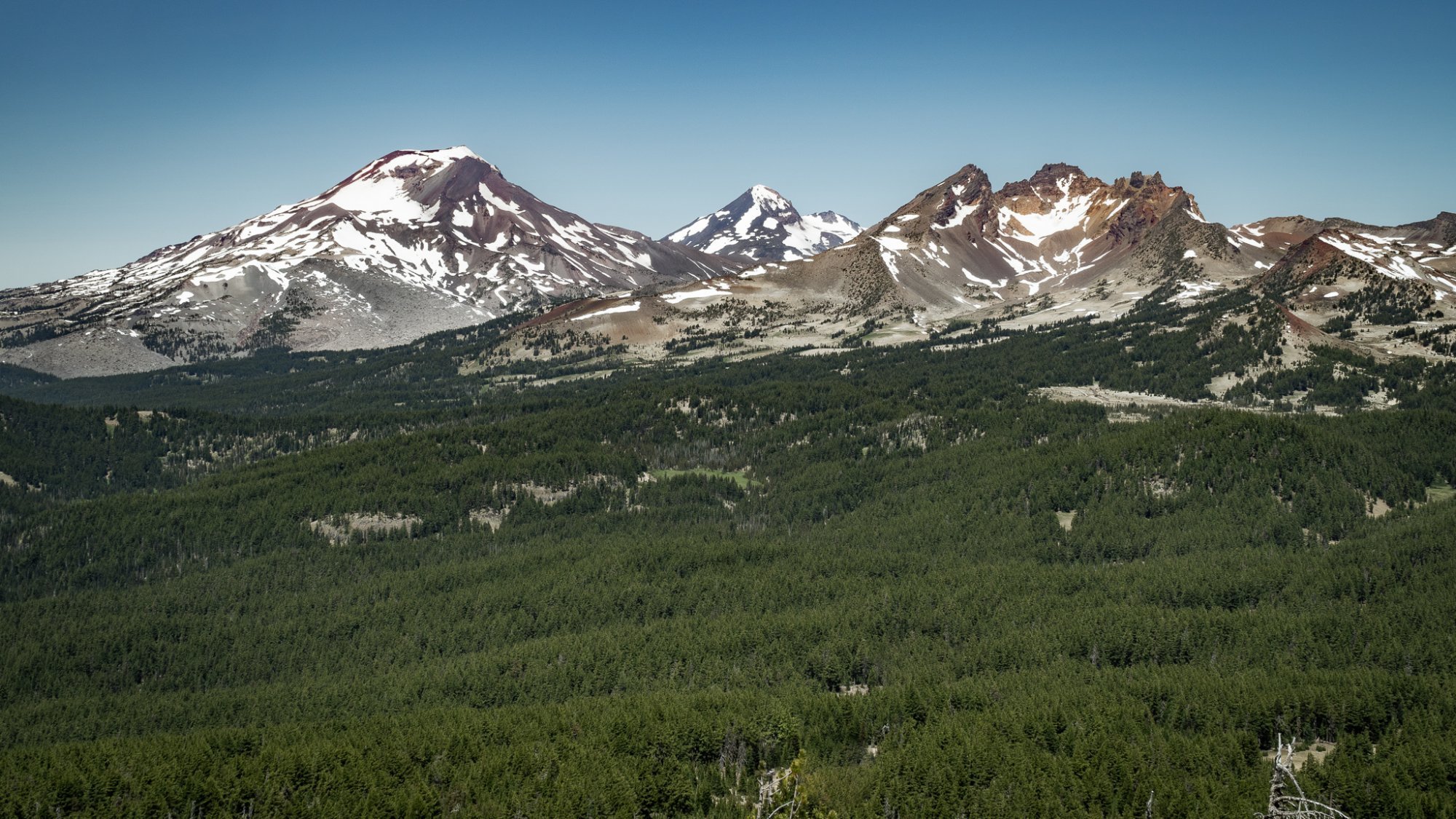
The Hike to Camp Lake in the Three Sisters Wilderness is Full of Surprises
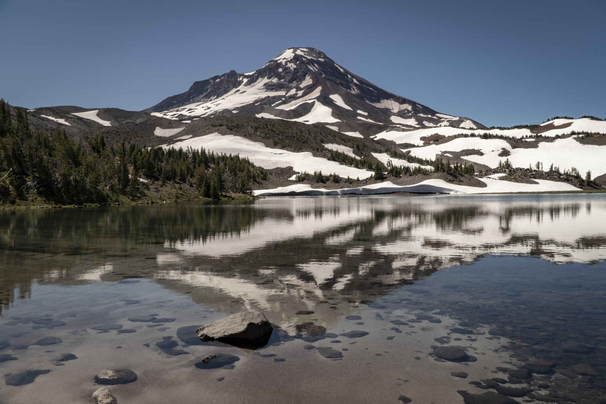
We have lived in Central Oregon since 1985, but during this entire time we have never hiked to Camp Lake. The start of this hike is located just outside Sisters off McKenzie Hwy on Forest Road 15 at the Pole Creek Trailhead. The hike into Camp Lake covers 7.1 miles (14.2 miles round trip), the first 4 through a burned forest, the result of 2017's Milli Fire. However, it is interesting to see how new plant growth is returning in the burned area. And the open areas provide for wonderful views of both Middle and North Sister.
Once we left the burned forest and entered the higher elevations, we had the opportunity to cross the North Fork of Whychus Creek and hike even closer to Middle Sister. Several trails off the main trail lead to the summit of Middle Sister, a hike only for very experienced hikers with recommendations for climbing gear. Our hike left Middle Sister at this point and traveled further southwest to end at Camp Lake, part of the Chambers Lake series of high elevation lakes in the area, at the base of South Sister. Many campers stay in this area - hiking in and enjoying the area before leaving the next day. The elevation change over the 7.1 miles is just shy of 1700 ft (5300 ft at the trailhead to 6980 at Camp Lake), but it is gradual enough that many take this hike, including children. The books call this a difficult hike, but we would call it more moderate - just longer than many other hikes in the area.
 |
 |
 |
20
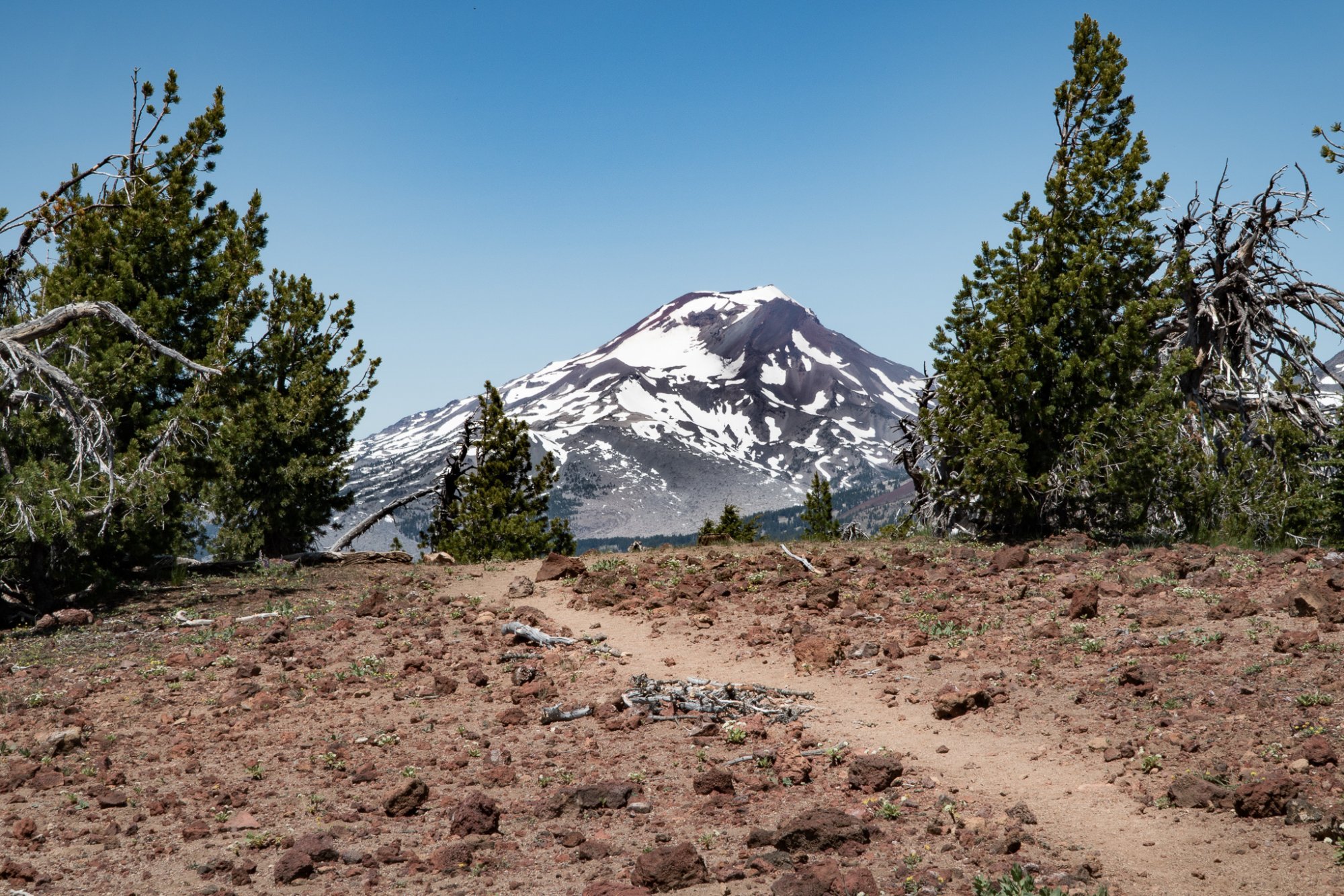
Tumalo Mountain is Always a Great Central Oregon Hike
Tumalo Mountain is One of the Best Places to View Mt. Bachelor
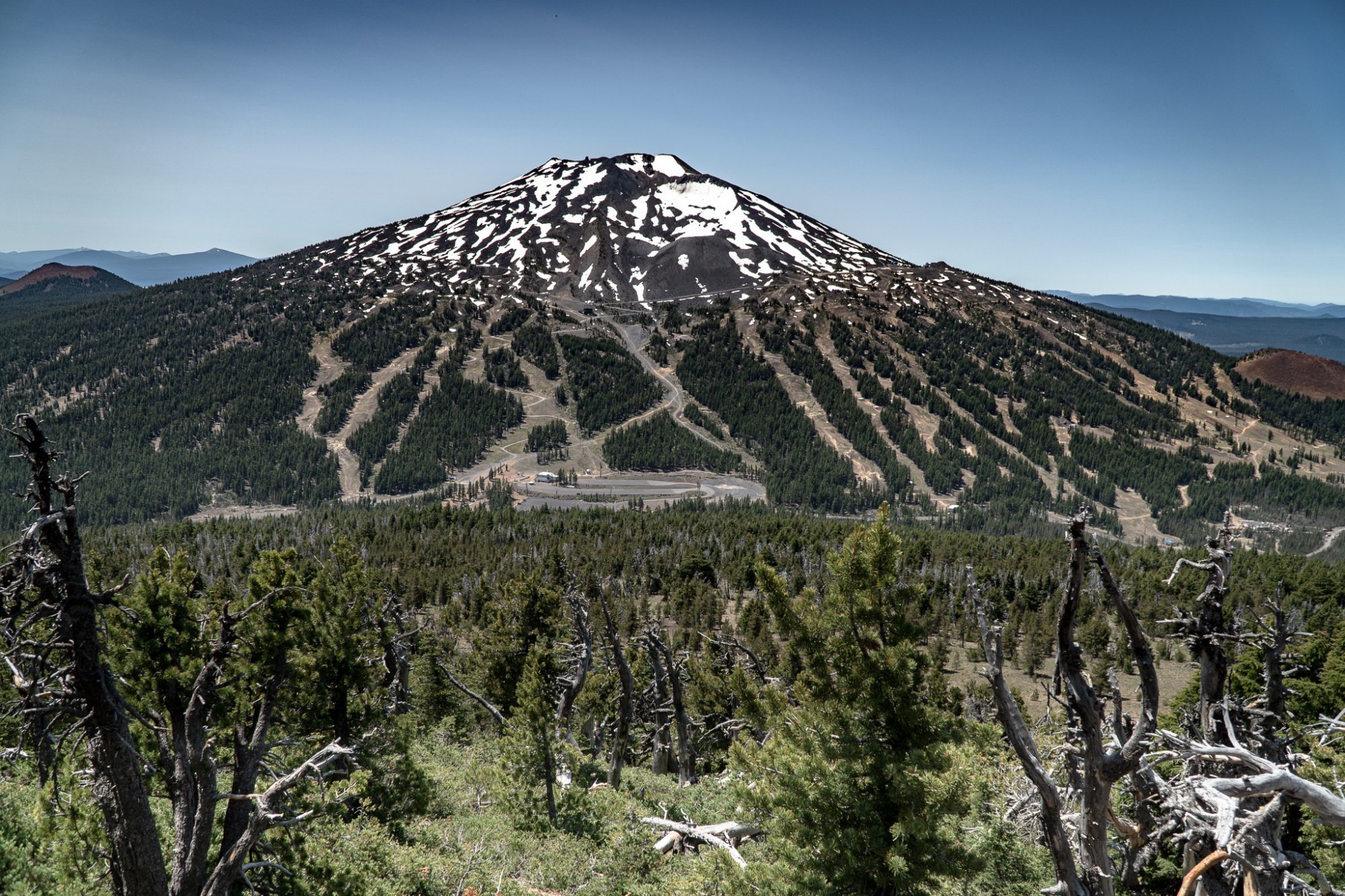
We have hiked Tumalo Mountain several times, but each has experience been enjoyable. The 4 mile round trip has 1400 foot elevation change, so it is fairly steep going up. However, once you reach the top, the views of Mt. Bachelor, South Sister, Broken Top, and east toward the Ochocos are fabulous. During July, the evidence that Mt. Bachelor is a renowned ski area is obvious with the ski runs and maintenance roads visible, but the beauty of the mountain is also easy to see. Tumalo Mountain is a popular hike and plan on seeing people during your trip up and back. Bring plenty of water and enjoy the experience.
 |
 |