Bend Premier Real Estate Blog
Subscribe and receive email notifications of new blog posts.
 RSS Feed
- 2026 | 57 Posts
- 2025 | 103 Posts
- 2024 | 110 Posts
- 2023 | 72 Posts
- 2022 | 52 Posts
- 2021 | 70 Posts
- 2020 | 84 Posts
- 2019 | 38 Posts
- 2018 | 48 Posts
- 2017 | 39 Posts
- 2016 | 31 Posts
- 2015 | 10 Posts
11
Bend Premier Real Estate | August 2025 Newsletter
What's in the August 2025 Bend Premier Newsletter?
- It is Taking Longer to Sell Bend Homes
- Gyro Smash Tacos
- Selling in Summer Versus Fall: What Changes and What Doesn't
- The Wildflowers Are Blooming at Canyon Meadow at Three Fingered Jack
- Home Price Forecasts for the Second Half of 2025
7
Bend Oregon Real Estate | July 2025 Trends
It is Taking Longer to Sell Bend Homes
Summer is traditionally the peak selling season for Central Oregon homes. For home buyers looking to buy a Bend home before school starts, July is usually the month when many purchases happen, with August the month for closing these sales and new owners moving into their new homes. While July 2025 has followed these trends to a certain extent, the change in the market with high mortgage interest rates limiting buying power, it has become a price driven market with sellers recognizing that if they really need to sell, the asking price has to match today's market and not that of previous years. July 2025 also saw a mar...
7
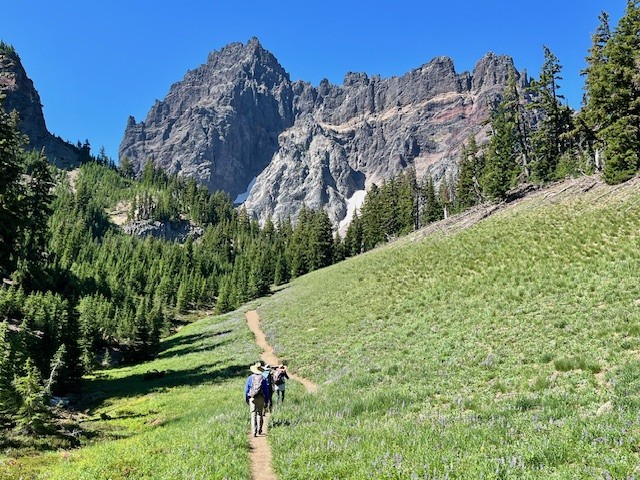
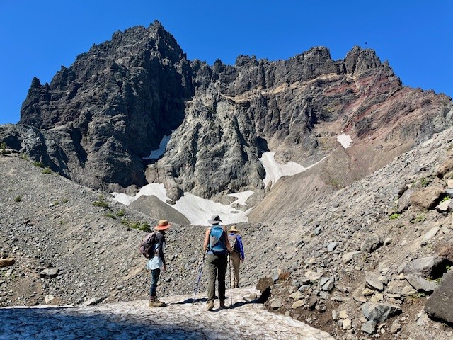
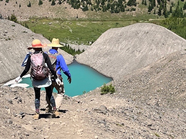
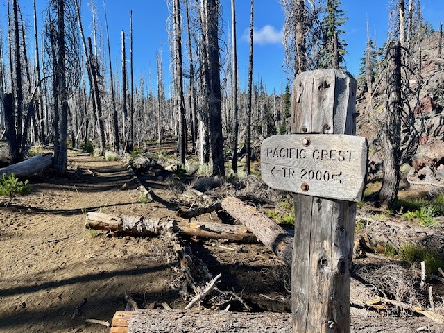
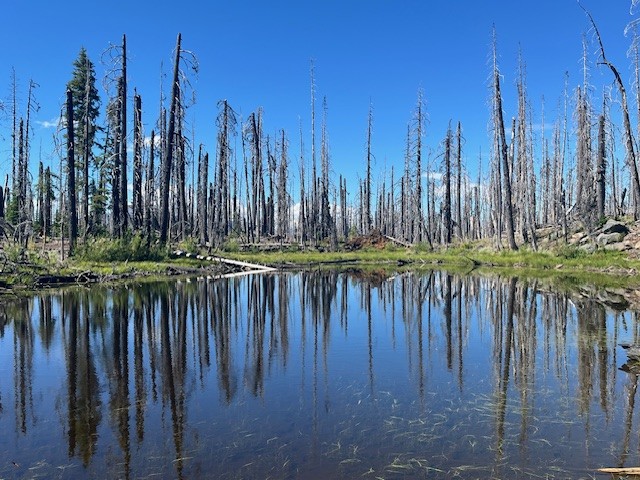
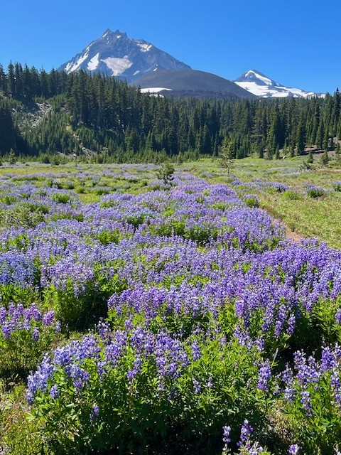
Canyon Meadow and Three Fingered Jack are Wonderful Summer Central Oregon Hikes
The Wildflowers are Abundant in Central Oregon's Canyon Meadow in the Mt. Jefferson Wilderness
The heavy snow experienced during the winter of 2024-2025 delayed the opening of the most popular Central Oregon hikes until later in the summer. However, the heavy snow also provided extra moisture in the soil which has resulted in a fabulous wildflower season. Among the best areas for wildflowers in the Central Oregon Cascades is Canyon Meadow, part of the hike to the base of Three Fingered Jack. Canyon Meadow hike is a moderate loop that takes hikers from Jack Lake to the meadow and then returns through the burned forest resulting from 2003's B & B complex fire. However, for those wanting a more challenging hike, taking the unmaintained spur from Canyon Meadow to Three Fingered Jack provides for spectacular views and a tough scramble up the moraine of Jack Glacier (unofficial name) which is mostly gone. The aqua blue of the glacial lake was especially stunning the beginning of August. Hikers can climb the moraine until they reach the ridge connecting Three Fingered Jack with the unnamed colorful hoodoo next to it. The flat top of the ridge can be a great location for lunch or a snack before taking the slow trek down the moraine back to the more established trail. There is a side trail that can be taken to the upper meadows following the stream which exits the moraine. The upper meadow was stunning with blooming wildflowers the beginning of August. Once the lower meadow is reached, the loop back to Jack Lake can be taken, although much of this is in burned forest. Another option is to return the way hikers arrived at Canyon Meadow rather than continuing the loop through the burned forest. This will add elevation and distance, however.
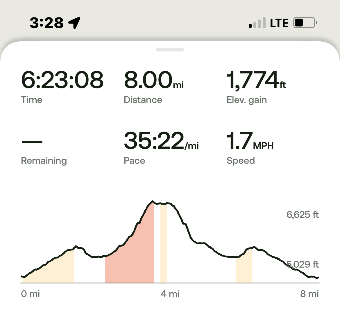
All in all, for those not taking the loop but returning the way to Jack Lake that they arrived at Canyon Meadow, the entire hike is roughly 8 miles and just shy of 1800 feet of elevation gain.
 |
 |
 |
 |
 |
 |
5
The 3 Things You Risk by Pricing Your Bend Home Too High
When selling your house, the price you choose isn't just a number, it's a strategy. And in today's market, that strategy needs to be sharp.
The number of homes for sale is climbing. And that means buyers have more choices and can be more selective. If your price doesn't line up with what else is out there, they'll scroll right past it and go on to the next one.
Pricing right from the start is your best move – and a great agent can help make sure you do.
Overpricing Comes at a Cost
And more sellers are finding that out the hard way. They list their house based on how things were a year ago – or based on a neighbor's sale that happened under completely different circumstances. Then, when thei...
28
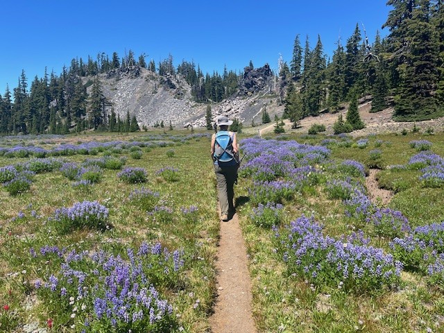
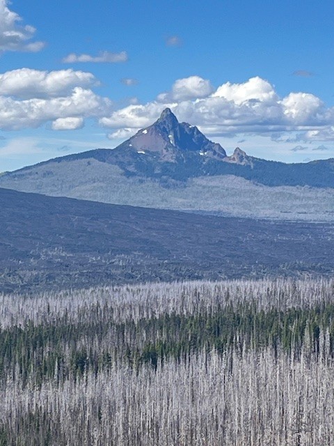
Collier Cone and Collier Glacier is a Challenging Central Oregon Hike on the Pacific Crest Trail
The Pacific Crest Trail Abuts Collier Cone
It is estimated that hundreds of thousands of people hike sections of the Pacific Crest Trail each year, but only a few hundred succeed in completing the entire 2650 +- miles. In Central Oregon, the PCT runs next to the Cascade Mountains, with sections on the east side and other sections on the west side of the seven prominent peaks. Collier cone is next to North Sister with Collier Glacier lying in the saddle between North and Middle Sister abutted on the west by Little Brother. Over the years the glacier has been in retreat with the greatest loss prior to 1950. The wet winter and cooler spring experienced in 2025 compared with 2023 appears to reflect more snow and more water in the glacial lake later in the summer.
Access to Collier Cone can be found through hiking the Obsidian Trail, Four in One Cone, or through Lava Camp Lake. All approaches come with at least seven miles one direction which is why there are few people who visit Collier Glacier. Even though the PCT runs right next to Collier Cone, climbing to the moraine bordering the lake takes another third of a mile one direction, which is probably why few PCT hikers take the time to see the view.
The hike from Lava Camp Lake starts in burned forest, the result of 2017's Milli Fire. However, there remains untouched forest near Matthieu Lakes and the lava fields were natural fire breaks. The meadow, which is the junction for Scott Trail and the PCT, was stunning in July 2025 with the lupines at their peak. California tortoiseshell butterflies were abundant and filled the dry stream beds in the meadow and circled in groups by the lava fields. The total in and back hike from Lava Camp Lake is 15 miles with 2400 feet of elevation gain.
 |
 |
 |
 |
 |
 |