11 articles found with the search of "forest pass"
Subscribe and receive email notifications of new blog posts.
 RSS Feed
- 2026 | 71 Posts
- 2025 | 103 Posts
- 2024 | 110 Posts
- 2023 | 72 Posts
- 2022 | 52 Posts
- 2021 | 70 Posts
- 2020 | 84 Posts
- 2019 | 38 Posts
- 2018 | 48 Posts
- 2017 | 39 Posts
- 2016 | 31 Posts
- 2015 | 10 Posts
22
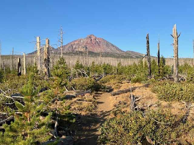
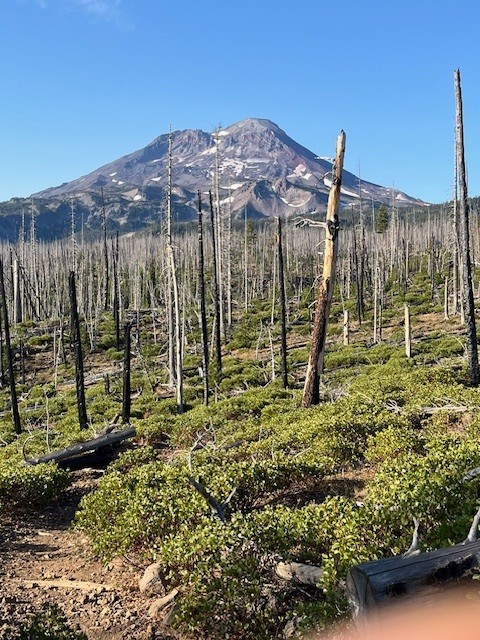
Hayden Glacier Hike on Middle Sister is a Challenge
Take the Climbers' Trail to Reach Hayden Glacier
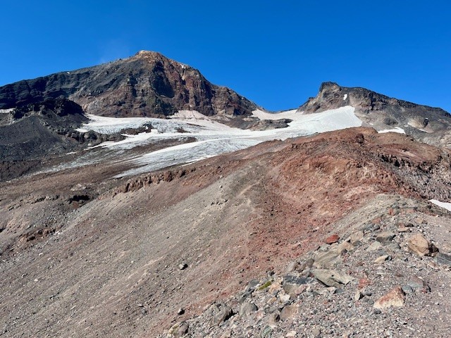
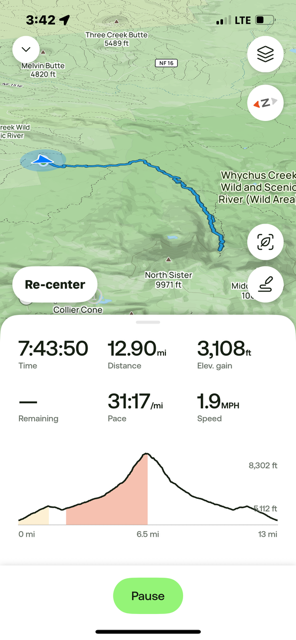
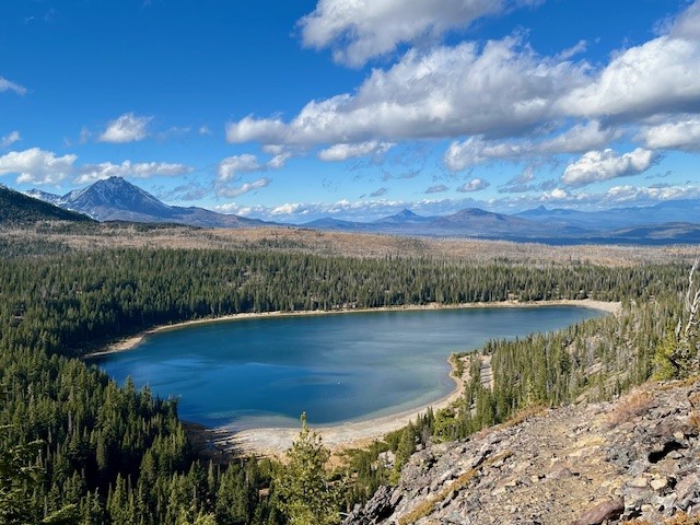
For Central Oregon hikers looking for something different that does not require a paid permit, the climbers' trail on Middle Sister is well worth it. Most hikers would start in the burned forest at the Pole Creek Trailhead located off forest service road 15 outside of Sisters (the parking at the trailhead requires $5 payment or a forest pass). After hiking the trail to the junction with Green Lakes Trail 17, trekkers continue on Trail 17 toward Park Meadow. Shortly after crossing Soap Creek is the junction with Camp Lake which hikers should take to reach the unmarked junction with the Climbers' Trail. If hikers miss this trail, it loops with another section of the Camp Lake trail near one of the branches of Wychus Creek which hikers to Camp Lake have to cross. Climbers don't cross the creek, but instead hike upstream toward Middle Sister.
Regardless of the looped trail route chosen, they join on the moraine just under Hayden Glacier. Both are steep, difficult hikes with loose pumice and boulders to traverse. For those who plan on summiting Middle or North Sister, Hayden Glacier is just another geological feature to pass by before the summiting. For those not wishing to go further, the Cascade views from the glacier are amazing.
For those starting at the Pole Creek Trailhead and hiking to the glacier but no further, plan on a full day, climbing over 3100 feet and roughly 13 miles.
 |
 |
 |
 |
23
The Historic Black Butte Hike Can Be Challenging
There Are Two Trailheads to Summit Black Butte
Many people will hike to the summit of Black Butte during the summer. It is an iconic volcano located just outside of Sisters next to Black Butte Resort which challenges both visitors and locals. Most people will take the gravel road which transitions into a terrible dirt road to the upper trailhead which is located 1500 feet below the summit. Hikers who start here will find a limited space parking area complete with facilities which require a current forest pass. Those who really want to challenge themselves can start at the base of Black Butte at the historic trail head located near Camp Sherman. The road to this trailhead is mostly paved until the turn off to the parking area so hikers avoid driving over challenging dirt roads before they start their trek. No parking pass but very limited parking available.
 |
 |
For those hiking the historic route, the trail gradually climbs as hikers pass through the old growth forest located at the base of Black Butte. In May, 2025, early signs of spring were evident with blooming wildflowers. After roughly 3/4 of a mile, the path steepens and hikers start climbing Black Butte. Peek-a-boo views of Black Butte Ranch, Suttle Lake, and the Cascades can be seen through the tall Ponderosa Pines.
 |
 |
After 3 miles the Historic Black Butte Trail reaches the upper trailhead and the last two mile of the hike is along this route. At the top of Black Butte in the middle of May, 2025, snow patches remained which were easily crossed. The top of the Butte was relatively snow free with all structures still locked and inaccessible to early visitors.
 |
 |
Hikers can enjoy the top of Black Butte with amazing Cascade Views. On a clear day, as many as 13 peaks can be seen from Mt. Bachelor in the south all the way to Mt. Adams in Washington to the north. After spending time at the summit, hikers need to descend back to the trail head in Camp Sherman. All in all, the historic Black Butte Trail is over 10 miles with 3400 feet of elevation gain in the ascending 5 miles.
 |
 |
30
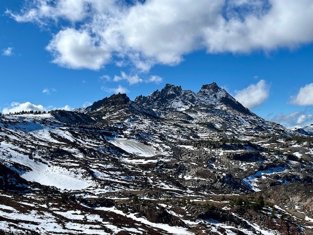
Hiking Tam McArthur Rim to No Name Lake in Fall is an Experience
Cascade Mountain Hikes in Fall Can Have Unexpected Weather Conditions
Hiking in the Oregon Cascades in the fall can offer amazing experiences with stunning views, early snow, fall colors, and no need for forest passes. However, the weather can also change suddenly and hikers need to be prepared.
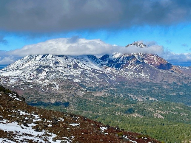
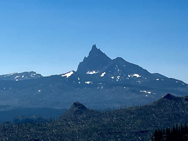
On October 26, 2024, the hike from Three Creeks Lake to Tam McArthur Rim began with low clouds covering the Cascades. The hike up from the trailhead (the sign was already covered for winter), to the rim experienced some wind, although much of the early part of the trail was in sheltered forest. Once reaching the rim, the winds really picked up, but the clouds also lifted so that the mountains (Broken Top, The Three Sisters, Mt Washington, Three Fingered Jack) could be seen.
 |
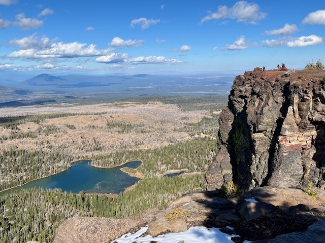 |
Typically the unmaintained trail from Tam McArthur Rim to Broken Top and No Name Lake is fairly simple until hikers reach the cinder rim which is traversed before getting to Broken Hand. On October 26, the clouds lifted and the wind picked up. For those not prepared for wind chill, the gusty winds would have really impacted comfort. Hiking below Broken Hand rather than across the face made a lot of sense as the wind was getting even more fierce. Upon reaching the ridge overlooking No Name Lake, the wind was extremely strong and it was difficult to even stand; anything loose would have been blown off the ridge. Getting a few pictures and returning to a more sheltered space behind a rock outcropping made sense, as well as drinking hot drinks before attempting the trek back. Very few people traveled this hike to Broken Top this day, although upon returning to Tam McArthur Rim, there were a good number who had reached the rim in the afternoon once the weather warmed a bit.
Anyone who hikes in the Cascades in the fall needs to be prepared for changing weather and unexpected situations. But for those who do, the rewards can be amazing.
 |
 |
17
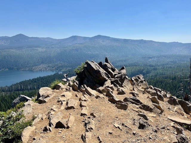
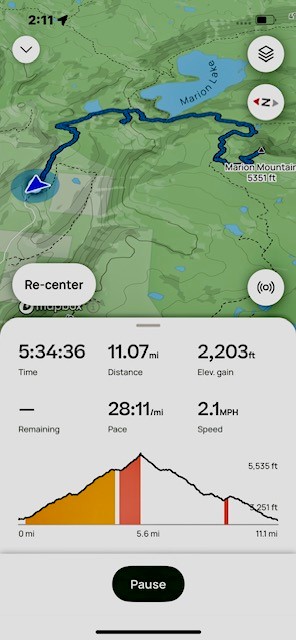
Marion Mountain Hike has Lakes, Mountains and Waterfalls
Marion Mountain Hike has it All in Central Oregon
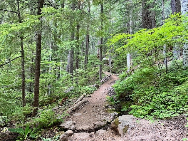
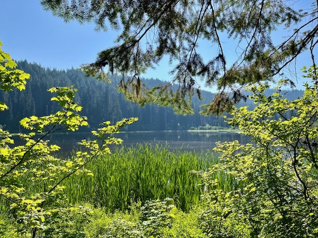
Past Santiam Pass off Hwy 22 over the bridge at Marion Forks is the turn off to the trail head for Marion Lake/Mountain. Hikers have to travel over 5 miles down a paved, then decent gravel road to the trail head and must present a forest pass to hike the trail. Once past the trail head, hikers climb two miles through old growth forest until they reach Lake Ann, accessing the lake shore over a stone covered creek which flows from the lake. The trail skirts the end of Lake Ann and after a half a mile, reaches Marion Lake.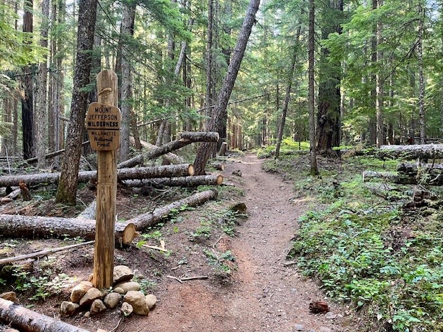 |
 |
 |
 |
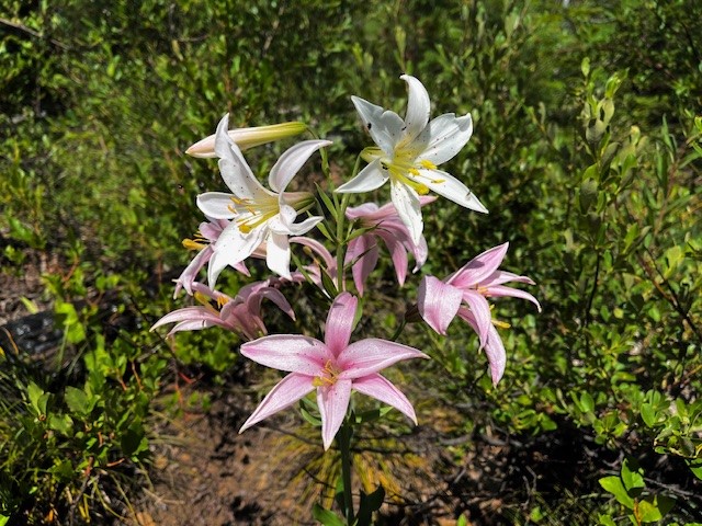
The trail splits here. Hikers wishing to take the path next to Marion Lake can do so, and others wishing to bypass the lake and travel on to either Marion Falls or Marion Mountain can do that. The path to Marion Mountain connects again with the path next to the lake, but past the lake the path steepens as hikers gain elevation hiking up Marion Mountain. There are scattered open areas (complete with the remnants of forest fires) and forested areas as the remaining miles to the top of the mountain are climbed. At the top of the mountain the views of Mt Jefferson and Three Fingered Jack are wonderful. The viewpoint is on a narrow rocky outcrop with steep drop-offs on each side. On July 13, 2024, butterflies and summer wildflowers were abundant.
 |
 |
On the hike back to the trail head, an unmarked path near the Marion Lake junction leads to Marion Falls. Hikers to the falls have to traverse over and around downed trees and a very steep path to get to Marion Falls. However, seeing the falls up close is wonderful. There is another steeper path to access the lower falls which adventurous hikers can take. The negative of seeing the falls up close is the steep path - which has to be climbed to get out and back to the main path back to the trail head. All in all, the total distance traveled was over 11 miles with over 2200 feet of elevation gain.
 |
 |
21
The Trail is Open to the Top of Black Butte
Black Butte Trail is Short but Steep
The trail to the top of Black Butte starts part way up the butte after a drive on a fairly well maintained dirt and gravel road followed by a poorly maintained dirt and rock road. Once you reach the trailhead (complete with stocked toilets), the two mile hike to the top of the butte can be accomplished fairly quickly. Hikers gain over 1500 feet in the two miles, but the Cascade views from Broken Top to Mt Adams can be spectacular on a clear day.
There is limited parking at the Black Butte Trailhead (forest pass required) so hikers are recommended to arrive early to get a spot and to avoid crowds. The hike is very popular with visitors to Black Butte Ranch and and Camp Sherman as well as local year-round residents.
 |
 |
 |
 |