11 articles found with the search of "forest pass"
Subscribe and receive email notifications of new blog posts.
 RSS Feed
- 2026 | 71 Posts
- 2025 | 103 Posts
- 2024 | 110 Posts
- 2023 | 72 Posts
- 2022 | 52 Posts
- 2021 | 70 Posts
- 2020 | 84 Posts
- 2019 | 38 Posts
- 2018 | 48 Posts
- 2017 | 39 Posts
- 2016 | 31 Posts
- 2015 | 10 Posts
3
Iron Mountain Hike 2023 - Wildflowers and People!
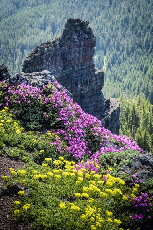
Iron Mountain is Known for its Wildflowers
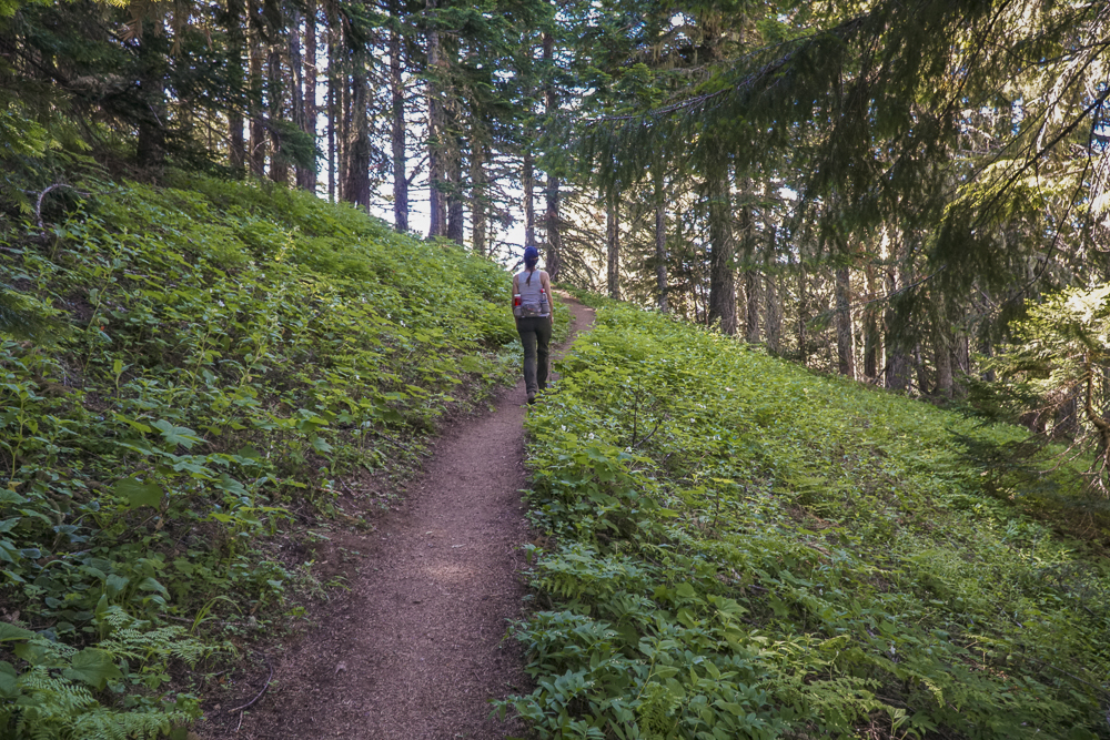
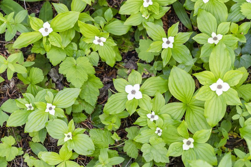
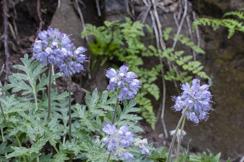
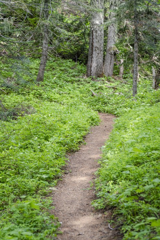
We have hiked Iron Mountain yearly since 2020, with each experience a little different. For those not familiar with Iron Mountain, it is a unique "Special Interest Area" in that it provides for over 300 species of wildflowers in various meadow, forested, and rocky environments. Each year the experience has been different, although our hike is typically done during the same few weeks in late June or early July. This year, our hike on July 1, 2023, was warm and we met many other very friendly people and families enjoying the same experience. The hike itself can be challenging and if hikers follow the route we do (which includes the Cone Peak Trail and portions of the Santiam Wagon Trail) the trek will amount to over 1900 feet of elevation gain and a total of 7 miles. We suggest getting an early start, take your camera, and don't rush the experience of seeing the lovely flowers and stunning mountain views from the summit.
To access the trailhead, travel west from Bend over Santiam Pass to the junction with Hwy 126. Take this until Hwy 20 (towards Sweet Home and Albany) branch off. Travel on Hwy 20 several miles until you reach Tombstone Pass. Park in the parking lot there (bring your forest pass) and start the Cone Peak Trail at this location.
 |
 |
12
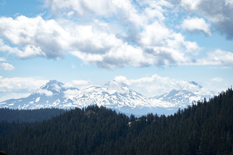
Wildflowers, Views and a Great Hike - Cone Peak Loop and Iron Mountain
Iron Mountain is a Yearly Favorite for Wildflowers

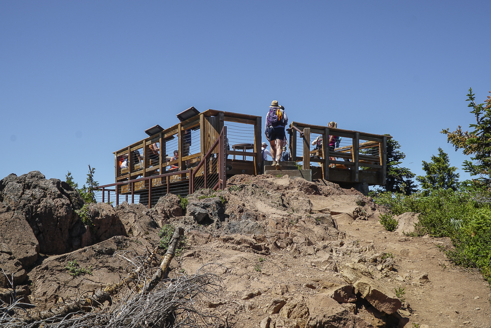
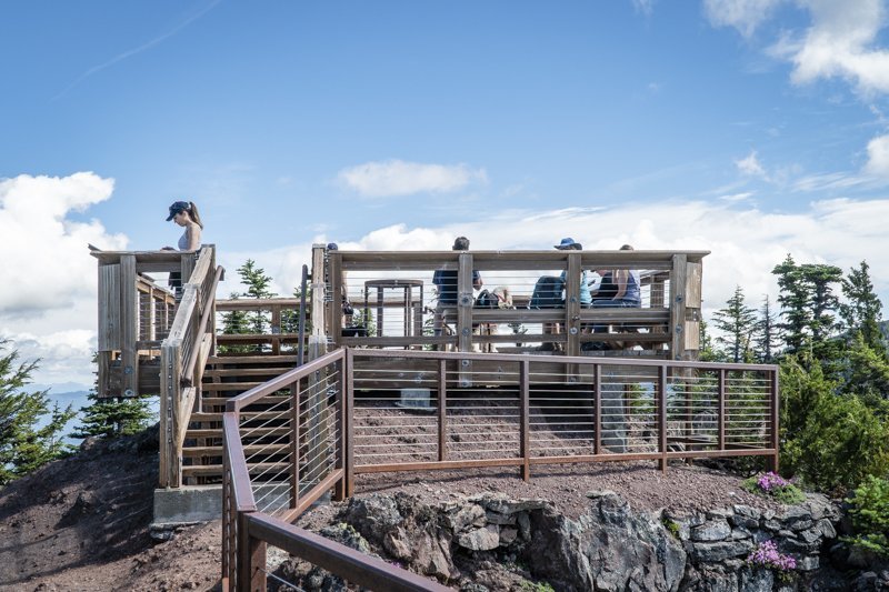
We try to hike the Cone Mountain Loop including Iron Mountain on a yearly basis, timing our hike to summer when the wildflowers are blooming. Located in the Willamette National Forest 20 miles east of Sweet Home on Hwy 20, this hike can be done multiple ways, but we opt for the longest route, parking at the Tombstone Summit parking lot (be sure to bring your National Forest Pass) and walking through the nearby nature trail and across the highway to the Cone Peak Trail. This trail switchbacks up the hillside in beautiful forest over several miles before it opens at the meadow at the base of Cone Peak which is filled with wildflowers (experts say there are over 300 varieties of blooming plants in the area). Continuing along the trail, hikers eventually leave the meadow and hike down the shoulder of the hill to the shoulder of Iron Mountain, where the trail continues up to the junction of the spur to take hikers to the top of Iron Mountain. This trail is somewhat steep with over 650 feet of elevation gain in less than a mile, but the views are fabulous and the wildflowers on the mountain stunning. At the top of the mountain is a nice, railed deck complete with mountain markers and benches for people to rest and enjoy a snack or lunch before returning down to rejoin the Cone Peak Trail to complete the loop back down across the highway and back to the Tombstone Parking lot via the Old Santiam Wagon Road. All in all, the hike is between 6.5 and 7 miles with just under 1900 feet elevation gain.
 |
 |
 |
 |
 |
 |
11
Black Butte is a Wonderful Central Oregon Hike
For a Great Aerobic Workout and Great Views, Hike Black Butte
Black Butte is an iconic landmark just outside Sisters Oregon and over the years has also been a fire lookout. Today it is a terrific hike climbing 1600 feet in just under 2 miles. When hiked Black Butte on May 8, 2021, the weather was cloudy and cool, but the trail was free from snow until just before the top of the butte. To access the trail head, travel west on Highway 22 five miles past Sisters until you reach the Indian Ford Campground exit (milepost 95). Travel on paved Forest Road 11 until you reach unpaved Forest Road 1110. Travel on 1110 just under six miles to the trailhead (the last mile is quite narrow and rough). The trail head requires a forest pass and the parking area can fill up early.
The path to the top of the Butte is well maintained and popular. We saw people running the path to the top and others hiking with children. On May 8th, the wind was blowing at the top of the Butte and it was chilly; those dressed in running shorts didn't stay long. We were dressed for cool weather and were able to enjoy the time at the top seeing the lookouts and the brand new observation deck still under construction.
During our hike down, we were amazed at the numbers of people we passed climbing up. During that two mile trek down, we estimate we passed 70 people hiking up. Obviously others enjoy climbing Central Oregon mountains as much as we do!
 |
 |
7
Sparks Lake - June 7, 2020
Sparks Lake Not Yet Ready for Visitors
.jpg)
Sparks Lake is one of our favorite Central Oregon places to take visitors to showcase why we love where we live. Located off the Cascade Lakes Highway, the views of Broken Top and South Sister from the Ray Atkeson Memorial Trail are spectacular and the lake is usually filled with non-motorized boats and paddle boards during the summer months. It is one of our favorite places to go, especially since the Ray Atkeson Memorial Trail is handicap accessible which makes it a fabulous place for us to take elderly parents.
We drove up to Sparks Lake today hoping to catch some mountain views between the clouds and late snow showers. However, the views did not come out and the weather remained cool and overcast.
4
The Best Central Oregon Hike Right Now
Black Butte Provides for Stunning Views and a Great Aerobic Workout
-6.JPG)
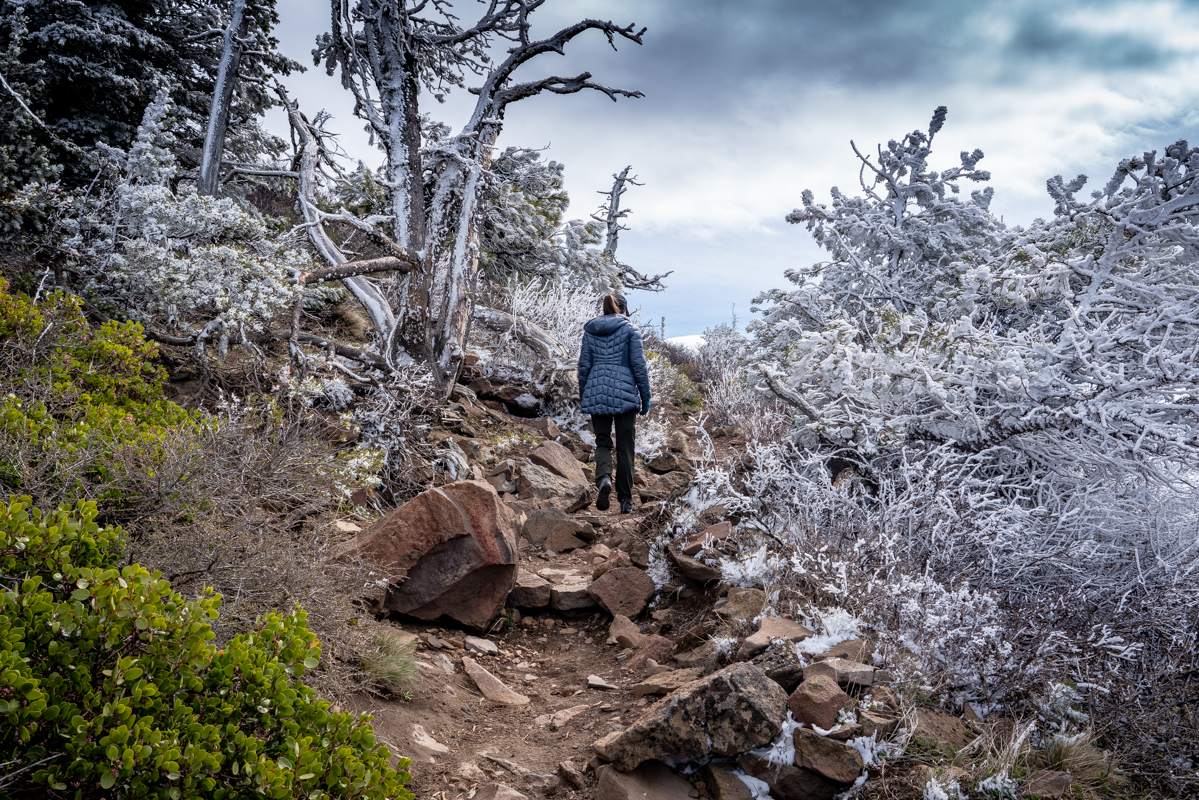
During the Covid-19 Pandemic with many of the most popular trails shut down, we have been looking for places to hike that may still be open and accessible this time of year. Yesterday we hiked Black Butte Trail for the first time. We have lived in Central Oregon since 1985, but have never attempted this hike before. The drive to the trail head was over 5 miles of dirt road (Forest Service Road 1110), after leaving paved Forest Service Road 11 with that last mile of road very rough. But we discovered that this is a very popular hike and the parking lot was full; forest passes are required to park.
.JPG)
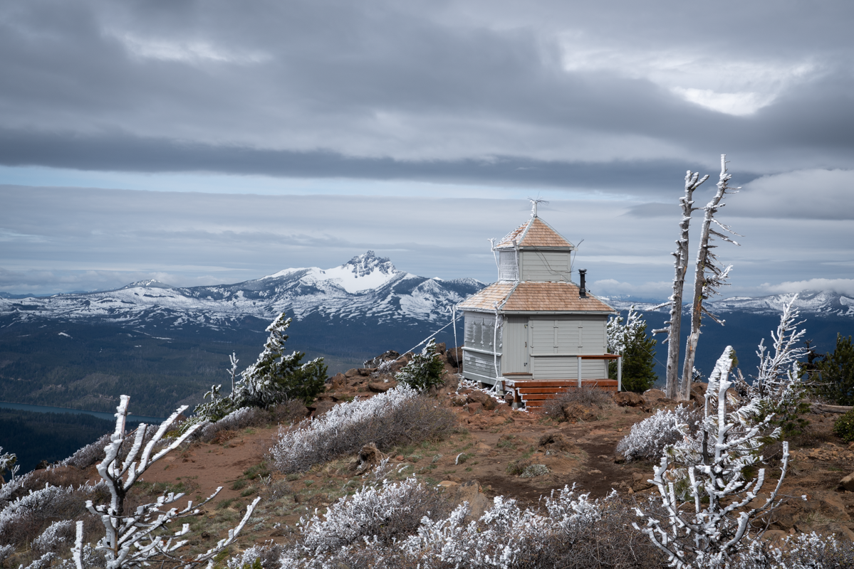
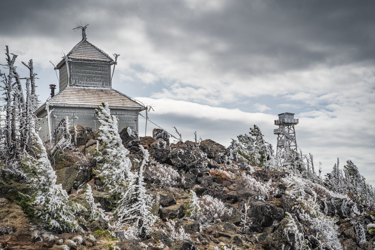
We had had a light dusting of snow the night before, so our hike started in the pines with the path highlighted by the snow on both sides. As we climbed, the snow was more prevalent in the trees and once we got close to the top, we had to traverse a slippery snow patch to reach the summit. But the views were stunning and all who were there seemed to appreciate wandering around the old fire lookout buildings and finding the best place to enjoy lunch and the Cascade views.
The hike was just under 4 miles up and back with the elevation gain 1600 feet. This is a moderate hike, not too long, with the trail pretty well maintained. With the high Cascades still closed, Black Butte has become our favorite Central Oregon hike for this time of year.
-5.JPG) |
-4.JPG) |