
Posts with tag 'Central Oregon Hikes'
Subscribe and receive email notifications of new blog posts.
 RSS Feed
- 2026 | 72 Posts
- 2025 | 103 Posts
- 2024 | 110 Posts
- 2023 | 72 Posts
- 2022 | 52 Posts
- 2021 | 70 Posts
- 2020 | 84 Posts
- 2019 | 38 Posts
- 2018 | 48 Posts
- 2017 | 39 Posts
- 2016 | 31 Posts
- 2015 | 10 Posts
17
The Tam-a-lau Trail at The Cove Palisades State Park is Worth the Hike
Lake Billy Chinook Area Offers Interesting Things to See

Many Central Oregonians will spend time during the summer at Lake Billy Chinook enjoying the houseboats and recreational opportunities available at The Cove Palisades State Park. However, hiking during the summer can be very uncomfortable with high temperatures in the area the norm. But in mid December, the cool temperatures can make for a nice hiking experience when a lot of exertion is needed.
Balancing Rocks is a Geological Formation to View Overlooking the Metolius Arm of Lake Billy Chinook
Not really a hike (1/2 a mile round trip), the Balancing Rocks (called hoodoos) can be located by driving all the way through the park past the airport toward the Perry South Campground. When forest service road 64 turns into a dirt road, travel just a short distance until you find the parking lot for the short walk to Balancing Rocks. The rocks were formed when a layer of harder volcanic rock flowed over a softer layer of volcanic rock. Over many thousands of years, the underlying softer rock has eroded at a faster rate than the overlying harder rock, thus forming the balancing rocks we see today. This is worth the extra drive to see such an unusual geological formation.
Tam-a-lau Trailhead is at the Day Use Area of the Cove Palisades State Park
 The trail to the top of the plateau between the Deschutes and Crooked River arms of Lake Billy Chinook has a very steep 800 foot elevation gain the first mile. Wooden stairs are built into some tough sections, but we found other areas to be slippery and later muddy as the frozen ground melted once the temperature rose above freezing later in the day. After reaching the top of the plateau, the level 4.5 mile loop around the hilltop provides for wonderful views of the lake and we were fortunate to see a soaring red-tailed hawk during this trek. In certain sections, the trail goes very close to the edge of the plateau and we recommend staying a safe distance from the edge as the drop is very steep and dangerous in some areas.
We have read that the Tam-a-lau trail can be very hot and uncomfortable during the summer and is best done either very early or late in the day when the temperatures are cooler. For our hike mid December, layers were best with us getting quite warm in the first mile, but cooling off a lot during the loop hike at the top of the plateau. We saw just a few people during the entire hike.
 |
 |
1
Blue Basin Overlook Trail is Part of the John Day Fossil Beds
Beyond Painted Hills is Blue Basin

Most tourists to Central Oregon will travel to see the Painted Hills, one of the 7 Wonders of Oregon. But the Painted Hills is just one of three locations of the John Day Fossil Beds National Monument. Located past Mitchell, closer to Dayville, the Blue Basin Overlook Trail is worth the hike and the panoramic views of colorful Blue Canyon worth seeing. The loop around the canyon is only 3.25 miles, but climbs 900 feet in elevation. The second hike in the area is an in and back 1.3 miles up the canyon itself with several stops along the Island in Time Trail with descriptions of fossils and wildlife that used to inhabit the area millions of years ago. The Thomas Condon Paleontology and Visitor Center is located just a few miles from Blue Basin and is another must for tourists.
If you plan on traveling to Blue Basin from Bend, be sure to have a full tank of gas before you leave town as there are limited services in this part of Central Oregon. The drive is roughly 40 miles from the Painted Hills and about 120 miles from Bend. In summer the hike will be hot with very little shade. We did this hike in November and it was cool with few people.
 |
 |
4
Mountain Biking Into Fall in Stunning Bend Oregon
There are so many reasons to love Central Oregon and it would take multiple lifetimes to experience them all. From the beautiful mountains to explore, the winding rivers to traverse, the desert flats to experience, and the beer to taste, there is a little something for everyone.
 This year, we have been taking on as many mountain biking trails as we can. With the mild fall season, we have even been able to push our biking into November! One of our favorite "go to" trails to bike is Ben's, part of the Phil's Trail Mountain Biking system. With roughly 12 miles of trail and a tad over 800 feet of elevation gain, this trail has a little bit of everything.
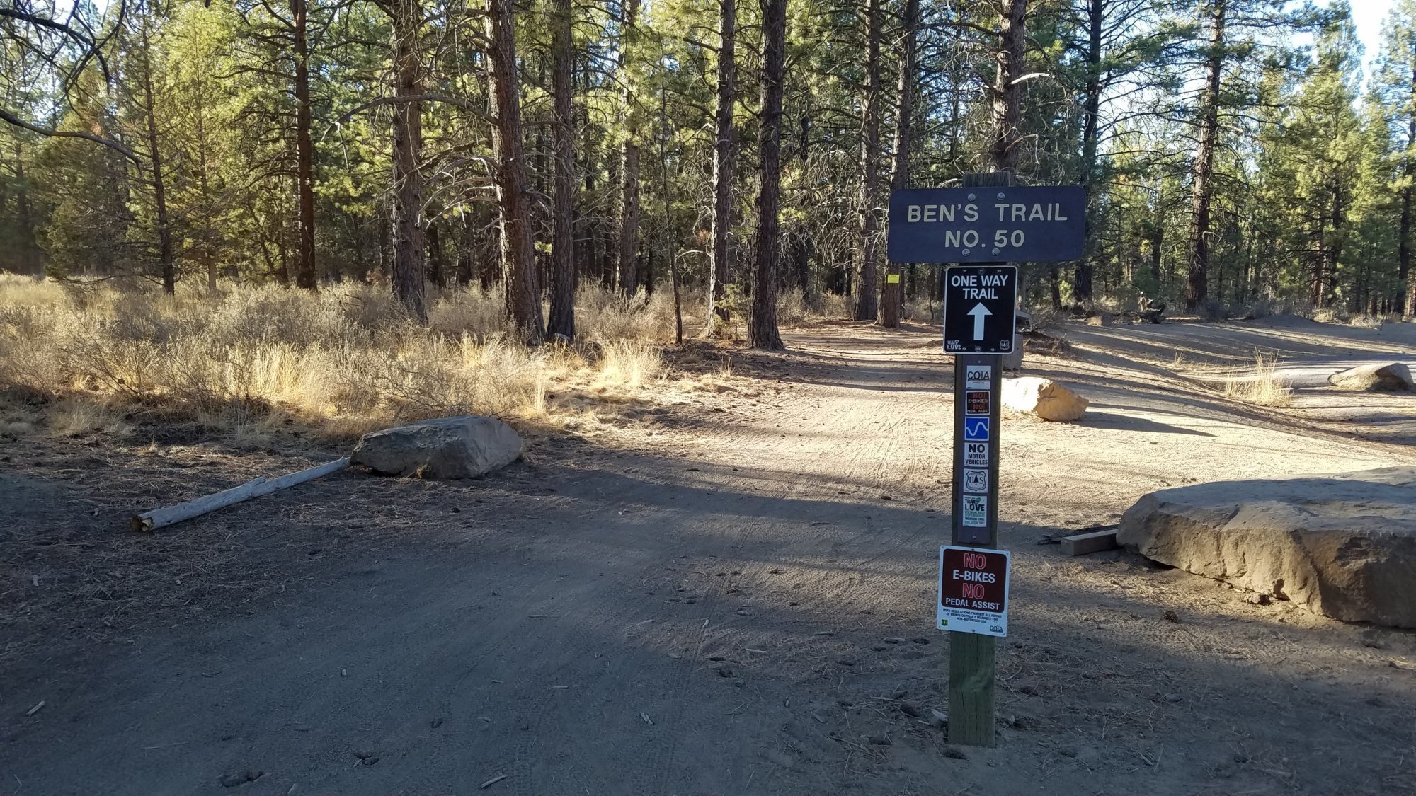
We love that this trail has a nice winding area to warm up before hitting the uphill. Upon completing the...
23
Green Lakes Via Soda Springs is the Central Oregon Hike Less Traveled

Probably one of the most popular hikes in Central Oregon is the trail from Century Drive via Fall Creek up to Green Lakes in the Three Sisters Wilderness. This nine mile round trip gains 1500 feet elevation, crossing the creek three times, but is relatively easy to moderate for most hikers. Hundreds of people will take this hike on sunny summer days and the enjoyment of the beauty of Green Lakes is one of the "must dos" for many Central Oregon visitors. During our years in Central Oregon, we have taken this hike often and have enjoyed the experience every time, despite the increased traffic on the trail.
Last Saturday we decided to hike the alternative trail to Green Lakes. This trail starts at the same parking lot as the Fall Creek trail, but instead travels via Soda Springs up the south side of Broken Top. We had never hiked this trail before and really enjoyed the unexpected views and relatively few people we saw in the early part of the hike. We started the hike at 7:40 am and for the first few miles, we believe we were the first and only people on the trail that morning. The trail joins with one coming from Todd Lake which eventually splits from the Green Lakes trail to the trail to hike Broken Top to No Name Lake. We saw a number of people taking this trek and debated whether or not Broken Top should be our destination, but decided to stay with our original plan and traveled to Green Lakes. In this stretch of the trail we saw a number of people hiking from Green Lakes, either with Broken Top as their destination or the Soda Springs trailhead we had started from.
Once we reached Green Lakes, we enjoyed the views for a while before returning to our car via the traditional Fall Creek trail. We passed hundreds of people coming up this trail as we hiked down. Next year Green Lakes will be accessible by permit only which should limit the numbers visiting this beautiful location. Hiking to Green Lakes via Soda Springs increased our trek by roughly three very enjoyable miles and we look forward to taking this hike again - but this next time to Broken Top.
 |
 |

12
Smith Rock's Burma Road is the Trail Less Taken
Smith Rock is One of Oregon's Most Popular State Parks
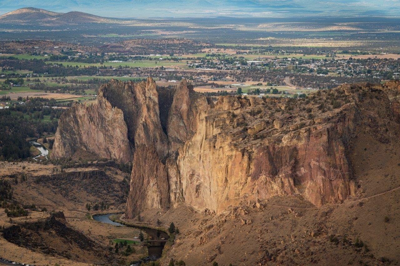
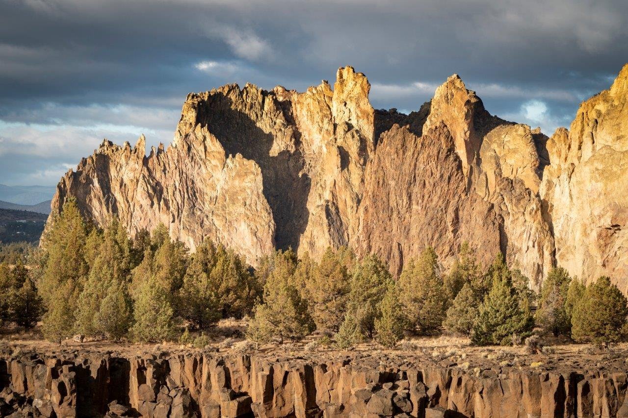
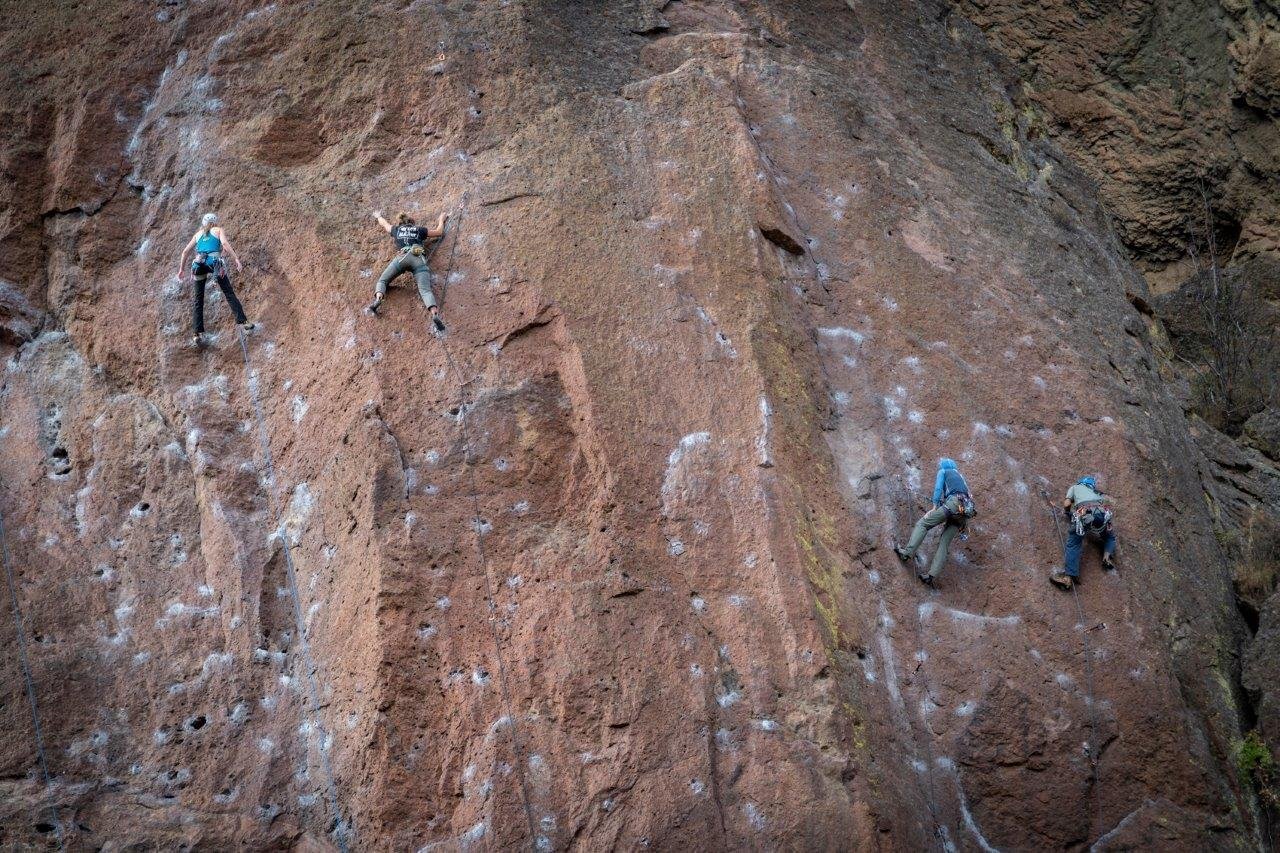
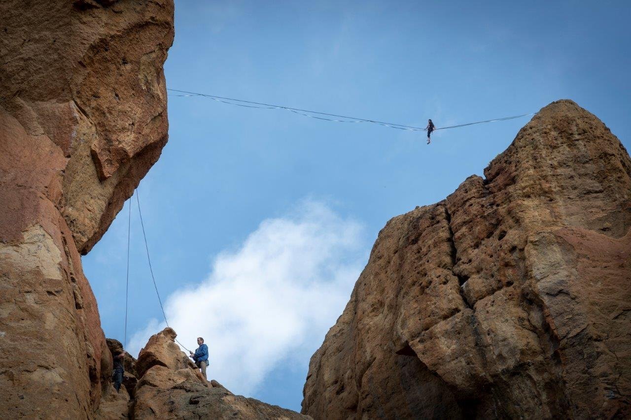
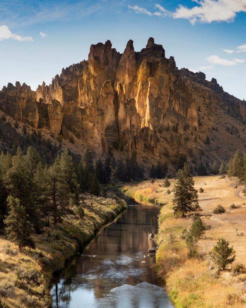
If you are planning on seeing one of Oregon's most popular state parks, be sure to get there early. Smith Rock, located north of Redmond and just east of Terrebonne, is an extremely popular destination for most visitors to Central Oregon as well as those locals just looking to recreate, hike, or rock climb. The iconic rock formation is credited as being the birthplace of modern American sport climbing and is popular with traditional, multi-pitched and bouldering as well with over 1800 rock climbing routes within the park. Most visitors who are not climbers, will hike on many of the trails scattered around the park, some along the Crooked River and others over the rocks - the most popular being Misery Ridge.
Last Sunday we took a longer hiking route we had never done before - the full 7.5 mile loop around the park which included the Canyon Trail to Wolf Tree to Homestead to Burma Road to Summit Trail to River Trail. The total elevation gain was 1200 feet and we did the hike counter clockwise in order to climb the steep, but not difficult Burma Road which brings you to the high point of the hike early in the day. We arrived at the park before 8 am and already there were many cars parked in the limited parking lot. We paid our $5 park fee and enjoyed the morning hiking. The views after the rain the night before were wonderful and the clean air after the wildfire haze most welcome. The Cascades were hidden behind clouds, but every now and then we could catch a view of one of the peaks scattered with fresh snow.
 |
 |
 |
 |
 |
 |