Posts in category 'Why We Love Central Oregon'
Subscribe and receive email notifications of new blog posts.
 RSS Feed
- 2026 | 72 Posts
- 2025 | 103 Posts
- 2024 | 110 Posts
- 2023 | 72 Posts
- 2022 | 52 Posts
- 2021 | 70 Posts
- 2020 | 84 Posts
- 2019 | 38 Posts
- 2018 | 48 Posts
- 2017 | 39 Posts
- 2016 | 31 Posts
- 2015 | 10 Posts
30
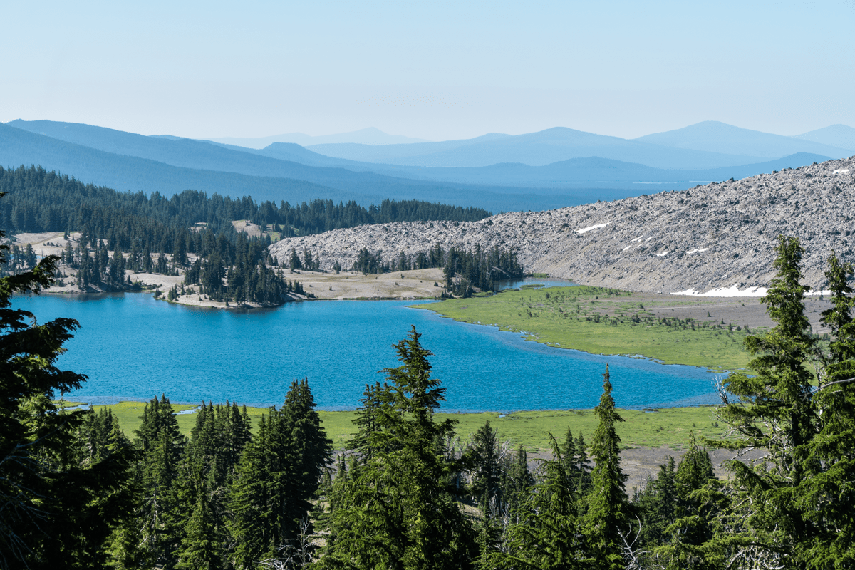
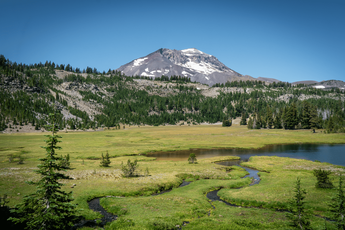
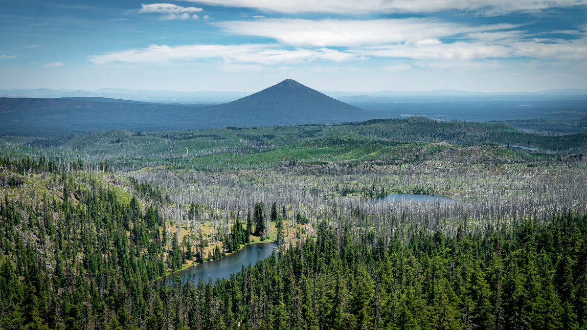
Camp Lake Has A Beautiful Setting Between South and Middle Sister
The Destination is Far Better Than the Hike There
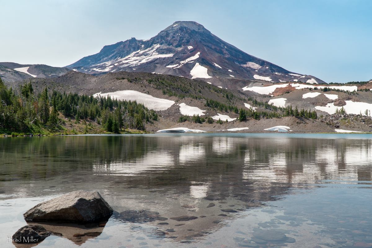
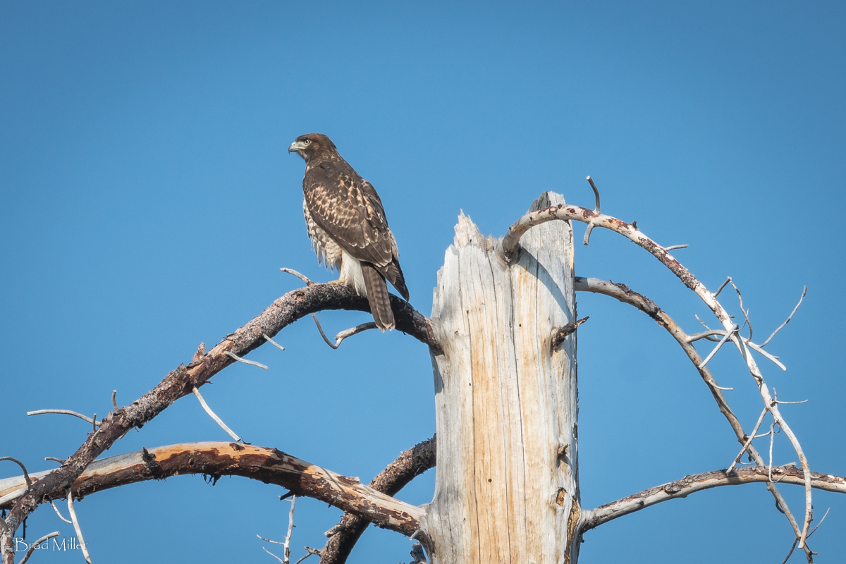
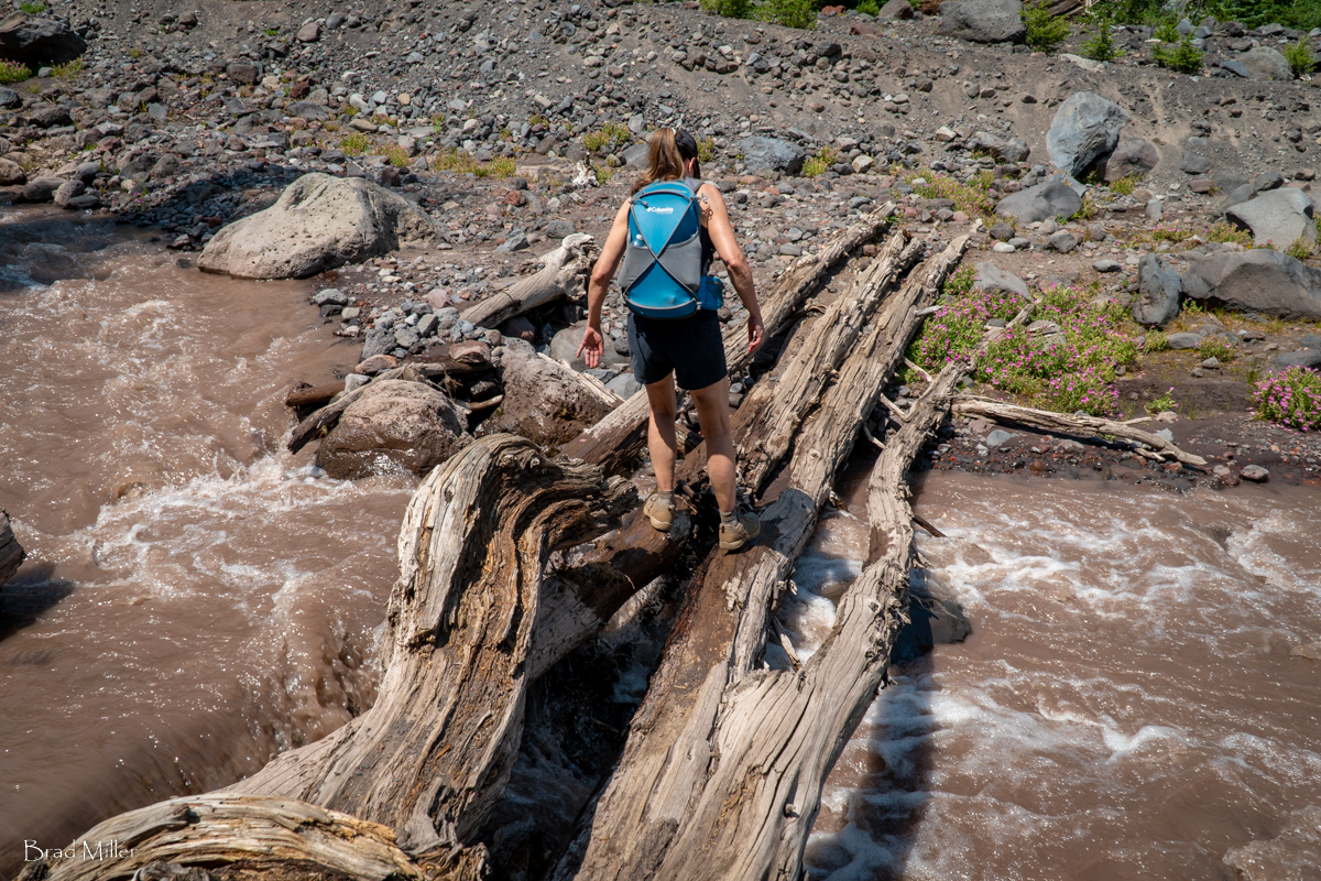
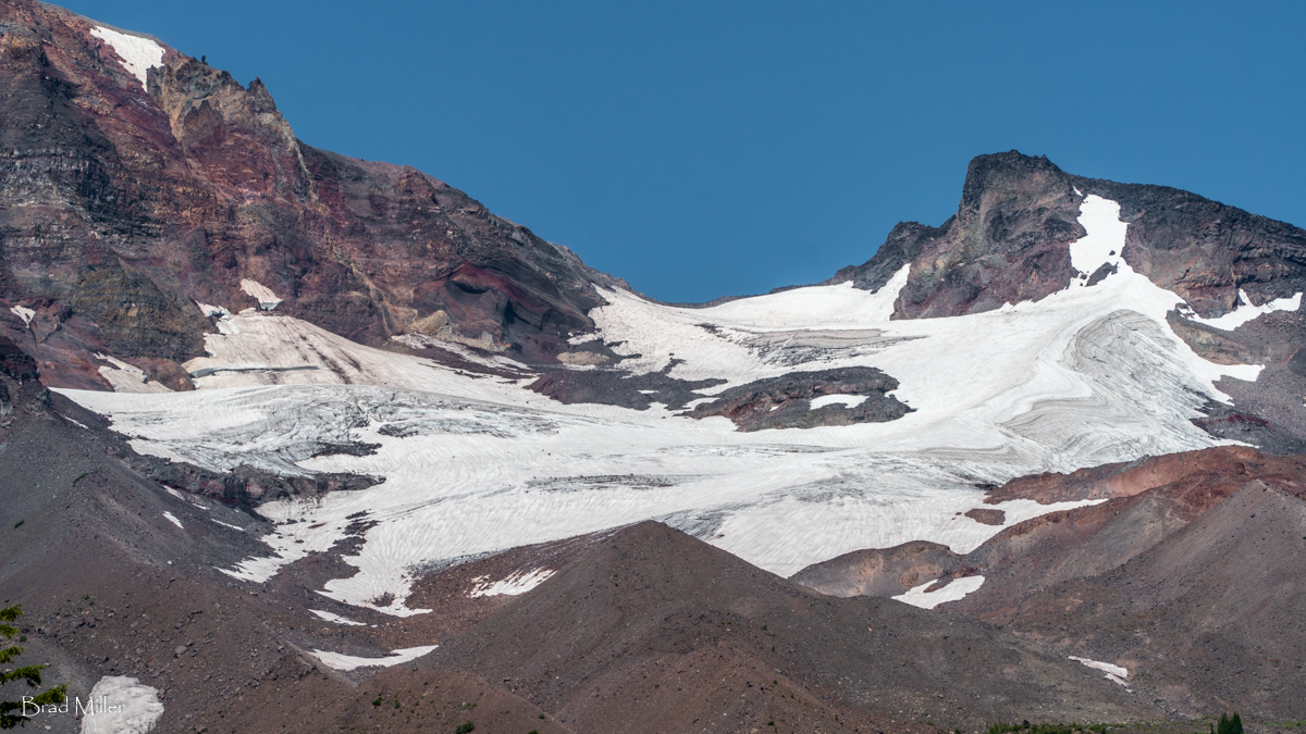
To reach Camp Lake, part of the Chambers Lakes in the Three Sisters Wilderness, hikers starting at the Pole Creek Trailhead have to trek trough 4 miles of dead trees, the result of 2012's Pole Creek Fire. We did this hike July 24, 2021 and it was a warm day. Despite the heat and the dry conditions, we saw some interesting things along the way, among them what we believe was a young Red Tailed Hawk sitting in one of the burned trees as it scouted the area for rodents. We also had fun crossing the North Fork of Whychus Creek as it flows out of Diller Glacier on Middle Sister.
 |
 |
 |
 |
The remaining 3 mile trek to Camp Lake is in alpine wooded areas with fabulous views of Middle and North Sister. Just before reaching Camp Lake, the views open and South Sister becomes the main mountain visible, towering over Camp Lake. When we arrived midday, we were the only people at the lake. We enjoyed the solitude, soaking our feet in the lake, having lunch and relaxing before starting the 7 mile hike back to the Pole Creek Trailhead. Most people who hike this trail will spend the night in the area, perhaps hiking an additional mile to the more distant Chambers Lakes. For us, it was a full day with 14 miles round trip, 2700 feet elevation gain, and warm weather. If you plan on taking this hike in the summer, be sure to bring plenty of water.
19
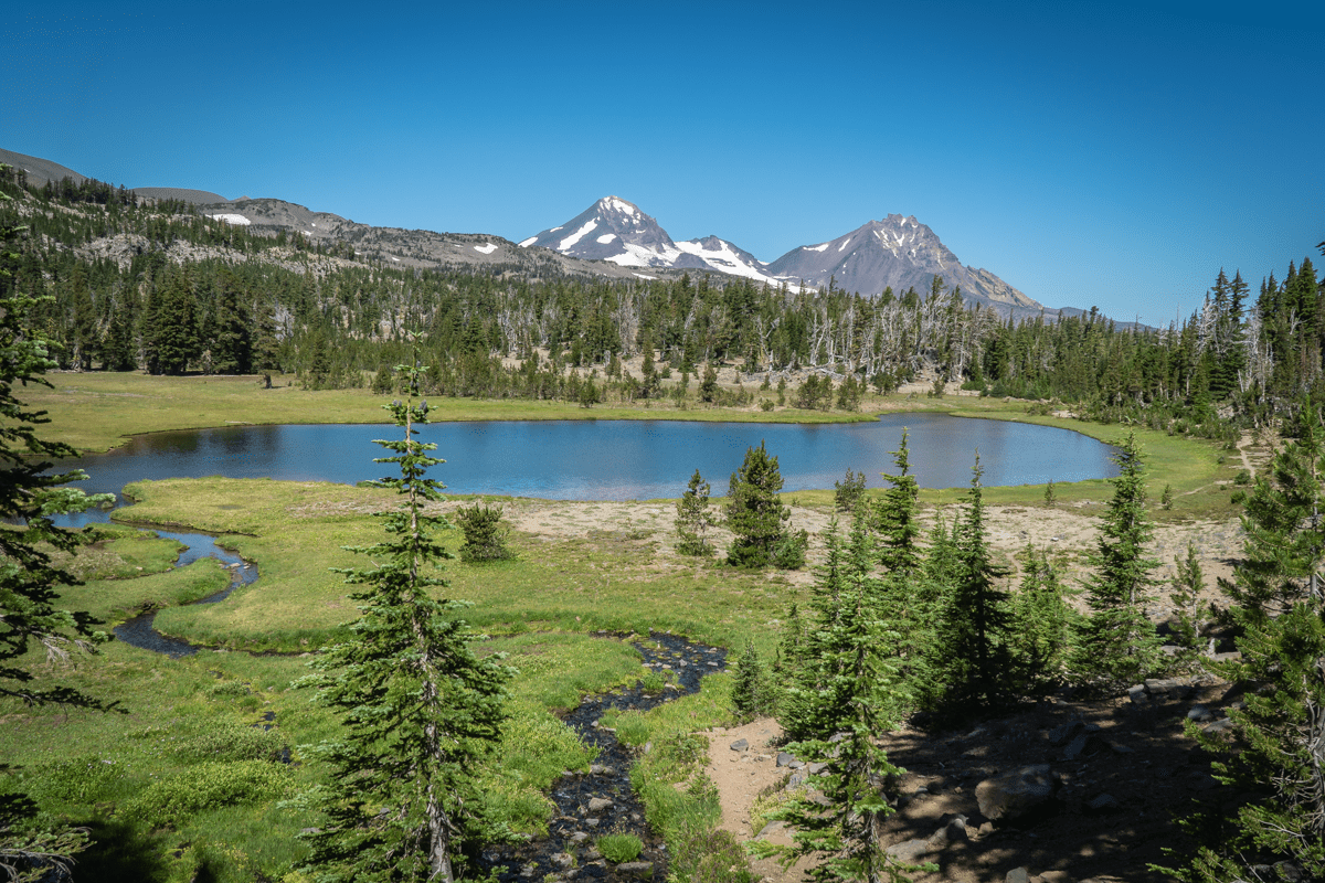
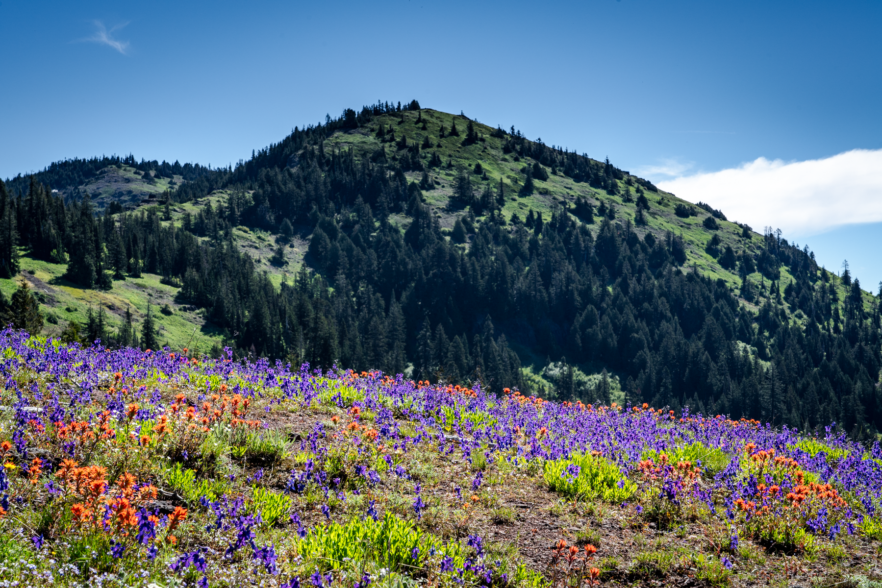
Our First Experience With Hiking Permits 2021 - Green Lakes to Golden Lake
Green Lakes is a Stunning Destination
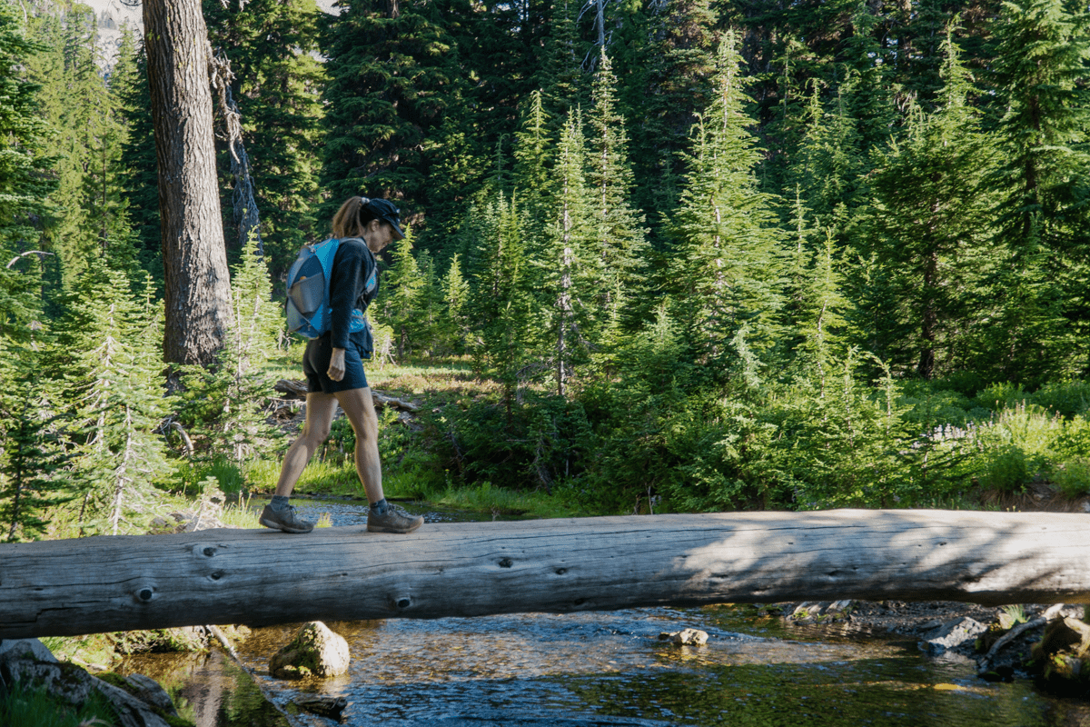
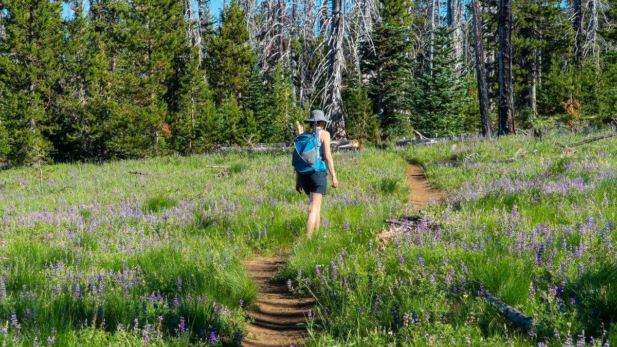
The Green Lakes trail, off Century Drive in the Central Oregon Cascades, has historically been one of the most popular hikes in Oregon. It has been used by families, trail runners, day hikers and backpackers for years as a beautiful and fairly easy hike to accomplish with the 4.5 miles and 1500 feet of gradual elevation change pretty doable for most. Over the years, we have hiked to Green Lakes many times, usually traveling on the east shore to the northern most lake, but enjoying the views and wildflowers and waterfalls of Fall Creek along the way. We have seen a huge increase of hikers traveling to Green Lakes over the years, but 2021 is the first year access to Green Lakes Trail is subject to the Central Oregon Wilderness Permit system. According to published articles, the Green Lakes/Soda Creek trails allow 120 day use permits during the 2021 hiking season.
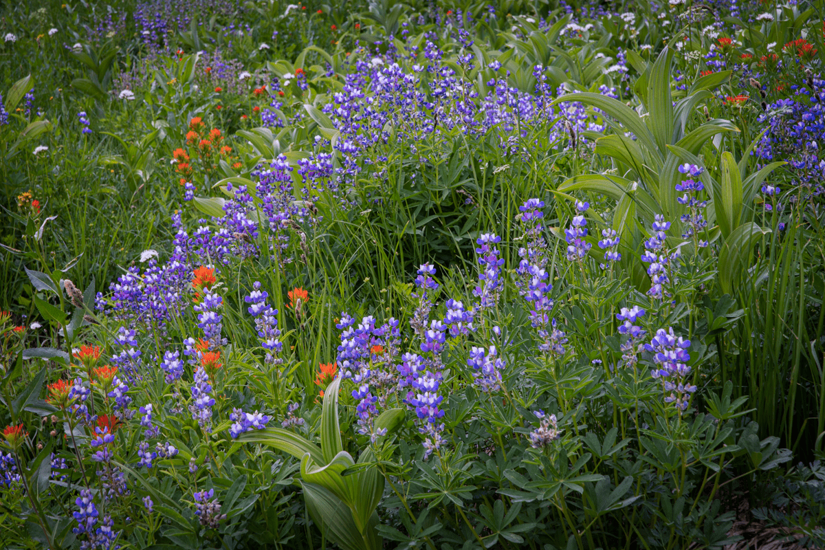
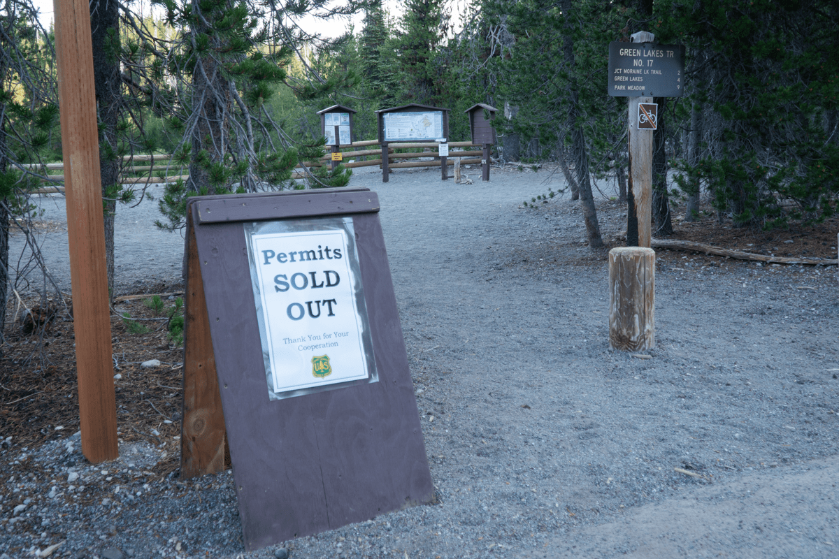 When we arrived at the trailhead at 7 am, we saw that all permits had been sold out. During the initial part of the hike, we saw just a small handful of people, mostly runners who were coming down from the lakes. The wildflowers were out and the waterfalls on Fall Creek were full and beautiful. Despite the mosquitoes, the experience was wonderful and our hike up to the lakes went very quick.
Once we arrived at Green Lakes, we looked around for the normal campers we were used to seeing at the 22 campsites around the lake. We only spotted 2, although there may have been others located on the west side of the main lake which we didn't see as we followed the trail north to the smallest lake.
 |
 |
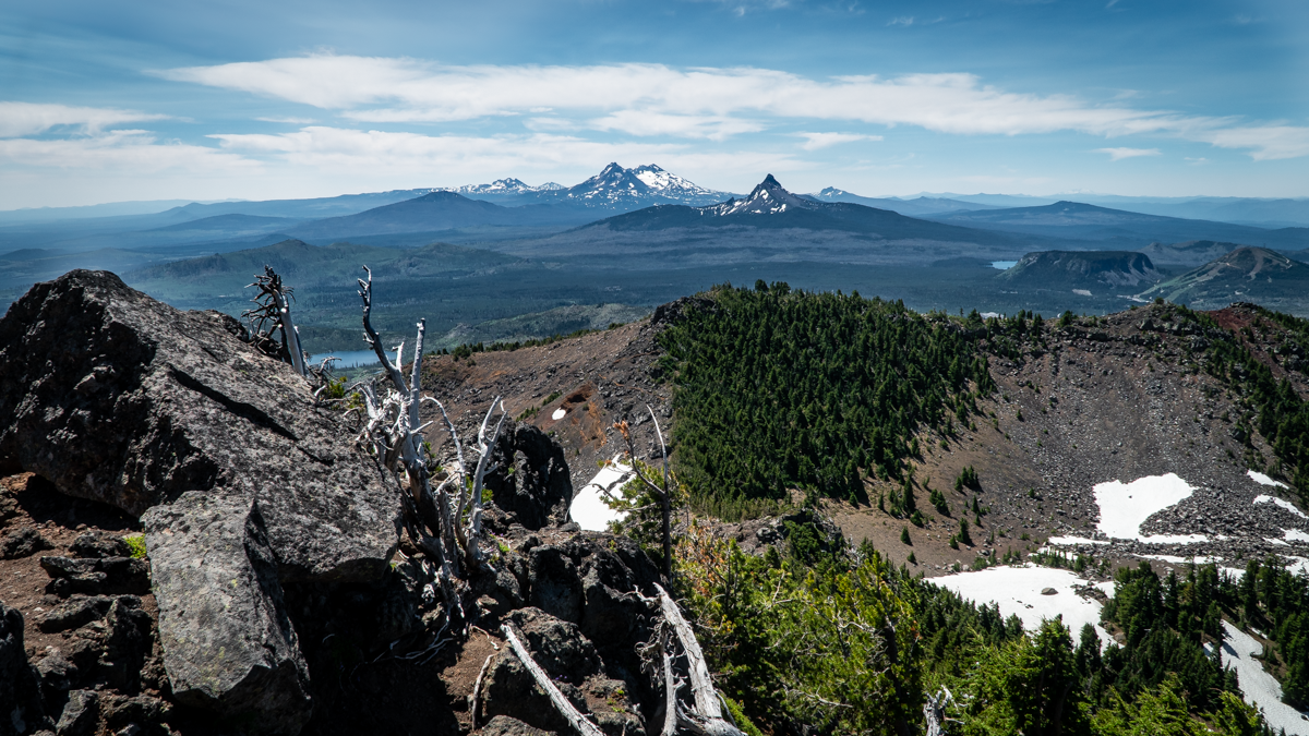
Last year was the first time we had hiked deeper into the Three Sisters Wilderness, following the trail past the northern most Green Lake up to the pass between South Sister and Broken Top, gaining 500 more feet of elevation. The views back toward Green Lakes were beautiful, as were the closer views of South Sister.
 |
 |
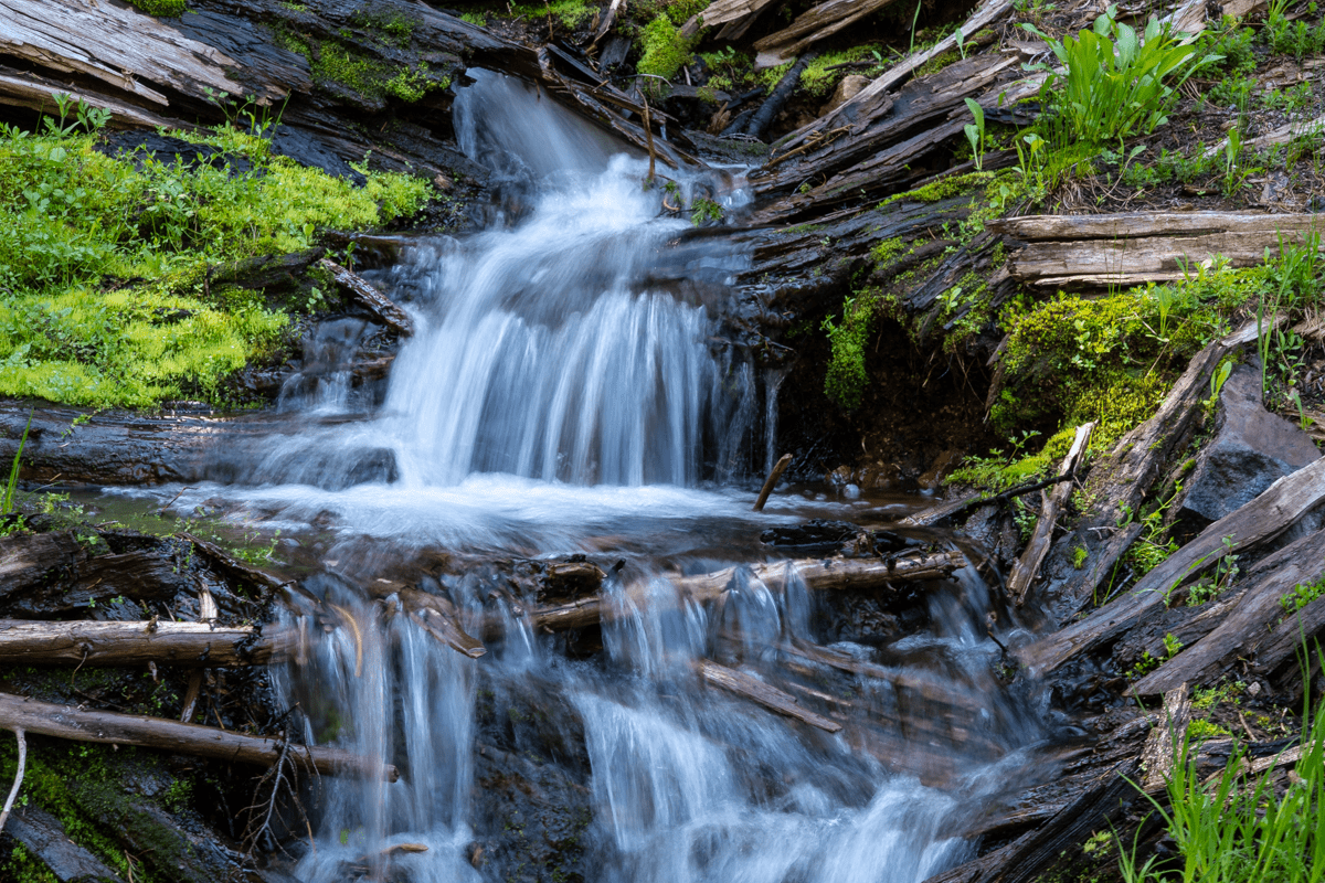
The trail in this part of the Three Sisters Wilderness is much less traveled. The few people we passed were all backpackers who were traveling multiple days with overnight stops at various campsites in the area. But the views of North and Middle Sister plus Broken Top from a different perspective make for a unique setting few people see . The trail towards Golden Lake is not marked, but if you are looking for it, it is obviously well traveled. It is about a half a mile from the main trail before the lake is seen. Golden Lake is called what it is due to the wildflowers which were past their prime when we arrived, but the basin was beautifully green and the waterfall across the lake its own special oasis.
 |
 |
All in all we hiked over 16 miles, a very full day, but enjoyed many beautiful views and new experiences. There is a reason why we believe the Central Oregon Cascades are among the most special places in the world and we look forward every year to seeing new sights in our local area.
7
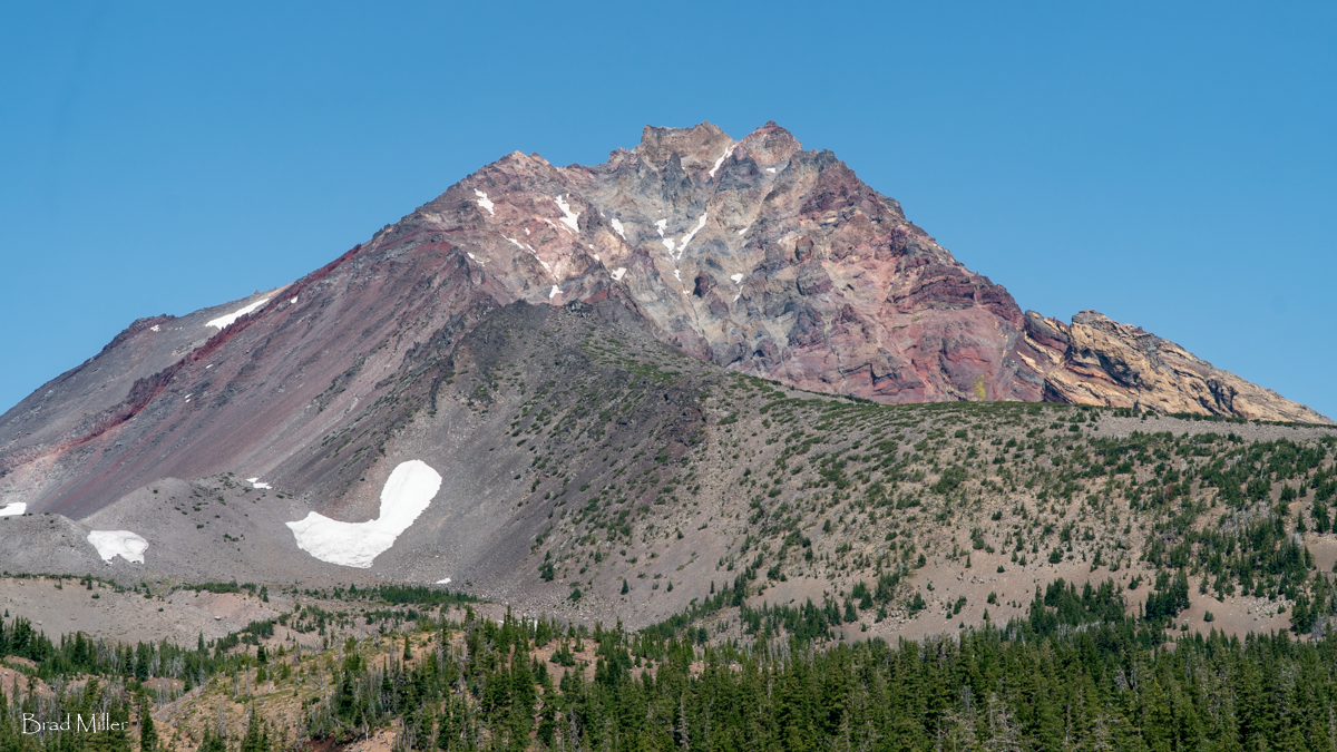
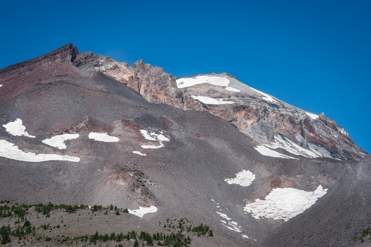
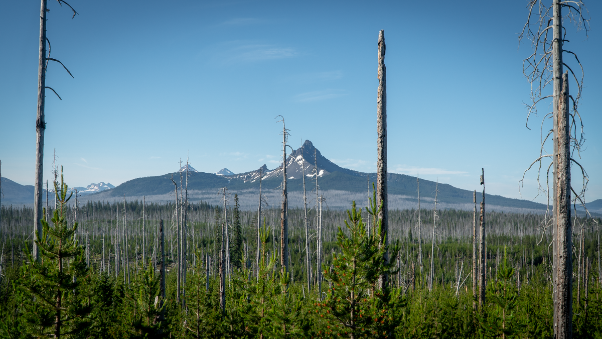
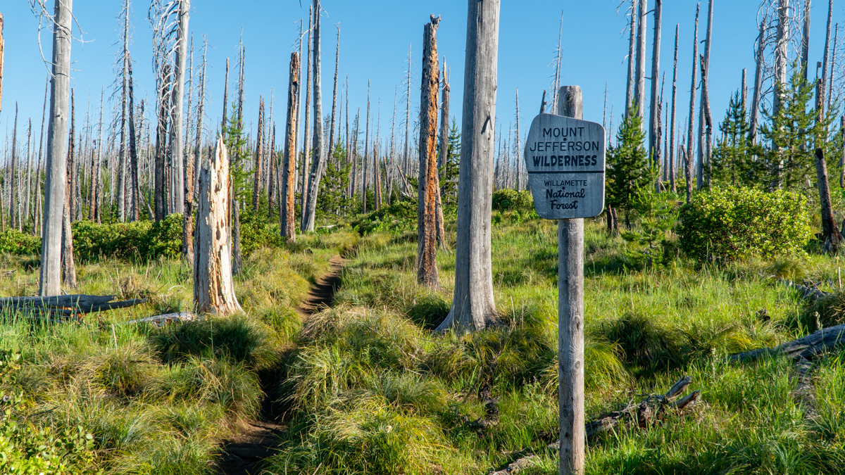
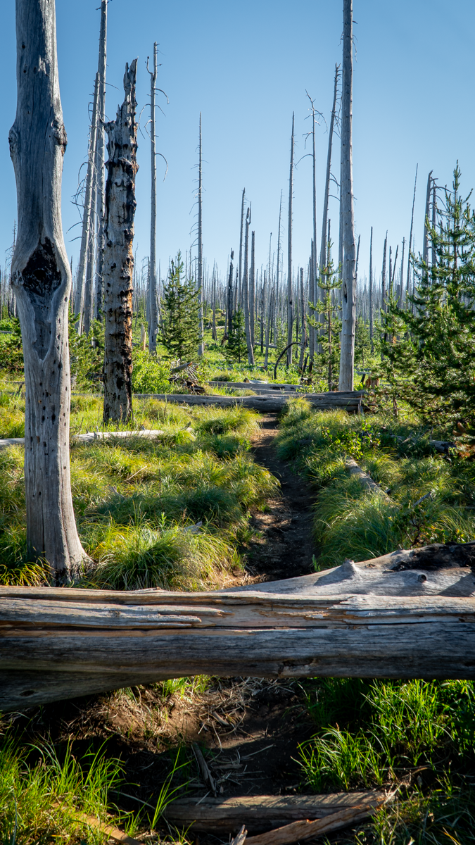
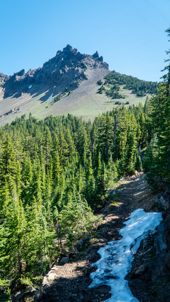
Three Finger Jack From Santiam Pass Offers Options for Hikers
We have hiked to Three Finger Jack's base several times through the NE access to it from Jack Lake via Canyon Meadow in the Mount Jefferson Wilderness. Last Saturday, July 3, 2021, we decided to hike to Three Finger Jack from the South from Santiam Pass along the Pacific Crest Trail (PCT). The route from Santiam Pass takes hikers through part of the 90,000 acres which burned in the 2003 B&B complex fire. 18 years later, the area still has many burned trees, but new growth is abundant with wildflowers, young trees and mosquitos. And the views toward Mt. Washington and the Three Sisters are evident through the burned trees, many of which have fallen across the trail and need to be either walked around or stepped over.
 |
 |
We had planned on hiking 5 miles in to what was described as a "viewpoint" in one of our hiking books. This hike would be roughly 10 miles round trip with 1500 feet elevation gain. However, as we proceeded along the hike and left the burn scars and entered areas of old growth forest, it became obvious that the trail app we were following was different than that which we read about in our local hiking book. The app led us to a "viewpoint" which was located just below the South Pillar of Three Finger Jack. As we climbed toward this extremely difficult location, we were half way before we recognized we had taken a wrong turn, but since we were half way, we became determined to complete the trek. The rewarding views were worth the difficulty, mosquito bites, and sore muscles. Plus we accomplished a "bucket list" item which we never had in the bucket to begin with. According to our app, we actually covered over 2300 feet of elevation gain and 12 miles round trip. We would not recommend this mistake to many, having determined that this unofficial trail is what is used by those few who rock climb the mountain, most of whom are much younger than us.
 |
 |
 |
 |
21
The 2021 Return to Iron Mountain
Iron Mountain Wildflower Hike is Always Special
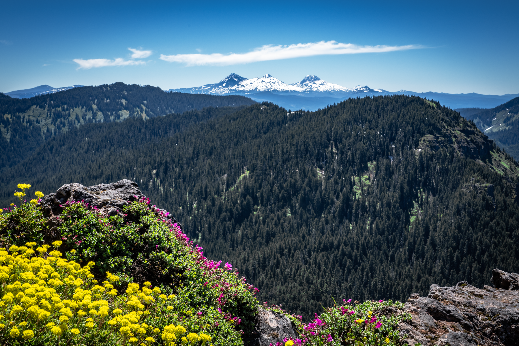
According to the US Department of Agriculture and the US Forest Service, nearly every wildflower found in the Western Cascades - over 300 species - can be found along the Iron Mountain Trail. There are five main factors which create the specific habitats for wildflowers: soil depth and type, moisture, amount of sunlight, daytime temperature ranges and elevation. These factors combine beautifully to create one of the most spectacular wildflower habitats in Oregon at Iron Mountain. Late June/early July is the best time to view the Iron Mountain wildflowers - and when you add in the extended 6.9 mile loop hike from Tombstone Summit through the Cone Peak Trail, up Iron Mountain, the 1900 feet of elevation gain provides many opportunities to see the multiple species of flowers.
Compared with our hike from 2020, the weather was about perfect with very few clouds and no smoke from wildfires. Once we climbed from our parking lot at Tombstone Pass through the old growth forest up to Cone Peak, we could see acres of wildflowers, although not as full as last year. The ground was drier than in 2020 and we believe our drought conditions and smaller winter snowpack impacted the early flowers. In addition, there were several downed trees which haven't yet been removed which created some hiking challenges, although nothing like what we have experienced in other hikes over the past year!
Upon reaching the summit (the former fire lookout), the views were spectacular with Cascade Mountains from Diamond Peak to Mt. Adams in Washington clearly visible, a distance of roughly 500 miles. Several families with younger children joined us at the summit and we were impressed that all those children were able to make the trek up, although it appeared that in some cases parents helped along the way. Our hike down the mountain and through a different old growth forest back to our car parked at Tombstone Summit went fairly quick and the drive back to Bend uneventful. All in all, it was a fulfilling day.
 |
 |
17
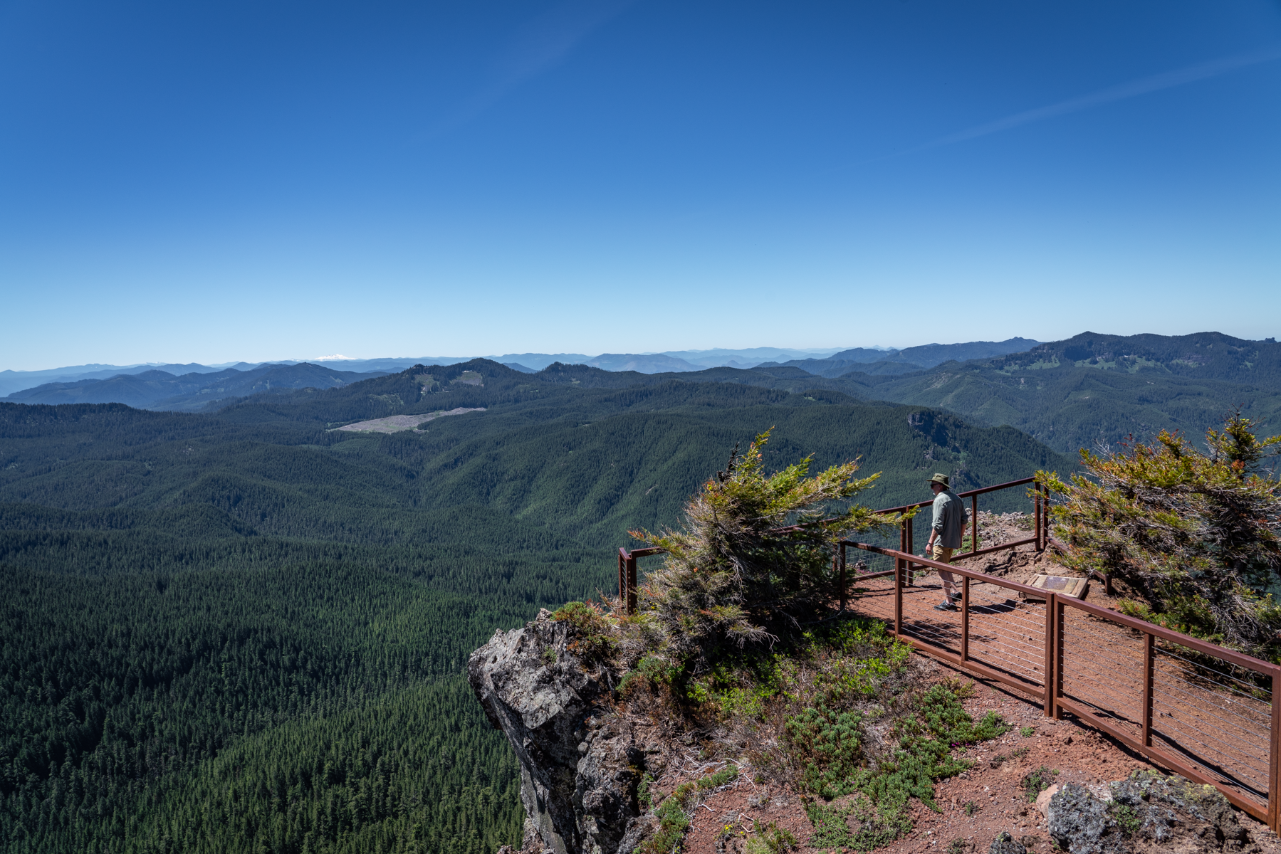
Paulina Peak - Amazing Views and Lots of Volcanoes
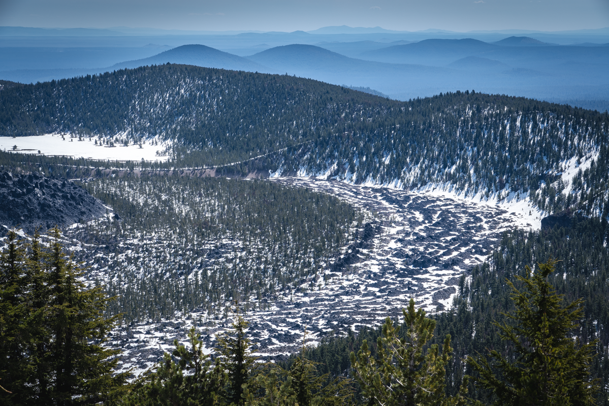
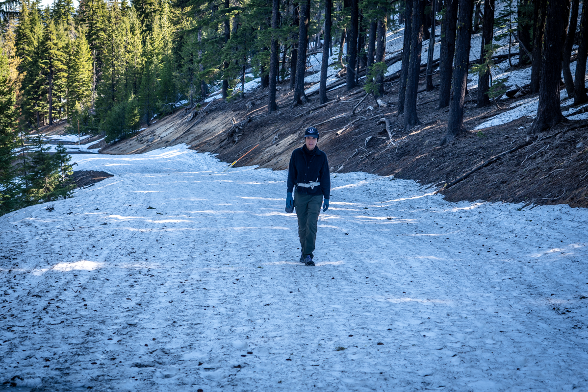
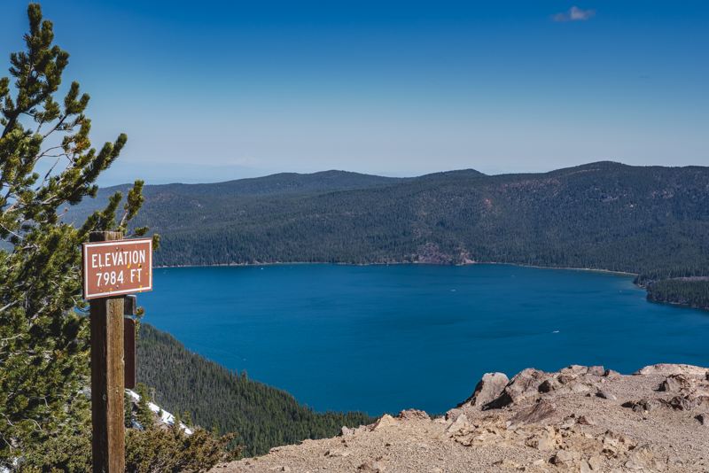
Having lived in Central Oregon for over 35 years, climbing Paulina Peak was on our bucket list of never done hikes. Last Saturday, May 14, 2021, we checked that hike off the list. We had anticipated that Newberry Crater National Volcanic Monument would be closed still as it is every winter, but were pleased to find that the unmanned gate to the monument was open and boaters were already enjoying outings on Paulina Lake and East Lake. We had planned on a 14 mile hike from the gate, but instead were able to drive to Paulina Lake Campground and park there before crossing the street to the gated road to Paulina Peak. This gravel road is normally open for cars to drive to the peak in the summer, but instead we hiked it to the top, avoiding the actual trail since we believed there would be a lot of snow drifts along the way. The 3 plus mile road to the top was fairly easy to hike, despite some sections still covered by snow. We gained 1600 feet in elevation from the trailhead to the top of the peak (just under 8000 feet) and as we climbed, were thrilled with all the views we had, not only of the Cascades, but also south and east toward Fort Rock and Christmas Valley.
At the top of Paulina Peak, there is a pit toilet (still closed) and wonderful views, although our vistas of the Cascades were hazy with controlled forest burns scattered around Central Oregon Saturday morning.
Some interesting facts about Central Oregon - there are roughly 400 volcanoes in our area. And three of the top ten classified as "very high threats" by the United States Geological Survey (USGS) are here as well...Crater Lake, South Sister, and Newberry Volcano - right where these photos were taken.
 |
 |
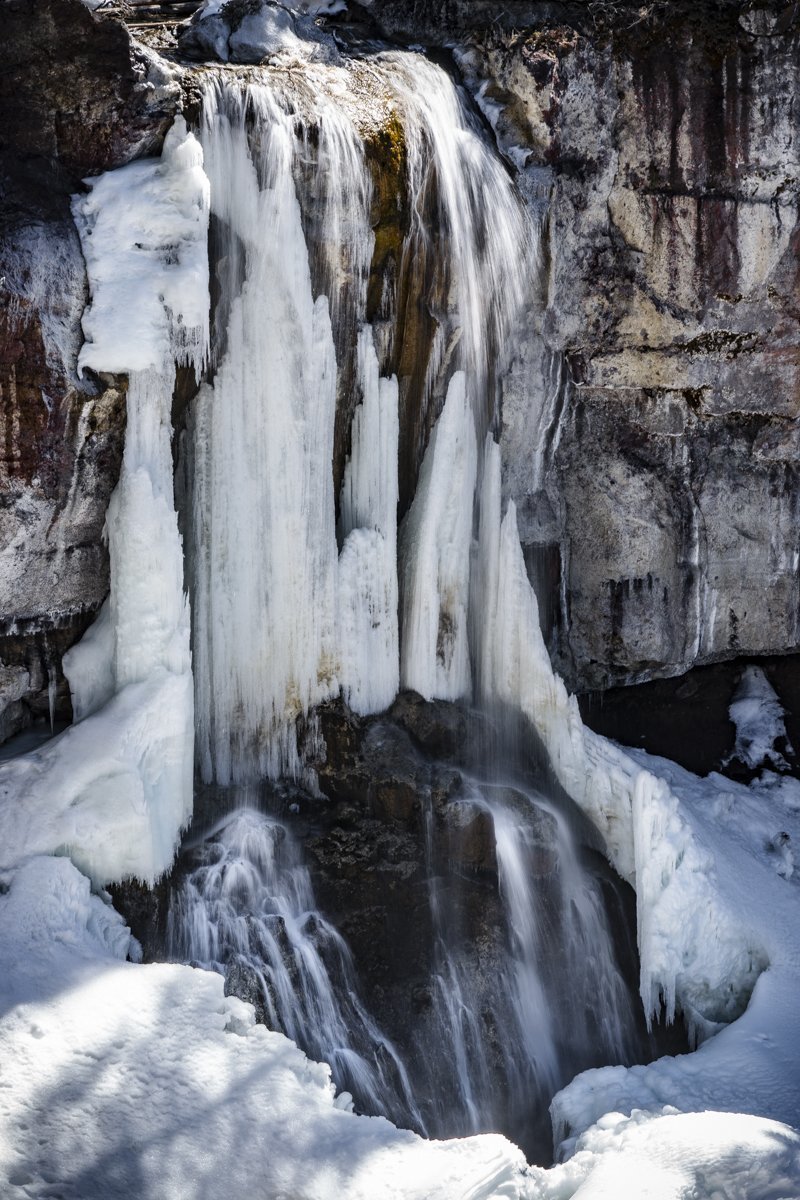
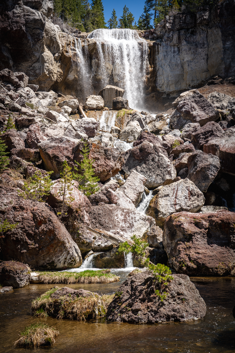
Since our anticipated 14 mile hike was shortened to roughly 6 miles and we were done a lot earlier than planned, we stopped off at Paulina Falls on the way back to Bend and trekked the 1/4 mile down to the base to view the falls. We had hiked Peter Skene Ogden trail the month previous which ended at Paulina Falls on the other side of the river. Quite a difference in one month!
 |
 |