Posts in category 'Why We Love Central Oregon'
Subscribe and receive email notifications of new blog posts.
 RSS Feed
- 2026 | 72 Posts
- 2025 | 103 Posts
- 2024 | 110 Posts
- 2023 | 72 Posts
- 2022 | 52 Posts
- 2021 | 70 Posts
- 2020 | 84 Posts
- 2019 | 38 Posts
- 2018 | 48 Posts
- 2017 | 39 Posts
- 2016 | 31 Posts
- 2015 | 10 Posts
2
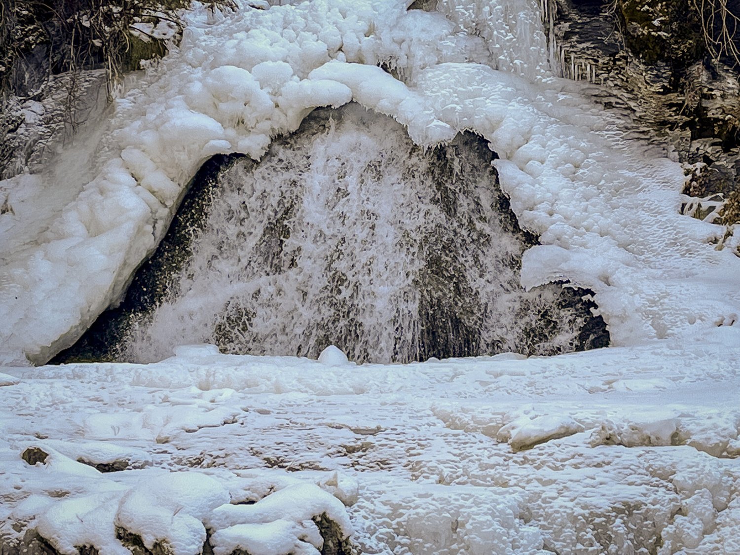
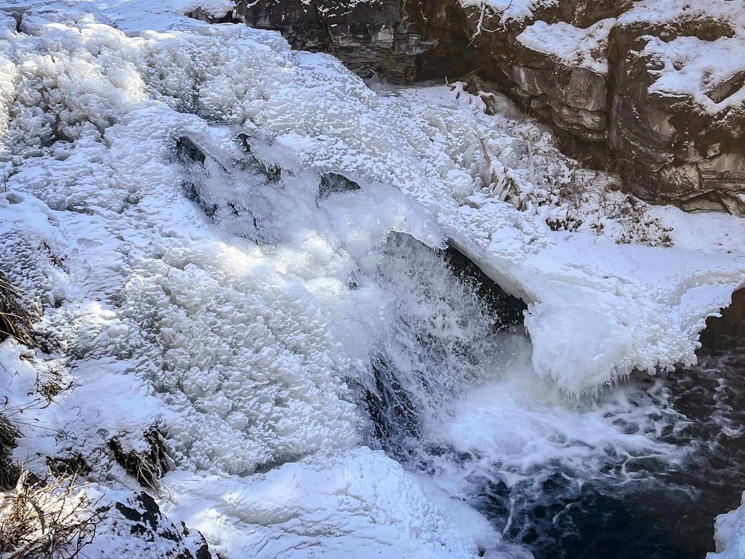
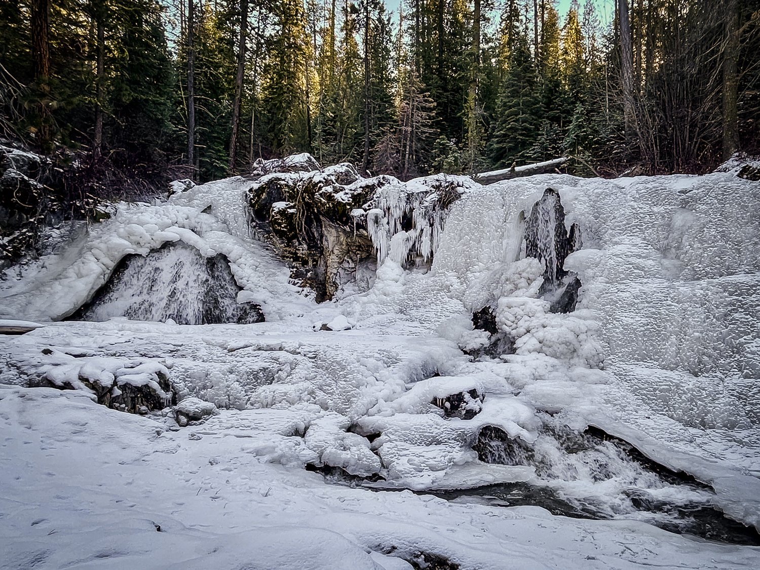
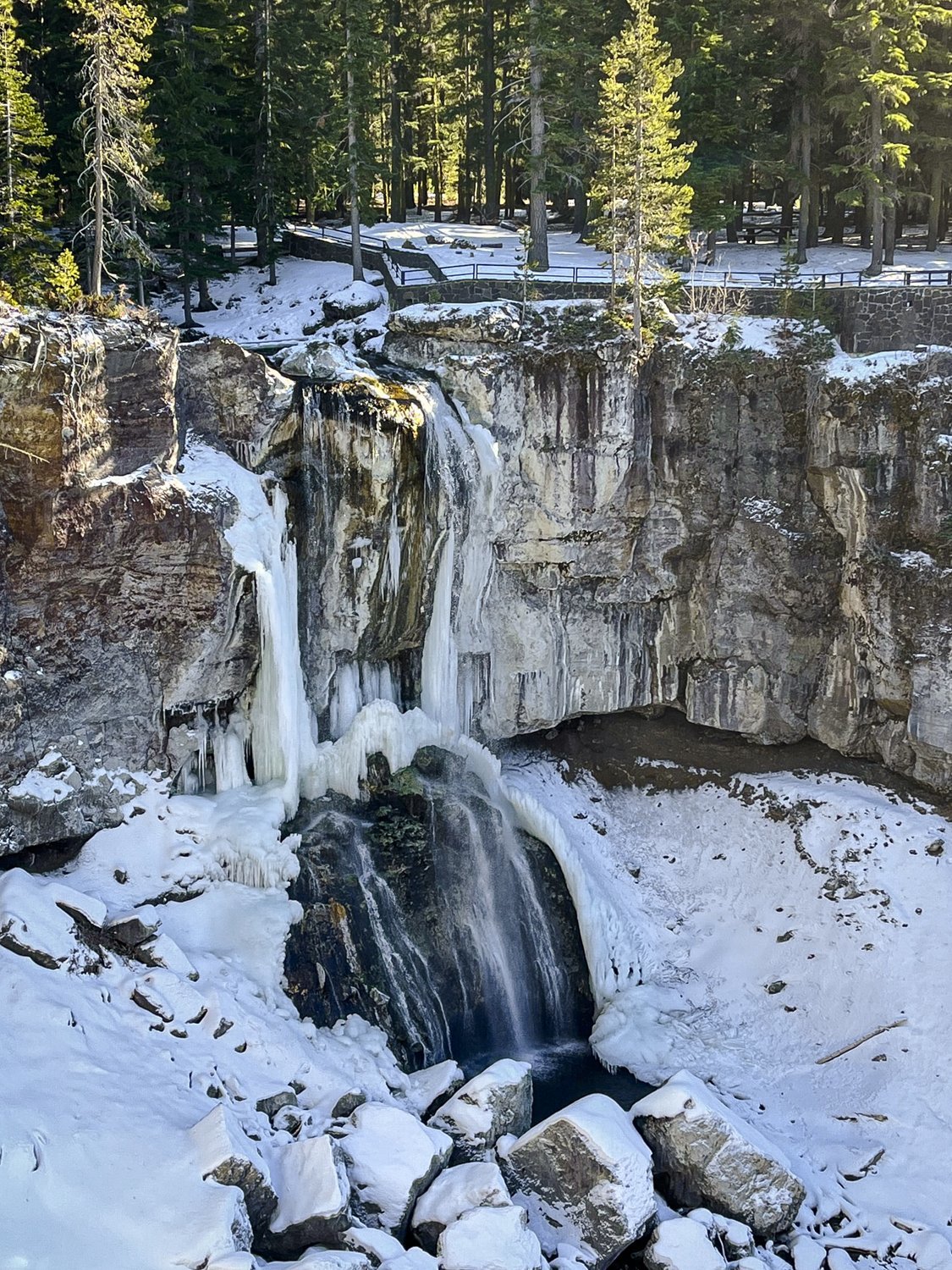
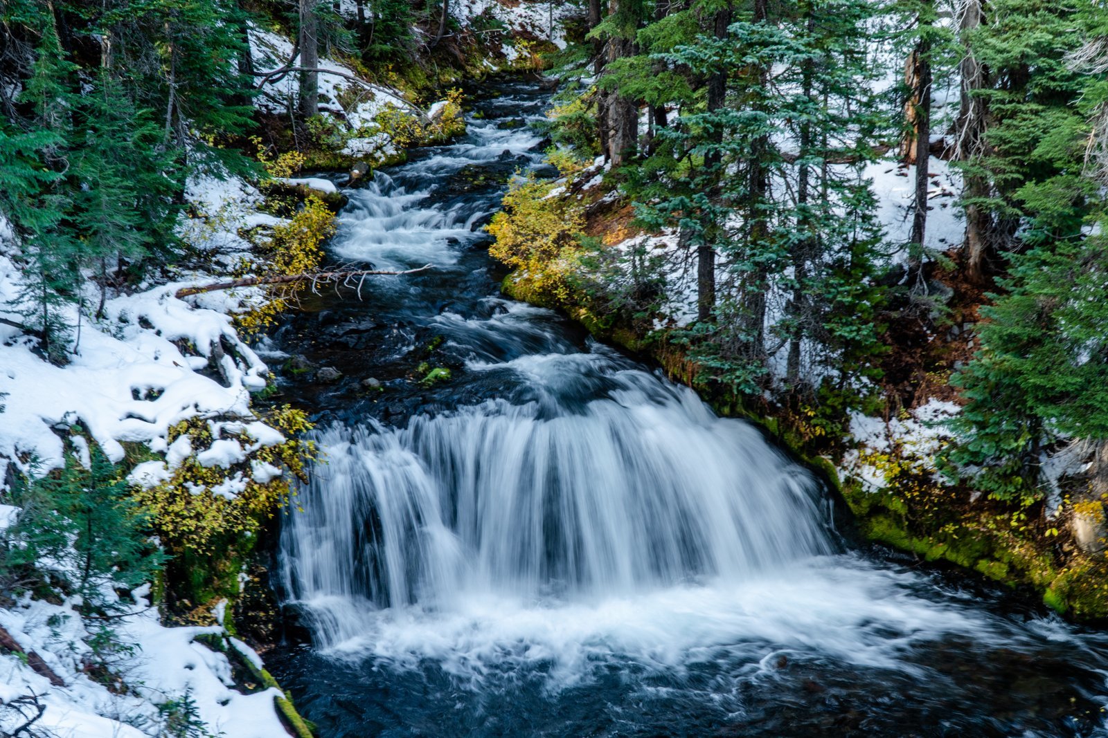
Chasing Frozen Waterfalls in Central Oregon
Paulina Creek in Late Fall Worth Seeing
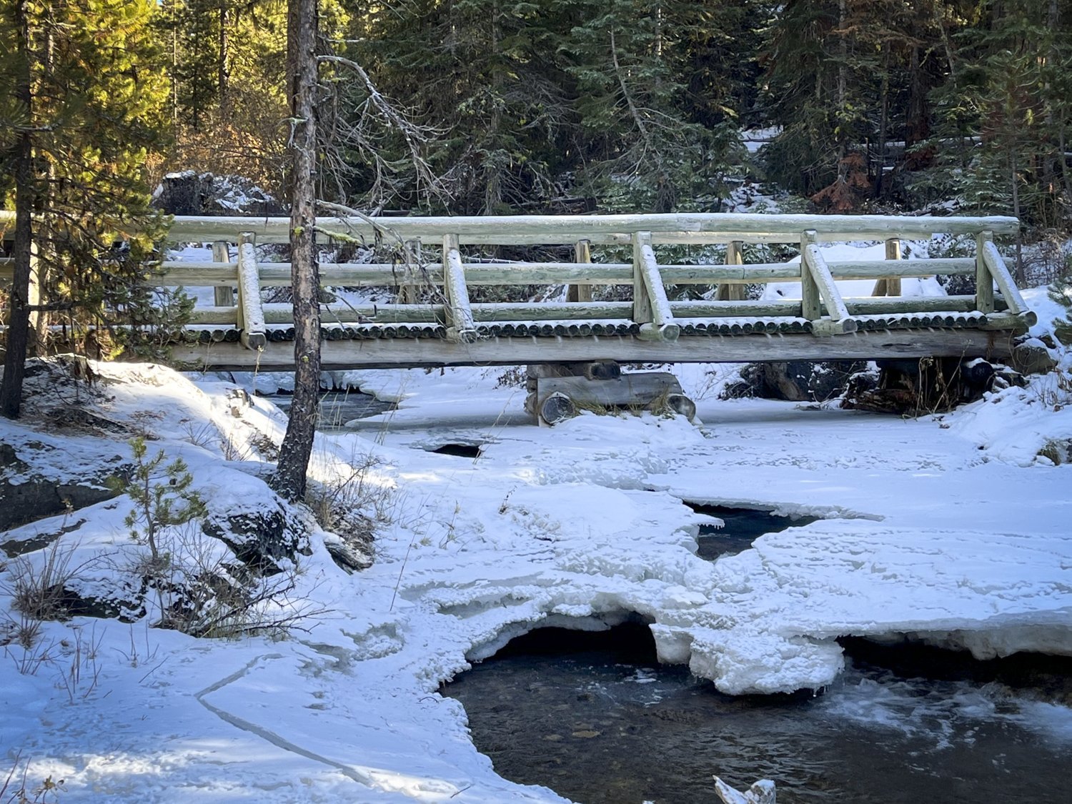
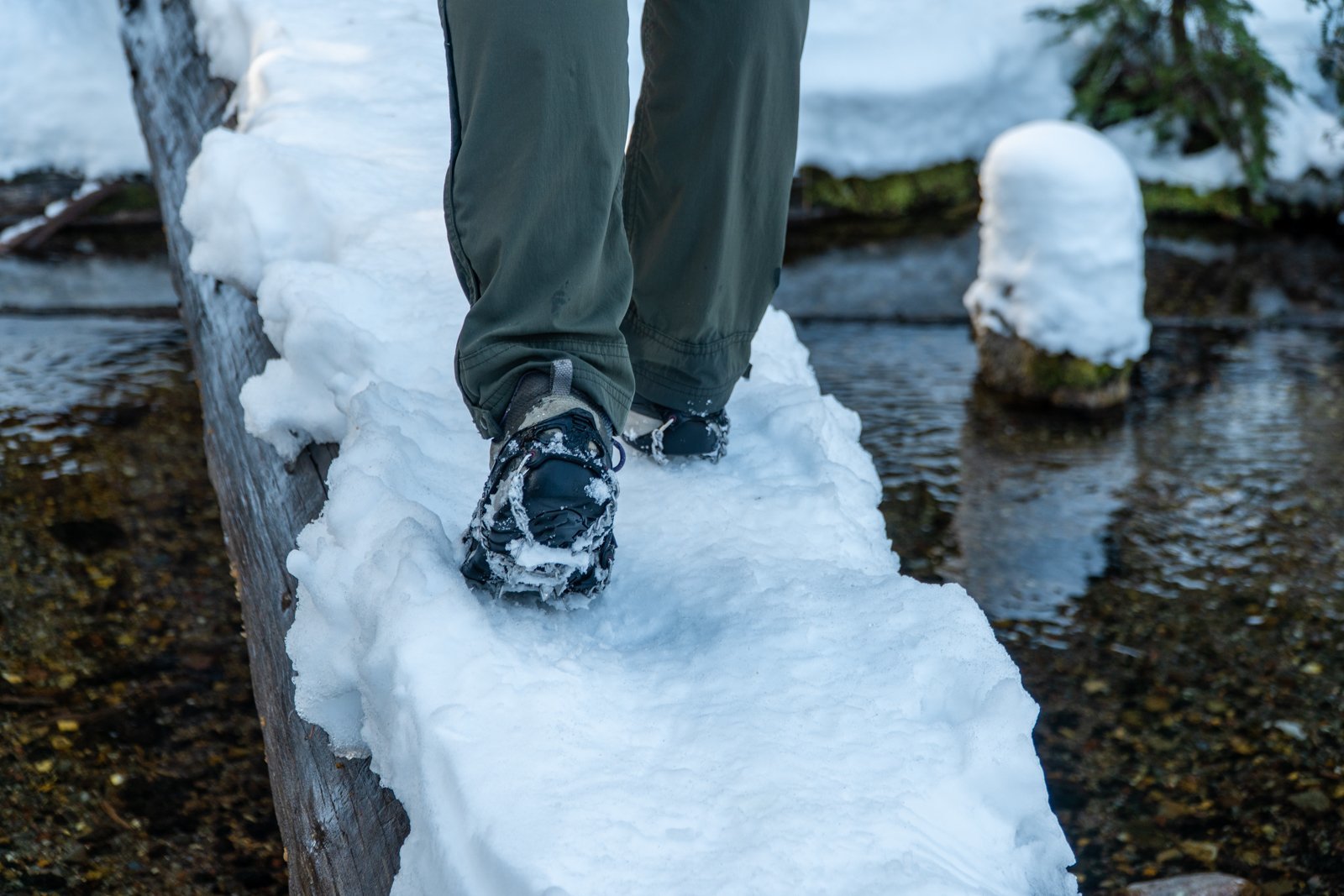
We have hiked the Peter Skene Ogden trail many times, but we never tire of doing this when the weather turns cold. Paulina Creek freezes and the multiple waterfalls along the trail turn into beautiful works of art with ice sculpted into interesting shapes. The sounds of the running water are also muffled when the ice gets deeper and the quiet and isolation of the hike will amaze. On November 26, 2022 we hiked Peter Skene Ogden trail from McKay Crossing campground up Paulina Creek planning on going as far as the early snow permitted. We we pleased to find we could trek the entire way to Paulina Falls using our micro spikes as the trail was icy; the deepest snow was roughly a foot in a shadowed gully roughly 2/3 of the way to Paulina Falls. During the hike we enjoyed total privacy with no other hikers seen the entire day. But the views of the partly frozen waterfalls were lovely and the 13 miles in and out were well worth the experience. We highly recommend this hike in the winter, but be prepared for deep snow as the season progresses.
 |
 |
 |
 |
4
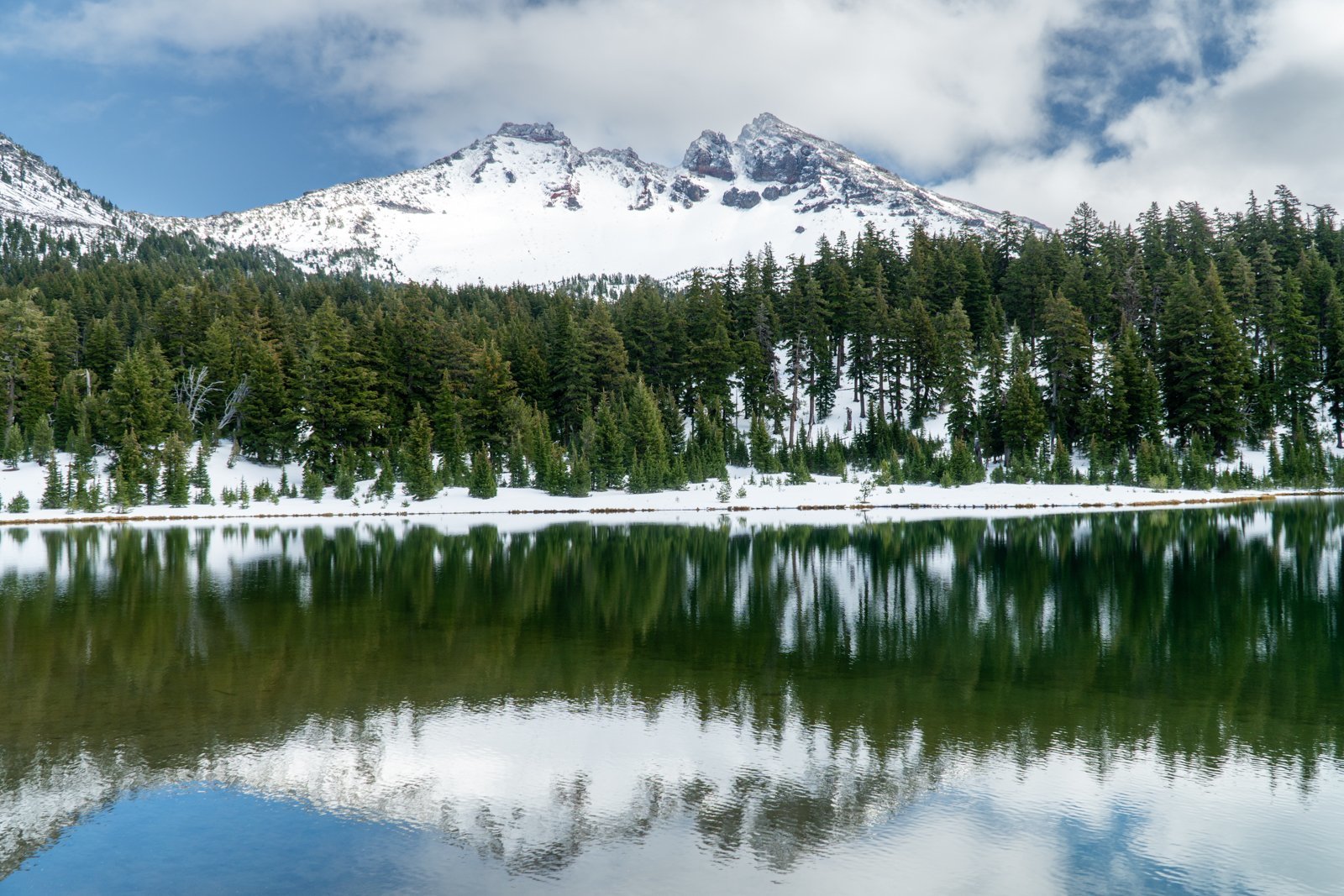
Green Lakes in the Fall, 2022
Green Lakes is One of Central Oregon's Most Beautiful Hiking Destinations
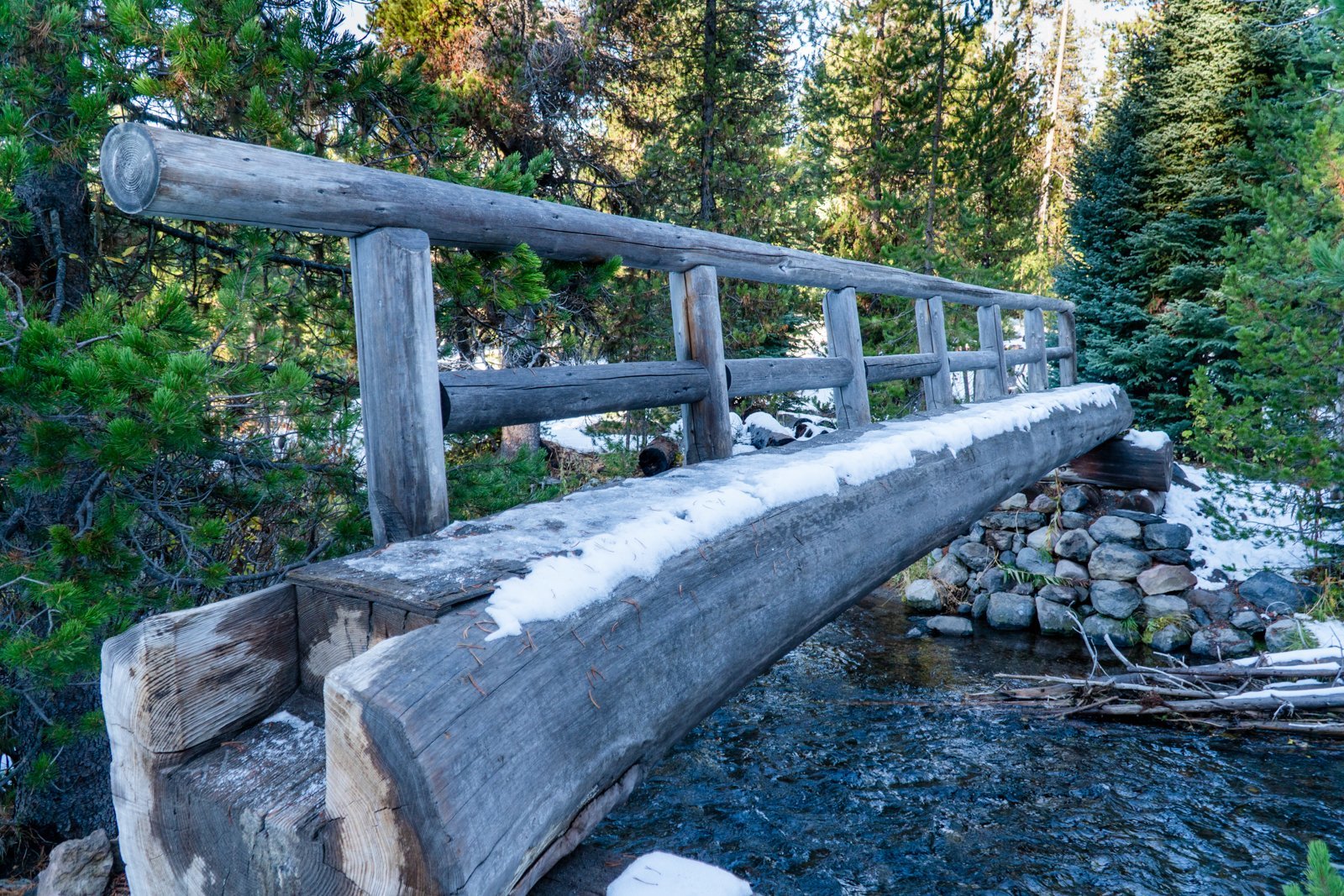
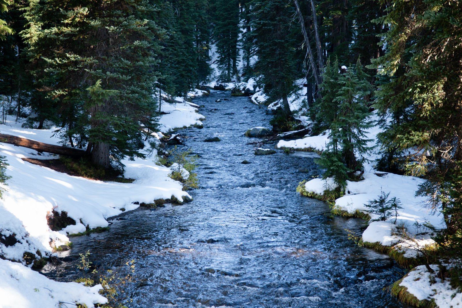
We have hiked to Green Lakes many times over the years, with each visit unique and special. However, the hike we experienced 10-29-22 has to have been among the very best, something we would call magical. The first snow of the season had fallen earlier in the week, but the day was brilliant with clean, clear air (all summer forest fires finally out due to the snow). The trail was a bit icy, but with microspikes, the packed snow was easy to manage.
 |
 |
The early snow covered a lot of the fall foliage, but Fall Creek with its numerous waterfalls was full and beautiful. And every now and then some lovely fall color could be seen.
 |
 |
When we reached Green Lakes, the handful of people we saw during the hike all traveled to the peninsula on the main, largest lake. However, we hiked to the first, smaller lake, post-holing through one foot of snow to the far side of the lake which provided us with stunning views of South Sister mirrored in the lake water. We sat on a fallen tree trunk and watched the lake and mountain for 45 minutes, seeing the clouds near South Sister's summit eventually blow away. During this time, we didn't see another person. On our return to the main trail, the views of Broken Top were the best we had ever seen from Green Lakes. It was truly a magical day.
19
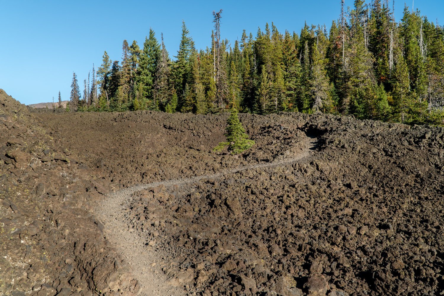
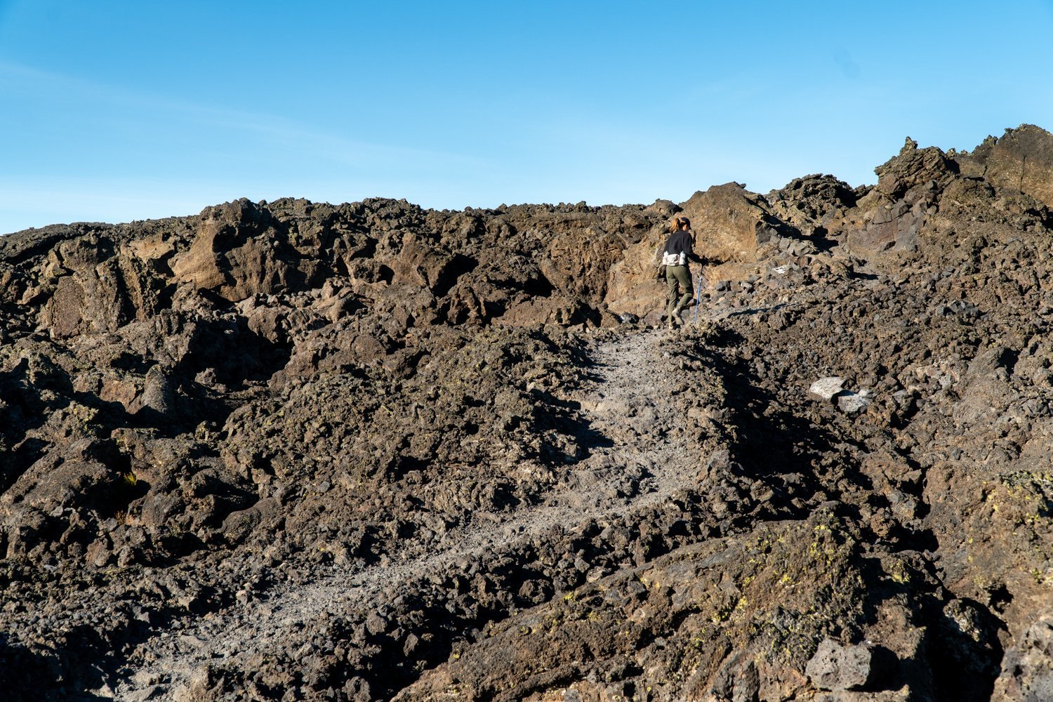
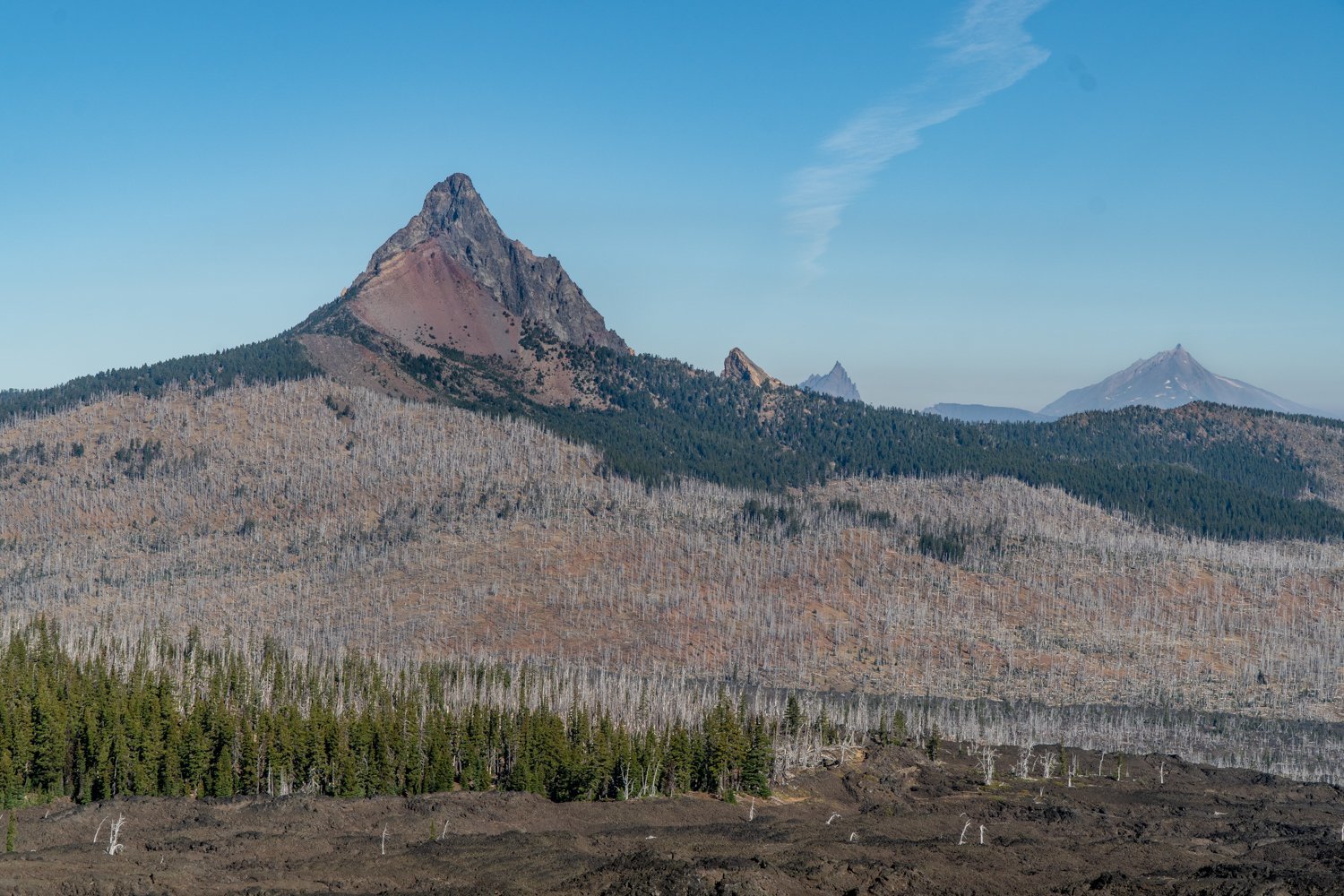
Belknap Crater Hike in the Mt. Washington Wilderness Treks Through a lot of Rock
Lots of Sun and Exposure on Little Belknap Crater Hike
Wear a hat and have good shoes if you decide to hike to Little Belknap Crater. With little shade, summertime temperatures can be high, so a fall hike is recommended. This was the second time we hiked to Little Belknap, so we knew what to expect. We took this hike on October 15, 2022, the last day for the required 2022 Central Cascades Wilderness Permits and we saw a total of 10 other people the entire time. It was a beautiful fall day with temperatures reaching the 60's, and despite some haze from the Cedar Creek fire which has been burning in the Willamette National Forest since early August, the views were good. After taking in the sights from the top of Little Belknap, we elected to continue on the Pacific Crest Trail to see if we could reach George Lake near Mt. Washington, a place we have never been.
 |
 |
 |
 |
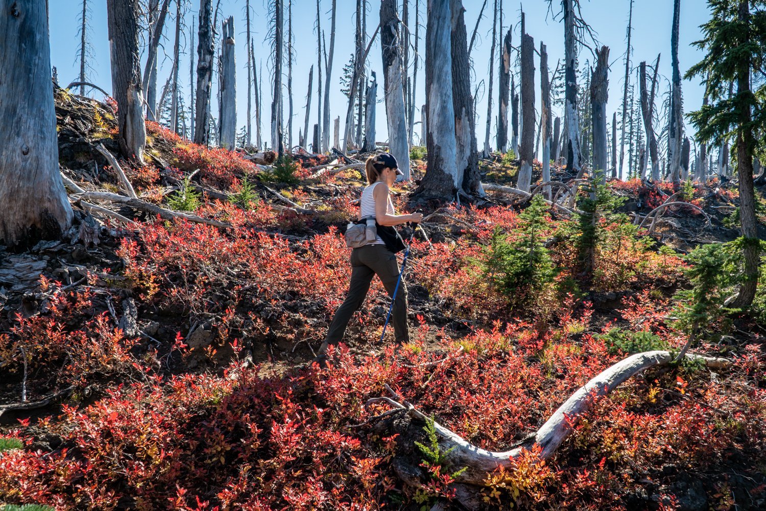
As we hiked past Little Belknap and the end of the acres of lava rock, we entered the forest and enjoyed the trees and fall foliage before, to our surprise, we were back trekking through lava rock interspersed with dead trees, the result of the 2017 Milli Fire. However, there were signs of new life with young trees and plants and even chipmunks and ground squirrels. Once we reached the end of the lava, the PCT turned left and the trail continued around the flanks of Mt. Washington. However, we had already hiked over 5 miles. Knowing we still had to hike out, we turned around and returned the way we came; we will have to find George Lake another day. All in all we traveled over 10.5 miles with 2000 feet of elevation gain mostly over difficult hiking conditions with the loose rock.
9
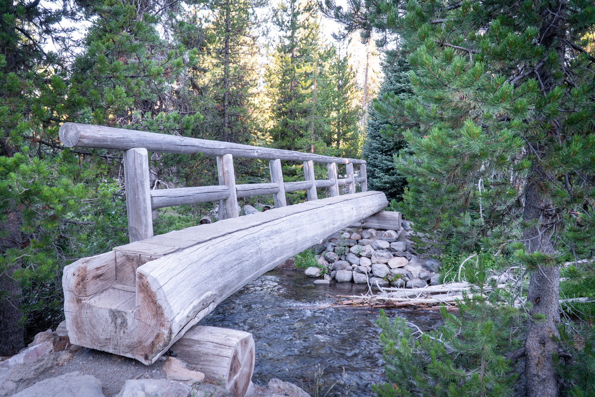
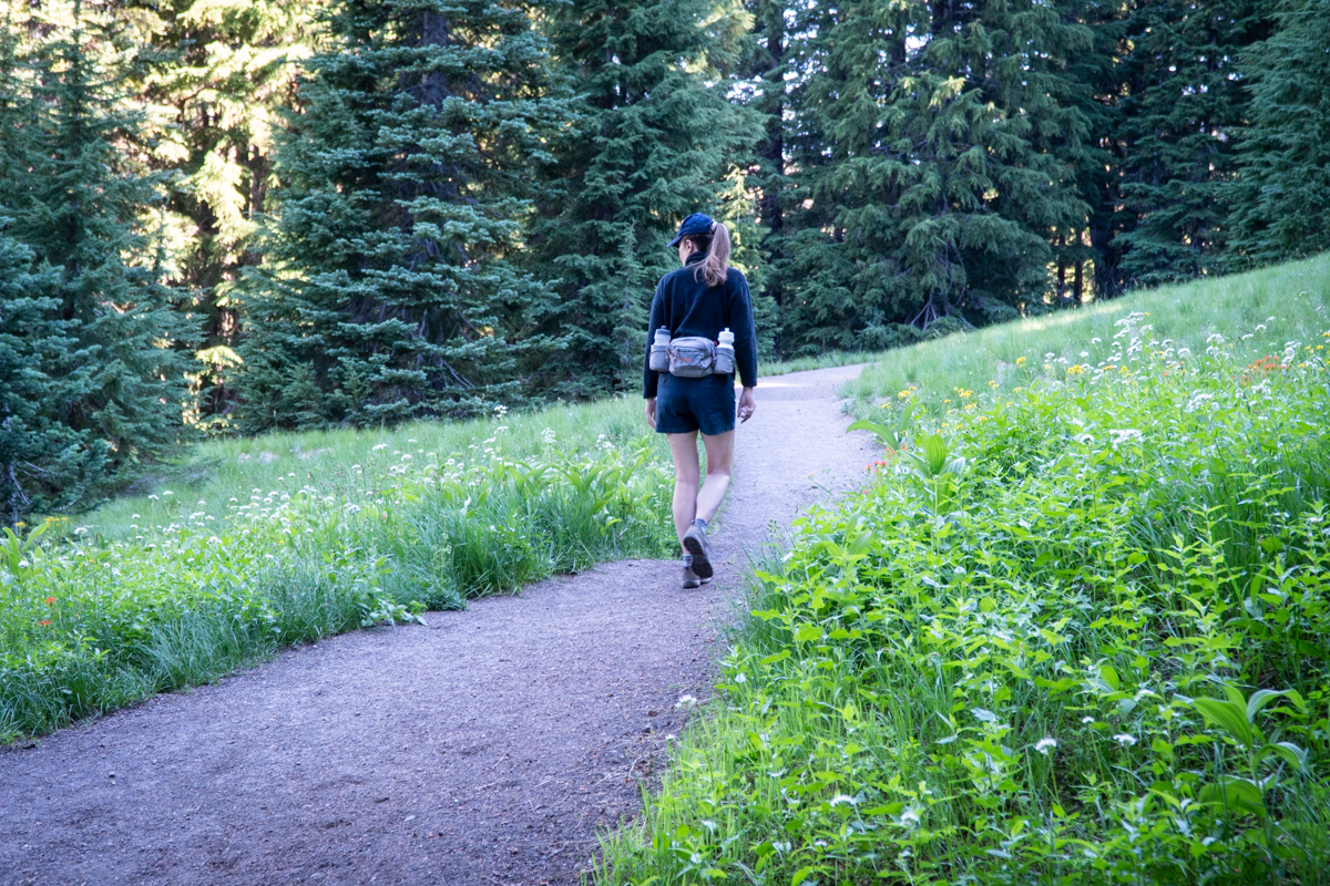
Green Lakes Hike is the Toughest Ticket in Town
The hardest tickets to get in Bend are not to the great acts at the Hayden Homes Amphitheater, but rather the trail pass required to hike the Green Lakes trail. These tickets literally sell out in 60 seconds once posted on the Forest Service website.
 |
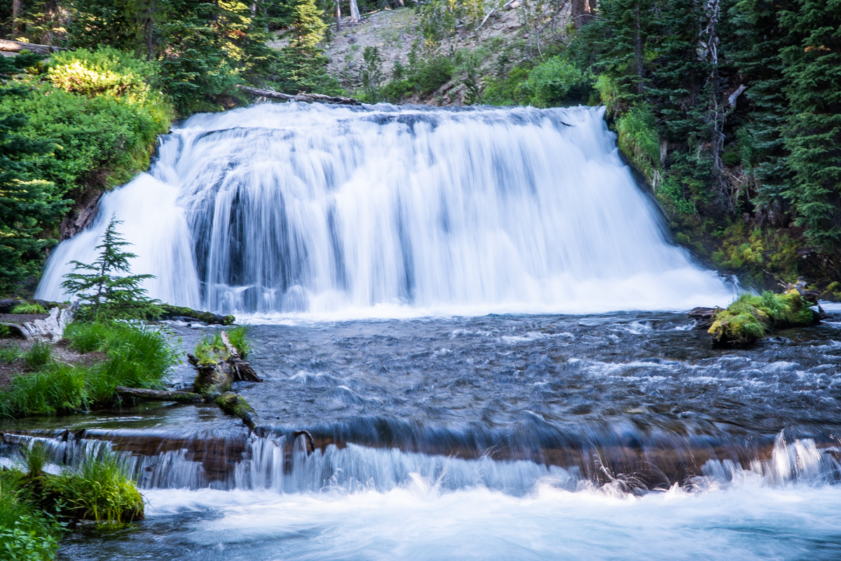 |
The trail largely runs alongside Fall Creek, which you will cross three times.
 |
 |
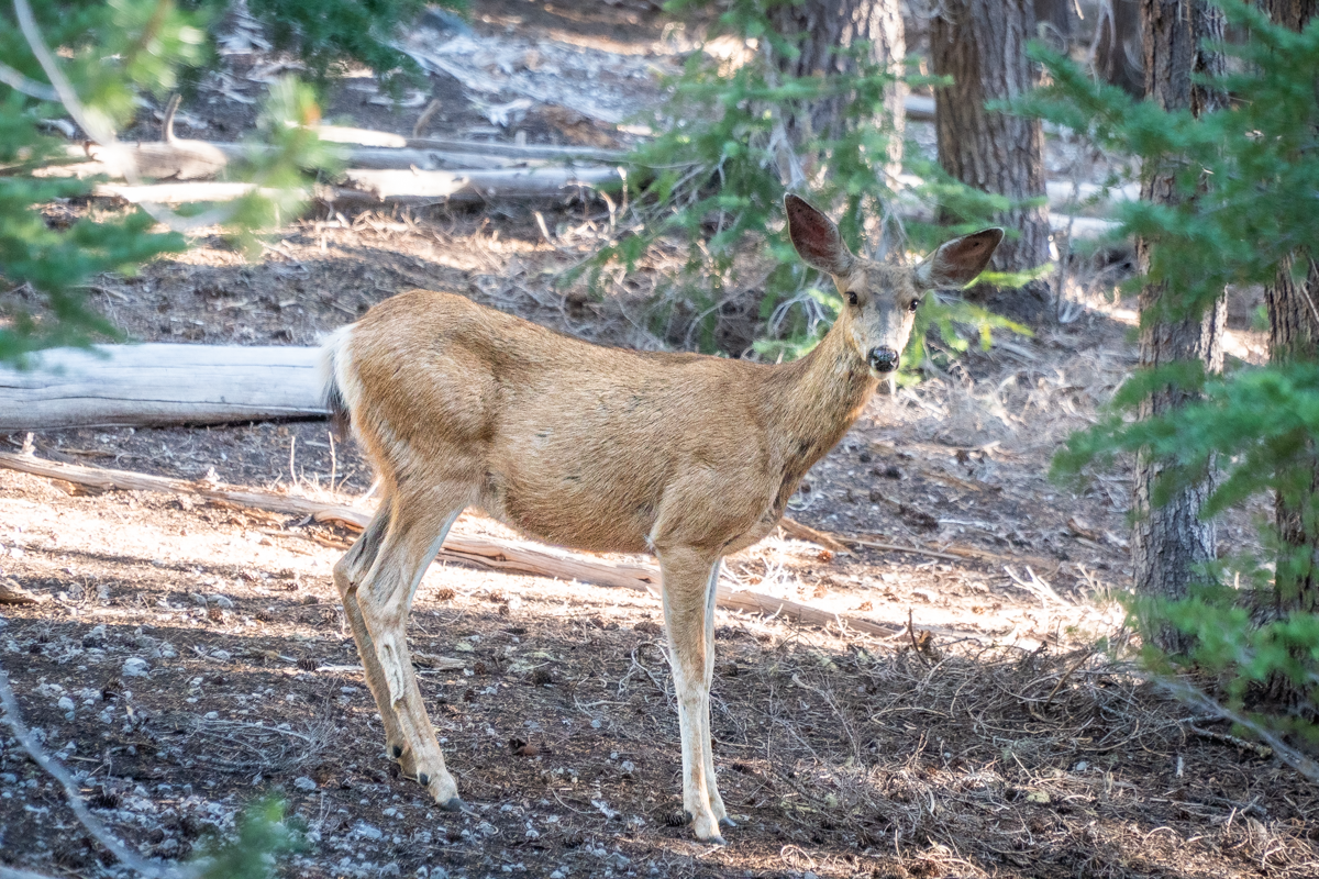
And there is simply no shortage of beautiful waterfalls, wildlife, wildflowers, and amazing views along the way.
 |
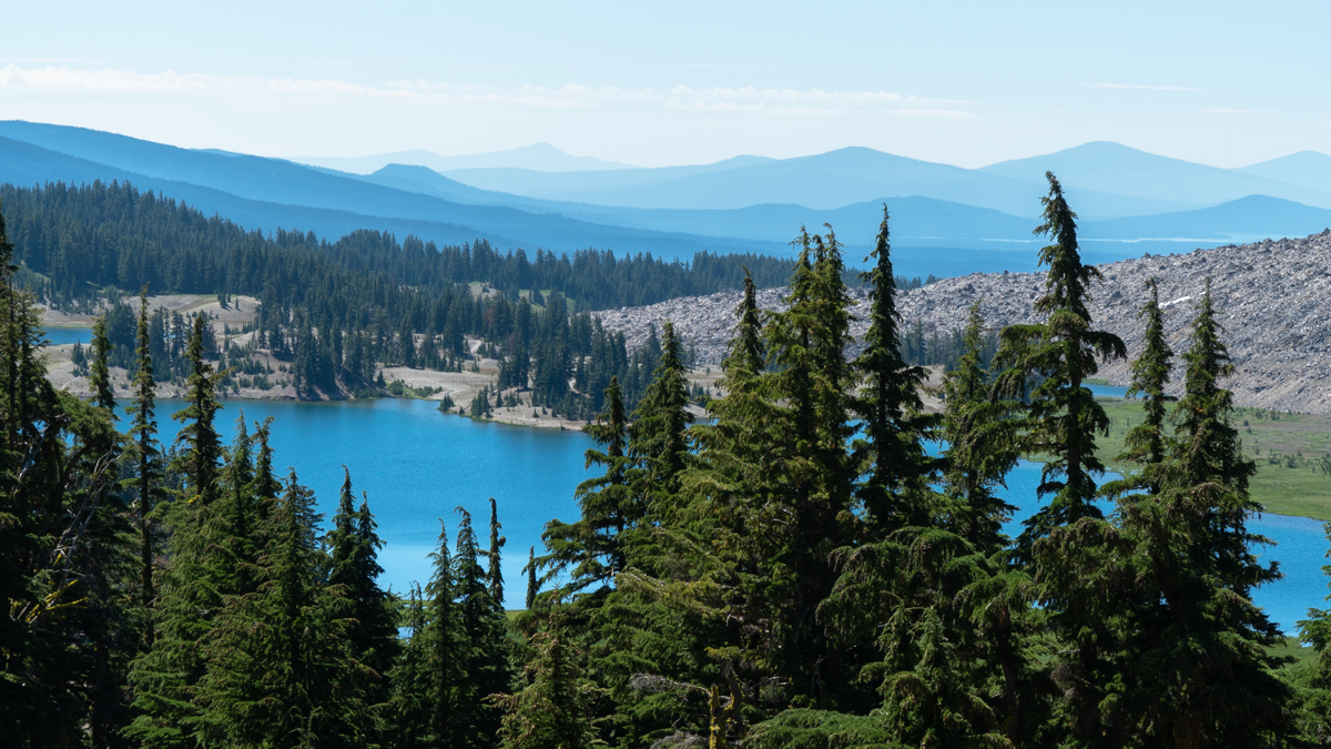 |
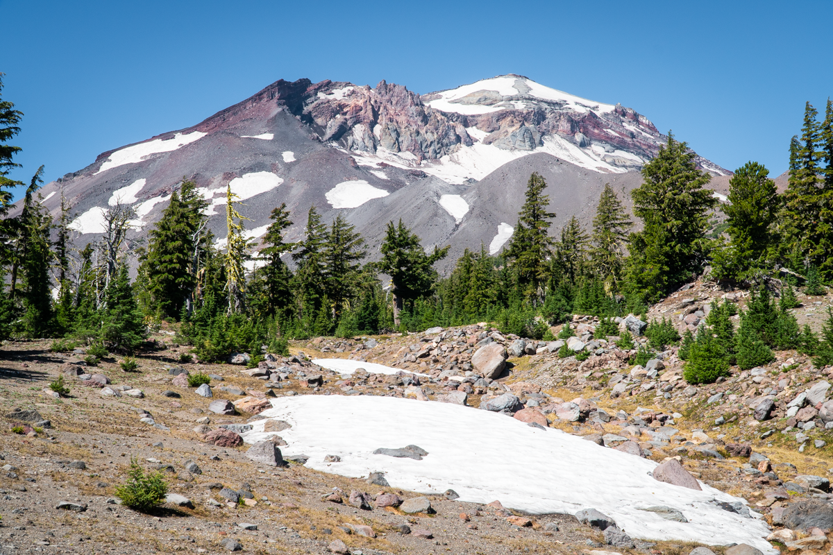
This trail is considered moderate due to it's length of 9.1 miles round trip and 1200 feet elevation gain, but it is pretty gradual almost the entire way and a very enjoyable adventure. For the adventurous, taking the path past the last lake deeper into the Three Sisters Wilderness will result in views few experience, including the Northeastern flank of South Sister and Northwest sections of Broken Top, and vistas including Mt. Hood, Mt. Jefferson, North and Middle Sister and Black Butte. A look back toward Green Lakes, if you can avoid looking the towering figures of South Sister, Mt. Bachelor and Broken Top, may make you think you are seeing the Great Smoky or Blue Ridge Mountains. If you opt to take this additional path, you will add a minimum of 500 feet of elevation gain plus 4 miles in and back. If you want to go even further in you can reach Golden Lake, which is an experience in itself.
25
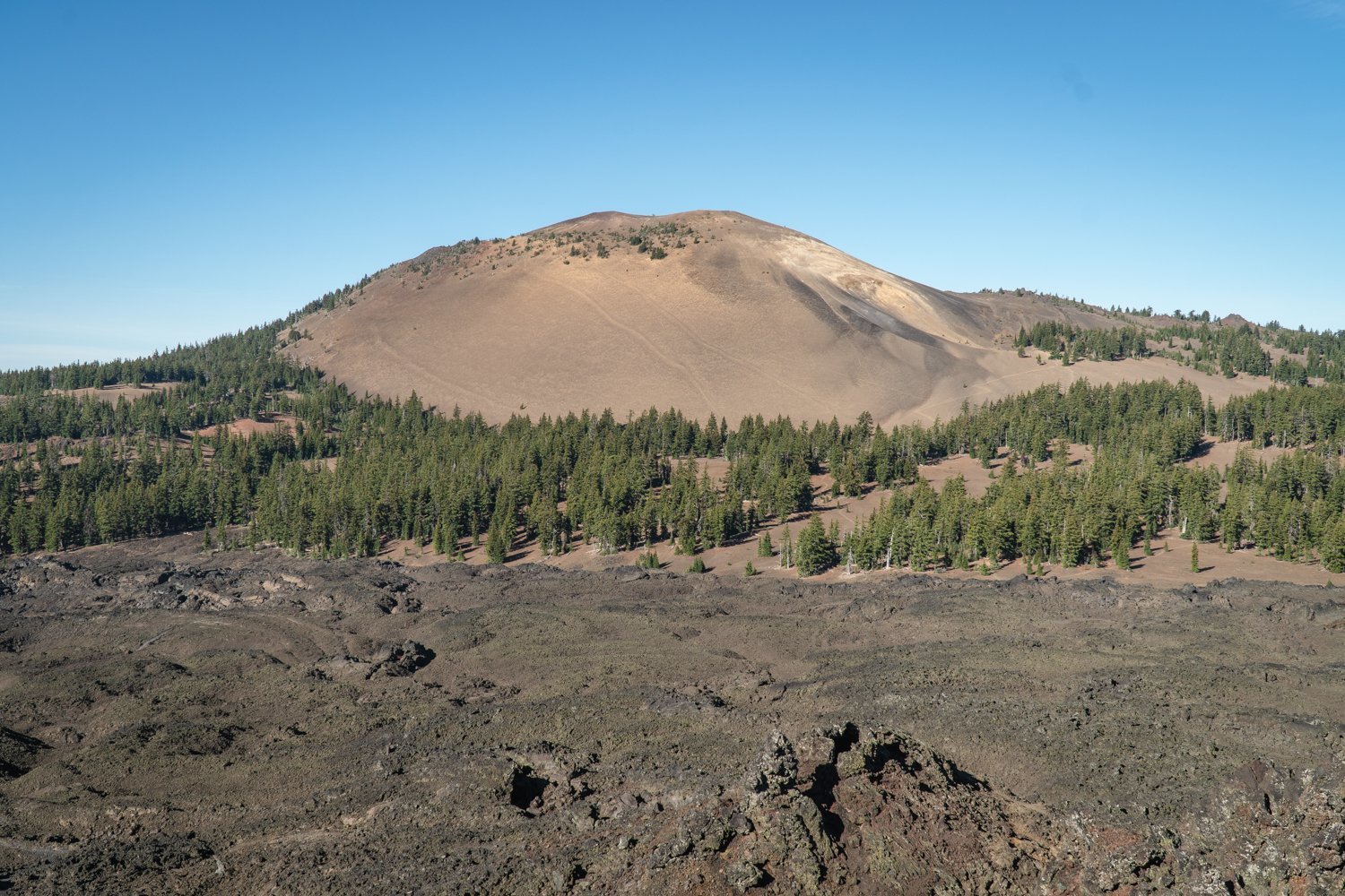
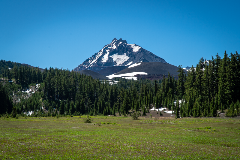
Four in One Cone is a Great Central Oregon Summer Hike
Fabulous Cascade Views Await Those Who Climb the Cones
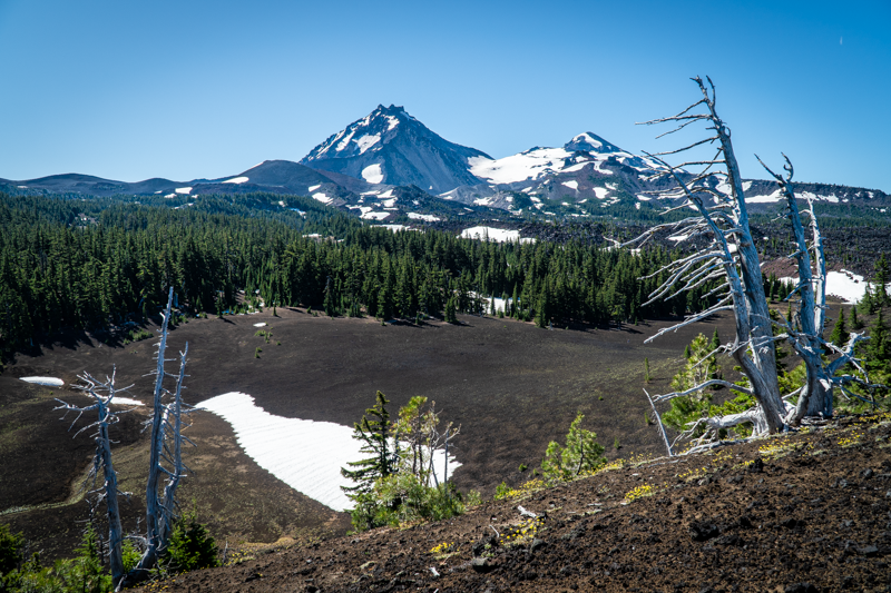
We climbed Four in One Cone for the first time in the middle of October, 2021. A moderate in and out hike with just over 1400 feet of elevation gain in 9 miles from the Scott Trailhead in the Three Sisters Wilderness, we looked forward to revisiting the area during the summer. The early spring snow we had in 2022 delayed access to the higher reaches of the Cascades with patches of snow evident above 6200 feet. But the trip up to the cones was fairly straight forward with little snow along the trail. Mosquitos were the worst thing we had to deal with - along with over 30 fallen trees to get around or over. But once we reached the lava flows, the mosquitos mostly disappeared and our hike to the top of the cones was great. The views of North and Middle Sister, along with Mt. Washington, Three Fingered Jack, Mt. Jefferson, Black Crater and Belknap Crater are outstanding from the top of the cones.
 |
 |
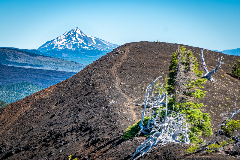
Four in One Cone has this name due to the fact there are four distinct cinder cones adjacent to each other which all erupted at different times, but which create the unique geological feature it is. The path at the top of the first cone traverses all the cones at the ridge line; it is roughly .4 miles to reach the end of the fourth cone and the drop off on each side of the path varies in steepness. When we first hiked to the top of the cones in October, the wind made us a little uncertain and we did not reach the far cone. This summer hike had much less wind and we made it to the furthest point.
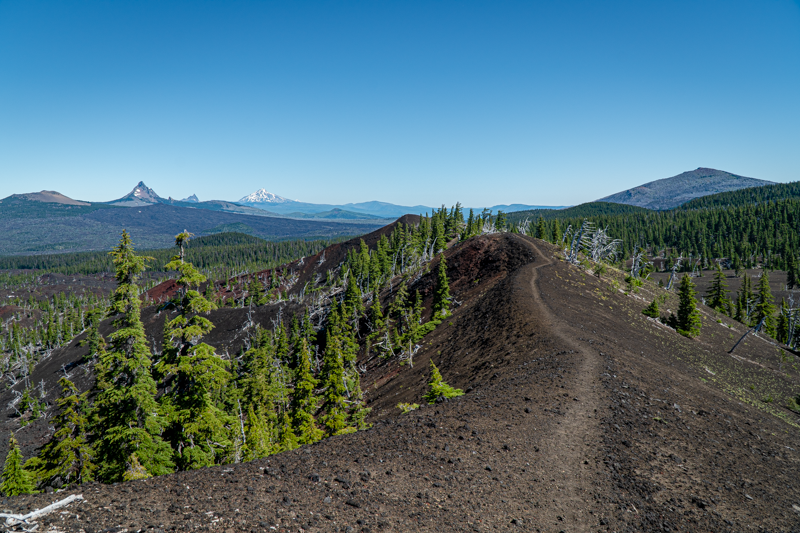
After enjoying the views, we climbed back down the cones and decided to continue the hike to the junction of the Pacific Crest Trail, which was another mile past the cones. There is a large meadow at this junction and we were hoping to see wildflowers along with the view of North Sister. The wildflowers were sparse, but the view of North Sister was spectacular.
Our return trip was much easier than the hike up due to the volunteer efforts of six amazing people who were clearing all the fallen trees from the path. These six plus one more hiking party of three, and one person we saw hiking the PCT were the only people we saw during the entire hike. Amazing solitude and a wonderful day.