Posts in category 'Places To See In Central Oregon'
Subscribe and receive email notifications of new blog posts.
 RSS Feed
- 2026 | 55 Posts
- 2025 | 103 Posts
- 2024 | 110 Posts
- 2023 | 72 Posts
- 2022 | 52 Posts
- 2021 | 70 Posts
- 2020 | 84 Posts
- 2019 | 38 Posts
- 2018 | 48 Posts
- 2017 | 39 Posts
- 2016 | 31 Posts
- 2015 | 10 Posts
21
A Perfect Day in Bend: How Locals Spend Their Weekend
Experience the Bend lifestyle through the eyes of those who call it home. From sunrise coffee and mountain views to riverside adventures and craft cocktails downtown, a weekend in Bend is about living fully — outdoors, connected, and inspired.
Morning: Coffee, Sunshine, and River Trails
 Bend mornings start early — not out of obligation, but out of excitement. The light over the Cascades is too beautiful to sleep through, and the smell of fresh-roasted coffee from local cafés is irresistible. Grab a morning latte at Sparrow Bakery, where locals linger ov...
3
Hike to Carl Lake and Beyond in Oregon's Mt Jefferson Wilderness
The Hike to Carl Lake is Little Known
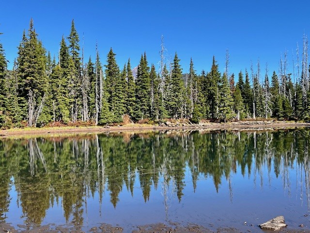
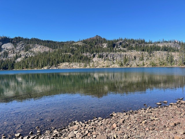
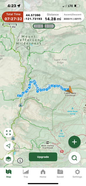
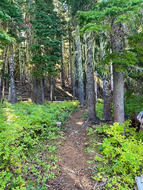
Many in Central Oregon know of the hike to Three Fingered Jack via Canyon Meadow. This trailhead to this hike is accessed from Jack Lake which is at the end of Forest Service Road 1234 in the Mt Jefferson Wilderness. Forest Service Road 1234 splits off Forest Service Road 1230 roughly two miles off paved Jack Lake Road. If instead of turning on 1234 to the Jack Lake Trailhead, people wanting a different experience can continue on 1230 for seven miles to reach the Cabot Lake (Carl Lake) trailhead (the last two miles of this road is rough).
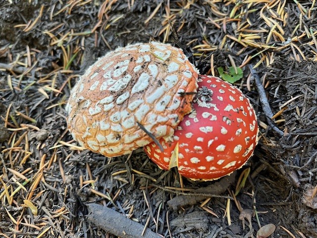
The first mile and a half of this hike is through the recovering burned forest of the B & B complex fire of 2003, but after that, the hike is in old growth forest. Two miles in the trail passes an overgrown and uncleared spur that can take hikers to Cabot Lake, a lovely forest lake. The trail has numerous blueberry bushes and in the fall, interesting mushrooms. After a series of switchbacks climbing a ridge, the trail levels out and passes three small unnamed lakes until at five miles the trail reaches Carl Lake.
 |
 |
Carl Lake is a lovely, deep blue, glaciated, trout filled alpine lake. There are also many camping spots dotted around the lake for those who wish to spend some time enjoying the area. For those wishing more hiking challenges, past the south side of the lake is a trail that goes to Shirley Lake and beyond it, climbs to reach the Pacific Crest Trail. Two tenths of a mile south on the PCT is a spur trail trail west that hikers can use to summit South Cinder Cone. For those who do, the views toward Mt. Jefferson to the north and Three Fingered Jack to the south are truly outstanding.
 |
 |
Day hikers can enjoy the entire trip from the trailhead up South Cinder Cone and back in 14.28 miles and see very few if any people.
 |
 |
22
Hayden Glacier Hike on Middle Sister is a Challenge
Take the Climbers' Trail to Reach Hayden Glacier
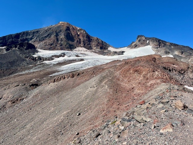
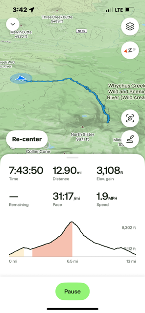
For Central Oregon hikers looking for something different that does not require a paid permit, the climbers' trail on Middle Sister is well worth it. Most hikers would start in the burned forest at the Pole Creek Trailhead located off forest service road 15 outside of Sisters (the parking at the trailhead requires $5 payment or a forest pass). After hiking the trail to the junction with Green Lakes Trail 17, trekkers continue on Trail 17 toward Park Meadow. Shortly after crossing Soap Creek is the junction with Camp Lake which hikers should take to reach the unmarked junction with the Climbers' Trail. If hikers miss this trail, it loops with another section of the Camp Lake trail near one of the branches of Wychus Creek which hikers to Camp Lake have to cross. Climbers don't cross the creek, but instead hike upstream toward Middle Sister.
Regardless of the looped trail route chosen, they join on the moraine just under Hayden Glacier. Both are steep, difficult hikes with loose pumice and boulders to traverse. For those who plan on summiting Middle or North Sister, Hayden Glacier is just another geological feature to pass by before the summiting. For those not wishing to go further, the Cascade views from the glacier are amazing.
For those starting at the Pole Creek Trailhead and hiking to the glacier but no further, plan on a full day, climbing over 3100 feet and roughly 13 miles.
 |
 |
 |
 |
4
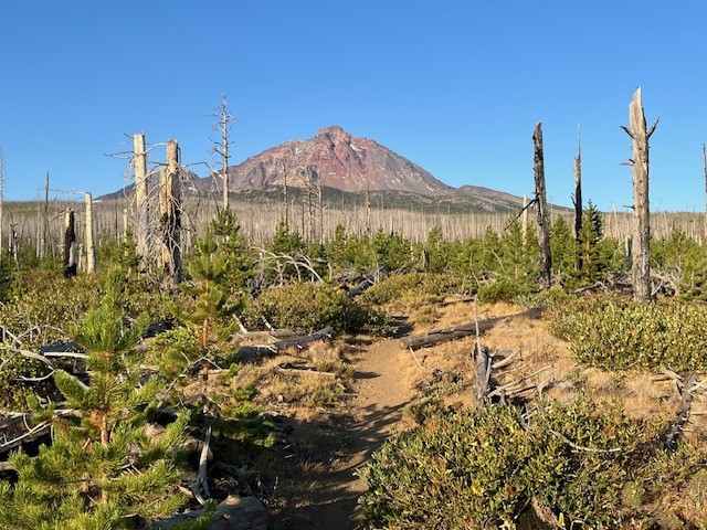
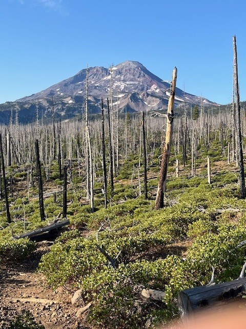
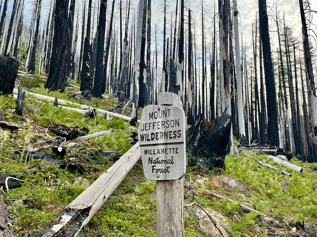
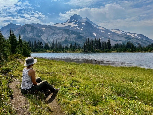
Jefferson Park in the Mt Jefferson Wilderness is Still Beautiful Despite Fires
Two Fires in Eight Years Have Impacted Jefferson Park
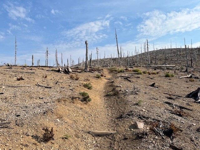
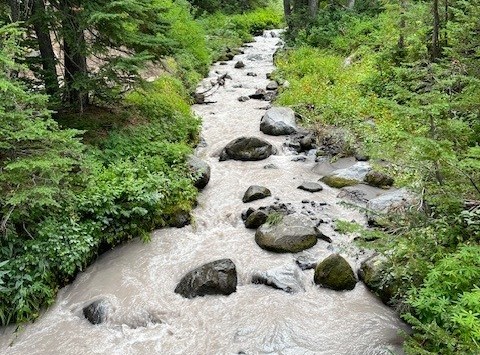
For those who enjoy hiking in the Mt. Jefferson Wilderness, one of the most treasured locations to see has been Jefferson Park. Located at the base of Mt. Jefferson, Oregon's second tallest peak, the beauty of the meadow and the reflection of Mt. Jefferson in the multiple lakes has been the destination for campers and day hikers for many years. In 2017, the Whitewater Fire destroyed 11,500 acres, much of which was near the Whitewater trailhead and surrounding forest. However, in 2020, the devastating Santiam Fire, which ballooned to 402,274 acres and destroyed several towns, over 1500 structures and killed 5 people was among the worst fires in Oregon's history. Access to Jefferson Park remained closed for several years after this fire, but has since reopened.
The hike to Jefferson Park from the Whitewater trailhead takes hikers through 4 miles of burned forest before coming to Whitewater Creek where hikers need to cross via stones or logs laid across the creek. There are signs of life returning to the burned area, although it will take many decades before the forest is restored to what it was before the fires. The Whitewater trail joins with the Pacific Crest Trail before reaching the park and once again hikers have to cross Whitewater Creek, this time via a bridge.
 |
 |
 |
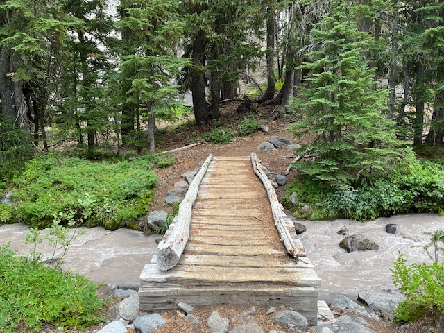 |
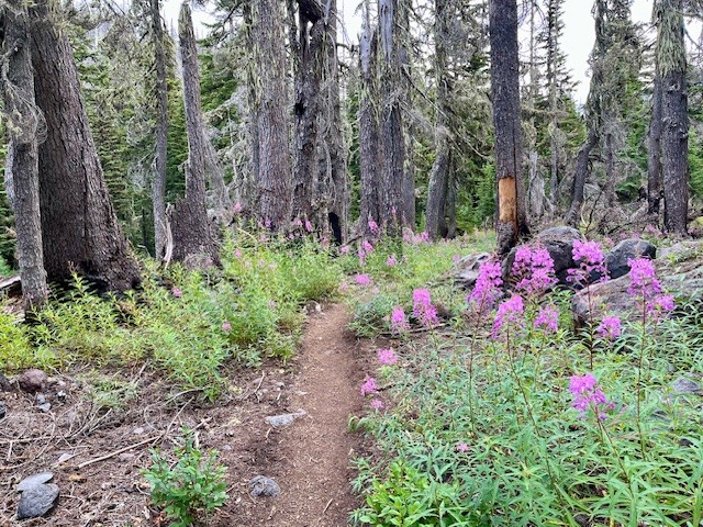
It is shortly after crossing the bridge that hikers actually enter the meadow which is Jefferson Park. There are sections of the surrounding forest that are burned, but also many sections which remain beautiful and alive. Several side paths provide access to Bay, Scout, Park and Rock Lakes, all clean and clear alpine lakes with sandy bottoms with many camping areas nearby. Russell Lake is at the far western end of the park and provides outstanding reflections of Mt. Jefferson. There are campsites around Russell Lake as well. For those who hike from the Whitewater Trailhead to Russell Lake and back, plan on 13 miles and over 2300 feet of elevation gain.
 |
 |
27
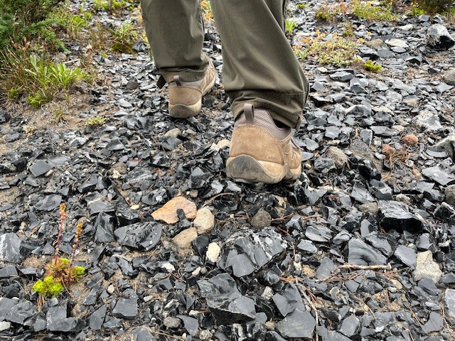
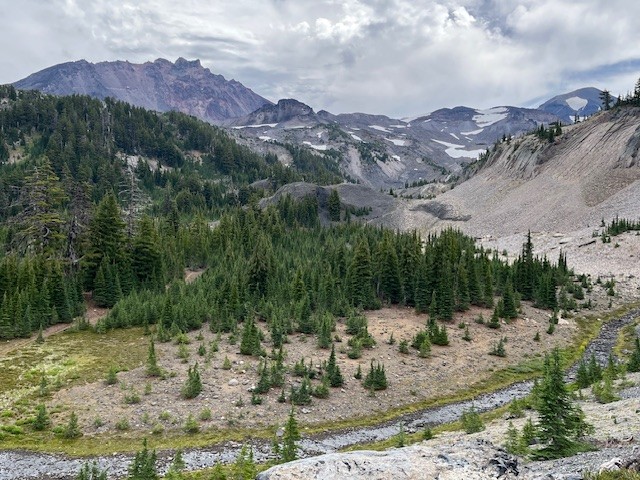
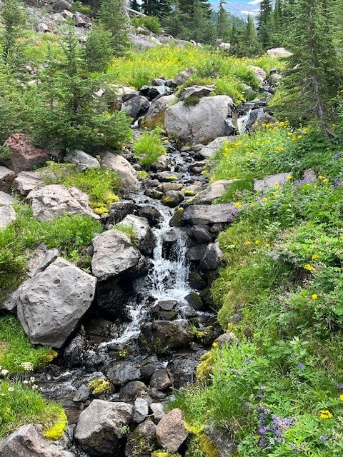
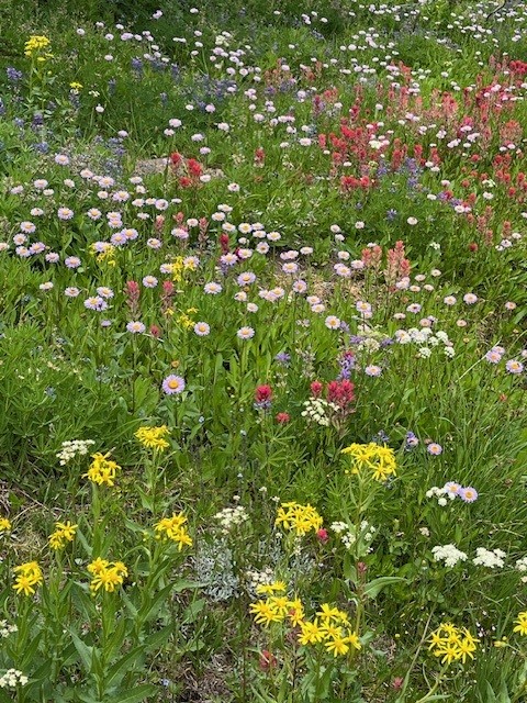
The Obsidian Trail is Stunning in 2025
The Obsidian Trail is a Favorite Central Oregon Hike
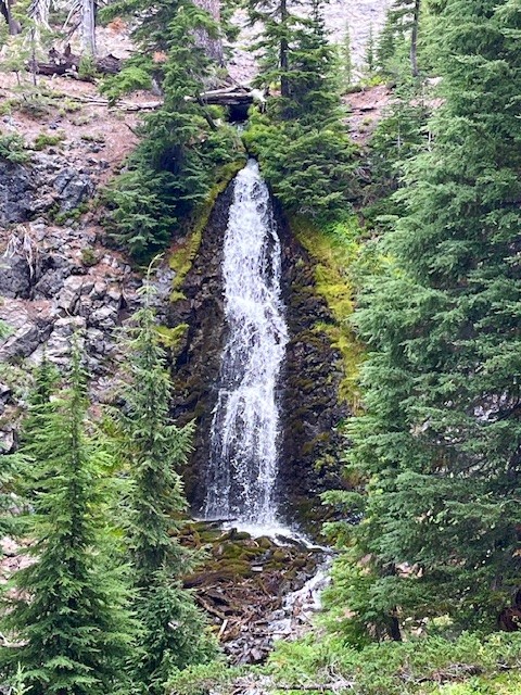
Before the National Forest Service required passes in 2021 for the most popular Central Oregon hikes, the Obsidian Trail had such a huge demand that trail passes were in place for many years earlier. The Obsidian Trail takes hikers from the trailhead off the seasonal McKenzie Pass Highway 242 up to the Pacific Crest Trail and through an area known for the obsidian rock that covers the ground. Before reaching the rock, hikers pass through wooded forest, climb lava flows, travel by Obsidian Falls and then reach the relatively flat land of the obsidian area.
 |
 |
There is a beautiful view point overlooking the climbing trail which some may take to summit Middle Sister. It is a logical place to stop and enjoy a snack or lunch before proceeding on to an area known as Sunshine which was a place many Pacific Crest Trail hikers or those planning to summit Middle Sister early morning would spend the night. Currently that location is undergoing restoration and not available for camping.
 |
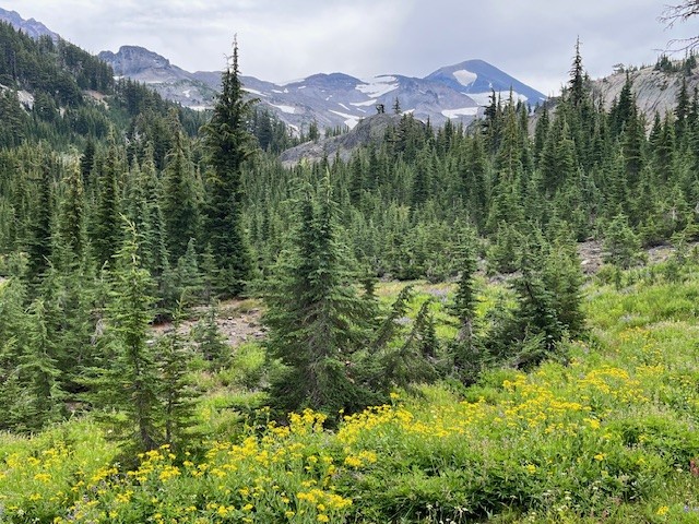 |
All in all, for those who wish to hike the loop from the Obsidian Trailhead, travel to Sunshine and return via Glacier Way (a side path that joins with the Pacific Crest Trail and avoids Obsidian Falls), the entire trek will cover about 11.5 miles and have over 2100 feet of elevation gain.
 |
 |