Posts in category 'Great Oregon Hikes'
Subscribe and receive email notifications of new blog posts.
 RSS Feed
- 2026 | 72 Posts
- 2025 | 103 Posts
- 2024 | 110 Posts
- 2023 | 72 Posts
- 2022 | 52 Posts
- 2021 | 70 Posts
- 2020 | 84 Posts
- 2019 | 38 Posts
- 2018 | 48 Posts
- 2017 | 39 Posts
- 2016 | 31 Posts
- 2015 | 10 Posts
18
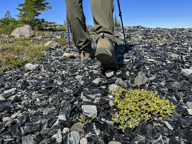
Collier Glacier in the Three Sisters Wilderness is Worth the Hike
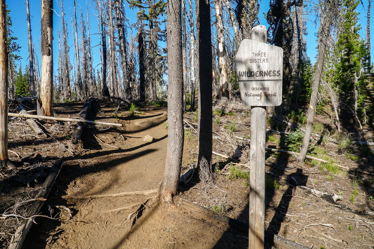
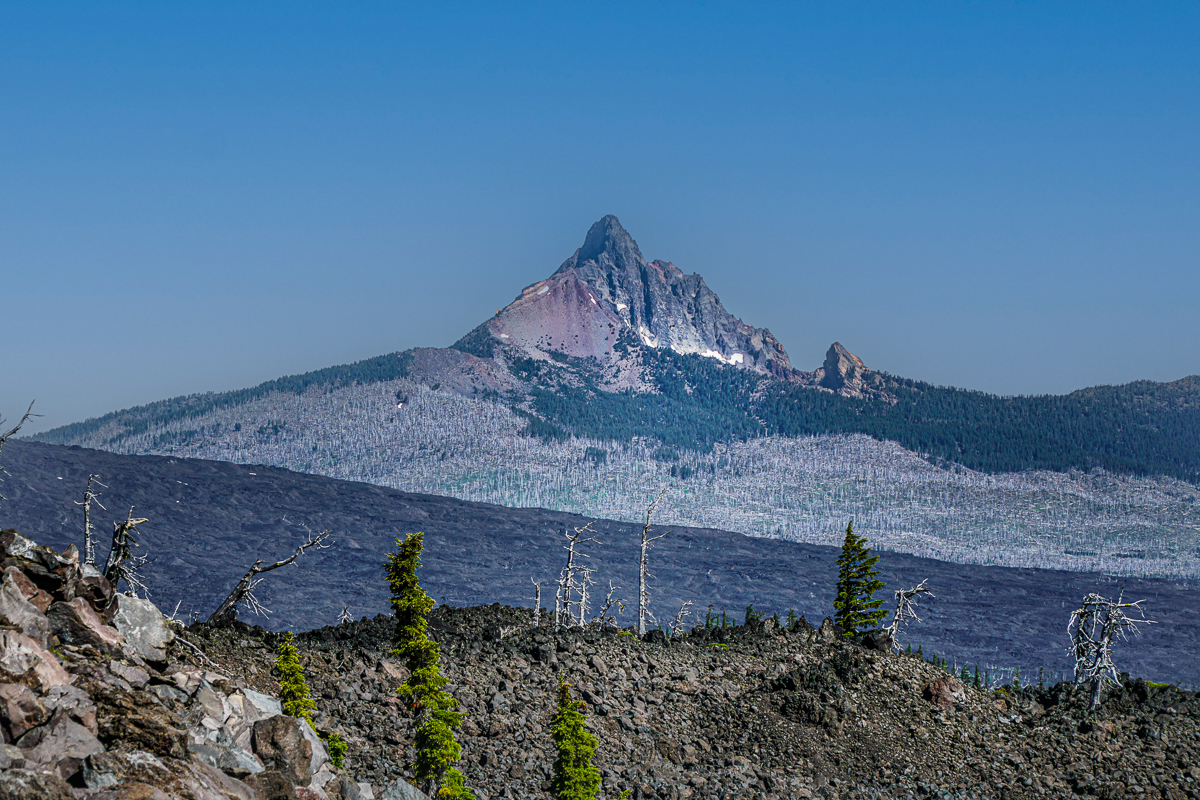
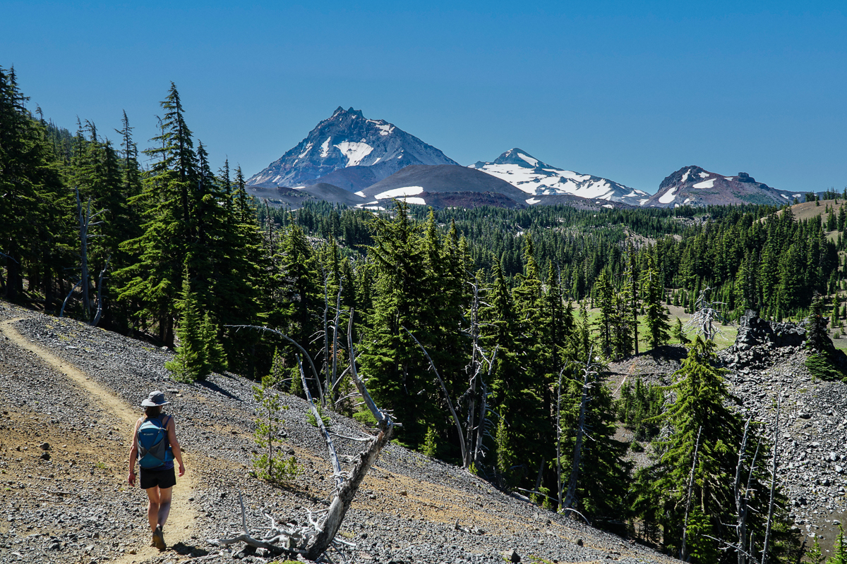
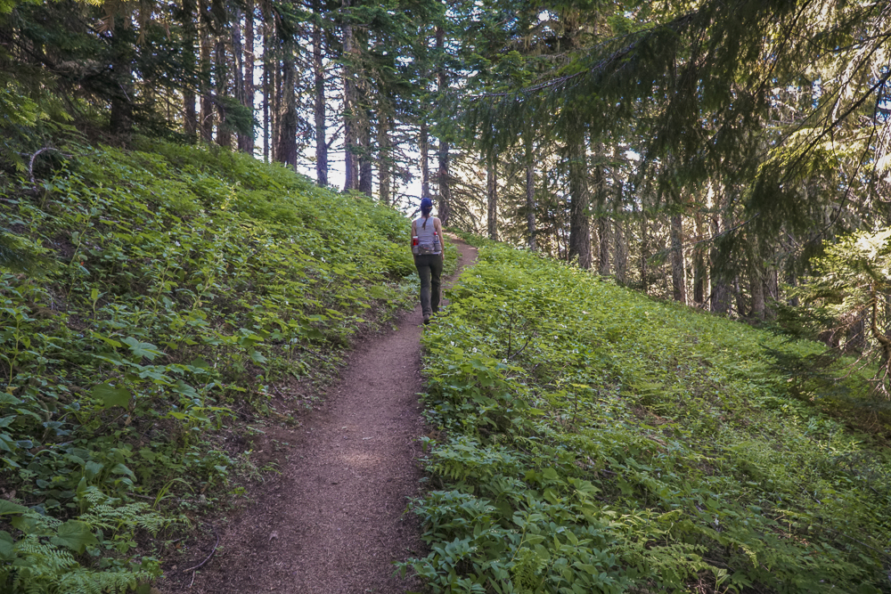
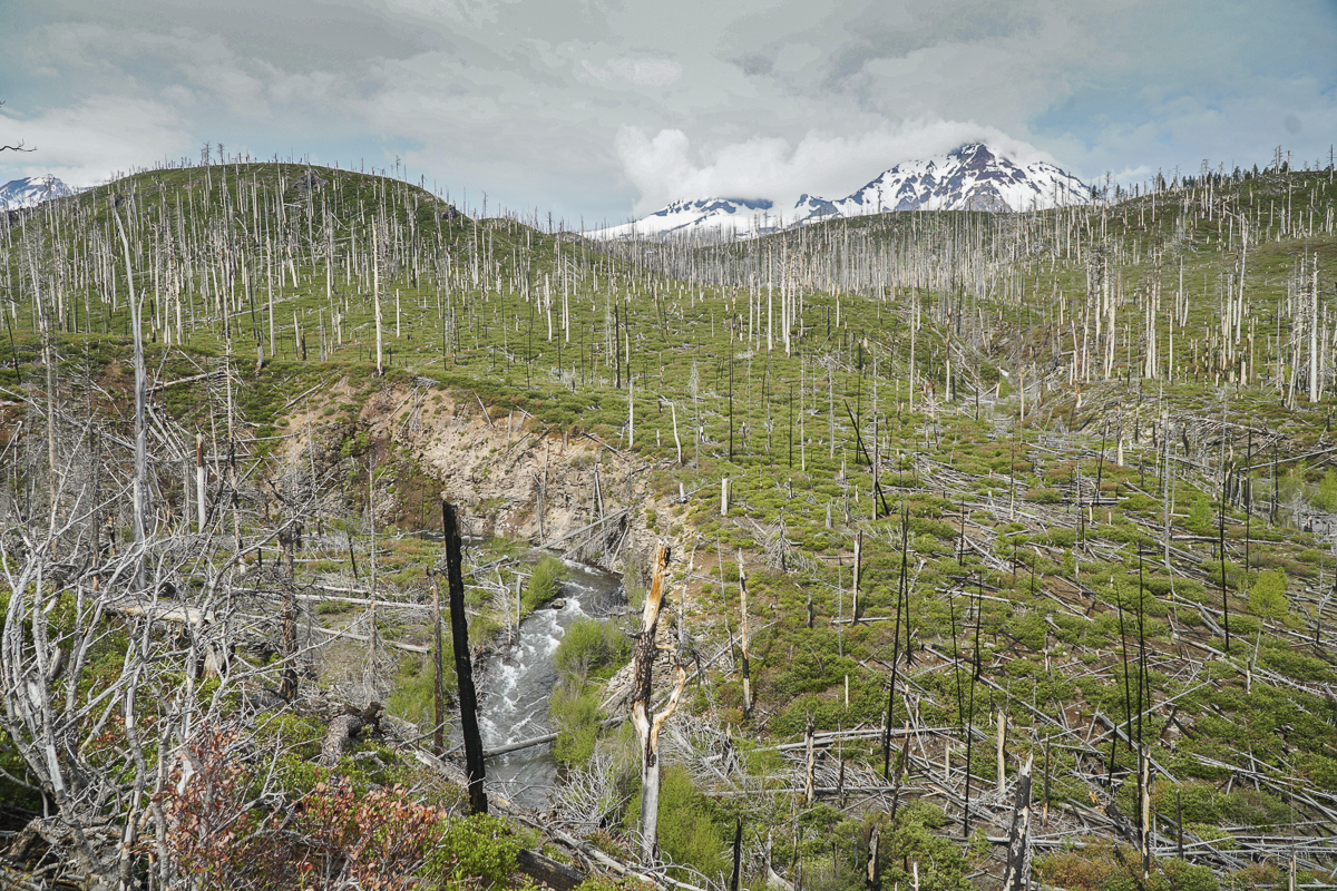
We have hiked in the Three Sisters Wilderness many times and have always enjoyed our experience. However, accessing views of Collier Glacier can be a bit of a challenge. Located in the saddle between North and Middle Sister, Collier Glacier views, on the north edge of Collier Cone, are obtained after a seven and a half mile hike from Lava Camp Lake Trailhead through Matthieu Lakes or the Obsidian Trailhead. While only 1/2 mile off the Pacific Crest Trail, to reach the edge of Collier Cone involves a scramble up a steep pumice hill, but once you arrive, the setting is spectacular with the glacial lake and towering vistas of North and Middle Sister and Little Brother. We hiked this trail 7-15-23 during one of the hottest days of the year. Although we started the hike early, it took almost 8 hours to complete it and much of the trail was exposed to the sun in lava fields or burned forest. However, there were beautiful shaded areas near Matthieu Lakes and our experience was wonderful. We brought a lot of water and enjoyed refilling a water container at Minnie Scott Spring where water can be seen percolating through the small stones. The total hike was over 15 miles and over 2500 feet of elevation gain.
 |
 |
 |
 |
11
The Obsidian Trail in the Three Sisters Wilderness is Open
The Obsidian Trail in the Three Sisters Wilderness is Available by Permit Only
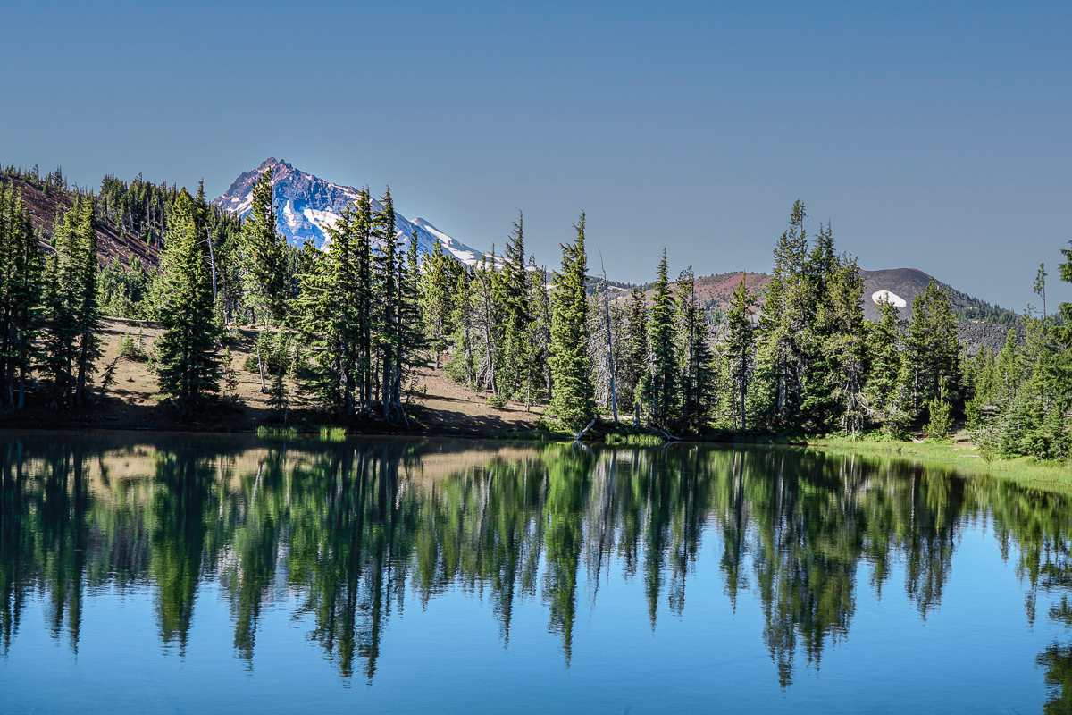
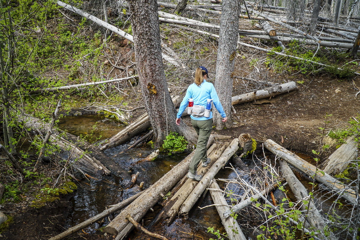
We have hiked the Obsidian Trail several time over the past few years, but the hike done July 2, 2023 was extra special. Late snow has delayed access to the high Cascades and we found patches of snow on our hike. However, these were easily traversed with trekking poles. The 11.5 mile loop connects with the Pacific Crest Trail for several miles and at the peak of the elevation, hikers walk by and on glaciated obsidian which sparkles in the sunlight. Photos do not properly reflect the actual experience of the glittering rock. The hike also passes through high alpine meadows, which had wildflowers blooming, and several shallow creeks to cross. Obsidian Falls can be a great rest stop, but our favorite lunch spot is in the sun taking in the amazing views of Middle and North Sister as well as Little Brother. All in all, the 11.5 miles gained 2165 feet in elevation and took 5.5 hours of actual walking time. Bring bug spray this time of year as the mosquitos are out.
 |
 |
|
 |
 |
3
Iron Mountain Hike 2023 - Wildflowers and People!
Iron Mountain is Known for its Wildflowers
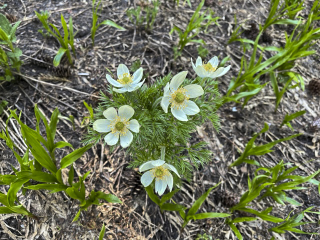
We have hiked Iron Mountain yearly since 2020, with each experience a little different. For those not familiar with Iron Mountain, it is a unique "Special Interest Area" in that it provides for over 300 species of wildflowers in various meadow, forested, and rocky environments. Each year the experience has been different, although our hike is typically done during the same few weeks in late June or early July. This year, our hike on July 1, 2023, was warm and we met many other very friendly people and families enjoying the same experience. The hike itself can be challenging and if hikers follow the route we do (which includes the Cone Peak Trail and portions of the Santiam Wagon Trail) the trek will amount to over 1900 feet of elevation gain and a total of 7 miles. We suggest getting an early start, take your camera, and don't rush the experience of seeing the lovely flowers and stunning mountain views from the summit.
To access the trailhead, travel west from Bend over Santiam Pass to the junction with Hwy 126. Take this until Hwy 20 (towards Sweet Home and Albany) branch off. Travel on Hwy 20 several miles until you reach Tombstone Pass. Park in the parking lot there (bring your forest pass) and start the Cone Peak Trail at this location.
 |
 |
16
Paulina Peak in Newberry National Monument Open for Hiking!
Paulina Peak in Newberry Crater Provides Great Views
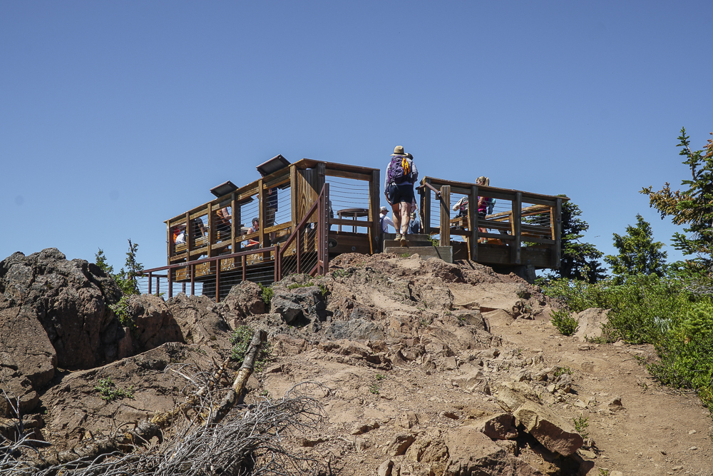
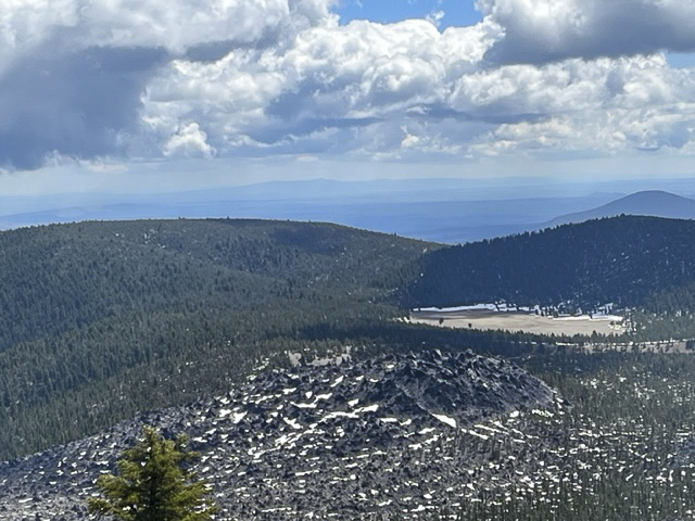
We have hiked Paulina Peak a number of times over several years, but haven't had the opportunity to do so this year until last Saturday, June 10, 2023. After a long winter with a lot of snowfall later in the season, access to higher elevations has been limited. However, the road to Paulina Peak provided us who hiked or mountain biked a chance to climb to almost 8000 feet and experience the beautiful views available from the top.
The road to Paulina Peak climbs 1600 feet over 3.75 miles, slightly longer than the trail, but easier to travel on, especially with snow on the trail and no motorized vehicles allowed to drive the road yet. While people were entering Newberry Volcanic National Monument and driving to Paulina and Eastlake, we saw no other hikers on the road to the Peak while we were there. Rather, only one mountain biker passed us during our hike and we chatted for a bit at the viewpoint at the top before he headed down. All in all, it was a wonderful day for a great hike in Central Oregon.
 |
 |
29
Upper Chush Falls is Such a Surprise
Chush Falls is Snow Free and Ready for Hikers
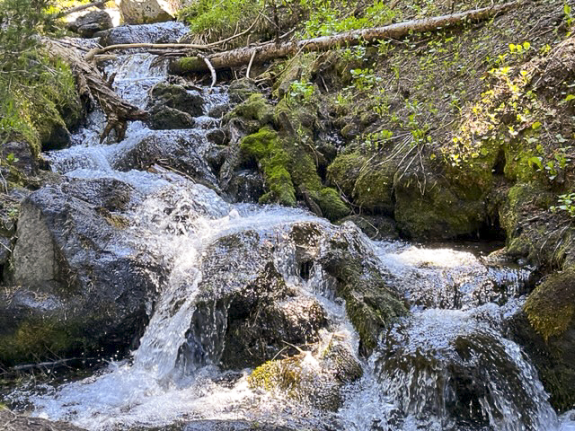
We have hiked Chush Falls several times, usually during the fall or winter with snow and ice. However, this Memorial Day weekend we elected to take the hike in the Three Sisters National Wilderness snow free. Unlike earlier hikes, many of the recently downed trees from the 2017 Milli Fire had been cut which enabled us to more easily hike the first two miles. However, the last quarter to half mile to the viewpoint had yet to receive this attention and scrambling over and under downed trees can always create challenges. The viewpoint overlooking Chush Falls is fairly obstructed by trees, so we typically take the very steep path down to the base of the falls, a path which should only be taken by people who are fit enough to make it both down and up. We had never seen the 60 foot Chush Falls as full as it was with the snow runoff from our wet winter really impacting the rivers and streams. Unlike winter time, if we got close to the falls, we would have been quite wet so we stayed a bit back and enjoyed the view from a distance.
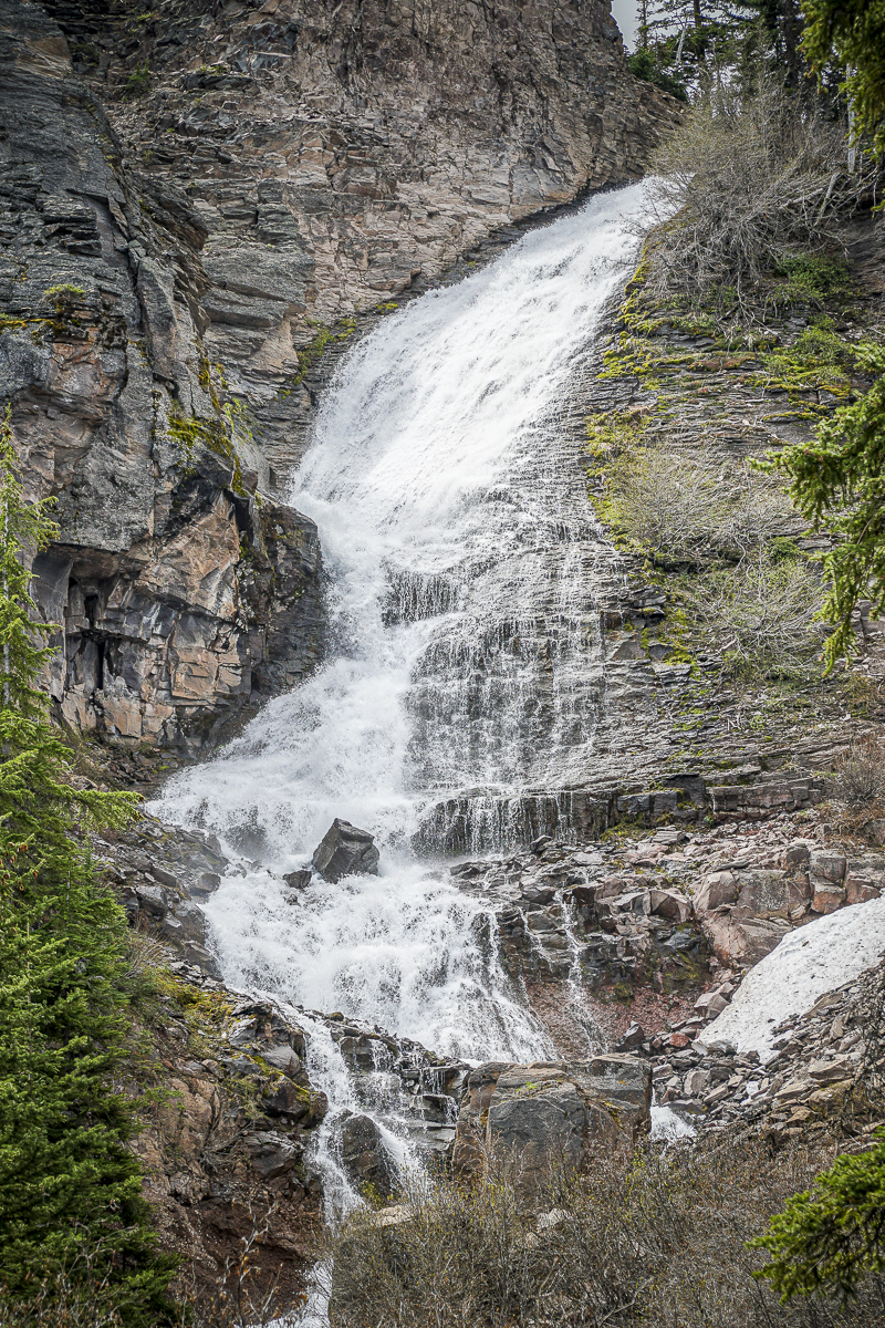 After clambering back up to the viewpoint, we decided to extend the hike to Upper Chush Falls, having never gone past Lower Chush Falls during our previous winter hikes. No attempt had been made to clear any downed trees, so hiking with GPS was very helpful since we often had to leave the path to maneuver around large fallen trees. It wasn't far past Lower Chush Falls that we reached the first lovely waterfall, the Cascades. Located on Whychus Creek just above the confluence with Park Creek, the Cascades is viewable just from the trail, without an easy way to get closer. Continuing past the Cascades, within a half mile we were surprised to see the spectacular, 200 foot Upper Chush Falls. For those of us familiar with Central Oregon waterfalls, Bend's popular Tumalo Falls is 97 feet. We didn't expect to see such a beautiful, towering waterfall. Following a social trail, we attempted to find a great viewpoint, but ended up on a steep ledge which felt a bit perilous, so we backtracked down to the base of the falls, getting as close as the vegetation would allow. All in all, we were very happy with our decision to hike the extra distance to experience all 3 waterfalls. Per GPS, we traveled a total of 6.25 miles with 950 feet of elevation gain (more than most trails note due to our steep side trips).
 |
 |