Bend Premier Real Estate Blog
Subscribe and receive email notifications of new blog posts.
 RSS Feed
- 2026 | 66 Posts
- 2025 | 103 Posts
- 2024 | 110 Posts
- 2023 | 72 Posts
- 2022 | 52 Posts
- 2021 | 70 Posts
- 2020 | 84 Posts
- 2019 | 38 Posts
- 2018 | 48 Posts
- 2017 | 39 Posts
- 2016 | 31 Posts
- 2015 | 10 Posts
19
Deschutes Riverwoods Real Estate
Deschutes Riverwoods Home Prices Trending Down
Deschutes Riverwoods has long been a Bend subdivision desired by those enjoying its proximity to the city (it abuts Bend's southern boundary), but the freedom of large lots without Homeowner's Associations or CC&Rs. Homes there range from single wide manufactured to luxury homes overlooking the Deschutes River. It is also a neighborhood in transition with more and more of the older mobile homes being replaced over time with stick-built single family.
Home prices have dropped in Deschutes Riverwoods over the past twelve months in comparison to the previous year. This could be due to the type of home being sold, or a general overall reduction in home prices as home sellers adjust their asking dollar to accommodate higher mortgage interest rates. Deschutes Riv...
18
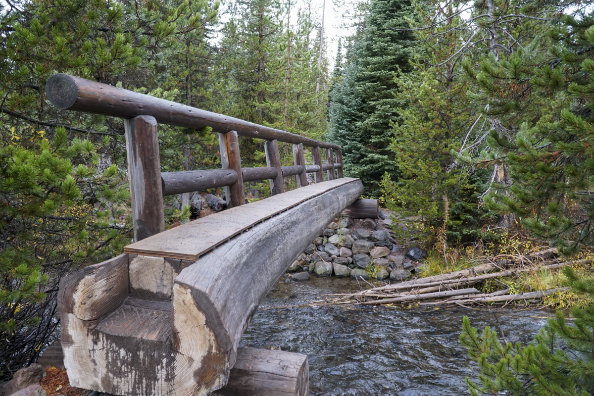
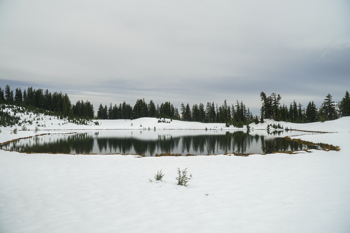
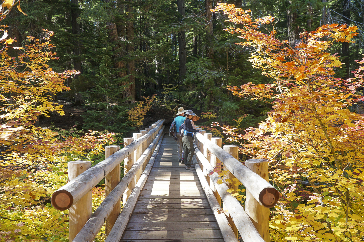
Hike Green Lakes in Snow for a Unique Experience
We have hiked to Green Lakes multiple times. However, fewer hike this popular trail when the weather turns cold and cloudy. Our experience hiking to Green Lakes on 10-14-23 was the first we had this year. The trail passes to Green Lakes are so hard to get that if you are 30 seconds past 7 am on the US Forest Service website, you will be too late. Despite trying weekly all year, last Saturday, the last weekend of the year where passes are required, we finally obtained two.
The weather was cloudy and cool, and during our hike the expected "ring of fire" eclipse occurred, resulting in a drop in temperature and a darker sky. However, after that event, the rest of our hike up to Green Lakes was uneventful, outside of hitting more and more snow the higher we climbed. At the second log bridge we put on our microspikes for safety against slippery conditions and the rest of the hike was fine. We had to do some postholing once we reached the first lake, but it was well worth the effort to travel to the far side which fewer people travel to, but is among our favorite spots due to the beautiful views of South Sister which can be mirrored in the lake. We also trekked a bit up the east side of the largest Green Lake, but decided against going further and returned back after enjoying lunch and the views.
On our hike back to the trailhead, we met a good number of hikers coming up in the later afternoon. Our morning experience was solitary with no one visible during our hour at the lake.
 |
 |
 |
 |
 |
 |
16
Bend Luxury Home Sales Slowing Down
There are More Bend Luxury Homes on the Market
The Bend real estate market has been in transition since Covid ended, with the demand for homes remaining strong, but rising mortgage interest rates greatly impacting the buying power of would-be homebuyers. It has been three months since we last looked at the Bend luxury homes. During this time, there have been changes with fewer new listings, more homes on the market, and fewer sales. All four categories we look at with high end home sales are up significanty with available inventory.
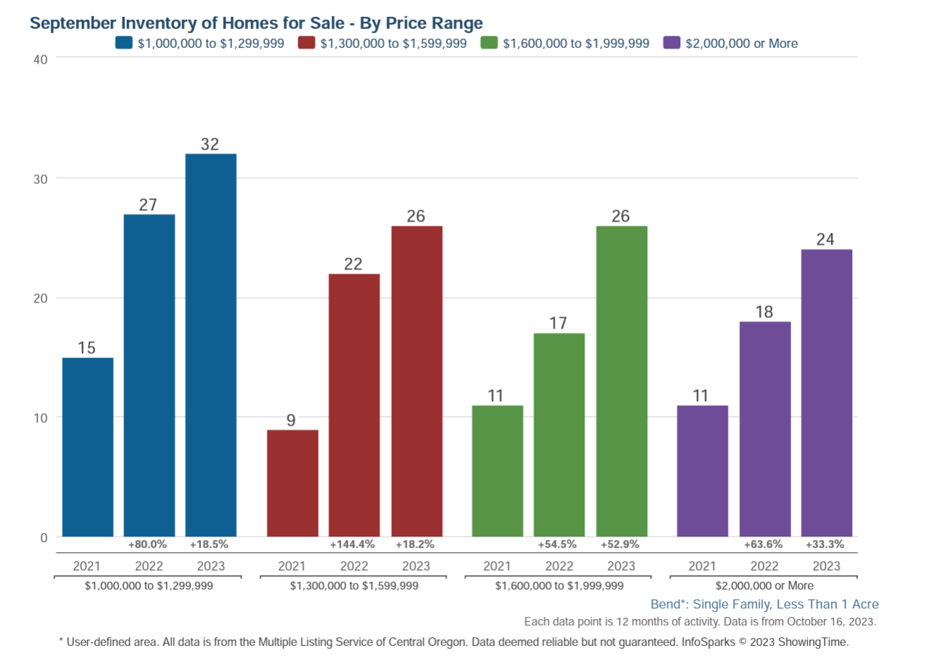
We are pushing closer to a neutral market with the highest prices where there is 5 to 6 months of inventory. We are not there yet, but there has been significant change over the past twelve months where higher priced homes are slower to sell.
12
River's Edge Village Real Estate Market Trends
River's Edge is an Established Bend Golf Course Community
Located on Awbrey Butte's eastern flank, River's Edge Village was originally developed in 1987 along with the River's Edge Hotel and Convention Center and the first nine holes of the golf course. The second nine holes of the course were built in 1992 and the next 200 homesites platted around this upper location of the development were released for individual purchase, creating a unique subdivision. Subsequent phases of River's Edge have been developed by Pahlisch Homes with the contemporary architecture that is popular in Bend today. The golf course was purchased by the neighborhood in 2022 and is a favored public course.
Market Trends for River's Edge Single Family Home Sales
Home prices are gradually increasing in River's Edge. Unlike many Bend subdivisio...
11
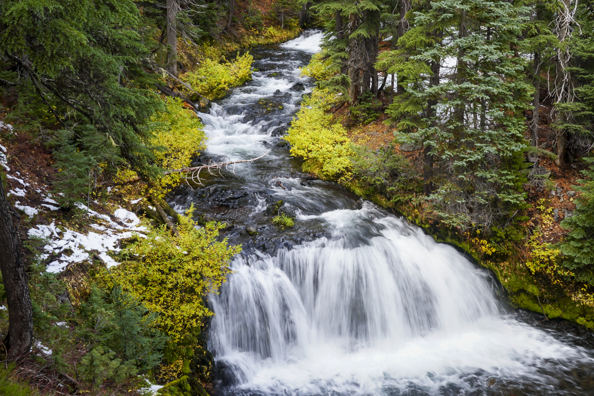
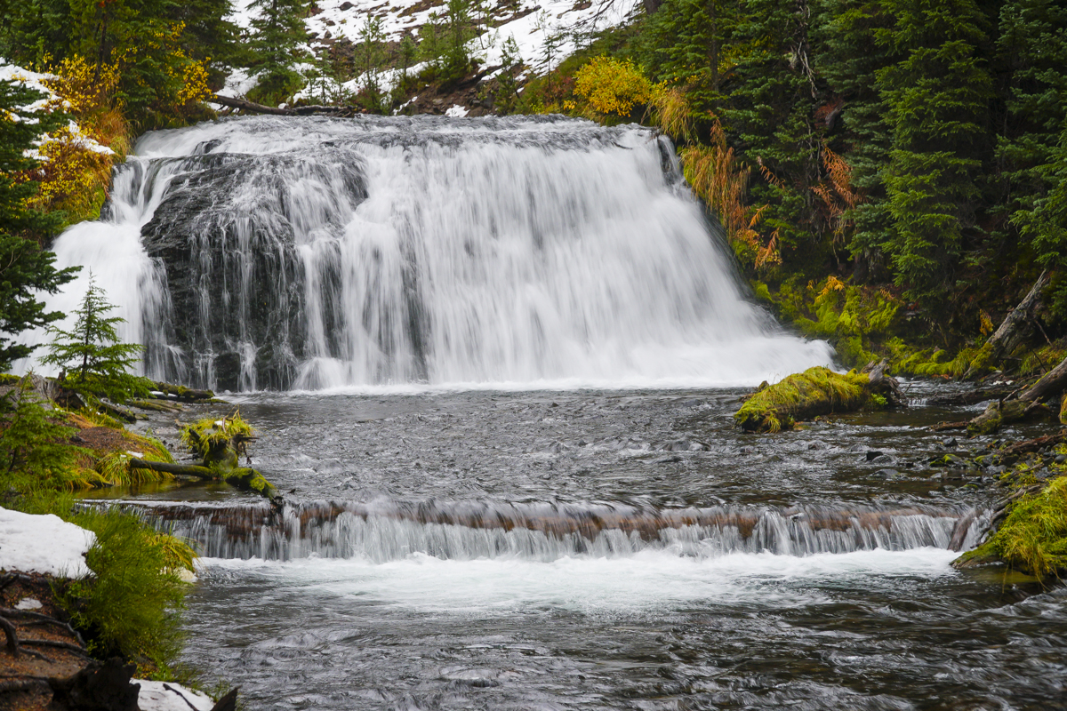
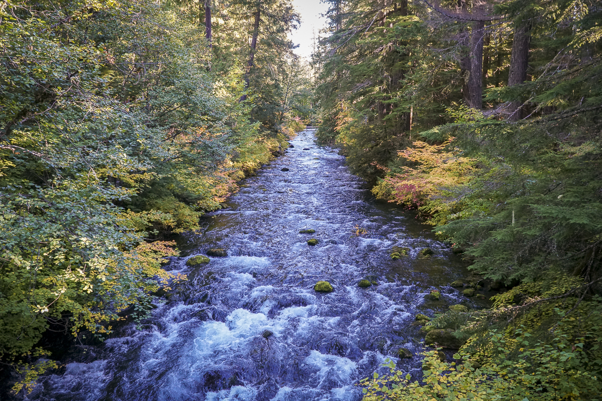
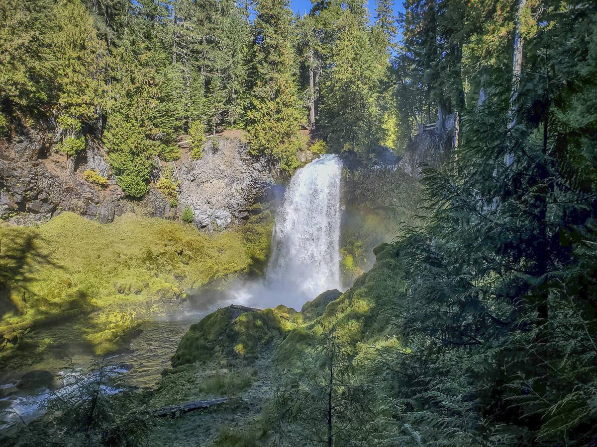
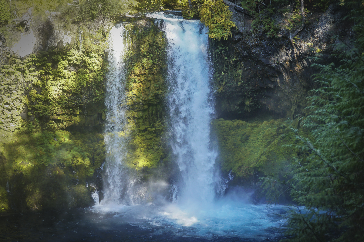
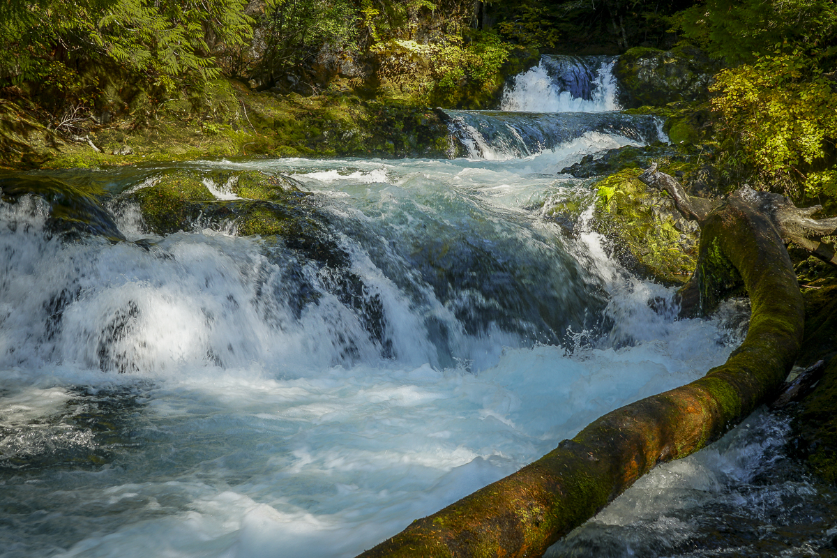
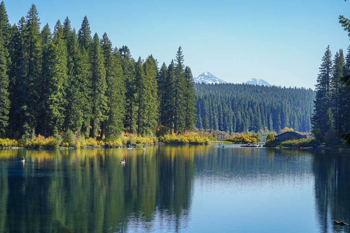
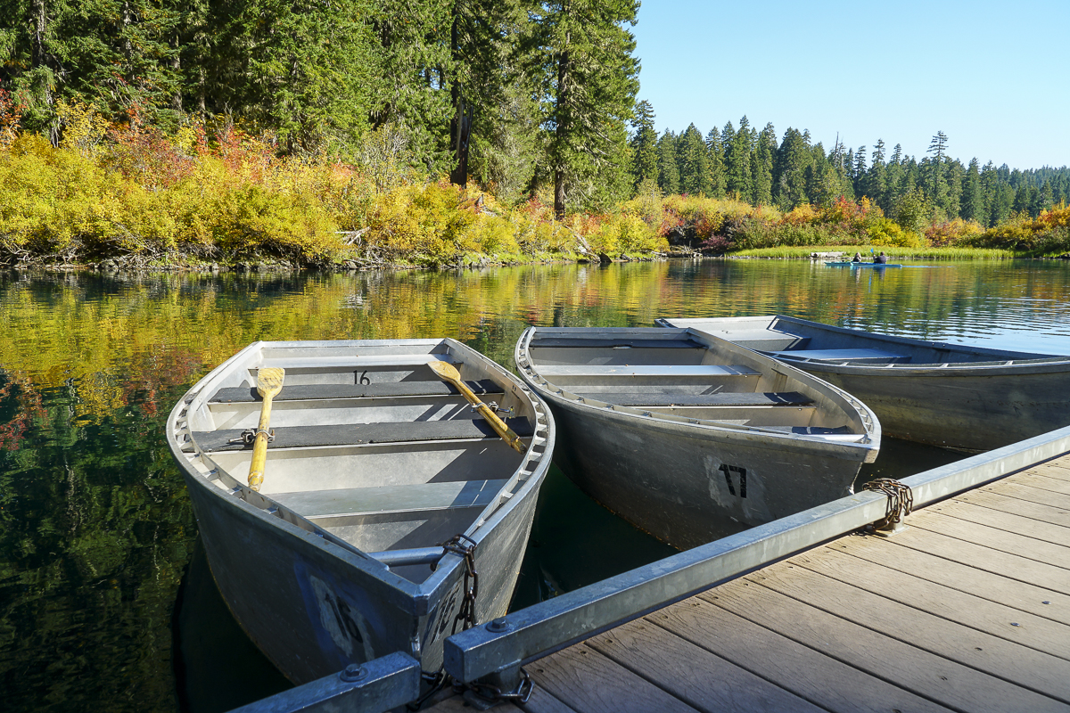
Hike Central Oregon's Clear Lake for Fall Color and Waterfalls
In all the years we have lived in Central Oregon, we have never been to Clear Lake, much less hiked around it. Located off Hwy 126 just south of the junction with Hwy 20 in the Willamette National Forest, the Clear Lake trailhead is next to the parking lot of the Clear Lake Resort where cabins, fishing supplies, boats and kayaks are available for rent. We arrived early before the parking lot filled and started our hike along Clear Lake's western shore. When we reached the southern edge of the lake, we took the cutoff trail to the Sahalie and Koosah Falls loop, which extended our hike and enabled us to view these beautiful waterfalls from the western side as well as the well known eastern viewpoints.
 |
 |
 |
 |
After completing the loop around the falls, we returned to Clear Lake and continued our hike up its eastern edge, passing the spring which is the headwaters of the McKenzie River and the northern edge of the lake. In reading up on Clear Lake, we learned that the lake was formed 3000 years ago when lava from Sand Mountain reached the river and backed up the water to form the lake. Hikers and boaters can still see remnants of the drowned forest in submerged trees still standing under 120 feet of water. The water is near freezing which is why these trees have not fully decomposed after 3000 years.
The northern part of the lake provides for views of North and Middle Sister. It is also here that we saw beautiful reflections in the lake, which at times had a turquoise tint. In returning to the lodge, the parking lot was filled to overflow. Our entire hike, including the waterfall loop, was just less than 10 miles and under 1000 feet of elevation gain. People wishing to see the beautiful colors need to hurry before the leaves fall.
 |
 |
 |
 |