3 articles found with the search of "winter hikes"
Subscribe and receive email notifications of new blog posts.
 RSS Feed
- 2026 | 71 Posts
- 2025 | 103 Posts
- 2024 | 110 Posts
- 2023 | 72 Posts
- 2022 | 52 Posts
- 2021 | 70 Posts
- 2020 | 84 Posts
- 2019 | 38 Posts
- 2018 | 48 Posts
- 2017 | 39 Posts
- 2016 | 31 Posts
- 2015 | 10 Posts
8
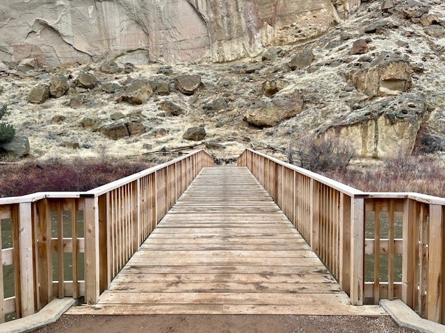
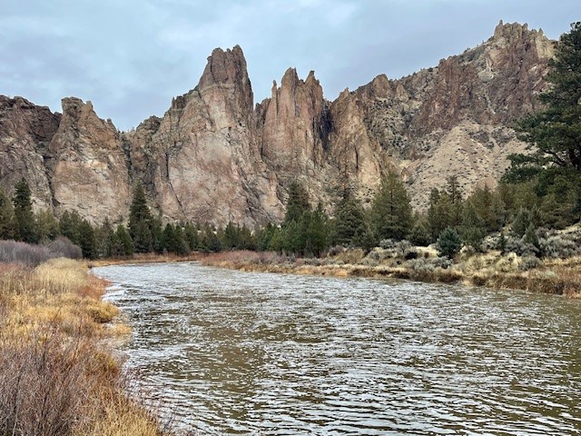
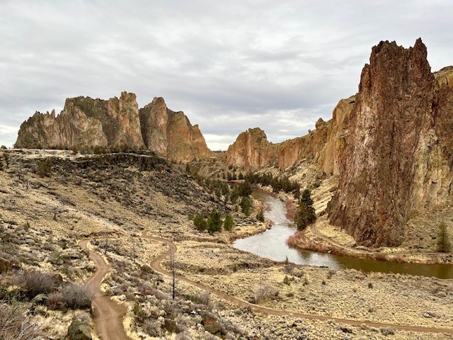
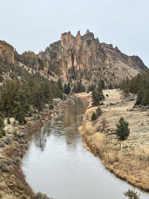
Hike Smith Rock's Burma Road and Misery Ridge Loop for a Great Winter Experience
The Burma Road, Summit Trail, Misery Ridge Loop Can be Challenging
For those looking to undergo a challenging Central Oregon hike when the Cascades are covered with snow, Smith Rock State Park can provide many options. Typically very busy in the summer when rock climbing is at its peak and the weather warm, winter hikes in Smith Rock can be rewarding with fewer crowds and different perspectives of the rocks. Before sections of the park are shut off in the spring due to falcon nesting, hikers can explore little known social trails and see portions of the park rarely visited. However, for those who wish to exert themselves, hiking along the Wolf Creek trail until connecting with Burma Road, climbing it and then hiking the north side of the park along the Summit Trail, then up Mesa Verde until connecting with Misery Ridge and climbing the backside past Monkey Face to the summit until returning down to Crooked River and then up the canyon to the parking lot can be a fulfilling winter hike of over six miles and close to 1800 feet of elevation gain. During the winter, sometimes weather conditions can create icy patches, so microspikes and trekking poles can be helpful. But if the weather cooperates, the Burma Road, Misery Ridge Loop can be a wonderful challenge.
 |
 |
 |
 |
29
Upper Chush Falls is Such a Surprise
Chush Falls is Snow Free and Ready for Hikers
We have hiked Chush Falls several times, usually during the fall or winter with snow and ice. However, this Memorial Day weekend we elected to take the hike in the Three Sisters National Wilderness snow free. Unlike earlier hikes, many of the recently downed trees from the 2017 Milli Fire had been cut which enabled us to more easily hike the first two miles. However, the last quarter to half mile to the viewpoint had yet to receive this attention and scrambling over and under downed trees can always create challenges. The viewpoint overlooking Chush Falls is fairly obstructed by trees, so we typically take the very steep path down to the base of the falls, a path which should only be taken by people who are fit enough to make it both down and up. We had never seen the 60 foot Chush Falls as full as it was with the snow runoff from our wet winter really impacting the rivers and streams. Unlike winter time, if we got close to the falls, we would have been quite wet so we stayed a bit back and enjoyed the view from a distance.
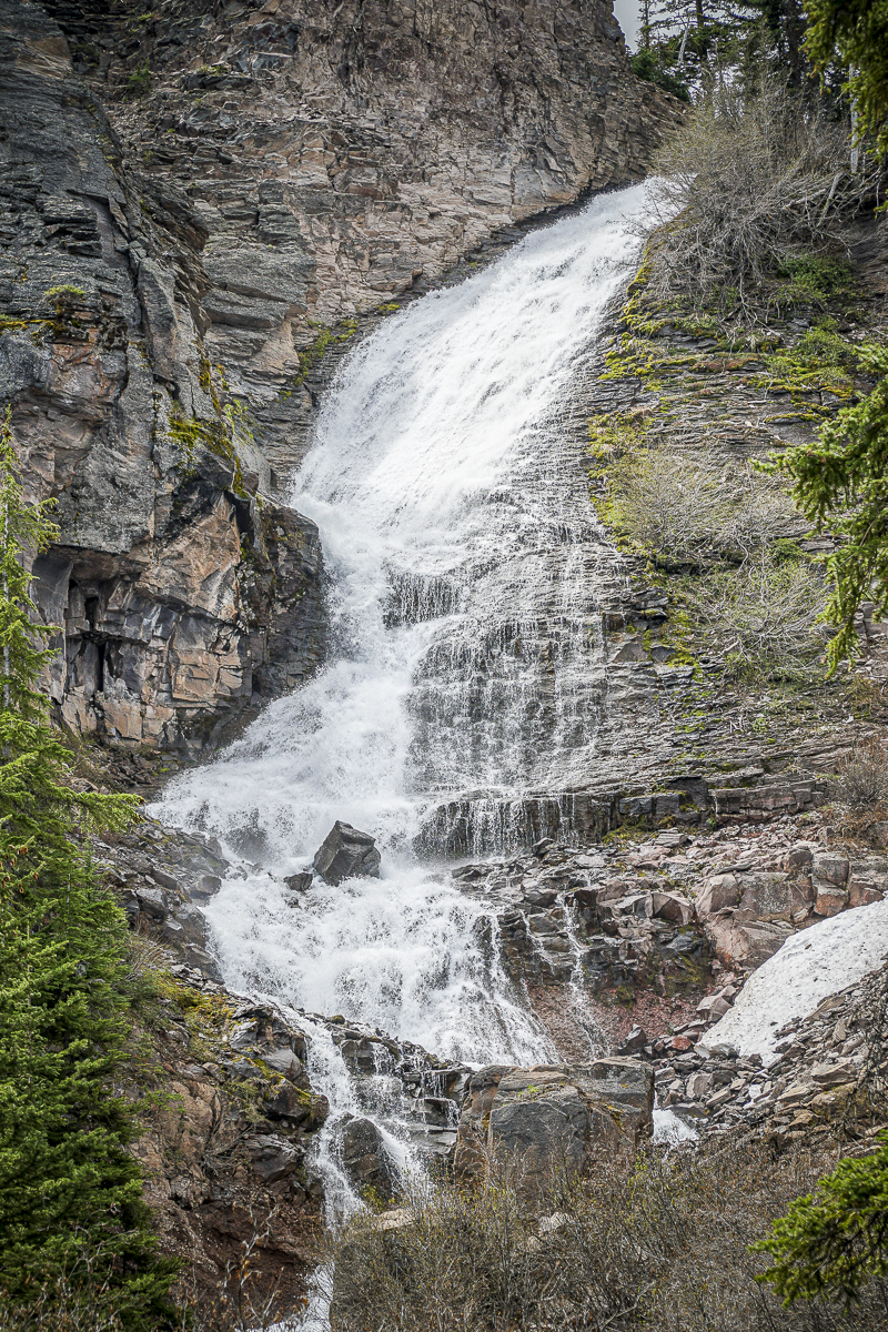 After clambering back up to the viewpoint, we decided to extend the hike to Upper Chush Falls, having never gone past Lower Chush Falls during our previous winter hikes. No attempt had been made to clear any downed trees, so hiking with GPS was very helpful since we often had to leave the path to maneuver around large fallen trees. It wasn't far past Lower Chush Falls that we reached the first lovely waterfall, the Cascades. Located on Whychus Creek just above the confluence with Park Creek, the Cascades is viewable just from the trail, without an easy way to get closer. Continuing past the Cascades, within a half mile we were surprised to see the spectacular, 200 foot Upper Chush Falls. For those of us familiar with Central Oregon waterfalls, Bend's popular Tumalo Falls is 97 feet. We didn't expect to see such a beautiful, towering waterfall. Following a social trail, we attempted to find a great viewpoint, but ended up on a steep ledge which felt a bit perilous, so we backtracked down to the base of the falls, getting as close as the vegetation would allow. All in all, we were very happy with our decision to hike the extra distance to experience all 3 waterfalls. Per GPS, we traveled a total of 6.25 miles with 950 feet of elevation gain (more than most trails note due to our steep side trips).
 |
 |
16
Ray Benson Sno Park Provides Access to Miles of Recreational Opportunities
.jpg)
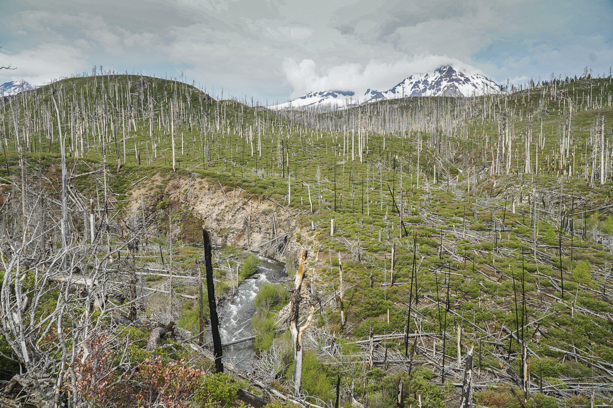
Winter hiking in snow has been a challenge for us this year since by the time we realized we needed snowshoes, they were sold out locally. Our winter hikes have involved more high desert locations with trips to Fort Rock, Whychus Canyon Preserve, Bessie Butte, Lake Billy Chinook, Blue Basin, and repeated visits to Smith Rock among our favorites. However, last Saturday we decided to visit Santiam Pass and hike the road to Big Lake.
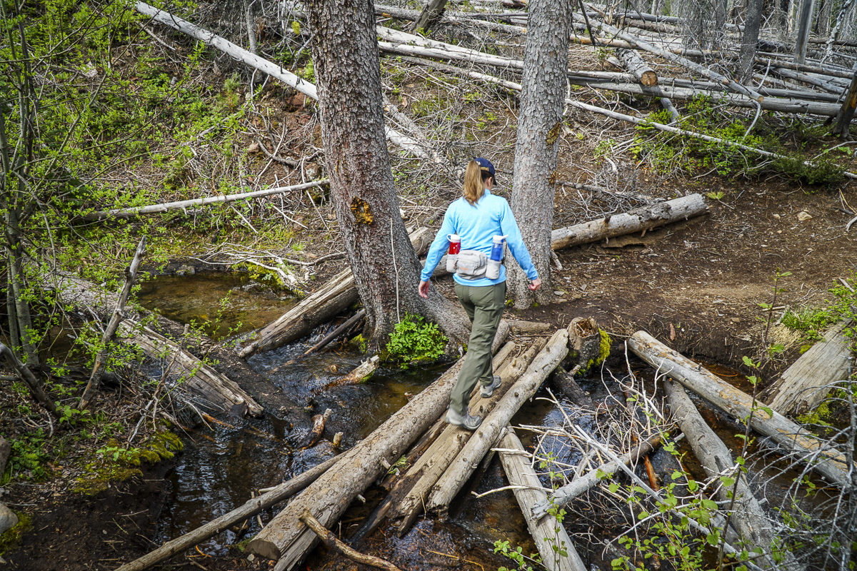
We arrived at the Ray Benson Sno Park around 8:40 am and found many people there either camping in their RVs or setting up their snow mobiles. We slipped on ice cleats and were determined to walk the couple miles to the far west side of Big Lake where we were told the views of Mt. Washington were the best. It was a beautiful sunny day and the weather warmed as the day wore on. The views of Mt. Washington from Big Lake were stunning and we were surprised to see that the lake was still frozen to the extent that snow mobiles were driven across the ice.
After leaving the lake, we decided to take the Ray Benson Sno Loop and visit the Brandenburg Shelter. The trails were fine traveling with our snow cleats and we saw several people cross country skiing as well as snow shoeing and hiking like us. The shelter provided us with both Mt. Washington and Three Fingered Jack views and an opportunity to talk with other people enjoying the day.
All in all, we traveled roughly 10 miles and really had fun being outside in the Mt. Washington Wilderness on a late winter day.
.jpg) |
.jpg) |