9 articles found with the search of "canyon meadow"
Subscribe and receive email notifications of new blog posts.
 RSS Feed
- 2026 | 71 Posts
- 2025 | 103 Posts
- 2024 | 110 Posts
- 2023 | 72 Posts
- 2022 | 52 Posts
- 2021 | 70 Posts
- 2020 | 84 Posts
- 2019 | 38 Posts
- 2018 | 48 Posts
- 2017 | 39 Posts
- 2016 | 31 Posts
- 2015 | 10 Posts
16
Three Fingered Jack Hike From Jack Lake Trailhead a Great Mid Summer Trek
We hike Three Fingered Jack yearly and always enjoy our experience. Our 2023 hike was no exception and the air was clear, a challenge this summer with the smoke from the Bedrock fire near Eugene coming and going for weeks.
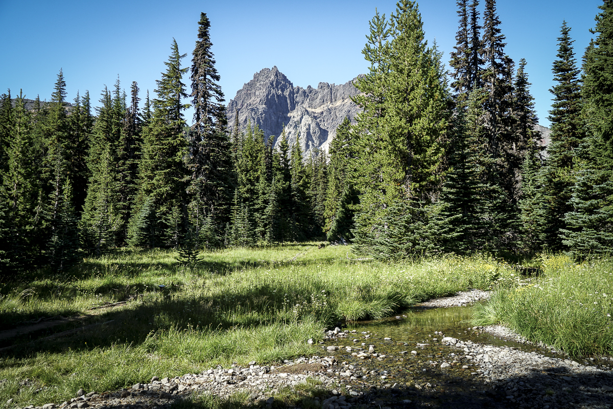
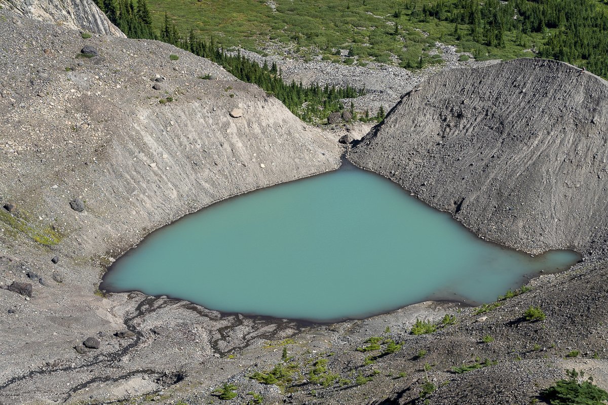
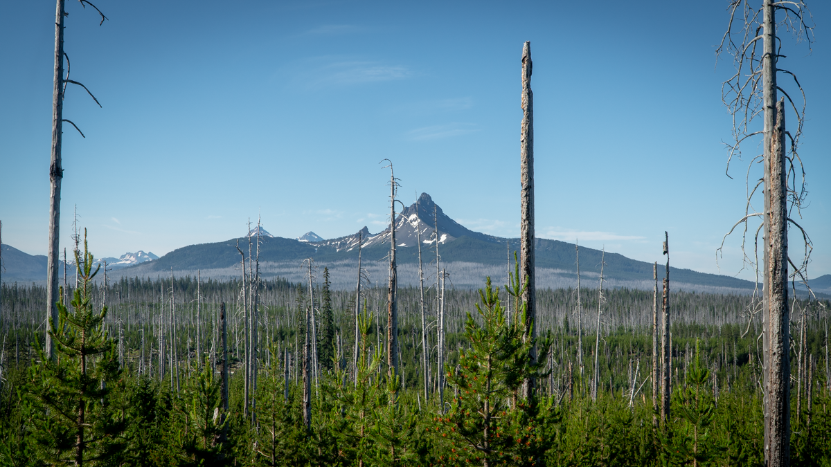
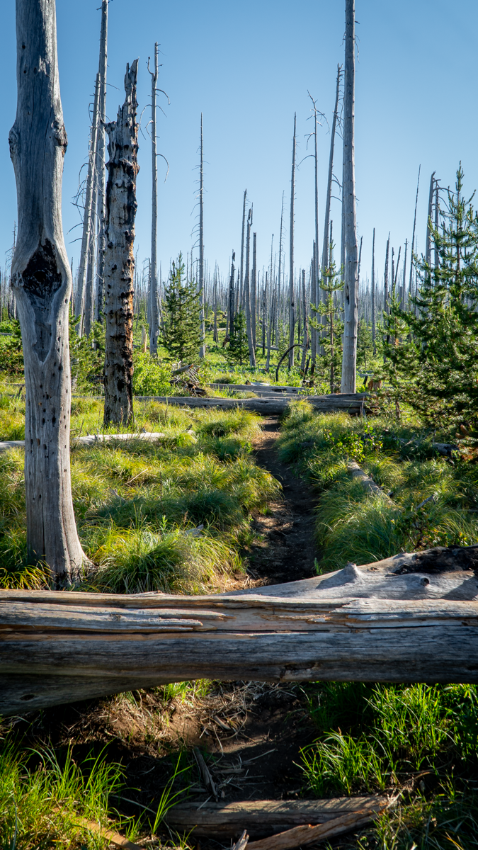
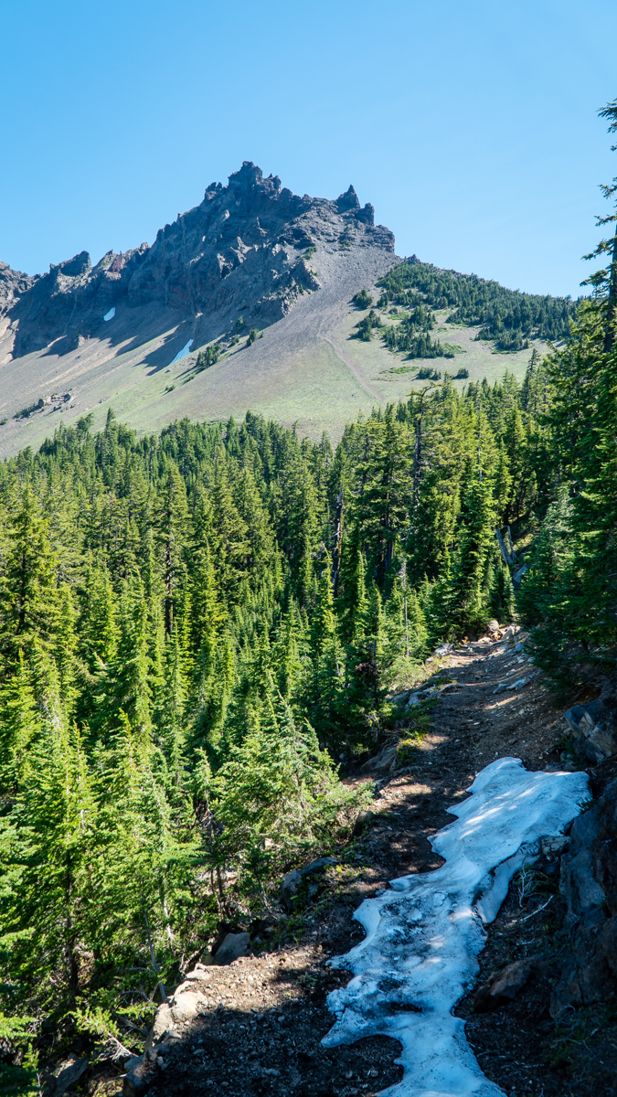
The Canyon Meadow/Three Fingered Jack hike is one of our less strenuous summer hikes, the entire route taking less than 8 miles with roughly 1700 feet of elevation gain. Traveling through the forest recovering from the 2003 B&B fire, it is nice to see the growth of new vegetation and young trees, and it was easy to sample huckleberries growing along the path. Once you enter unburned forest, it isn't far until hikers reach Canyon Meadow with its green grass, wildflowers, and views of Three Fingered Jack. The "unmaintained" spur path to the mountain had a number of fallen trees to traverse, but past that it was easy to reach the base of the moraine which holds the blue glacial lake.
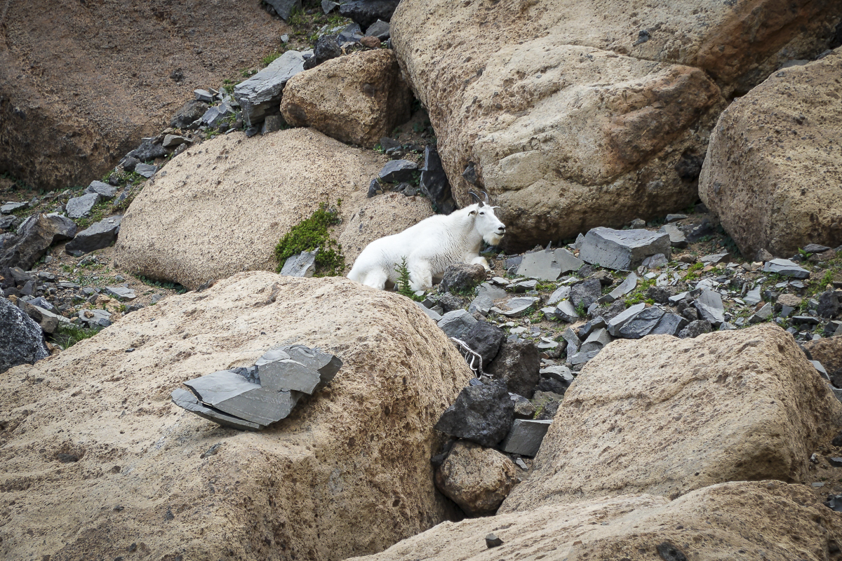
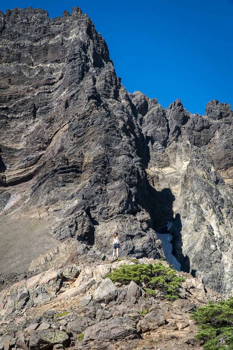
It is harder to scramble up the loose rock of the moraine (going down you have to be careful), but we always do this and reach the saddle between Three Fingered Jack and a nearby peak which we have nicknamed "Dragon Mountain". From there, stunning views of the Three Sisters, Broken Top and Mt Bachelor can be seen. Looking the other way, views of Mt Jefferson can't be missed. During this trip, we also saw a nearby mountain goat; these goats were reintroduced to the Mt. Jefferson Wilderness around Three Fingered Jack in 2010 and have grown in number.
 |
 |
 |
 |

12
Bend Premier Real Estate | September 2022 Newsletter
What's in the September 2022 Newsletter?
- Number of Bend Home Listings Down
- Canyon Meadow Loop and Three Fingered Jack Hike
- Prep Your Home for the Season
- Here's Why its Still a Seller's Market
15
Jack Lake to Three Fingered Jack - Great Central Oregon Hike
Canyon Meadow Loop and Three Fingered Jack is a Beautiful Summer Hike
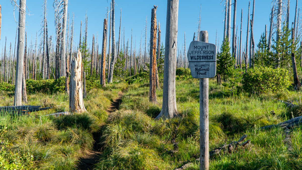
Hiking to Three Fingered Jack via Jack Lake and Canyon Meadow Loop is an annual event for us. Located in the Mt. Jefferson Wilderness, access to the trailhead is outside of Camp Sherman off Hwy 20 via several paved and dirt roads. But once hikers arrive at the trailhead, the path is obvious.
 |
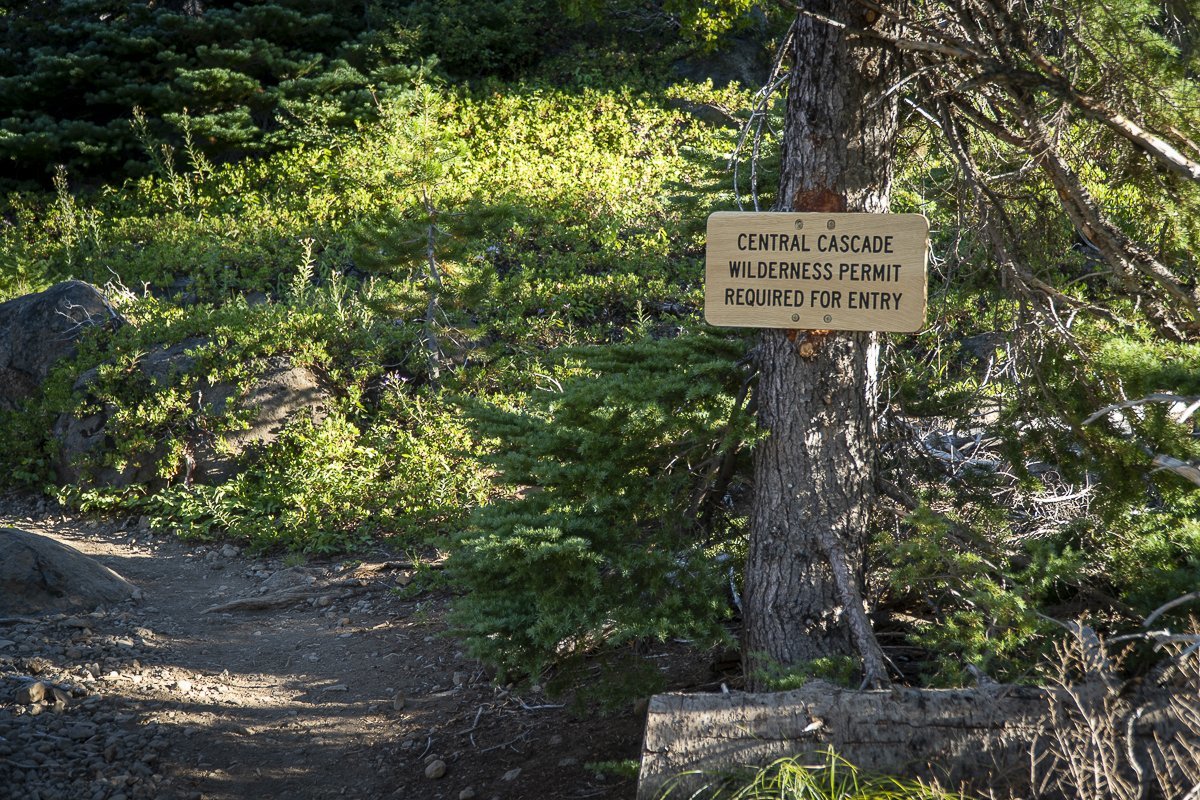 |
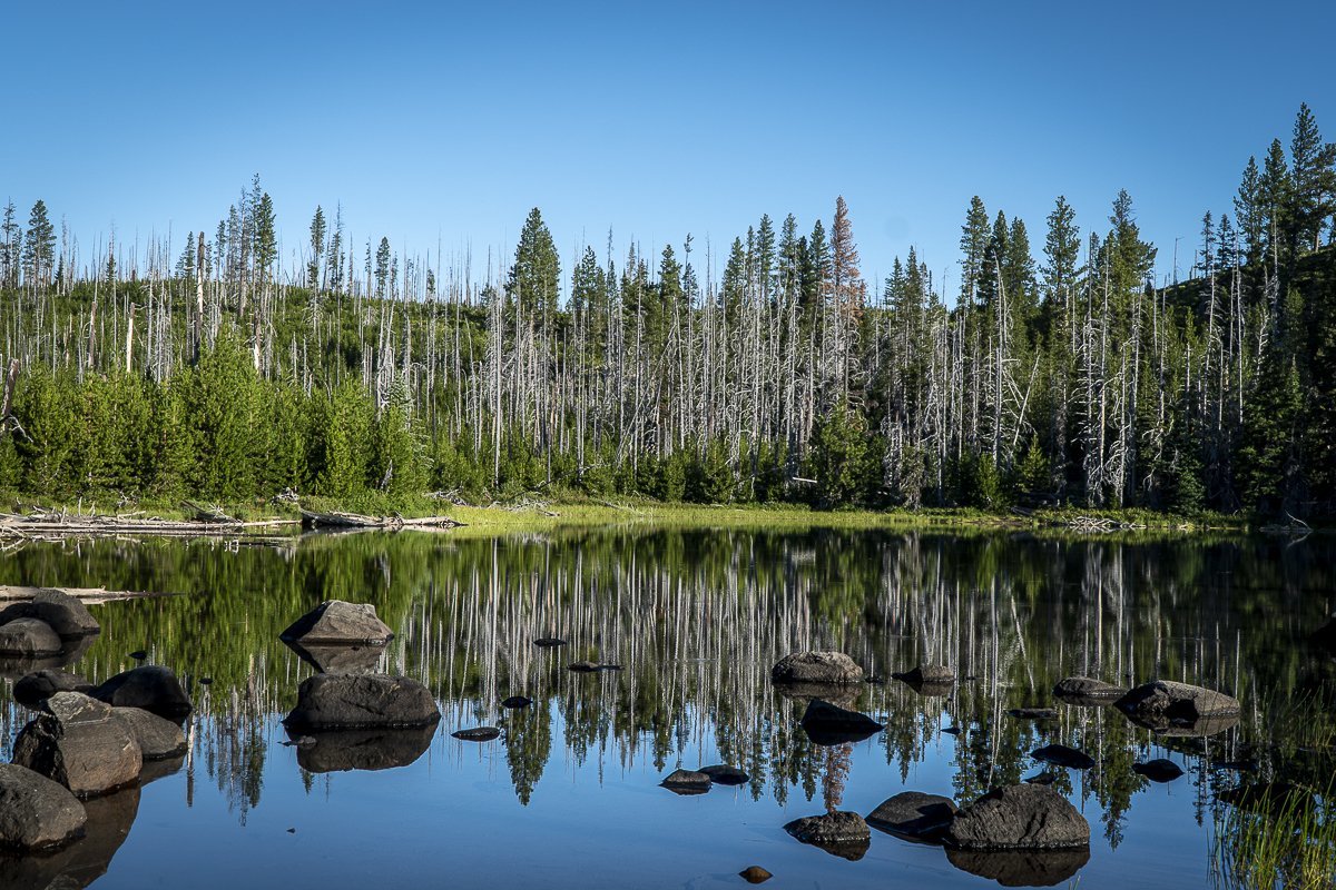
The trail starts next to Jack Lake, which reflects the burned trees of the 2003 B&B Complex Fire, but also the new growth that has come back since. It is evident that the new Wilderness Permits are required to take this hike.
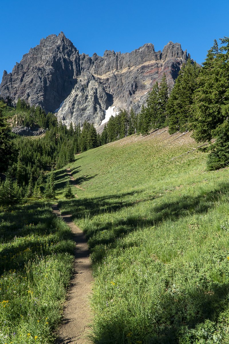
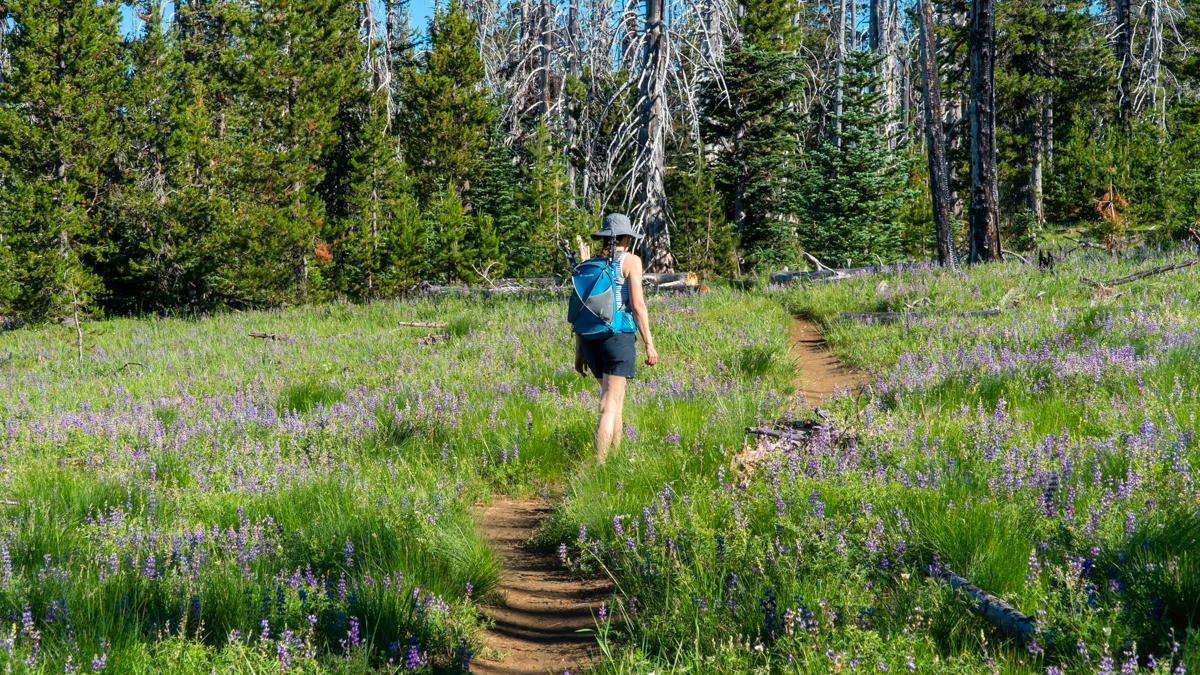
The trail opens at Canyon Meadow, which survived the 2003 fire unscathed. Canyon Creek runs through the meadow and during the summer, the blooming wildflowers, the sound of the creek and the beauty of towering Three Fingered Jack create an unparalleled Wilderness experience.
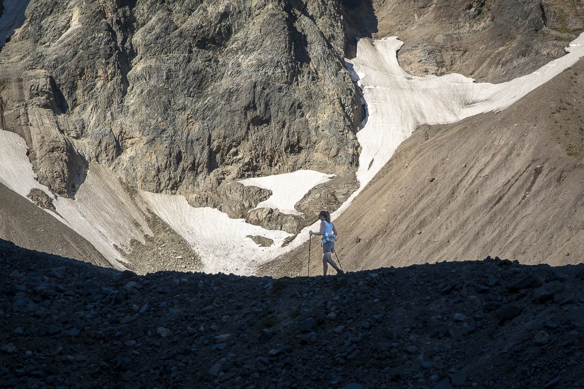
Once hikers reach the base of the mountain, there is a moraine which can be climbed (a scramble up loose rocks) which provides a perspective of the glacial lake and, if you are lucky, a view of the mountain goats which are known to live in the area.
 |
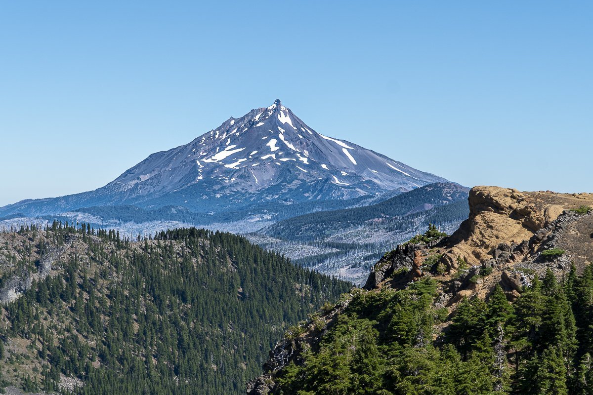 |
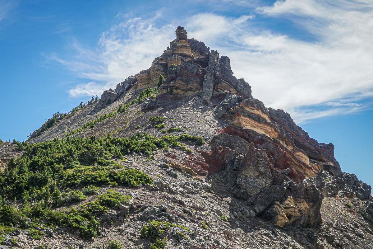
For hikers who make it up to the saddle above the lake, the views of the Three Sisters and Mount Jefferson are amazing as are the close up views of the jagged rocks of Three Fingered Jack (the eroded core of an extinct 100,000 year old volcano). Hikers should be careful coming down from the saddle as the rock is loose and the grade exceeds 30 degrees in some areas. Overall, the hike gains 1600 feet in a little over 3 miles and the entire loop is under 8 miles.
7
Three Finger Jack From Santiam Pass Offers Options for Hikers
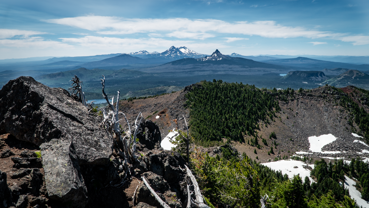
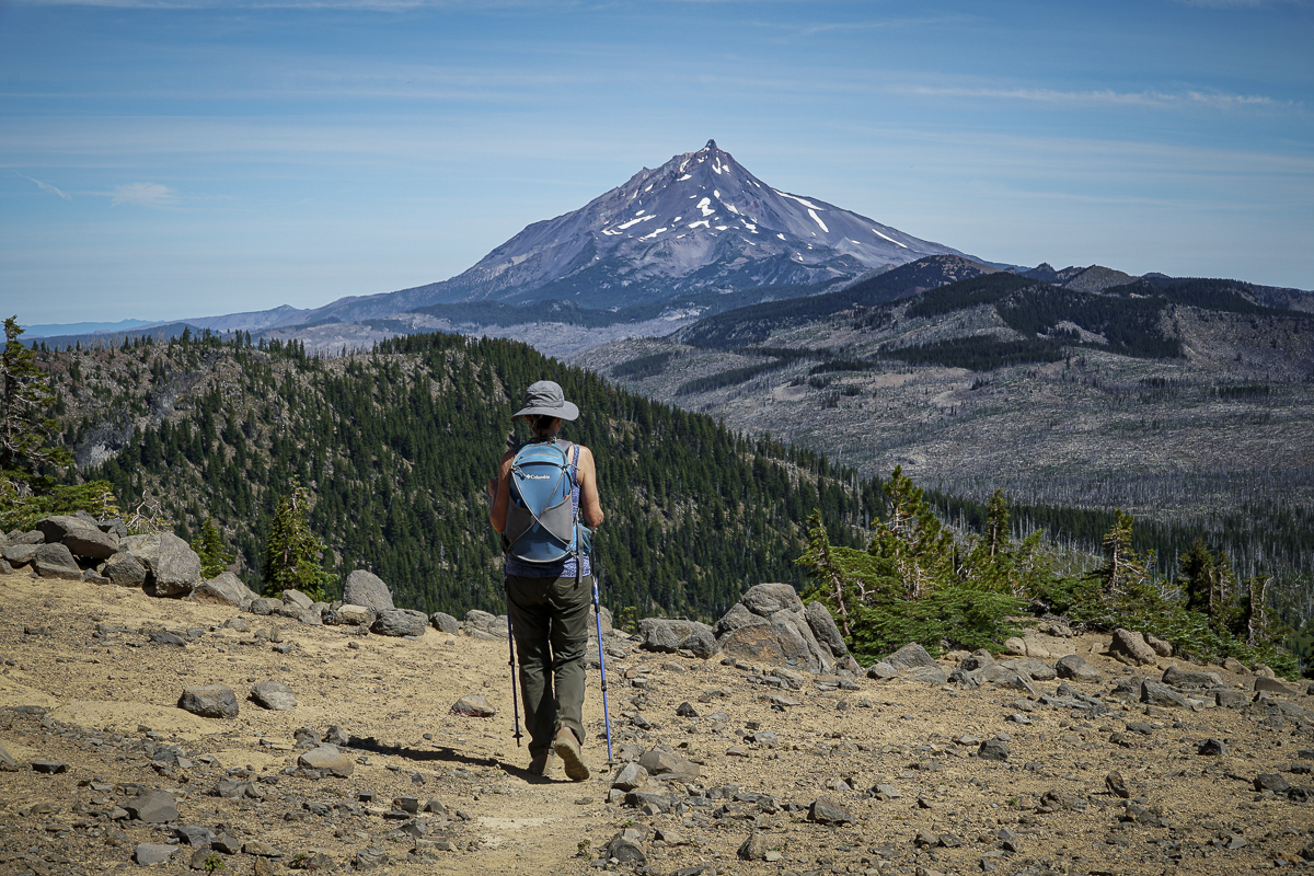
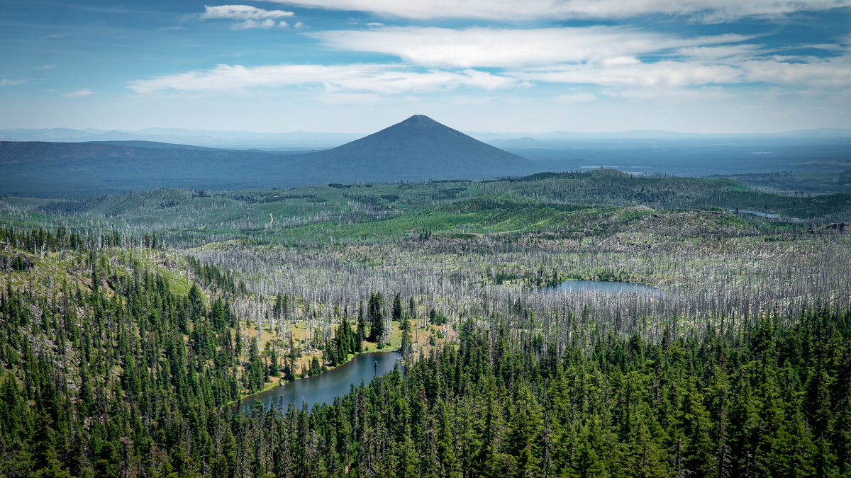
We have hiked to Three Finger Jack's base several times through the NE access to it from Jack Lake via Canyon Meadow in the Mount Jefferson Wilderness. Last Saturday, July 3, 2021, we decided to hike to Three Finger Jack from the South from Santiam Pass along the Pacific Crest Trail (PCT). The route from Santiam Pass takes hikers through part of the 90,000 acres which burned in the 2003 B&B complex fire. 18 years later, the area still has many burned trees, but new growth is abundant with wildflowers, young trees and mosquitos. And the views toward Mt. Washington and the Three Sisters are evident through the burned trees, many of which have fallen across the trail and need to be either walked around or stepped over.
 |
 |
We had planned on hiking 5 miles in to what was described as a "viewpoint" in one of our hiking books. This hike would be roughly 10 miles round trip with 1500 feet elevation gain. However, as we proceeded along the hike and left the burn scars and entered areas of old growth forest, it became obvious that the trail app we were following was different than that which we read about in our local hiking book. The app led us to a "viewpoint" which was located just below the South Pillar of Three Finger Jack. As we climbed toward this extremely difficult location, we were half way before we recognized we had taken a wrong turn, but since we were half way, we became determined to complete the trek. The rewarding views were worth the difficulty, mosquito bites, and sore muscles. Plus we accomplished a "bucket list" item which we never had in the bucket to begin with. According to our app, we actually covered over 2300 feet of elevation gain and 12 miles round trip. We would not recommend this mistake to many, having determined that this unofficial trail is what is used by those few who rock climb the mountain, most of whom are much younger than us.
 |
 |
 |
 |